Rock Creek, Alabama

Last updated

Rock Creek, Alabama
CDP
Jefferson County Alabama Incorporated and Unincorporated areas Rock Creek Highlighted.svg
Location in Jefferson County and the state of Alabama
Coordinates: 33°28′33″N87°4′44″W / 33.47583°N 87.07889°W / 33.47583; -87.07889
Country United States
State Alabama
County Jefferson
Area
[1]
  Total3.02 sq mi (7.81 km2)
  Land3.02 sq mi (7.81 km2)
  Water0.00 sq mi (0.00 km2)
Elevation
587 ft (179 m)
Population
 (2020)
  Total1,471
  Density487.73/sq mi (188.32/km2)
Time zone UTC-6 (Central (CST))
  Summer (DST) UTC-5 (CDT)
ZIP code
35023 [2]
Area code(s) 205 and 659
FIPS code 01-65412
GNIS feature ID1852798

Rock Creek is a census-designated place in Jefferson County, Alabama, United States. Its location is northwest of Hueytown. At the 2020 census, the population was 1,471. This area was damaged by an F5 tornado on April 8, 1998. An EF2 tornado struck northwest from here on January 23, 2012.

Contents

Geography

Rock Creek is located at 33°28′33″N87°4′44″W / 33.47583°N 87.07889°W / 33.47583; -87.07889 (33.475884, -87.079003). [3]

According to the U.S. Census Bureau, the CDP has a total area of 3.0 square miles (7.8 km2), all land.

Demographics

Historical population
CensusPop.Note
2000 1,495
2010 1,456−2.6%
2020 1,4711.0%
U.S. Decennial Census [4]
1850 [5] 1860 [6] 1870 [7]
1880 [8] 1890-1900 [9]
1910 [10] 1920 [11] 1930 [12]
1940 [13] 1950 [14] 1960 [15]
1970 [16] 1980 [17] 1990 [18]
2000 [19] 2010 [20] 2020 [21]

Rock Creek was first listed as a census designated place in the 2000 U.S. Census. [19] [18]

2020 census

Rock Creek CDP, Alabama – Racial and ethnic composition
Note: the US Census treats Hispanic/Latino as an ethnic category. This table excludes Latinos from the racial categories and assigns them to a separate category. Hispanics/Latinos may be of any race.
Race / Ethnicity (NH = Non-Hispanic)Pop 2000 [22] Pop 2010 [23] Pop 2020 [21] % 2000% 2010% 2020
White alone (NH)1,4701,4191,35098.33%97.46%91.77%
Black or African American alone (NH)412310.27%0.82%2.11%
Native American or Alaska Native alone (NH)61000.40%0.69%0.00%
Asian alone (NH)1100.07%0.07%0.00%
Pacific Islander alone (NH)0320.00%0.21%0.14%
Some Other Race alone (NH)20100.13%0.00%0.68%
Mixed Race or Multi-Racial (NH)411570.27%0.76%3.87%
Hispanic or Latino (any race)80210.54%0.00%1.43%
Total1,4951,4561,471100.00%100.00%100.00%

As of the 2020 United States census, there were 1,471 people, 645 households, and 443 families residing in the CDP.

2010 census

As of the census [24] of 2010, there were 1,456 people, 576 households, and 447 families living in the CDP. The population density was 490 inhabitants per square mile (190/km2). There were 615 housing units at an average density of 205 per square mile (79/km2). The racial makeup of the CDP was 97.5% White, 0.8% Black or African American, 0.7% Native American, 0.1% Asian, 0.0% from other races, and 0.8% from two or more races. 0.0% of the population were Hispanic or Latino of any race.

There were 576 households, out of which 27.8% had children under the age of 18 living with them, 63.0% were married couples living together, 9.9% had a female householder with no husband present, and 22.4% were non-families. 19.4% of all households were made up of individuals, and 7.7% had someone living alone who was 65 years of age or older. The average household size was 2.53 and the average family size was 2.90.

In the CDP, the population was spread out, with 20.5% under the age of 18, 7.5% from 18 to 24, 27.2% from 25 to 44, 28.8% from 45 to 64, and 16.0% who were 65 years of age or older. The median age was 41 years. For every 100 females, there were 93.6 males. For every 100 females age 18 and over, there were 97.2 males.

The median income for a household in the CDP was $43,370, and the median income for a family was $44,321. Males had a median income of $44,500 versus $38,244 for females. The per capita income for the CDP was $19,878. About 8.4% of families and 8.0% of the population were below the poverty line, including 8.0% of those under age 18 and 0% of those age 65 or over.

2000 census

As of the census [25] of 2000, there were 1,495 people, 569 households, and 458 families living in the CDP. The population density was 515.0 inhabitants per square mile (198.8/km2). There were 592 housing units at an average density of 203.9 per square mile (78.7/km2). The racial makeup of the CDP was 98.86% White, 0.27% Black or African American, 0.40% Native American, 0.07% Asian, 0.13% from other races, and 0.27% from two or more races. 0.54% of the population were Hispanic or Latino of any race.

There were 569 households, out of which 35.7% had children under the age of 18 living with them, 67.8% were married couples living together, 9.5% had a female householder with no husband present, and 19.5% were non-families. 17.9% of all households were made up of individuals, and 6.9% had someone living alone who was 65 years of age or older. The average household size was 2.63 and the average family size was 2.98.

In the CDP, the population was spread out, with 24.7% under the age of 18, 7.7% from 18 to 24, 29.9% from 25 to 44, 26.6% from 45 to 64, and 11.0% who were 65 years of age or older. The median age was 38 years. For every 100 females, there were 89.7 males. For every 100 females age 18 and over, there were 92.0 males.

The median income for a household in the CDP was $41,875, and the median income for a family was $49,375. Males had a median income of $35,294 versus $27,250 for females. The per capita income for the CDP was $33,333. About 6.2% of families and 3.8% of the population were below the poverty line, including none of those under age 18 and 7.9% of those age 65 or over.

Related Research Articles

<span class="mw-page-title-main">Lawrence County, Alabama</span> County in Alabama, United States

Lawrence County is a county in the northern part of the U.S. state of Alabama. As of the 2020 census, the population was 33,073. The county seat is Moulton. The county was named after James Lawrence, a captain in the United States Navy from New Jersey.

<span class="mw-page-title-main">Randolph County, Alabama</span> County in Alabama, United States

Randolph County is a county on the central eastern border of the U.S. state of Alabama. As of the 2020 census, the population was 21,967. Its county seat is Wedowee. Its name is in honor of John Randolph, a member of the United States Senate from Virginia. Randolph County was a prohibition or dry county until 2012, when the citizens of Randolph County voted to repeal prohibition.

Selmont-West Selmont is a census-designated place (CDP) in Dallas County, Alabama, United States. At the 2020 census, the population was 2,158.

<span class="mw-page-title-main">Concord, Alabama</span> CDP in Alabama, United States

Concord is a census-designated place in Jefferson County, Alabama, United States. At the 2010 census the population was 1,837, up from 1,809 in 2000. It is northwest from the Birmingham suburb of Hueytown.

<span class="mw-page-title-main">McDonald Chapel, Alabama</span> CDP in Alabama, United States

McDonald Chapel is a census-designated place in Jefferson County, Alabama, United States. It is northeast of the Birmingham suburb of Pleasant Grove. At the 2020 census, the population was 739. Large portions of this area were damaged by violent tornadoes in 1956, 1998, and 2011. The 1998 tornado was rated F5 on the Fujita scale.

<span class="mw-page-title-main">Pinson, Alabama</span> City in Alabama, United States

Pinson is a city in Jefferson County near Birmingham, Alabama, United States, northwest of Center Point. As of the 2010 census, the population was 7,163.

<span class="mw-page-title-main">Underwood-Petersville, Alabama</span> Census-designated place in Alabama, United States

Underwood-Petersville is a census-designated place (CDP) in Lauderdale County, Alabama United States. It is part of the Florence - Muscle Shoals Metropolitan Statistical Area known as "The Shoals". As of the 2010 census, the population of the CDP is 3,247.

<span class="mw-page-title-main">Rock Mills, Alabama</span> CDP in Alabama, United States

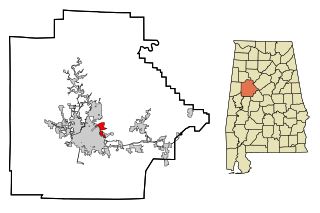
Rock Mills is a census-designated place (CDP) in Randolph County, Alabama, United States. At the 2010 census the population was 600, down from 676 in 2000. According to the U.S. Census, from 1890 until the 1920s, Rock Mills was an incorporated community. It was later designated a CDP beginning in 2000.

<span class="mw-page-title-main">Holt, Alabama</span> Census-designated place & Unincorporated community in Alabama, United States

Holt is an unincorporated community and census-designated place (CDP) in Tuscaloosa County, Alabama, United States. At the 2020 census, the population was 3,413. It is part of the Tuscaloosa, Alabama Metropolitan Statistical Area. Holt appeared on the 1930 census.

<span class="mw-page-title-main">Village of Oak Creek, Arizona</span> Community in Yavapai County, Arizona

Village of Oak Creek is an unincorporated community located within Big Park a census-designated place (CDP) in Yavapai County, Arizona, United States. The population was 6,147 at the 2010 census, up from 5,245 in 2000. Big Park is the name of the CDP while the community is more commonly known as the Village of Oak Creek (VOC), and is a bedroom community for Sedona, located seven miles away. Tourism and service to retirees and second-home owners are the basis for the local economy. Big Park, the pioneers' name for the large open area that became the Village of Oak Creek in the early 1960s, is set among scenic red-rock buttes and canyons. The Bell Rock scenic area adjoins the north end of VOC, and the town is surrounded by the Coconino National Forest. A Forest Service Visitor Center is located at the south end of VOC.

<span class="mw-page-title-main">Hensley, Arkansas</span> Census-designated place in Arkansas, United States

Hensley is a census-designated place (CDP) in Pulaski County, Arkansas, United States. The population was 139 at the 2010 census. It is part of the Little Rock–North Little Rock–Conway Metropolitan Statistical Area.

<span class="mw-page-title-main">Lagunitas-Forest Knolls, California</span> Census-designated place in California, United States

Lagunitas-Forest Knolls is a census-designated place, composed of two unincorporated areas in the western half of the San Geronimo Valley in Marin County, California. It is located to the west of San Geronimo and Woodacre. The population was 1,924 at the 2020 census.

Limestone Creek is a census-designated place (CDP) in Palm Beach County, Florida, United States. It is part of the Miami metropolitan area of South Florida. The population was 1,316 at the 2020 US census.

Long Lake is an unincorporated community and census-designated place (CDP) in Lake County, Illinois, United States. Per the 2020 census, the population was 3,663.

<span class="mw-page-title-main">Willow Brook Estates, Illinois</span> Census-designated place in Illinois, United States

Willow Brook Estates is an unincorporated census-designated place in Will County, Illinois, United States. The population was 1,346 at the 2020 census. it is considered a far south suburb of Chicago.

<span class="mw-page-title-main">North Terre Haute, Indiana</span> Census-designated place in Indiana, United States

North Terre Haute is a census-designated place (CDP) in Otter Creek Township, Vigo County, in the U.S. state of Indiana. The population was 4,305 at the 2010 census. It is part of the Terre Haute Metropolitan Statistical Area.

<span class="mw-page-title-main">New Hope, Mississippi</span> Census-designated place in Mississippi, United States

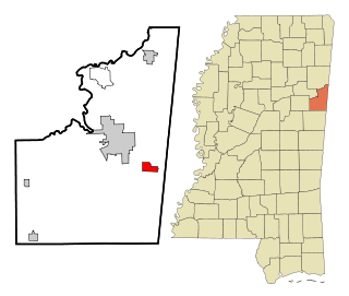
New Hope is a census-designated place (CDP) in Lowndes County, Mississippi, United States. As of the 2010 census, the CDP population was 3,193.

Cloud Creek is an unincorporated community and census-designated place (CDP) in Delaware County, Oklahoma, United States. The population was 121 at the 2010 census, a 40.7 percent increase over the figure of 86 recorded in 2000 census.

<span class="mw-page-title-main">Green Grass, South Dakota</span> CDP in South Dakota, United States

Green Grass is a census-designated place (CDP) in Dewey County, South Dakota, United States. The population was 21 at the 2020 census.

<span class="mw-page-title-main">Chevy Chase (CDP), Maryland</span> Census-designated place in Maryland, United States

Chevy Chase is a census-designated place (CDP) in Montgomery County, Maryland, United States. The population was 10,176 at the 2020 census.

References

  1. "2020 U.S. Gazetteer Files". United States Census Bureau. Retrieved October 29, 2021.
  2. "Rock Creek AL ZIP Code". zipdatamaps.com. 2023. Retrieved February 17, 2023.
  3. "US Gazetteer files: 2010, 2000, and 1990". United States Census Bureau. February 12, 2011. Retrieved April 23, 2011.
  4. "Decennial Census of Population and Housing by Decade" (PDF). United States Census Bureau.
  5. "1850 Census of Population - Alabama - Population of Civil Divisions less than Counties" (PDF). United States Census Bureau. 1850.
  6. "1860 Census of Population - Alabama - Population of Civil Divisions less than Counties" (PDF). United States Census Bureau. 1860.
  7. "1870 Census of Population - Alabama - Population of Civil Divisions less than Counties" (PDF). United States Census Bureau. 1870.
  8. "1880 Census of Population - Alabama - Population of Civil Divisions less than Counties" (PDF). United States Census Bureau. 1880.
  9. "1900 Census of Population - Alabama". United States Census Bureau. 1900.
  10. "1910 Census of Population - Alabama" (PDF). United States Census Bureau. 1910.
  11. "1920 Census of Population - Alabama" (PDF). United States Census Bureau. 1920. p. 178-179.
  12. "1930 Census of Population - Alabama" (PDF). United States Census Bureau. 1930. p. 139.
  13. "1940 Census of Population - Alabama" (PDF). United States Census Bureau. 1940.
  14. "1950 Census of Population - Alabama" (PDF). United States Census Bureau. 1950.
  15. "1960 Census of Population - Population of all incorporated places; and all unincorporated places of 1,000 or more - Alabama" (PDF). United States Census Bureau. 1960.
  16. "1970 Census of Population - Alabama" (PDF). United States Census Bureau. 1970.
  17. "1980 Census of Population - Alabama" (PDF). United States Census Bureau. 1980.
  18. 1 2 "1990 Census of Population - Alabama" (PDF). United States Census Bureau. 1990.
  19. 1 2 "2000 Census of Population - Summary Population and Housing Characteristics - Alabama" (PDF). United States Census Bureau. 2000.
  20. "2010 Census of Population - General Population Characteristics - Alabama" (PDF). United States Census Bureau. 2010.
  21. 1 2 "P2 Hispanic or Latino, and Not Hispanic or Latino by Race – 2020: DEC Redistricting Data (PL 94-171) – Rock Creek CDP, Alabama". United States Census Bureau .
  22. "P004 Hispanic or Latino, and Not Hispanic or Latino by Race – 2000: DEC Summary File 1 – Rock Creek CDP, Alabama". United States Census Bureau .
  23. "P2 Hispanic or Latino, and Not Hispanic or Latino by Race – 2010: DEC Redistricting Data (PL 94-171) – Rock Creek CDP, Alabama". United States Census Bureau .
  24. "U.S. Census website". United States Census Bureau . Retrieved July 29, 2015.
  25. "U.S. Census website". United States Census Bureau . Retrieved January 31, 2008.

33°28′33″N87°04′44″W / 33.475884°N 87.079003°W / 33.475884; -87.079003