
Matamata-Piako District is a local government area in the Waikato region of New Zealand. It lies to the east of the city of Hamilton.

Hauraki District is a territorial authority within the Hauraki region of New Zealand. The seat of the council is at Paeroa.

Colville, a small town in the north of the Coromandel Peninsula in the North Island of New Zealand, lies 26 kilometres north of Coromandel in Colville Bay on the Hauraki Gulf, and is the northernmost town of any note on the peninsula. North of Colville, 28 kilometres of rough road lead to the small settlement of Port Jackson, close to the peninsula's northwesternmost point, Cape Colville and 20 km to Port Charles on the northeastern side.

Ngatea is a small town on the Hauraki Plains in the North Island of New Zealand. It is located 18 kilometres southwest of Thames and 70 kilometres southeast of Auckland. Ngatea lies on the Piako River, eight kilometres south of its outflow into the Firth of Thames.

The Hauraki Plains are a geographical feature and non-administrative area located in the northern North Island of New Zealand, at the lower (northern) end of the Thames Valley. They are located 75 kilometres south-east of Auckland, at the foot of the Coromandel Peninsula and occupy the southern portion of a rift valley bounded on the north-west by the Hunua Ranges, to the east by the Coromandel and Kaimai ranges and to the west by a series of undulating hills which separate the plains from the much larger plains of the Waikato River. Broadly, the northern and southern parts of the Hauraki Plains are administered by the Hauraki District and the Matamata-Piako District respectively.

Kawau Island is in the Hauraki Gulf, close to the north-eastern coast of the North Island of New Zealand. At its closest point it lies 1.4 km (0.87 mi) off the coast of the Northland Peninsula, just south of Tāwharanui Peninsula, and about 8 km (5.0 mi) by sea journey from Sandspit Wharf, and shelters Kawau Bay to the north-east of Warkworth. It is 40 km (25 mi) north of Auckland. Mansion House in the Kawau Island Historic Reserve is an important historic tourist attraction. Almost every property on the Island relies on direct access to the sea. There are only two short roads serving settlements at Schoolhouse Bay and South Cove, and most residents have private wharves for access to their front door steps.
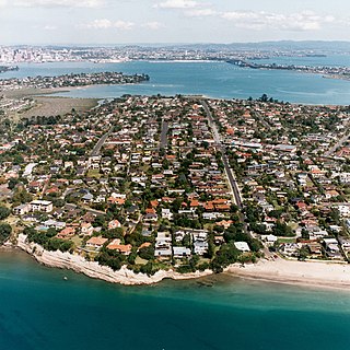
Hauraki is a suburb located on the southern North Shore of Auckland, the largest metropolitan city in New Zealand. It is under the local governance of the Auckland Council.

Te Poi is a small village in rural Waikato, New Zealand, established in 1912 at the base of the Kaimai Range. Te Poi is part of a thriving farming area, particularly for dairying, thoroughbred horse breeding and cropping.
Turua is a small village community on the banks of the Waihou River in the Hauraki Plains in the North Island of New Zealand. It is located close to the mouth of the river, 9 kilometres south of the Firth of Thames and 12 km south of Thames. It is connected by road to SH 25 in the north and SH 2 to the south.
Rahotu is a community in the west of Taranaki, in the North Island of New Zealand. It is located on State Highway 45, 16 kilometres north of Ōpunake and 11 km south of Warea.
Kaharoa is a rural area of New Zealand approximately 20 km from Rotorua and 45 km from Tauranga on the North Island. At its highest point the area is approx. 500m above sea level, with some areas able to see towards the coastline of the eastern Bay of Plenty.
Panguru is a community in the northern Hokianga harbour, in Northland, New Zealand. The Whakarapa Stream flows from the Panguru Range in the Warawara Forest to the west, through Panguru and into the Hokianga.
Kennedy Bay is a locality in the north eastern Coromandel Peninsula of New Zealand. The Harataunga and Omoho Streams flow from the Coromandel Range past the settlement and into the bay to the east.
Rawhitiroa is a locality in South Taranaki, New Zealand. It is approximately 6.5 km east of Eltham.

Ongaonga is a village in Central Hawkes Bay District of New Zealand's North Island. It is located 20 kilometres west of Waipawa and a similar distance from Waipukurau.
Waikeria is a rural community in the Otorohanga District and Waikato region of New Zealand's North Island.
Hexton is a village and rural area in the Gisborne District of New Zealand's North Island. It is located north-west of Gisborne City, and includes the settlements of Makauri and Waerengaahika.
Pukeatua is a rural farming community in Waipa District and Waikato region of New Zealand's North Island. It is situated at the south-western foot of the Pukeatua hill, of the Maungatautari mountain range.

Waitakaruru is a rural community in the Hauraki District and Waikato region of New Zealand's North Island. It is situated at the mouth of Waitakaruru River
Kerepehi is a rural community in the Hauraki District and Waikato region of New Zealand's North Island. The alternative spelling Kerepeehi was in use until 1933.
