Related Research Articles
Paeroa is a town in the Hauraki District of the Waikato Region in the North Island of New Zealand. Located at the base of the Coromandel Peninsula, it is close to the junction of the Waihou River and Ohinemuri River, and is approximately 20 kilometres south of the Firth of Thames.

Hauraki District is a territorial authority governed by the Hauraki District Council within the Waikato region of New Zealand. The seat of the council is at Paeroa.

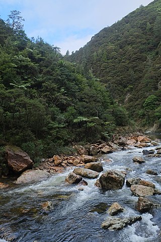
The Karangahake Gorge lies between the Coromandel and Kaimai ranges, at the southern end of the Coromandel Peninsula in New Zealand's North Island. A sharply winding canyon, it was formed by the Ohinemuri River. State Highway 2 passes through this gorge between the towns of Paeroa, Waikino and Waihi. This road is the main link between the Waikato region and the Bay of Plenty.
The Waihou River is located in the northern North Island of New Zealand. Its former name, Thames River, was bestowed by Captain James Cook in November 1769, when he explored 14 mi (23 km) of the river from the mouth. An older Māori name was "Wai Kahou Rounga". A 1947 Geographic Board enquiry ruled that the official name would be Waihou.
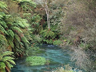
The Ohinemuri River is located in the northern half of New Zealand's North Island, at the base of the Coromandel Peninsula.

The Hauraki Plains are a geographical area located in the northern North Island of New Zealand, at the lower (northern) end of the Thames Valley. They are located 75 kilometres south-east of Auckland, at the foot of the Coromandel Peninsula and occupy the southern portion of a rift valley bounded on the north-west by the Hunua Ranges, to the east by the Coromandel and Kaimai ranges and to the west by a series of undulating hills which separate the plains from the much larger plains of the Waikato River.
Te Pīhopatanga o Te Manawa o Te Wheke is an episcopal polity or diocese of the Anglican Church in Aotearoa, New Zealand and Polynesia. Literally, the diocese is the Anglican bishopric of the heart of the octopus of the North Island of Aotearoa, New Zealand; also known as the synod.

Hikutaia is a locality on the Hauraki Plains of New Zealand. It lies on State Highway 26, south east of Thames and north of Paeroa. The Hikutaia River runs from the Coromandel Range through the area to join the Waihou River.

Ngāti Tamaterā is a Māori iwi (tribe) of the Hauraki region of New Zealand, descended from Tamaterā, the second son of Marutūāhu. It is a major tribe within the Marutūāhu confederation and its leaders have been prominent in Hauraki history and Marutūāhu tribal affairs. It is one of five tribes of the Marutūāhu confederation, the others being Ngāti Maru, Ngāti Paoa, Ngāti Rongoū and Ngāti Whanaunga. The Marutūāhu tribes are all descended from Marutūāhu, a son of Hotunui, who is said to have arrived in New Zealand on the Tainui canoe. The Marutūāhu tribes are therefore part of the Tainui group of tribes. The Marutūāhu confederation is also part of the Hauraki collective of tribes.

The Thames Branch railway line connected Thames, New Zealand, with Hamilton and was originally part of the East Coast Main Trunk railway. Part of the line between Morrinsville and Waitoa remains open and is in use as the Waitoa Branch line, connecting to the Fonterra Dairy Factory at Waitoa.
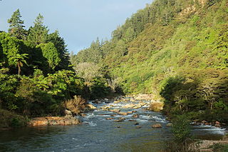
The Waitawheta River is a river of the Waikato Region of New Zealand's North Island. It flows from a point south-east of Mount Te Aroha in the Kaimai Range to the Karangahake Gorge at the foot of the Coromandel Peninsula to reach the Ohinemuri River at Karangahake, five kilometres east of Paeroa.
Karangahake is a locality in the Hauraki District of New Zealand. In Māori, Karangahake translates as a "humpbacked ridge or a call from the other side".

James Mackay was a New Zealand farmer, explorer, public servant, administrator, land purchaser, interpreter, advocate and politician.

Ohinemuri County was one of the counties of New Zealand of the North Island.
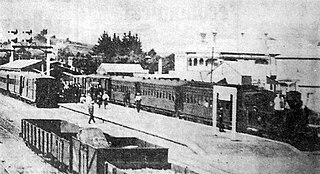
Paeroa railway station is a former railway station in Paeroa; on the Thames Branch, and on the East Coast Main Trunk Railway to Waihi. Between 1895 and 1991 Paeroa had a station at the north end of the town centre, followed by one further north, another back near the town centre and then another over a mile south of the town.
Te Patukirikiri is a Māori iwi of the Tāmaki and Hauraki areas of New Zealand. It has its origins in the Waiohua Confederation, a group of tribes that are located in the Tāmaki isthmus and trace back to the Tainui Waka. Te Patukiriri is a small iwi with only 45 people identifying as being a descendant in the 2013 New Zealand census.
Tirohia is a rural community in the Hauraki District and Waikato region of New Zealand's North Island. It was one of the main areas used by Ngāti Hako, including Te Rae o te Papa pā. A bridge was built over the Waihou River in 1919.
Awaiti is a rural community in the Hauraki District and Waikato region of New Zealand's North Island, west of Paeroa.
Kopuarahi is a rural settlement and farming community in the Hauraki District and Waikato region of New Zealand's North Island.

Whakatīwai is a locality on the Seabird Coast on the western shore of the Firth of Thames, in the Hauraki District, New Zealand. Whakatīwai is the location of Wharekawa Marae, which holds importance for Ngāti Paoa and Ngāti Whanaunga. Whakatīwai Regional Park is just north of Whakatīwai. Until 2010, Whakatīwai was a part of the Franklin District. Because it was previously considered a part of the Auckland region, the Whakatīwai Regional Park continues to be owned and operated by the Auckland Council.
References
- 1 2 3 4 5 6 7 8 Climie, N S (1983). "Introduction". Karangahake: the years of the gold 1875 -1935. Whakatane: Paeroa & District Historical and Arts Society.
- ↑ "Mackaytown". hauraki-dc.govt.nz. Hauraki District Council.
- ↑ Pedersen, Marcus (2017). Great Expeditions: the Journeys of John Rochfort, James Mackay and Julius Haast to the West Coast of the South Island, New Zealand, 1859–60. Greymouth, New Zealand: Toro Press. ISBN 978-0-473-40254-9.
- 1 2 3 Climie, N S (1983). "Growth of Mackaytown". Karangahake: the years of the gold 1875 -1935. Whakatāne: Paeroa & District Historical and Arts Society.
- 1 2 The Cyclopedia of New Zealand. Christchurch: Cyclopedia Company. 1902. p. 917.
- ↑ Price, William Archer (12 May 1914). Photograph by William A Price. Mackaytown: William A Price.
- ↑ Aerial photograph taken by Whites Aviation. Mackaytown: Whites Aviation Limited. 10 April 1958.