Point of Rocks, Wyoming

Last updated

Point of Rocks, Wyoming
Point of Rocks Stage Station.jpg
Almond Stage Station at Point of Rocks, built in 1862
WYMap-doton-PointOfRocks.PNG
Location of Point of Rocks, Wyoming
Coordinates: 41°40′42″N108°47′29″W / 41.67833°N 108.79139°W / 41.67833; -108.79139
Country United States
State Wyoming
County Sweetwater
Area
  Total1.8 sq mi (4.7 km2)
  Land1.8 sq mi (4.7 km2)
  Water0.0 sq mi (0.0 km2)
Elevation
[1]
6,529 ft (1,990 m)
Population
 (2000)
  Total3
  Density1.6/sq mi (0.6/km2)
Time zone UTC-7 (Mountain (MST))
  Summer (DST) UTC-6 (MDT)
ZIP code
82942
Area code 307
FIPS code 56-62160 [2]
GNIS feature ID1597462 [1]

Point of Rocks is an unincorporated community in Sweetwater County, Wyoming, United States. As of the 2000 census, Point of Rocks had a total population of three, when it was a census-designated place (CDP).

Contents

Geography

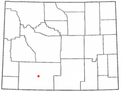
According to the United States Census Bureau, in 2000 the CDP has a total area of 1.8 square miles (4.7 km2), all land.

Demographics

As of the census [2] of 2000, there were three people, two households, and one family residing in the CDP. The population density was 1.6 people per square mile (0.6/km2). There were two housing units at an average density of 1.1/sq mi (0.4/km2). All residents were white and between forty-five and sixty-four. The median age was sixty-three years.

One household was a married couple living together, while the other was a male individual.

The median income for a household in the CDP was $41,250, and the median income for a family was $41,250. The per capita income for the CDP was $21,050.

Education

Public education in Point of Rocks is provided by Sweetwater County School District #1.

Jim Bridger Power Station

Point of Rocks is home to the Jim Bridger Power Station. The 2,110 megawatt facility jointly owned by PacifiCorp (2/3 owner and operator of the plant), and Idaho Power (1/3 owner), and is one of the largest coal-fired electric power generation facilities in the western United States. [3]

This plant is connected to the grid by numerous 500kv transmission lines.

The Monument to the Almond Stage Station located in Point of Rocks, WY. Almondstage.JPG
The Monument to the Almond Stage Station located in Point of Rocks, WY.

Almond Stage Station

Also located in Point of Rocks are the remnants of the original Almond Stage Station, built in 1862 at the behest of Ben Holladay. Holladay wished to move his stage coach line further south because of repeated attacks by Indians. The station was constructed of local sandstone with a sod-covered roof, which allowed it to survive at least one attack and attempted burning. In 1868, the station was converted to a stop along the transcontinental railroad and the Overland Trail. When mining declined in the area the station was sold and used as a private home before being absorbed by the Wyoming State Parks and restored. The Point of Rocks Stage Station was never used as a Pony Express stop at any time and was not even on the route of the Pony Express. [4]

Related Research Articles

<span class="mw-page-title-main">Sweetwater County, Wyoming</span> County in Wyoming, United States

Sweetwater County is a county in southwestern Wyoming, United States. As of the 2020 United States Census, the population was 42,272, making it the fourth-most populous county in Wyoming. Its county seat is Green River. By area, it is the largest county in Wyoming. Its southern boundary line abuts the north lines of the states of Colorado and Utah.

<span class="mw-page-title-main">Smoot, Wyoming</span> Census-designated place in Wyoming, United States

Smoot is a census-designated place (CDP) in Lincoln County, Wyoming, United States. The population was 195 at the 2010 census.

<span class="mw-page-title-main">Brookhurst, Wyoming</span> CDP in Wyoming, United States

Brookhurst is a census-designated place (CDP) in Natrona County, Wyoming, United States. It is part of the Casper, Wyoming Metropolitan Statistical Area. The population was 185 at the 2010 census.

<span class="mw-page-title-main">Bondurant, Wyoming</span> CDP in Wyoming, United States

Bondurant is a census-designated place (CDP) in Sublette County, Wyoming, United States. The population was 93 at the 2010 census. The town was named after B. F. Bondurant.

Arrowhead Springs is a census-designated place (CDP) in Sweetwater County, Wyoming, United States. The population was 63 at the 2010 census.

Clearview Acres is a census-designated place (CDP) in Sweetwater County, Wyoming, United States. The population was 795 at the 2010 census.

<span class="mw-page-title-main">Eden, Wyoming</span> CDP in Wyoming, United States

Eden is a census-designated place (CDP) in Sweetwater County, Wyoming, United States. The population was 281 at the 2010 census.

<span class="mw-page-title-main">Farson, Wyoming</span> CDP in Wyoming, United States

Farson is a census-designated place (CDP) in Sweetwater County, Wyoming, United States. The population was 313 at the 2010 census.

<span class="mw-page-title-main">Granger, Wyoming</span> Town in Sweetwater County, Wyoming, United States

Granger is a town along Blacks Fork near the western edge of Sweetwater County, Wyoming, United States. The population was 139 at the 2010 census. It is located near the confluence of the Blacks Fork and the Hams Fork rivers. The geography of the area is flat with semi-arid scrub.

<span class="mw-page-title-main">James Town, Wyoming</span> CDP in Wyoming, United States

James Town is a census-designated place (CDP) in Sweetwater County, Wyoming, United States. The population was 536 at the 2010 census.

<span class="mw-page-title-main">Little America, Wyoming</span> CDP in Wyoming, United States

Little America is a census-designated place (CDP) in Sweetwater County, Wyoming, United States. The population was 68 at the 2010 census. The community got its name from the Little America motel, which was purposefully located in a remote location as a haven, not unlike the Little America base camp the polar explorer Richard E. Byrd set up in the Antarctic in 1928. However, being situated on a coast-to-coast highway and offering travel services, it thrived, launching a chain of travel facilities by the same name. Its developer, Robert Earl Holding, died on April 19, 2013, with a personal net worth of over $3 billion.

<span class="mw-page-title-main">McKinnon, Wyoming</span> Census-designated place in Sweetwater County, Wyoming, United States

McKinnon is a census-designated place (CDP) in Sweetwater County, Wyoming, United States. The population was 60 at the 2010 census.

North Rock Springs is a census-designated place (CDP) in Sweetwater County, Wyoming, United States. The population was 2,439 at the 2020 census.

Purple Sage is a census-designated place (CDP) in Sweetwater County, Wyoming, United States. The population was 535 at the 2010 census.

<span class="mw-page-title-main">Reliance, Wyoming</span> CDP in Wyoming, United States

Reliance is a census-designated place (CDP) in Sweetwater County, Wyoming, United States. The population was 714 at the 2010 census.

<span class="mw-page-title-main">Rock Springs, Wyoming</span> City in Wyoming, United States

Rock Springs is a city in Sweetwater County, Wyoming, United States. The population was 23,526 at the 2020 census, making it the fifth most populous city in the state of Wyoming, and the most populous city in Sweetwater County. Rock Springs is the principal city of the Rock Springs micropolitan statistical area, which has a population of 37,975. Rock Springs is known as the Home of 56 Nationalities because of the influx of immigrants from all over the world who came to work in the coal mines that supplied the fuel to power the steam engines of the Union Pacific Railroad. The city's rich cultural heritage is celebrated each summer on International Day, a festival where the foods, costumes, and traditions of residents' ancestors are recreated and enjoyed at Bunning Park in downtown Rock Springs.

Sweeney Ranch is an unincorporated community in Sweetwater County, Wyoming, United States. The population was 17 at the 2000 census, when it was a census-designated place (CDP).

<span class="mw-page-title-main">Table Rock, Wyoming</span> Town in Wyoming, United States

Table Rock is a ghost town in Sweetwater County, Wyoming, United States. It was part of a census-designated place at the 2000 census, with a population of 82, but the 2010 census reported a population of 0.

Washam is a census-designated place (CDP) in Sweetwater County, Wyoming, United States. The population was 51 at the 2010 census.

<span class="mw-page-title-main">Fort Bridger, Wyoming</span> Census-designated place in Uinta County, Wyoming, United States

Fort Bridger is a census-designated place (CDP) in eastern Uinta County, Wyoming, United States. The population was 345 at the 2010 census. The community takes its name from the eponymous Fort Bridger, established in 1842, which is located within the boundaries of the CDP.

References

  1. 1 2 U.S. Geological Survey Geographic Names Information System: Point of Rocks, Wyoming
  2. 1 2 "U.S. Census website". United States Census Bureau . Retrieved January 31, 2008.
  3. "Jim Bridger Plant" (PDF). Retrieved November 9, 2014.
  4. "Wyoming State Parks" . Retrieved October 9, 2010.[ permanent dead link ]