Sweetwater County is a county in southwestern Wyoming, United States. As of the 2020 United States Census, the population was 42,272, making it the fourth-most populous county in Wyoming. Its county seat is Green River. By area, it is the largest county in Wyoming. Its southern boundary line abuts the north lines of the states of Colorado and Utah.

Fremont County is a county in the U.S. state of Wyoming. As of the 2020 United States census, the population was 39,234, making it the fifth-most populous county in Wyoming. Its county seat is Lander. The county was founded in 1884 and is named for John C. Frémont, a general, explorer, and politician. It is roughly the size of the state of Vermont.

Ingalls Park is an unincorporated community, census-designated place (CDP), and suburb of Joliet in Will County, Illinois, United States. The population was 3,314 at the 2010 census. The town consists of a small neighborhood and a few businesses between Joliet's Pilcher Park and Interstate 80. It is the nearest town to Chicagoland Speedway, which hosted the NASCAR Cup Series from 2001 to 2019.
South Lancaster is a census-designated place (CDP) in the town of Lancaster and close to the Town of Clinton in Worcester County, Massachusetts, United States. The population was 1,642 at the 2020 census.
Windermere is a former census-designated place (CDP) in Travis County, Texas, United States. The population was 1,037 at the 2010 census. It has since largely been annexed by the city of Pflugerville.

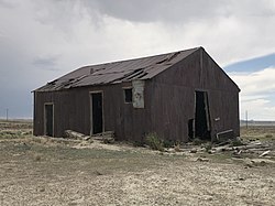
Atlantic City is a census-designated place (CDP) in Fremont County, Wyoming, United States. The population was 37 at the 2010 census. The community is a small mining settlement in a gulch near South Pass in southwestern Wyoming. It was founded in 1868 as a mining camp following the 1867 gold rush in the region. The "Atlantic" name refers to its location on the eastern side of the nearby Continental Divide. The town declined following the end of the placer gold rush in the early 1870s, but continued to exist as advances in mining technology allowed further extraction of gold. From the 1960s until 1983, it was the location of a US Steel iron ore mine. The town is accessible by gravel roads from nearby Wyoming Highway 28.
Taylor is a census-designated place (CDP) in Lincoln County, Wyoming, United States. The population was 90 at the 2010 census.
Arrowhead Springs is a census-designated place (CDP) in Sweetwater County, Wyoming, United States. The population was 63 at the 2010 census.
Clearview Acres is a census-designated place (CDP) in Sweetwater County, Wyoming, United States. The population was 795 at the 2010 census.
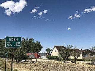
Eden is a census-designated place (CDP) in Sweetwater County, Wyoming, United States. The population was 281 at the 2010 census.
Farson is a census-designated place (CDP) in Sweetwater County, Wyoming, United States. The population was 313 at the 2010 census.

James Town is a census-designated place (CDP) in Sweetwater County, Wyoming, United States. The population was 536 at the 2010 census.
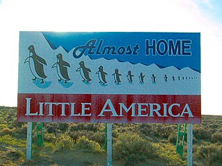
Little America is a census-designated place (CDP) in Sweetwater County, Wyoming, United States. The population was 68 at the 2010 census. The community got its name from the Little America motel, which was purposefully located in a remote location as a haven, not unlike the Little America base camp the polar explorer Richard E. Byrd set up in the Antarctic in 1928. However, being situated on a coast-to-coast highway and offering travel services, it thrived, launching a chain of travel facilities by the same name. Its developer, Robert Earl Holding, died on April 19, 2013, with a personal net worth of over $3 billion.

McKinnon is a census-designated place (CDP) in Sweetwater County, Wyoming, United States. The population was 60 at the 2010 census.
North Rock Springs is a census-designated place (CDP) in Sweetwater County, Wyoming, United States. The population was 2,439 at the 2020 census.
Purple Sage is a census-designated place (CDP) in Sweetwater County, Wyoming, United States. The population was 535 at the 2010 census.
Reliance is a census-designated place (CDP) in Sweetwater County, Wyoming, United States. The population was 714 at the 2010 census.
Sweeney Ranch is an unincorporated community in Sweetwater County, Wyoming, United States. The population was 17 at the 2000 census, when it was a census-designated place (CDP).

Wamsutter is a town in Sweetwater County, Wyoming, United States. The population was 203 at the 2020 census.
Washam is a census-designated place (CDP) in Sweetwater County, Wyoming, United States. The population was 51 at the 2010 census.