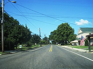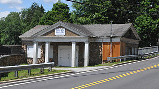
Chatsworth is an unincorporated community located within Woodland Township in Burlington County, New Jersey, United States. The area is served as United States Postal Service ZIP Code 08019. The New Jersey Central's Blue Comet passenger train was wrecked here in 1939. Chatsworth has been called "Capital of the Pine Barrens."

Thorofare is an unincorporated community and census-designated place (CDP) located within West Deptford Township in northwestern Gloucester County, situated in the South Jersey region of the U.S. state of New Jersey. The area is served as United States Postal Service ZIP Code 08086. As of the 2020 United States census, the CDP's population was 2,806. As of the 2000 census, the population of a different geographic entity containing Thorofare, namely ZIP Code Tabulation Area 08086, was 5,424.

Newport is an unincorporated community and census-designated place (CDP) located within Downe Township in Cumberland County, in the U.S. state of New Jersey. The area is served as United States Postal Service ZIP Code 08345.

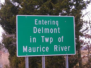
Delmont is an unincorporated community and census-designated place (CDP) located within Maurice River Township, in Cumberland County, in the U.S. state of New Jersey. The area is served as United States Postal Service ZIP Code 08314. It was first listed as a CDP in the 2020 census with a population of 122.

Hibernia is an unincorporated community and census-designated place (CDP) located along County Route 513 in Rockaway Township of Morris County, in the U.S. state of New Jersey. The area is served as United States Postal Service ZIP Code 07842. The community takes its name from Hibernia, the classical name for Ireland.

Layton is an unincorporated community and census-designated place (CDP) located within Sandyston Township in Sussex County, in the U.S. state of New Jersey. The area is served as United States Postal Service ZIP Code 07851.

Johnsonburg is an unincorporated community and census-designated place (CDP) located within Frelinghuysen Township in Warren County, in the U.S. state of New Jersey, that was created as part of the 2010 United States Census. As of the 2020 Census, the CDP's population was 381, up from 101 in the 2010 Census.

Oak Ridge is an unincorporated community and census-designated place (CDP) located along the border of West Milford Township in Passaic County and Jefferson Township in Morris County, in the U.S. state of New Jersey. The area is served as United States Postal Service ZIP Code 07438.
New Gretna is an unincorporated community and census-designated place (CDP) located within Bass River Township in Burlington County, in the U.S. state of New Jersey. The area is served as United States Postal Service ZIP Code 08224.

Asbury is an unincorporated community and census-designated place (CDP) located within Franklin Township in Warren County, in the U.S. state of New Jersey, that was created as part of the 2010 United States Census. As of the 2010 Census, the CDP's population was 273.

Mauricetown is a census-designated place and unincorporated community that is part of Commercial Township in Cumberland County, in the U.S. state of New Jersey.
Dorchester is an unincorporated community located within Maurice River Township, in Cumberland County, in the U.S. state of New Jersey. The area is served as United States Postal Service ZIP Code 08316.

Jobstown is an unincorporated community and census-designated place (CDP) located within Springfield Township in Burlington County, in the U.S. state of New Jersey. The area is served as United States Postal Service ZIP Code 08041.
Leesburg is an unincorporated community and census-designated place (CDP) located within Maurice River Township in Cumberland County, in the U.S. state of New Jersey. The area is served as United States Postal Service ZIP Code 08327.

Stewartsville is an unincorporated community and census-designated place (CDP) located within Greenwich Township in Warren County, in the U.S. state of New Jersey, that was created as part of the 2010 United States Census. As of the 2010 Census, the CDP's population was 349.
Seabrook is an unincorporated community located within Upper Deerfield Township in Cumberland County, in the U.S. state of New Jersey. The area is served as United States Postal Service ZIP code 08302. The unincorporated community and the census-designated Place Seabrook Farms within it are each named after Charles F. Seabrook, a businessman who at one point ran the largest irrigated truck farm in the world in this region.
Cumberland is a small unincorporated community located within Maurice River Township in Cumberland County, in the U.S. state of New Jersey. For statistical purposes, Cumberland and neighboring Hesstown together comprise the Cumberland-Hesstown census-designated place.

Harrisonville is an unincorporated community and census-designated place (CDP) located within South Harrison Township, in Gloucester County, in the U.S. state of New Jersey. The area is served as United States Postal Service ZIP Code 08039.

Ocean View is an unincorporated community and census-designated place (CDP) located within Dennis Township in Cape May County, in the U.S. state of New Jersey. The area is served as United States Postal Service ZIP Code 08230. The post office was established in 1872, with William Doolittle as the first postmaster.

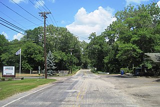
Birmingham is an unincorporated community located within Pemberton Township in Burlington County, in the U.S. state of New Jersey. As of the 2010 United States Census, the ZIP Code Tabulation Area for ZIP Code 08011 had a population of 33. Though sparsely populated, it houses a post office and a Lanxess chemical facility.


