
Fairfield Township is a township in Cumberland County, New Jersey, United States. It is part of the Vineland-Millville- Bridgeton Primary Metropolitan Statistical Area for statistical purposes. As of the 2010 United States Census, the township's population was 6,295, reflecting an increase of 12 (+0.2%) from the 6,283 counted in the 2000 Census, which had in turn increased by 584 (+10.2%) from the 5,699 counted in the 1990 Census.

Barnegat Light is a borough in Ocean County, New Jersey, United States. As of the 2010 United States Census, the borough's population was 574, reflecting a decline of 190 (−24.9%) from the 764 counted in the 2000 Census, which had in turn increased by 89 (+13.2%) from the 675 counted in the 1990 Census. The borough borders the Atlantic Ocean on Long Beach Island and is home to Barnegat Lighthouse.
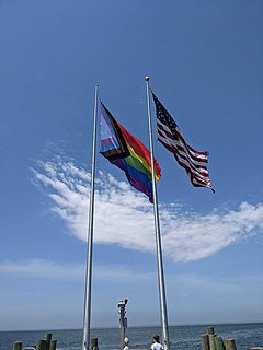
Cherry Grove is a hamlet in the Town of Brookhaven, Suffolk County, New York, United States. It is located on Fire Island, a barrier island separated from the southern side of Long Island by the Great South Bay. The hamlet has approximately 300 houses on 41 acres (170,000 m2), a summer seasonal population of 2,000 and a year-round population of 15.

Jamestown is a town in Newport County, Rhode Island in the United States. The population was 5,559 at the 2020 census. Jamestown is situated almost entirely on Conanicut Island, the second largest island in Narragansett Bay. It also includes the uninhabited Dutch Island and Gould Island.

The Jersey Shore is the coastal region of the U.S. state of New Jersey. Geographically, the term encompasses about 141 miles (227 km) of oceanfront bordering the Atlantic Ocean, from Perth Amboy in the north to Cape May Point in the south. The region includes Middlesex, Monmouth, Ocean, Atlantic, and Cape May counties, which are in the central and southern parts of the state. Located in the center of the Northeast Megalopolis, the northern half of the shore region is part of the New York metropolitan area, while the southern half of the shore region is part of the Delaware Valley. The Jersey Shore hosts the highest concentration of oceanside boardwalks in the United States.

Washington Crossing State Park is a 3,575-acre (14 km2) New Jersey state park that is part of Washington's Crossing, a U.S. National Historic Landmark area. It is located in the Washington Crossing and Titusville sections of Hopewell Township in Mercer County, north of Trenton along the Delaware River. The park is operated and maintained by the New Jersey Division of Parks and Forestry. It is supported by the Washington Crossing Park Association, a friends group that works to preserve, enhance, and advocate for the park.

Lake Hopatcong is the largest freshwater body in New Jersey, United States, about 4 square miles (10 km2) in area. Located 30 miles (48 km) from the Delaware River and 40 miles (64 km) from Manhattan, New York City, the lake forms part of the border between Sussex and Morris counties in the state's northern highlands region. Lake Hopatcong was produced by damming and flooding of two ponds, known as the Great Pond and Little Pond, and the Musconetcong River, its natural outlet. Historically known as a resort lake for vacationing New Yorkers, it is now a mostly suburban residential lake.

Eagle Harbor is an unincorporated community and census-designated place located on the north side of the Keweenaw Peninsula within Eagle Harbor Township, Keweenaw County in the U.S. State of Michigan. Its population was 69 as of the 2020 census. M-26 passes through this community. This hamlet was especially popular with the sailors in days past, as it had a good steamboat landing and is about equally distant from Sault Sainte Marie, Michigan, and Duluth, Minnesota. It was the first stop for supplies for the many boats on Lake Superior.

Long Beach Island is a barrier island and summer colony along the Atlantic Ocean coast of Ocean County, New Jersey. Aligned north to south, the northern portion generally has more expensive low-density housing, whereas the southern portion possesses higher-density housing and considerable commercial development. Long Beach Island is 1-2 miles away from Mainland New Jersey. The primary industries include tourism, fishing, and real estate. The only access point to the island by land is a single causeway.

Elizabethtown-Kitley is a township in eastern Ontario, Canada, in the United Counties of Leeds and Grenville. Its southern border lies along the St. Lawrence River and it extends north into many rural hamlets and villages. The township was created on January 1, 2001 by the amalgamation of the former Township of Elizabethtown and Township of Kitley.

Mount Tabor is an unincorporated community that was founded as a Methodist camp meeting in what is now Parsippany-Troy Hills, in Morris County, New Jersey, United States.
A sea breeze is a wind from the sea.

Franklin Park is an unincorporated community and census-designated place (CDP) located within Franklin Township, in Somerset County, New Jersey, United States. As of the 2010 United States Census, the CDP's population was 13,295. Route 27 bisects the village and serves as the dividing line between the two counties. The adjacent sections of South Brunswick and North Brunswick, Middlesex County on the east side of Route 27 are also known as Franklin Park, but are not included within the CDP's boundaries.

Lake Wawasee is a large, natural, freshwater lake southeast of Syracuse in Kosciusko County, Indiana. It is the largest natural lake within Indiana's borders.
Bay de Verde is an incorporated town in Conception Bay on the northern tip of the Bay de Verde Peninsula of Newfoundland and Labrador, Canada. The first recorded inhabitants at Bay de Verde arrived in 1662. Bay de Verde became an incorporated town in 1950.

Seabrook–Wilson House is located in the town of Port Monmouth, a part of Middletown Township in Monmouth County, New Jersey, United States. The house was built in 1663 and was added to the National Register of Historic Places on October 29, 1974.
Warner Leisure Hotels is a hospitality company owning 14 country and coastal properties around the UK in North Wales, Somerset, Herefordshire, Berkshire, North Yorkshire, Nottinghamshire, Isle of Wight, Suffolk, Hampshire and Warwickshire. Since 1994, its hotels have been adult-only.

Fairfield is an unincorporated community located within Howell Township in Monmouth County, New Jersey, United States. The community is centered on the intersection of County Route 524 (CR 524) and Ketchum Road, where the Colonial Era Our House Tavern is located. The area includes several small businesses, township offices and schools. There are also small farms and residential developments in the area. Fairfield was a stop on the Freehold and Jamesburg Agricultural Railroad.
Marlboro Township, New Jersey has a number of historic sites. The Monmouth County Historic Site Inventory (HSI) was started in 1980 by the directors of both the Monmouth County Historical Association and the Monmouth County Park System. This inventory project provided an inventory number to all historic properties in Monmouth County, New Jersey. In addition to property details, this listing provides reference numbers for easy identification. In addition to the park system inventory, the Marlboro Township Historic Commission provides a listing of Historic Commission Landmarks (HCL). These are physical signs placed in historically significant locations. There was also a list presented by the NJ Department of Environmental Protection - Historic Preservation Office (HPO).

Higbee Beach Wildlife Management Area is a 1,159-acre (469 ha) wildlife management area in Lower Township, Cape May County, New Jersey.


