| Portwood | |
|---|---|
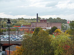 Meadow Mill and the Tesco supermarket, 2013 | |
 Portwood Location within Greater Manchester | |
| OS grid reference | SJ910926 |
| Metropolitan borough | |
| Metropolitan county | |
| Region | |
| Country | England |
| Sovereign state | United Kingdom |
| Post town | STOCKPORT |
| Postcode district | SK1 |
| Dialling code | 0161 |
| Police | Greater Manchester |
| Fire | Greater Manchester |
| Ambulance | North West |
| UK Parliament | |
Portwood is an area of Stockport, in Greater Manchester, England. It lies just east of the town centre, along Great Portwood Street. The rivers Tame and Goyt run through the area, along with the M60 motorway.