Stockport Tiviot Dale railway station

Last updated

Stockport Tiviot Dale
Stockport Tiviot Dale railway station c.1902.jpg
Stockport Tiviot Dale railway station c.1902
Location Stockport, Metropolitan Borough of Stockport
England
Coordinates 53°24′53″N2°09′28″W / 53.4148°N 2.1579°W / 53.4148; -2.1579 Coordinates: 53°24′53″N2°09′28″W / 53.4148°N 2.1579°W / 53.4148; -2.1579
Grid reference SJ896908
Platforms3
Other information
StatusDisused
History
Original company Stockport, Timperley and Altrincham Junction Railway
Pre-grouping Cheshire Lines Committee
Post-groupingCheshire Lines Committee
Key dates
1 December 1865 (1865-12-01)Station opened as Stockport Teviot Dale
circa 1874Renamed Stockport Tiviot Dale
2 January 1967 (1967-01-02)Station closed

Stockport Tiviot Dale was one of two main railway stations serving the town of Stockport, Cheshire, England; the other being Stockport Edgeley (now simply referred to as Stockport).

Contents

Tiviot Dale was named after Teviotdale in Scotland. Prince Charles Stuart camped to the north of the town in 1745. [1]

Location and operating companies

A 1903 Railway Clearing House Junction Diagram showing the station as Teviot Dale, a name often used locally; also the CLC line (in orange) through the station. The joining Midland Railway line (in green) is shown near Heaton Mersey, as are the nearby goods depots at Wellington Road and Portwood Cheadle, Chorlton, Heaton Mersey & Northenden RJD 149.jpg
A 1903 Railway Clearing House Junction Diagram showing the station as Teviot Dale, a name often used locally; also the CLC line (in orange) through the station. The joining Midland Railway line (in green) is shown near Heaton Mersey, as are the nearby goods depots at Wellington Road and Portwood

Tiviot Dale station was located on the Cheshire Lines Committee (CLC) operated Stockport, Timperley and Altrincham Junction Railway line from Portwood to Skelton Junction, a section of what became the Woodley to Glazebrook line. It was situated at the bottom of Lancashire Hill, next to the present motorway bridge. It was opened on 1 December 1865 [2] and was originally known as Stockport Teviot Dale. From 1880, Tiviot Dale was also served by long-distance trains running on the Manchester South District Railway to London St Pancras. [3]

Tiviot Dale remained a part of the CLC, which was jointly owned from 1923 by the London and North Eastern Railway (two-thirds) and the London Midland and Scottish Railway (one-third), until 1948 when it became part of the British Railways London Midland Region.

Station facilities and train services

The Prince of Wales inspecting the guard of honour at Tiviot Dale Station, 1908 The Prince of Wales inspecting the guard of honour at Tiviot Dale Station, 1908.jpg
The Prince of Wales inspecting the guard of honour at Tiviot Dale Station, 1908

The station buildings were substantially built. The main building with booking hall, waiting rooms etc. was located on the south side of the line, approached from Tiviot Dale. It had an ornate Jacobean-style external facade incorporating a long covered portico. [4] There were four lines passing through the station; the central pair permitting goods and other trains to pass through without affecting trains stopping in the two main passenger platforms. There were shorter stub lines to the outer sides of the main platforms to accommodate local trains. [5] A covered footbridge with an unusual arched profile linked the two sides of the station. Tiviot Dale signal box was located just west of the station on the south side of the lines. [6]

A small two-line engine shed was located immediately to the north of the station between 1866 and 1889, with a turntable and six short storage lines. It closed on the opening of Heaton Mersey engine shed in early 1889. [7] Services from the station included routes to Manchester Central, Liverpool Central via Warrington Central, Sheffield via the Hope Valley line, Buxton and Derby via Millers Dale.

Station closure

The station was closed by British Railways on 2 January 1967, [2] with most of its services having fallen victim to the Beeching Axe between 1964 and 1966. The station was demolished the following year. The lines through the station remained in heavy use by coal trains heading for Fiddlers Ferry power station near Warrington from the Woodhead Line. These, however, ceased in 1980 [3] when damage was caused to the nearby Tiviot Dale tunnel during construction work on the M63 motorway (now M60 motorway) and the line temporarily closed for safety reasons. The closure was made permanent west of Bredbury's stone terminal in 1982, following the demise of the Woodhead route; the track was subsequently lifted in 1986 and the tunnel partially filled in. The area surrounding the station was further altered at the beginning of the 21st century to allow the construction of a supermarket and office buildings, which now block the old trackbed.

Related Research Articles

Cheshire Lines Committee Railway in England: active from 1863 to 1947

The Cheshire Lines Committee (CLC) was formed in the 1860s and became the second-largest joint railway in Great Britain. The committee, which was often styled the Cheshire Lines Railway, operated 143 miles (230 km) of track in the then counties of Lancashire and Cheshire. The railway did not get grouped into one of the Big Four during the implementation of the 1923 grouping, surviving independently with its own management until the railways were nationalised at the beginning of 1948. The railway served Liverpool, Manchester, Stockport, Warrington, Widnes, Northwich, Winsford, Knutsford, Chester and Southport with connections to many other railways.

Woodhouse railway station Railway station in South Yorkshire, England

Woodhouse railway station, is a railway station serving Woodhouse and Woodhouse Mill in Sheffield, South Yorkshire, England. The station is 5.25 miles (8 km) east of Sheffield station on the Sheffield to Lincoln Line.

Woodley railway station Railway station in Greater Manchester, England

Woodley railway station serves the suburb of Woodley in Stockport, Greater Manchester, England. The station is 9 14 miles (14.9 km) east of Manchester Piccadilly on a branch of the Hope Valley Line to Rose Hill Marple. It is situated where the A560 road from Stockport to Gee Cross, near Hyde, crosses over the railway line.

Altrincham Interchange

Altrincham Interchange is a transport hub in Altrincham, Greater Manchester, England. It consists of a bus station on Stamford New Road, a Northern Trains-operated heavy rail station on the Mid-Cheshire Line, and a light rail stop which forms the terminus of Manchester Metrolink's Altrincham line. The original heavy rail element of the station was opened by the Manchester, South Junction and Altrincham Railway as Altrincham and Bowdon railway station in April 1881, changing to Altrincham railway station in May 1974. The Metrolink element opened in June 1992. The Interchange underwent a complete redevelopment, at a cost of £19 million, starting in mid-July 2013. The new bus station opened officially on 7 December 2014.

Mid-Cheshire line

The Mid-Cheshire line is a railway line in the northwest of England that used to run from Chester Northgate to Edgeley Junction, Stockport and connects Chester with Manchester Piccadilly via Knutsford. After Chester Northgate closed in 1969 the section between Mickle Trafford Junction and Chester was used for freight trains only until it closed in 1992. From Mickle Trafford passenger trains use the Chester–Warrington line to Chester General instead. The route taken by passenger trains has changed over the years and now differs considerably from the original. Between 2001 and 2014, passenger journeys on the line increased to over 1.7 million per year. A near doubling of the passenger service will occur from December 2018.

Stockport, Timperley and Altrincham Junction Railway

The Stockport, Timperley and Altrincham Junction Railway(ST&AJR) was authorised by an Act of Parliament, passed on 22 July 1861 to build a 8 miles 17 chains (13.2 km) railway from Stockport Portwood to Altrincham.

Liverpool Central High Level railway station Former railway station in Liverpool city centre, England

Liverpool Central High Level was a terminus railway station in central Liverpool, England. It opened on 1 March 1874, at the western end of the Cheshire Lines Committee (CLC) line to Manchester Central. It replaced Brunswick as the CLC's Liverpool passenger terminus, becoming the headquarters of the committee.
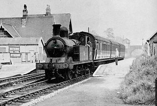
Northenden railway station

Northenden railway station in Sharston, Manchester, England, was built by the Stockport, Timperley and Altrincham Junction Railway (ST&AJ) and opened for passenger and goods traffic on 1 February 1866.

Baguley railway station

Baguley railway station was a station in the south of Manchester, England, at the extreme western edge of Baguley near the southern end of Brooklands Road where Shady Lane crossed the railway line.
Heaton Mersey railway station

Heaton Mersey railway station served the Heaton Mersey district of Stockport between 1880 and 1961.

Godley East railway station

Godley East was a railway station in the Godley area of Hyde, Tameside, Greater Manchester, on the Woodhead Line.

Cheadle North railway station Disused railway station in Cheshire, England

Cheadle North railway station served the village of Cheadle, six miles south of Manchester. It was renamed from Cheadle to Cheadle North on 1 July 1950.

West Timperley railway station was situated on the Glazebrook East Junction–Skelton Junction line of the Cheshire Lines Committee between Glazebrook and Stockport Tiviot Dale. It served the locality between 1873 and 1964.

Broadheath (Altrincham) railway station

Broadheath (Altrincham) railway station served Broadheath and the northern part of Altrincham in Cheshire, England, between its opening in 1853 and closure in 1962.

Cheadle railway station (London and North Western Railway)

Cheadle LNW railway station was a railway station that served Cheadle, Cheshire, England, between 1866 and its closure in 1917.

Glazebrook East Junction–Skelton Junction line

Glazebrook East Junction–Skelton Junction line was a railway line from Glazebrook to Skelton Junction in Greater Manchester.

Widnes Central railway station served the town of Widnes, England from 1879 to 1964.

The Widnes loop was a 5 miles 2 chains (8.1 km) railway line which served the town of Widnes, England from 1879 to 2000.

South Manchester Line

The South Manchester Line (SML) is a tram line of the Manchester Metrolink in Greater Manchester running from Manchester city centre to Didsbury. The line was opened as far as St. Werburgh's Road in 2011 and then to East Didsbury in 2013 as part of phase three of the system's expansion, and runs entirely along a former railway trackbed.

Manchester South District Railway

The Manchester South District Railway (MSDR) was a British railway company that was formed in 1873. It was formed by a group of landowners and businessmen in the south of Manchester, England, with the purpose of building a new railway line through the city's southern suburbs.

References

Notes
  1. 28DL Urban Explorers- Secret Stockport
  2. 1 2 Butt 1995 , p. 220
  3. 1 2 Disused Stations - Stockport Tiviot Dale www.disused-stations.org.uk; Retrieved 2013-08-05
  4. Johnson 1989 , p. 239
  5. Bolger 1984 , p. 76
  6. Johnson 1995 , pp. 76–77
  7. Bolger 1984 , p. 104
Bibliography
Preceding station Disused railways Following station
Cheadle North
Line and station closed
  Cheshire Lines Committee   Reddish North
Line closed, station open
   Woodley
Line closed, station open
   Romiley
Line closed, station open
Heaton Mersey
Line and station closed
  Midland Railway   Reddish North
Line closed, station open