
Rochdale is a seat represented in the House of Commons of the UK Parliament. It has elected one Member of Parliament (MP) since its 1832 creation.

Littleborough railway station serves the town of Littleborough in the Metropolitan Borough of Rochdale, Greater Manchester, England.

Smithy Bridge railway station serves the village of Smithy Bridge and Hollingworth Lake near Rochdale in Greater Manchester, England. The station is on the Caldervale Line 12+3⁄4 miles (20.5 km) north of Manchester Victoria on the way to Leeds.

Rochdale railway station is a multi-modal transport hub in Rochdale, Greater Manchester, England. It consists of a Northern-operated heavy rail station on the Caldervale Line, and an adjoining light rail stop on Metrolink's Oldham and Rochdale Line. The original heavy-rail element of the station was opened by the Manchester and Leeds Railway in 1839 0.5 miles (0.80 km) to the south of Rochdale town centre. The Metrolink element opened in February 2013. Further changes to the station are planned as part of the Northern Hub rail-enhancement scheme.

Castleton railway station serves Castleton in the Metropolitan Borough of Rochdale, Greater Manchester, England. It is 8¾ miles (14 km) north of Manchester Victoria on the Caldervale Line operated and managed by Northern.

Moston railway station in Moston, Manchester, England, is 4 miles (6 km) north of Manchester Victoria on the Caldervale Line managed by Northern.

Whalley railway station serves the village of Whalley in Lancashire, England. The station lies on the Ribble Valley Line 7+1⁄4 miles (11.7 km) north of Blackburn. The station has two platforms, slightly offset from each other. It is unstaffed, with shelters on each platform. Immediately beyond its eastern end, the line crosses the River Calder on a 678-yard (620 m) long, brick viaduct of 48 arches.
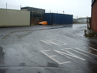
Wardleworth railway station served the township of Wardleworth in Rochdale, in the Metropolitan Borough of Rochdale in Greater Manchester, England, from 1870 until closure in 1947. It was on the Facit Branch between Rochdale and Facit, which was extended to Bacup in 1881. The station was quite well placed for Rochdale town centre and so, in addition to the branch trains, a few other services from Manchester terminated here. Between here and Rochdale station was the Roch Valley Viaduct, now demolished.
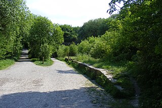
Broadley railway station served Broadley in Rochdale, England, from 1870 until closure in 1947. It was situated at Healey Dell.

Shawclough is a mainly residential area to the north of Rochdale, Greater Manchester, England. Its boundaries are roughly Whitworth Road, Shawclough Road and Healey Corner. Housing is mixed but predominantly owned semi-detached and detached 3-4 bedroom houses. House building over the past 30 years has significantly reduced green spaces, though Healey Dell and Falinge Park are notable areas within Shawclough. Industry in the area is low level, though at one time, manufacturing did take place at the Turner Brothers Asbestos Company in the near vicinity. Shawclough is part of the Healey parish district of Rochdale.

Healey is part of the Metropolitan Borough of Rochdale, Greater Manchester, England. Historically part of Lancashire, it includes Shawclough, Syke and Nook Farm and the rest of the land known as Healey on the right side of Whitworth Road (A671) after Gale Street up to Healey Corner. The population of this Rochdale ward at the 2011 census was 10,411.

Miles Platting railway station served the district of Miles Platting in Manchester from 1844 until closure on 27 May 1995. The station was opened on 1 January 1844 by the Manchester and Leeds Railway; after amalgamating with other railways, this became the Lancashire and Yorkshire Railway in 1847. The station was situated at the junction of the lines to Stalybridge and Rochdale, and had platforms on both routes. Little trace remains of the station today, as the platforms were removed and the buildings demolished after closure. However, a length of platform awning has been re-erected at Ramsbottom station on the preserved East Lancs Railway.

Newton Heath Railway Station served the district of Newton Heath in east Manchester. It was opened by the Lancashire and Yorkshire Railway (LYR) on 1 December 1853 and was closed by British Railways on 3 January 1966.
The Rochdale–Bacup line was a branch railway line which ran between Rochdale in Lancashire and Bacup in Lancashire via seven intermediate stops, Wardleworth, Shawclough and Healey, Broadley, Whitworth, Facit, Shawforth, and Britannia.
Roch Valley Viaduct was built in the 1860s in Rochdale, Greater Manchester and carried the Rochdale to Bacup railway line between Rochdale and Wardleworth stations.

.

The River Tib is a minor tributary of the River Medlock in Manchester, England. It has been culverted along its entire length since about 1783 and now runs beneath Manchester city centre. Tib Street and Tib Lane are named after the watercourse.
Drake Street tram stop was a proposed tram stop for Greater Manchester's Metrolink light rail system, that was to be created to serve passengers boarding and alighting at Drake Street in Rochdale, England. It was also known by the name Wet Rake tram stop, and was set to be located on the Oldham and Rochdale Line between Rochdale railway station and Rochdale Town Centre tram stop.
Slattocks is a proposed railway station in Castleton, Greater Manchester. It would be located between Mills Hill and Castleton in the Metropolitan Borough of Rochdale.
