Potony

Last updated
Potony
Potonja(in Croatian)
Village
HUN Potony COA.svg
Hungary location map.svg
Red pog.svg
Potony
Location of Potony
Coordinates: 45°55′49″N17°39′02″E / 45.93033°N 17.65060°E / 45.93033; 17.65060 Coordinates: 45°55′49″N17°39′02″E / 45.93033°N 17.65060°E / 45.93033; 17.65060
Country Flag of Hungary.svg  Hungary
Region Southern Transdanubia
County Somogy
District Barcs
RC Diocese Pécs [1]
Area
  Total15.9 km2 (6.1 sq mi)
Population
 (2017)
  Total176 [2]
Demonym potonyi
Time zone UTC+1 (CET)
  Summer (DST) UTC+2 (CEST)
Postal code
7977
Area code (+36) 82
NUTS 3 code HU232
MP László Szászfalvi (KDNP)

Potony (Croatian : Potonja) is a village in Somogy County, Hungary.

Contents

Geography

It lies east of Barcs, 4 km (2.5 mi) from the River Drava, on the border of Somogy and Baranya County. Neighboring villages are Kastélyosdombó, Lakócsa, Tótújfalu and Drávagárdony. The EuroVelo international cycling 13th Vasfüggöny trail runs through the settlement.

History

Potony was first mentioned in the papal tithe register between 1332 and 1337 and already had its own parish. In 1376 it appeared as Poton, in 1403 as Szent-Pál Valley in official documents. There was also another village, Gerenda which perished after 1660. There were nine peasant families in the village in 1695. From the 18th century it was a possession of the Esterházy family who invited Croatian settlers there at that time from Slavonia. [3] According to the 1772 census the residents of Potony spoke all Croatian. The 1870 census shows that it had 431 Croatian or Serb, 154 Hungarian, 1 German and 1 Slovak resident. The name Potony is since 1909 in use. It had 699 residents, 82% of whom were Croats.

Economy

A 400,000 m³ reservoir is under construction as part of the Old-Drava Program.

Main sights

Related Research Articles

<span class="mw-page-title-main">Baranya County</span> County of Hungary

Baranya is a county in southern Hungary. It is part of the Southern Transdanubia statistical region and the historical Baranya region, which was a county (comitatus) in the Kingdom of Hungary dating back to the 11th century. Its current status as one of the 19 counties of Hungary was established in 1950 as part of wider Soviet administrative territorial reform following World War II. It is bordered by Somogy County to the northwest, Tolna County to the north, Bács-Kiskun County and the Danube to the east, and the border with Croatia to the south.

<span class="mw-page-title-main">Somogy County</span> County of Hungary

Somogy is an administrative county in present Hungary, and also in the former Kingdom of Hungary.

<span class="mw-page-title-main">Transdanubia</span> Traditional region of Hungary

Transdanubia is a traditional region of Hungary. It is also referred to as Hungarian Pannonia, or Pannonian Hungary.

<span class="mw-page-title-main">Barcs</span> Town in Southern Transdanubia, Hungary

Barcs is a border town in Somogy County, Hungary, and the seat of Barcs District. The Drava River marks the southern boundary of the settlement.

<span class="mw-page-title-main">Csurgó</span> Town in Southern Transdanubia, Hungary

Csurgó is a town in Somogy County, Hungary, and the seat of Csurgó District.

<span class="mw-page-title-main">Zala County (former)</span>

Zala was an administrative county (comitatus) of the Kingdom of Hungary, bordered by the river Drave to the south. The territory of the former county is now divided between Hungary, Croatia and Slovenia. The capital of the county was Zalaegerszeg.

<span class="mw-page-title-main">Somogy County (former)</span>

Somogy was an administrative county (comitatus) of the Kingdom of Hungary. Its territory, which was slightly larger than that of present Somogy county, is now in south-western Hungary. The capital of the county was Kaposvár.

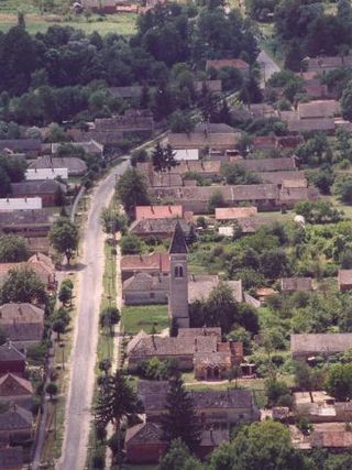
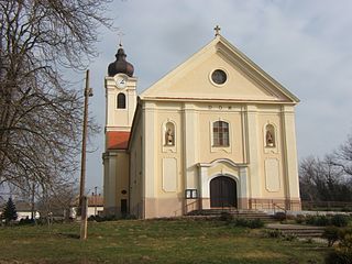
Heresznye is a village in Somogy county, Hungary.

Ecseny is a village in Somogy county, Hungary.

<span class="mw-page-title-main">Somogyaracs</span> Village in Southern Transdanubia, Hungary

Somogyaracs is a village in Somogy county, Hungary.

<span class="mw-page-title-main">Babócsa</span> Village in Southern Transdanubia, Hungary

Babócsa is a village in Somogy County, Hungary.

<span class="mw-page-title-main">Somogyszentpál</span> Village in Southern Transdanubia, Hungary

Somogyszentpál is a village in Somogy County, Hungary.

Szulok is a village in Somogy county, Hungary.

<span class="mw-page-title-main">Gyékényes</span> Village in Southern Transdanubia, Hungary

Gyékényes is a village in Somogy county, Hungary next to the Croatian border. Its train station serves as an important crossing point into Croatia.

Lakócsa is a village in Somogy County, Hungary.

<span class="mw-page-title-main">Vízvár</span> Village in Southern Transdanubia, Hungary

Vízvár is a village in Somogy County, Hungary. Zsitvapuszta and Csütörtökhely are parts of the settlement.

Tótújfalu is a village in Somogy county, Hungary.

Szentborbás is the southernmost village of Somogy county, Hungary. Krancsevicza-puszta is part of the village.

<span class="mw-page-title-main">Barcs District</span> Districts of Hungary in Southern Transdanubia

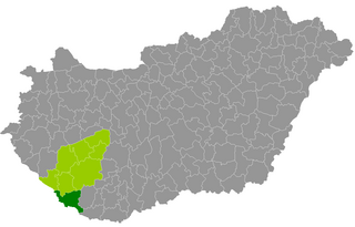
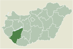
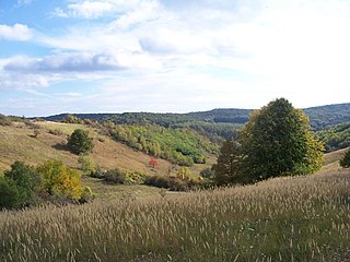
Barcs is a district in southern part of Somogy County. Barcs is also the name of the town where the district seat is found. The district is located in the Southern Transdanubia Statistical Region.

<span class="mw-page-title-main">Somogy County 2nd constituency</span> Constituency in Hungary (2012-)

The 2nd constituency of Somogy County is one of the single member constituencies of the National Assembly, the national legislature of Hungary. The constituency standard abbreviation: Somogy 02. OEVK.

References