Bruin, Dutch for "brown", is used in English as a folk term for brown bears.

U.S. Route 1 or U.S. Highway 1 (US 1) is a major north–south United States Numbered Highway that serves the East Coast of the United States. It runs 2,369 miles (3,813 km), from Key West, Florida north to Fort Kent, Maine, at the Canadian border, making it the longest north–south road in the United States. US 1 is generally paralleled by Interstate 95 (I-95), though the former is significantly farther west (inland) between Jacksonville, Florida, and Petersburg, Virginia. The highway connects most of the major cities of the East Coast—including Miami, Jacksonville, Richmond, Washington, D.C., Baltimore, Philadelphia, New York City, and Boston passing from the Southeastern United States to New England.

The East Coast of the United States, also known as the Eastern Seaboard, the Atlantic Coast, and the Atlantic Seaboard, is the coastline along which the Eastern United States meets the North Atlantic Ocean. The coastal states that have shoreline on the Atlantic Ocean are, from north to south, Maine, New Hampshire, Massachusetts, Rhode Island, Connecticut, New York, New Jersey, Delaware, Maryland, Virginia, North Carolina, South Carolina, Georgia, and Florida.
Providence often refers to:

Caswell County is a county located in the U.S. state of North Carolina. As of the 2010 census, the population was 23,719. Its county seat is Yanceyville.

Lake Providence is a town in and the parish seat of East Carroll Parish in northeastern Louisiana. The population was 5,104 at the 2000 census but declined by 21.8 percent to 3,991 in 2010. The town's poverty rate is approximately 55 percent; the average median household income is $16,500, and the average age is 31.

Waxhaw is a town in Union County, North Carolina, United States. The population was 9,859 according to the 2010 Census.

New Providence is the most populous island in The Bahamas, containing more than 70% of the total population. It is the location of the national capital city of Nassau, whose boundaries are coincident with the island; it had a population of 246,329 at the 2010 Census; the latest estimate (2016) is 274,400. The island was originally under Spanish control following Christopher Columbus's discovery of the New World, but the Spanish government showed little interest in developing the island. Nassau, the island's largest city, was formerly known as Charles-town, but it was burned to the ground by the Spanish in 1684. It was laid out and renamed Nassau in 1695 by Nicholas Trott, the most successful Lord Proprietor, in honor of the Prince of Orange-Nassau who became William III of England. The three branches of Bahamian Government: the executive, the legislative, and the judiciary, are all headquartered on New Providence. New Providence functions as the main commercial hub of The Bahamas. It is also home to more than 400 banks and trust companies, and its hotels and port account for more than two-thirds of the four million-plus tourists who visit The Bahamas annually. Other settlements on New Providence include Grants Town, Bain Town, Fox Hill, Adelaide, Yamacraw, South Beach, Coral Harbour, Lyford Cay, Paradise Island, Sea Breeze, Centreville, The Grove (South) and The Grove, Cable Beach, Delaporte, Gambier, Old Fort Bay, and Love Beach.
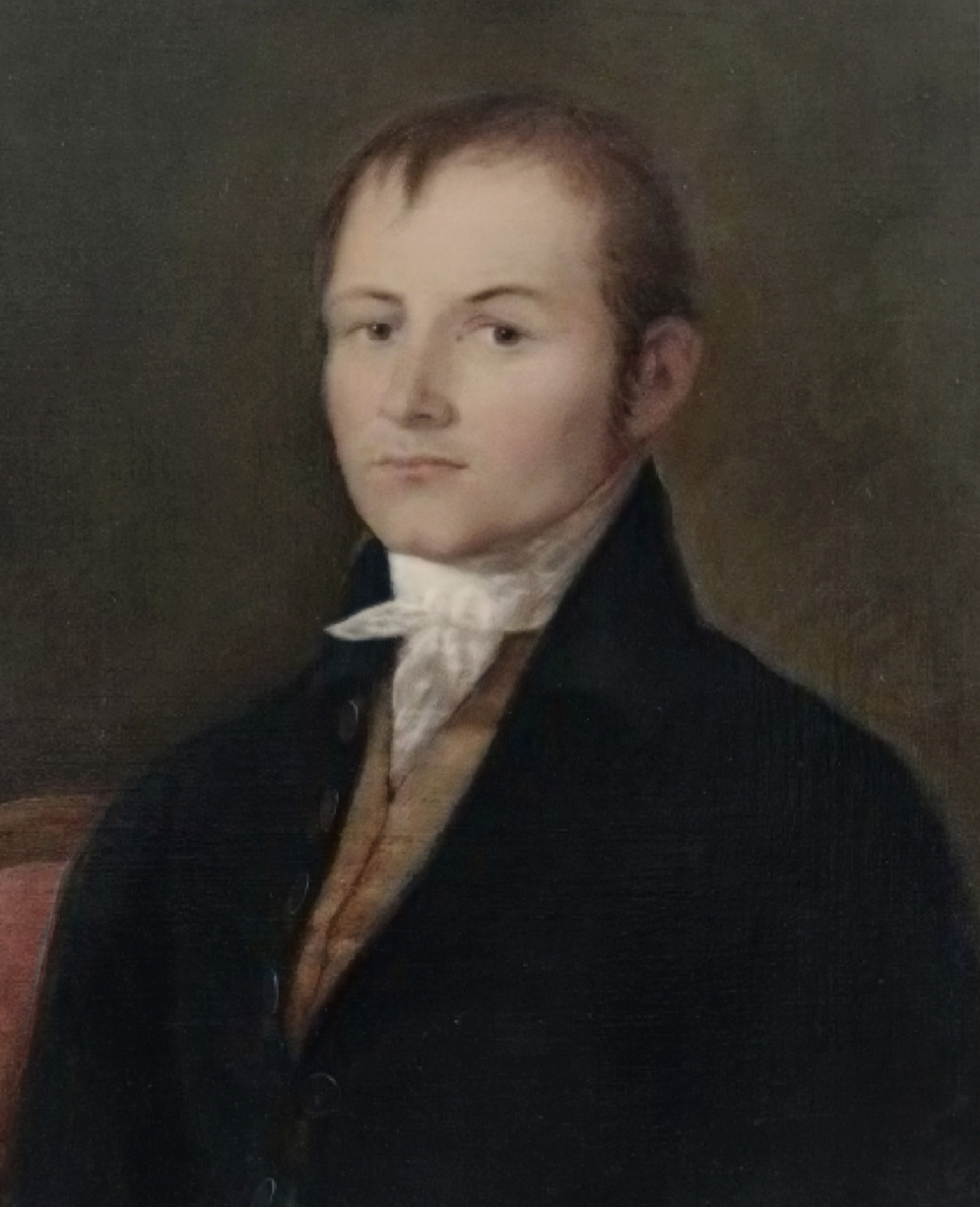
Alexander Gillon was an American merchant and seaman from Charleston, South Carolina. He represented South Carolina in the U.S. House in 1793 and 1794.
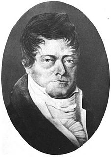
David Rogerson Williams was a Representative in the United States Congress and the 45th Governor of South Carolina from 1814 to 1816.

Providence Senior High School is a Charlotte Mecklenburg School District high school located off of Pineville-Matthews Road in Charlotte, North Carolina, in suburban South Charlotte. Providence serves southern and southeastern Mecklenburg County. Its mascot is the Panther, and its colors are black and gold.

Climax is an unincorporated community on the border of Guilford County and Randolph County, North Carolina, United States. Its ZIP code is 27233. The center of the community is in Fentress Township in Guilford County, but development with Climax mailing addresses extends south into Providence Township in Randolph County. The community is located along North Carolina Highway 62 west of its junction with the U.S. Highway 421 freeway. North Carolina Highway 22 leads south from NC 62 in the east part of Climax into Randolph County. Climax is just south of the town of Pleasant Garden.
The 1971 Davis Cup was the 60th edition of the Davis Cup, the most important tournament between national teams in men's tennis. 28 teams entered the Europe Zone, 13 teams entered the Americas Zone, and 9 teams entered the Eastern Zone. Bolivia made its first appearance in the tournament.
Jonathan Maxcy was the second president of Brown University ; the third president of Union College; and the first president of the University of South Carolina.
Ojetta Rogeriee Thompson, known commonly as O. Rogeriee Thompson, is a United States Circuit Judge of the United States Court of Appeals for the First Circuit and a former Rhode Island Superior Court justice.
The United States Senate elections of 1804 and 1805 were elections that expanded the Democratic-Republican Party's overwhelming control over the United States Senate. The Federalists went into the elections with such a small share of Senate seats that even if they had won every election, they would have still remained a minority caucus.
The United States Senate elections of 1802 and 1803 were elections for the United States Senate which had the Democratic-Republican Party assume an overwhelming control thereof.
Providence is an unincorporated community in Caswell County, North Carolina, United States. Providence is 7 miles (11 km) north-northwest of Yanceyville and directly south of Danville, Virginia. Providence has a post office with ZIP code 27315.
The Carolinas Geographical Union is the Geographical Union (GU) for rugby union teams playing in North Carolina and South Carolina for USA Rugby.

The 2016 NCAA Division I Men's Soccer Tournament was the 58th annual single-elimination tournament to determine the national champion of NCAA Division I men's collegiate soccer. The first, second, third, and quarterfinal rounds were held at college campus sites across the United States during November and December 2016, with host sites determined by seeding and record. The four-team College Cup finals was played at BBVA Compass Stadium in Houston, Texas on December 9 and 11, 2016.


