Woodford, South Carolina

Last updated

Woodford, South Carolina
SCMap-doton-Woodford.PNG
Coordinates: 33°40′4″N81°6′44″W / 33.66778°N 81.11222°W / 33.66778; -81.11222
Country United States
State South Carolina
County Orangeburg
Area
[1]
  Total0.79 sq mi (2.03 km2)
  Land0.79 sq mi (2.03 km2)
  Water0.00 sq mi (0.00 km2)
Elevation
381 ft (116 m)
Population
 (2020) [2]
  Total161
  Density205.10/sq mi (79.18/km2)
Time zone UTC-5 (EST)
  Summer (DST) UTC-4 (EDT)
ZIP code
29112 [3]
Area code 803
FIPS code 45-78910 [4]
GNIS feature ID1231936 [5]

Woodford is a town in Orangeburg County, South Carolina, United States. The population was 185 at the 2010 census.

Contents

Geography

Woodford is located at 33°40′4″N81°6′44″W / 33.66778°N 81.11222°W / 33.66778; -81.11222 (33.667720, -81.112088). [6]

According to the United States Census Bureau, the town has a total area of 0.8 square miles (2.1 km2), all land.

Demographics

Historical population
CensusPop.Note
1900 205
1910 190−7.3%
1920 144−24.2%
1930 22354.9%
1940 211−5.4%
1950 179−15.2%
1960 172−3.9%
1970 19513.4%
1980 2065.6%
1990 200−2.9%
2000 196−2.0%
2010 185−5.6%
2020 161−13.0%
U.S. Decennial Census [7] [2]

2020 census

Woodford town, South Carolina – Demographic Profile
(NH = Non-Hispanic)
Note: the US Census treats Hispanic/Latino as an ethnic category. This table excludes Latinos from the racial categories and assigns them to a separate category. Hispanics/Latinos may be of any race.
Race / EthnicityPop 2010 [8] Pop 2020 [9] % 2010% 2020
White alone (NH)757140.54%44.10%
Black or African American alone (NH)977952.43%49.07%
Native American or Alaska Native alone (NH)311.62%0.62%
Asian alone (NH)000.00%0.00%
Pacific Islander alone (NH)000.00%0.00%
Some Other Race alone (NH)000.00%0.00%
Mixed Race/Multi-Racial (NH)060.00%3.73%
Hispanic or Latino (any race)1045.41%2.48%
Total185161100.00%100.00%

As of the census [4] of 2000, there were 196 people, 81 households, and 54 families residing in the town. The population density was 248.2 inhabitants per square mile (95.8/km2). There were 103 housing units at an average density of 130.5 per square mile (50.4/km2). The racial makeup of the town was 50.51% African American, 47.96% White, 1.02% from other races, and 0.51% from two or more races. Hispanic or Latino of any race were 1.53% of the population.

There were 81 households, out of which 23.5% had children under the age of 18 living with them, 48.1% were married couples living together, 13.6% had a female householder with no husband present, and 32.1% were non-families. 30.9% of all households were made up of individuals, and 19.8% had someone living alone who was 65 years of age or older. The average household size was 2.42 and the average family size was 3.00.

In the town, the population was spread out, with 22.4% under the age of 18, 7.7% from 18 to 24, 26.0% from 25 to 44, 25.5% from 45 to 64, and 18.4% who were 65 years of age or older. The median age was 41 years. For every 100 females, there were 90.3 males. For every 100 females age 18 and over, there were 76.7 males.

The median income for a household in the town was $24,792, and the median income for a family was $36,875. Males had a median income of $26,667 versus $19,375 for females. The per capita income for the town was $12,158. About 14.3% of families and 12.4% of the population were below the poverty line, including 10.4% of those under the age of eighteen and 31.6% of those 65 or over.

Related Research Articles

<span class="mw-page-title-main">Shorter, Alabama</span> Town in Alabama, United States

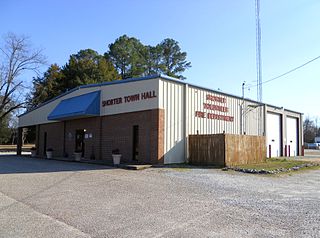
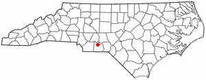
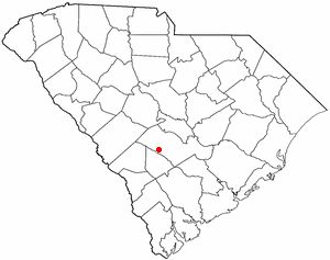
Shorter is a town in Macon County, Alabama, United States. At the 2020 census the population was 385, down from 474 at the 2010 census. According to the 1990 U.S. Census records, it was incorporated in 1984.

<span class="mw-page-title-main">Harrell, Arkansas</span> Town in Arkansas, United States

Harrell is a town in Calhoun County, Arkansas, United States. The population was 254 at the 2010 census. It is part of the Camden Micropolitan Statistical Area.

<span class="mw-page-title-main">Zolfo Springs, Florida</span> Town in the state of Florida, United States

Zolfo Springs is a town in Hardee County, Florida, United States. It is part of the Florida Heartland region. The population was 1,737 at the 2020 census.

<span class="mw-page-title-main">Astatula, Florida</span> Town in the state of Florida, United States

Astatula is a town in Lake County, Florida, United States. The population was 1,889 at the 2020 census. It is part of the Orlando–Kissimmee–Sanford Metropolitan Statistical Area.

<span class="mw-page-title-main">Mascotte, Florida</span> City in Florida

Mascotte is a city in Lake County, Florida, United States. As of the 2020 census, the population was 6,609, up from 5,101 in 2010. It is part of the Orlando–Kissimmee–Sanford Metropolitan Statistical Area.

<span class="mw-page-title-main">Pierson, Florida</span> Town in the state of Florida, United States

Pierson is a town in Volusia County, Florida, United States. The town is part of the Deltona–Daytona Beach–Ormond Beach, Florida Metropolitan Statistical Area. The population was 1,542 as of the 2020 census.

<span class="mw-page-title-main">Winstonville, Mississippi</span> Town in Mississippi, United States

Winstonville is a town in Bolivar County, Mississippi, United States. Per the 2020 census, the population was 153.

<span class="mw-page-title-main">Bellerive Acres, Missouri</span> City in Missouri, United States

Bellerive Acres is a northern suburban city in St. Louis County, Missouri, United States. The population was 188 at the 2010 census. In April, 2015, the residents voted to change the village of Bellerive to a fourth class city named Bellerive Acres.

<span class="mw-page-title-main">Ansonville, North Carolina</span> Town in North Carolina, United States

Ansonville is a town in Anson County, North Carolina, United States. The population was 440 at the 2020 census. The town has a total area of 1.5 square miles (3.8 km2), all land. It is located on the northern edge of Anson County, about a mile west of the Pee Dee River.

Boardman is a town in Columbus County, North Carolina, United States. Per the 2020 census, the population was 166.

<span class="mw-page-title-main">Hassell, North Carolina</span> Town in North Carolina, United States

Hassell is a town in Martin County, North Carolina, United States. The population was 84 at the 2010 census.

<span class="mw-page-title-main">Oak City, North Carolina</span> Town in North Carolina, United States

Oak City, formerly known as Goose Nest, is a town in Martin County, North Carolina, United States. The population was 266 at the 2020 census.

<span class="mw-page-title-main">Forest Park, Oklahoma</span> Town in Oklahoma, United States

Forest Park is a town in Oklahoma County, Oklahoma, United States, and a part of the Oklahoma City metropolitan area. The population was 998 at the 2010 census.

<span class="mw-page-title-main">Pamplico, South Carolina</span> Town in South Carolina, United States

Pamplico is a town in southeastern Florence County, South Carolina, United States. The population was 1,226 at the 2010 census. It is part of the Florence Metropolitan Statistical Area.

<span class="mw-page-title-main">Heath Springs, South Carolina</span> Town in South Carolina, United States

Heath Springs is a town in Lancaster County, South Carolina, United States. The population was 742 at the 2020 census.

<span class="mw-page-title-main">Blenheim, South Carolina</span> Town in South Carolina, United States

Blenheim is a town in Marlboro County, South Carolina, United States. The population was 154 at the 2010 census. It is named for Blenheim Palace in Oxfordshire, England. Blenheim Palace was the residence of the Duke of Marlborough, after whom Marlboro County is named.

<span class="mw-page-title-main">Cope, South Carolina</span> Town in South Carolina, United States

Cope is a town in Orangeburg County, South Carolina, United States. The population was 65 at the 2020 census, a decline from 80 in 2010.

<span class="mw-page-title-main">Neeses, South Carolina</span> Town in South Carolina, United States

Neeses is a town in Orangeburg County, South Carolina, United States. The population was 374 at the 2010 census.

<span class="mw-page-title-main">Springfield, South Carolina</span> Town in South Carolina, United States

Springfield is a town in Orangeburg County, South Carolina, United States. The population was 524 at the 2010 census.

<span class="mw-page-title-main">Northfork, West Virginia</span> Town in West Virginia, United States

Northfork is a town in McDowell County, West Virginia, United States, located on U.S. Route 52 between Welch and Bluefield.

References

  1. "ArcGIS REST Services Directory". United States Census Bureau. Retrieved October 15, 2022.
  2. 1 2 "Census Population API". United States Census Bureau. Retrieved October 15, 2022.
  3. "Woodford SC ZIP Code". zipdatamaps.com. 2023. Retrieved February 17, 2023.
  4. 1 2 "U.S. Census website". United States Census Bureau . Retrieved January 31, 2008.
  5. "US Board on Geographic Names". United States Geological Survey. October 25, 2007. Retrieved January 31, 2008.
  6. "US Gazetteer files: 2010, 2000, and 1990". United States Census Bureau. February 12, 2011. Retrieved April 23, 2011.
  7. "Census of Population and Housing". Census.gov. Retrieved June 4, 2015.
  8. "P2 HISPANIC OR LATINO, AND NOT HISPANIC OR LATINO BY RACE – 2010: DEC Redistricting Data (PL 94-171) – Woodford town, South Carolina". United States Census Bureau .
  9. "P2 HISPANIC OR LATINO, AND NOT HISPANIC OR LATINO BY RACE – 2020: DEC Redistricting Data (PL 94-171) – Woodford town, South Carolina". United States Census Bureau .