Queen Anne, Prince George's County, Maryland

Last updated

Queen Anne
USA Maryland location map.svg
Red pog.svg
Queen Anne
Location within the state of Maryland
Usa edcp location map.svg
Red pog.svg
Queen Anne
Queen Anne (the United States)
Coordinates: 38°53′55″N76°40′42″W / 38.89861°N 76.67833°W / 38.89861; -76.67833
CountryFlag of the United States.svg  United States
State Flag of Maryland.svg  Maryland
County Flag of Prince George's County, Maryland (1963-present).svg Prince George's
Area
[1]
  Total8.74 sq mi (22.63 km2)
  Land8.71 sq mi (22.57 km2)
  Water0.02 sq mi (0.06 km2)
Elevation
50 ft (20 m)
Population
 (2020)
  Total1,405
  Density161.23/sq mi (62.25/km2)
Time zone UTC−5 (Eastern (EST))
  Summer (DST) UTC−4 (EDT)
Area code(s) 301, 240
FIPS code 24-64495

Queen Anne in Prince George's County, Maryland, United States, is a former port on the Patuxent River. It was delineated as a CDP for the 2010 census, at which time it had a population of 1,280. [2] Per the 2020 census, the population was 1,405. [3]

Contents

Geography

Queen Anne is located at 38°53'55" North, 76°40'42" West (38.8987239 -76.6782992). [4] Most of the town's former waterfront area is now part of Patuxent River Park, owned and operated by the Maryland-National Capital Park and Planning Commission. This includes hiking trails, two paddling launches, fishing locations, and an environmental education center operated by 4H. The head of tidewater on the Patuxent River is at the downstream (4H---a group not affiliated with the National 4H Club) launch site in Queen Anne.

According to the U.S. Census Bureau, Queen Anne has a total area of 8.7 square miles (22.6 km2), of which 0.02 square miles (0.06 km2), or 0.25%, is water. [5]

History

The town was created in 1706 when the colonial Maryland Legislature authorized surveying and laying out the towns of Queen Anne Town, Nottingham, Mill Town, Piscataway, Aire (also known as Broad Creek) and Upper Marlboro (then known as Marlborough Town). [6] [7] [8]

Queen Anne's Town was created as part of a 1706 act "for the advancement of trade and erecting ports and towns in the Province of Maryland." The town grew to a population of about 150.

In 1747, the legislature tried to improve the quality and the method of marketing tobacco, then the major crop of the area, and established a formal system of tobacco inspection and quality control. A tobacco inspection station and warehouse was located on Hazelwood, then owned by Thomas Lancaster, one of the town's leading merchants. [9] Hazelwood Mansion, though in disrepair, stands today and is owned by the Maryland National Park and Planning Commission). This was one of seven state tobacco warehouses built in Prince George's County. [8] A horse racing track was also built in the town. [10]

By the mid-18th century, upland farming in the Patuxent basin without erosion control led to massive silting of the river. The ports along the Patuxent quickly filled with silt and could no longer take in ocean-going vessels [10] such as the snows that frequented the town. [8] The last cargo ship left for England about 1790, and the town began to decline. [10]

During the War of 1812, the Chesapeake Bay Flotilla commanded by Joshua Barney scuttled his entire fleet in the half dozen miles of river below Queen Anne to avoid the vessels being captured by the advancing British. [11]

Demographics

Historical population
CensusPop.Note
2010 1,280
2020 1,4059.8%
U.S. Decennial Census [12]
2010 [13] 2020 [14]

2020 census

Queen Anne CDP, Maryland – Racial and ethnic composition
Note: the US Census treats Hispanic/Latino as an ethnic category. This table excludes Latinos from the racial categories and assigns them to a separate category. Hispanics/Latinos may be of any race.
Race / Ethnicity (NH = Non-Hispanic)Pop 2010 [13] Pop 2020 [14] % 2010% 2020
White alone (NH)54049242.19%35.02%
Black or African American alone (NH)63468549.53%48.75%
Native American or Alaska Native alone (NH)420.31%0.14%
Asian alone (NH)16481.25%3.42%
Pacific Islander alone (NH)210.16%0.07%
Some Other Race alone (NH)560.39%0.43%
Mixed Race or Multi-Racial (NH)30532.34%3.77%
Hispanic or Latino (any race)491183.83%8.40%
Total1,2801,405100.00%100.00%

Queen Anne Bridge

Queen Anne Bridge, originally built in 1755, once served as a main road connecting Anne Arundel County to Prince George's County. [15]

Renaming

In 1897 the United States Board on Geographic Names decided to change the name of Queen Anne to Hardesty to avoid confusion with the other town in Maryland named Queen Anne. [16] However, local usage including signage, road names, bridge names, commercial mapping, the community association name, etc. continues to reflect the Queen Anne name. For the 2010 census, the U.S. Census Bureau used the original name of "Queen Anne" in delineating a new census-designated place covering the community.

Education

Prince George's County Public Schools operates public schools serving the census-designated place. [17]

Schools serving sections of the CDP are Pointer Ridge Elementary School, [18] Benjamin Tasker Middle School, [19] and Bowie High School. [20]

Related Research Articles

<span class="mw-page-title-main">Prince George's County, Maryland</span> County in Maryland, United States

Prince George's County is located in the U.S. state of Maryland bordering the eastern portion of Washington, D.C. As of the 2020 U.S. census, the population was 967,201, making it the second-most populous county in Maryland, behind neighboring Montgomery County. The 2020 census counted an increase of nearly 104,000 in the previous ten years. Its county seat is Upper Marlboro. It is the largest and the second most affluent African American-majority county in the United States, with five of its communities identified in a 2015 top ten list.

<span class="mw-page-title-main">Odenton, Maryland</span> Census-designated place in Maryland, U.S.

Odenton is a census-designated place (CDP) in Anne Arundel County, Maryland, United States, located approximately 10–20 minutes from the state capital, Annapolis. The population was 37,132 at the 2010 census, up from 20,534 at the 2000 census. The town's population growth rate of 80.8% between 2000 and 2010 was the greatest of any town in western Anne Arundel County. Odenton is located west of Annapolis, south of Baltimore, and northeast of Washington.

<span class="mw-page-title-main">Prince Frederick, Maryland</span> Census-designated place in Maryland, United States

Prince Frederick is an unincorporated community and census-designated place (CDP) in Calvert County, Maryland, United States. As of the 2020 census, the population of Prince Frederick was 3,226, up from 2,538 in 2010. It is the county seat of Calvert County.

<span class="mw-page-title-main">Bowie, Maryland</span> City in Maryland, United States

Bowie is a city in Prince George's County, Maryland, United States. Per the 2020 census, the population was 58,329. Bowie has grown from a small railroad stop to the largest municipality in Prince George's County, and the fifth most populous city and third largest city by area in the U.S. state of Maryland. In 2014, CNN Money ranked Bowie 28th in its Best Places to Live list.

<span class="mw-page-title-main">Eagle Harbor, Maryland</span> Town in Maryland, United States

Eagle Harbor is an incorporated town in the far southeast corner of Prince George's County, Maryland, United States, and near the rural community of Aquasco that is known as a historic African American community founded in 1925. Per the 2020 census, the population was 67. The Chalk Point Generating Station, owned by NRG Energy, which was sold to Mirant by the Potomac Electric Power Company (PEPCO) in 2000, is located adjacent to the town.

<span class="mw-page-title-main">Kettering, Maryland</span> Census-designated place in Maryland, United States

Kettering is an unincorporated area and census-designated place in Prince George's County, Maryland, United States. At the 2020 United States Census, the population was 14,424,. Kettering is adjacent to Prince George's Community College, the upscale gated community of Woodmore, Six Flags America, Evangel Temple megachurch, and the community of Largo at the end of the Washington Metro Blue Line. Watkins Regional Park in Kettering offers a large playground, a colorful carousel, miniature golf, a miniature train ride, and various animals.

<span class="mw-page-title-main">Mitchellville, Maryland</span> Census-designated place in Maryland

Mitchellville is an upper-class majority African-American unincorporated area and census-designated place (CDP) in Prince George's County, Maryland, United States. Per the 2020 census, the population was 11,136.

<span class="mw-page-title-main">Springdale, Maryland</span> Census-designated place in Maryland

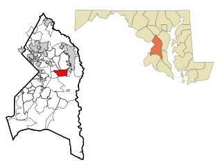
Springdale is an unincorporated area and census-designated place (CDP) in Prince George's County, Maryland, United States. Per the 2020 census, the population was 5,301.

<span class="mw-page-title-main">Upper Marlboro, Maryland</span> Town in Maryland, United States

Upper Marlboro, officially the Town of Upper Marlboro, is the seat of Prince George's County, Maryland. As of the 2020 census, the population within the town limits was 652, although Greater Upper Marlboro, which covers a large area outside the town limits, is many times larger.

<span class="mw-page-title-main">Patuxent River</span> River in Maryland, United States

The Patuxent River is a tributary of the Chesapeake Bay in the state of Maryland. There are three main river drainages for central Maryland: the Potomac River to the west passing through Washington, D.C., the Patapsco River to the northeast passing through Baltimore, and the Patuxent River between the two. The 908-square-mile (2,352 km2) Patuxent watershed had a rapidly growing population of 590,769 in 2000. It is the largest and longest river entirely within Maryland, and its watershed is the largest completely within the state.

Seabrook is an unincorporated community and census-designated place (CDP) in Prince George's County, Maryland, United States, located approximately 12 miles (19 km) east of Washington, D.C. Per the 2020 census, the population was 19,627. Prior to 2010, Seabrook was part of the Lanham-Seabrook census-designated place.

Lanham is an unincorporated community and census-designated place in Prince George's County, Maryland. As of the 2020 United States Census it had a population of 11,282. The New Carrollton station as well as an Amtrak station are across the Capital Beltway in New Carrollton, Maryland. Doctors Community Hospital is located in Lanham.

<span class="mw-page-title-main">Piscataway, Maryland</span> Historic district in Maryland, United States

Piscataway is an unincorporated community in Prince George's County, Maryland, United States. It is one of the oldest European-colonized communities in the state. The Piscataway Creek provided sea transportation for export of tobacco. It is located near the prior Piscataway tribe village of Kittamaqundi.

<span class="mw-page-title-main">Aquasco, Maryland</span> Census-designated place in Maryland

Aquasco is an unincorporated area and census-designated place in southeastern Prince George's County, Maryland, United States, surrounding the town of Eagle Harbor and bordering Charles County. As of the 2020 census, the CDP had a population of 913. Aquasco was home to the Aquasco Speedway.

<span class="mw-page-title-main">Croom, Maryland</span> Census-designated place in Maryland

Croom is an unincorporated community and census-designated place in Southern Prince George's County, Maryland, United States. As of the 2020 census it had a population of 2,720. Croom largely consists of former tobacco farms and forests converted to Washington bedroom subdivisions such as nearby Marlton. The main part of Patuxent River Park is in Croom.

<span class="mw-page-title-main">Baden, Maryland</span> Census-designated place in Maryland, United States

Baden is an unincorporated area and census-designated place in southeastern Prince George's County, Maryland, United States. As of the 2020 census, the CDP had a population of 2,114.

<span class="mw-page-title-main">Brock Hall, Maryland</span> Census-designated place in Maryland

Brock Hall is an unincorporated area and census-designated place in eastern Prince George's County, Maryland, United States, located south of Largo and Bowie, and north of Upper Marlboro. As of the 2020 census, the CDP had a population of 13,181.

Fairwood is an unincorporated area and census-designated place (CDP) in Prince George's County, Maryland, United States. The population was 7,983 at the 2020 census.

<span class="mw-page-title-main">Marlboro Meadows, Maryland</span> Census-designated place in Maryland

Marlboro Meadows is an unincorporated community and census-designated place (CDP) in Prince George's County, Maryland, United States. Per the 2020 census, the population was 3,655. It was newly delineated for the 2010 census prior to which the area was part of the Greater Upper Marlboro census-designated place.

Queensland is a census-designated place south of Upper Marlboro in Prince George's County, Maryland, United States. The population of the CDP was 2,191 at the 2020 census. It was formerly known as Queenland until 2014 when its name was changed to Queensland and a small portion of its geography was transferred to Upper Marlboro.

References

  1. "2020 U.S. Gazetteer Files". United States Census Bureau. Retrieved April 26, 2022.
  2. "Profile of General Population and Housing Characteristics: 2010 Demographic Profile Data (DP-1): Queen Anne CDP, Maryland". United States Census Bureau . Retrieved December 23, 2011.
  3. "Queen Anne CDP, Maryland". United States Census Bureau . Retrieved April 15, 2022.
  4. "US Gazetteer files: 2010, 2000, and 1990". United States Census Bureau. February 12, 2011. Retrieved April 23, 2011.
  5. "Geographic Identifiers: 2010 Demographic Profile Data (G001): Queen Anne CDP, Maryland". United States Census Bureau . Retrieved December 23, 2011.
  6. Baltz, Shirley Vlasak (1984). A Chronicle of Belair . Bowie, Maryland: Bowie Heritage Committee. pp. 4–7. LCCN   85165028.
  7. "African-American Sites Along the Patuxent River: Queen Anne Town". Maryland Department of Natural Resources. Archived from the original on October 11, 2007. Retrieved May 4, 2007.
  8. 1 2 3 Virta, Alan (1984). Prince George's County: A Pictorial History. Norfolk, Virginia: The Donning Company. pp. 39–44.
  9. Lavoie, Catherine C. (March 1991). "Hazelwood (written historical and descriptive data)" (PDF). Historic American Buildings Survey . Washington, D.C.: Library of Congress. Archived from the original (PDF) on October 22, 2012. Retrieved April 3, 2012.
  10. 1 2 3 Weller, Bob (1984). Prince Georges's Bounty. Upper Marlboro, Maryland: Queen Anne School. pp. 41–42.
  11. Shomette, Donald (1982). Shipwrecks on the Chesapeake . Centreville, Maryland: Tidewater Publishers. pp.  87–93. ISBN   0-87033-283-X.
  12. "Decennial Census of Population and Housing by Decades". US Census Bureau.
  13. 1 2 "P2 Hispanic or Latino, and Not Hispanic or Latino by Race – 2010: DEC Redistricting Data (PL 94-171) – Queen Anne CDP, Maryland". United States Census Bureau .
  14. 1 2 "P2 Hispanic or Latino, and Not Hispanic or Latino by Race – 2020: DEC Redistricting Data (PL 94-171) – Queen Anne CDP, Maryland". United States Census Bureau .
  15. Pearl, Susan G. "Maryland Historical Trust Property P.G.#74B-1-12" (PDF). Maryland Inventory of Historic Bridges. State of Maryland . Retrieved January 12, 2013.
  16. Shomette, Donald (2000). Lost Towns of Tidewater Maryland. Centreville, Maryland: Tidewater Publishers. pp. 161–192. ISBN   0-87033-527-8.
  17. "2010 CENSUS - CENSUS BLOCK MAP: Queen Anne CDP, MD." U.S. Census Bureau. Retrieved on August 28, 2018.
  18. "NEIGHBORHOOD ELEMENTARY SCHOOLS AND BOUNDARIES SCHOOL YEAR 2018-2019." Prince George's County Public Schools. Retrieved on August 26, 2018.
  19. "NEIGHBORHOOD MIDDLE SCHOOLS AND BOUNDARIES SCHOOL YEAR 2018-2019." Prince George's County Public Schools. Retrieved on August 26, 2018.
  20. "NEIGHBORHOOD HIGH SCHOOLS AND BOUNDARIES SCHOOL YEAR 2018-2019." Prince George's County Public Schools. Retrieved on August 26, 2018.