 | ||||
|---|---|---|---|---|
| Route information | ||||
| Length | 65 km (40 mi) | |||
| Major junctions | ||||
| North end | ||||
| South end | ||||
| Location | ||||
| Country | South Africa | |||
| Towns | Atlantis, Klipheuwel, Stellenbosch | |||
| Highway system | ||||
| ||||
The R304 is a Regional Route in South Africa that connects Stellenbosch with Atlantis.
| | ||||
|---|---|---|---|---|
| Route information | ||||
| Length | 65 km (40 mi) | |||
| Major junctions | ||||
| North end | ||||
| South end | ||||
| Location | ||||
| Country | South Africa | |||
| Towns | Atlantis, Klipheuwel, Stellenbosch | |||
| Highway system | ||||
| ||||
The R304 is a Regional Route in South Africa that connects Stellenbosch with Atlantis.
Its north-western origin is a junction with the R307 (Dassenberg Drive) adjacent to Mamre Nature Garden north of Atlantis (south of Mamre). It heads south-south-east as Charel Uys Drive to enter the centre of Atlantis, where it becomes Reygersdal Avenue towards the east-south-east before bending south. After 10 kilometres, the R304 reaches a t-junction, where the road southwards becomes Old Mamre Road and the R304 turns to the east via a left turn to cross the N7 highway and enter the village of Philadelphia. [1]
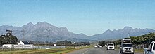
From Philadelphia, the R304 continues east to reach Klipheuwel and meet the R302 (Klipheuwel Road), with which it is co-signed for one kilometre, heading north. After leaving the R302, the route heads south-east, crossing the R312 east of the Cape Winelands Airport before crossing the N1 highway. It then meets the R101 at a staggered junction east of Kraaifontein. The route proceeds south-south-east to end at a junction with the R44 and the R310 in Stellenbosch (north of the town centre). [1]

The R27 is a provincial route in South Africa that consists of two disjoint segments. The first segment, also known as the West Coast Highway, connects Cape Town with Velddrif along the West Coast. The second runs from Vredendal via Vanrhynsdorp, Calvinia, Brandvlei and Kenhardt to Keimoes on the N14 near Upington. The connection between Velddrif and Vredendal has never been built, although it can be driven on various gravel roads.

The R30 is a provincial route in South Africa that connects Bloemfontein with Rustenburg via Brandfort, Welkom, Bothaville, Klerksdorp and Ventersdorp. The southern part of the route is tolled, as the R30 forms the first section of the ZR Mahabane Toll Route, with the Brandfort Toll Plaza found 10 kilometres north of its southern terminus junction with the N1 national route. The tolled portion ends at the junction with the R730.

The R33 is a provincial route in South Africa that connects Pietermaritzburg with Lephalale via Greytown, Paulpietersburg, Carolina, Belfast and Vaalwater. It is a very long road, passing through 3 provinces.

The R34 is a long provincial route in South Africa that connects Vryburg with Richards Bay via Kroonstad and Newcastle. It passes through three provinces, North West, the Free State and KwaZulu-Natal.

The R37 is a provincial route in South Africa that connects Polokwane with Mbombela via Burgersfort and Lydenburg (Mashishing).

The R40 is a provincial route in South Africa that connects the Eswatini border at Bulembu via Barberton, Mbombela, Bushbuckridge, Acornhoek and Hoedspruit with Phalaborwa. The route spans two provinces and passes through several private game reserves.

The R44 is a provincial route in Western Cape, South Africa that connects Piketberg with Kleinmond via Wellington, Stellenbosch, Somerset West and Strand. The coastal section between Kleinmond and Gordon's Bay is a very scenic ocean drive. The section between Gordon's Bay and Stellenbosch via Strand and Somerset West is a dual carriageway. The R44 is co-signed with the R46 between Gouda and Hermon in the Berg River valley.

The R45 is a provincial route in Western Cape, South Africa that connects Saldanha with Villiersdorp via Vredenburg, Malmesbury and Paarl. The route is mostly a two-lane wide-shouldered highway, however sections within Paarl and between Vredenburg and Saldanha are dual-carriageways. The R45 is co-signed with the N7 for a short segment north of Malmesbury.

The R59 is a provincial route in South Africa that connects Hertzogville with Alberton via Bothaville, Parys and Vereeniging. The R59 is a freeway from the R57 Junction in Sasolburg until the N12 Reading Interchange in Alberton, signposted as the Sybrand van Niekerk Freeway.

The R63 is a tarred provincial route in South Africa that connects Calvinia with Komga via Carnarvon, Victoria West, Graaff-Reinet, Somerset East and King William's Town. It is cosigned with the N10 between Eastpoort and Cookhouse for 24 kilometres.

The R82 is a provincial route in South Africa that connects Johannesburg with Kroonstad via Vereeniging and Sasolburg. It starts just south of the M1 Johannesburg Municipal Highway's interchange with the N12 Southern Bypass, going south, meeting the R59, R54, R42 & R28 routes at Vereeniging before crossing the Vaal River into the Free State & proceeding to Kroonstad. It is an alternative, but longer route to the N1 National Route between Johannesburg & Kroonstad.
The R104 is a regional route in South Africa that is the designation for some of the old sections of roads that were previously the N4, prior to upgrading. It connects Rustenburg in the North West province with eMalahleni in Mpumalanga province via Mooinooi, Hartbeespoort, Pretoria and Bronkhorstspruit. There are two additional sections in Mpumalanga province: a 50km section connecting Middelburg and Wonderfontein and a 17km section passing through Mbombela.

The N4 is a national route in South Africa that runs from Skilpadshek on the Botswana border, past Rustenburg, Pretoria, eMalahleni and Mbombela, to Komatipoort on the Mozambique border. The entire route is a toll road.

The N11 is a national route in South Africa which runs from the Botswana border at Groblersbrug, through Mokopane, Middelburg, Ermelo and Newcastle to end at the N3 just after Ladysmith.

The N14 is a national route in South Africa which runs from Springbok in the Northern Cape to Pretoria in Gauteng. It passes through Upington, Kuruman, Vryburg, Krugersdorp and Centurion. The section between Pretoria and Krugersdorp is maintained by the Gauteng Provincial government and is also designated the P158.
The R512 is a Regional Route in South Africa that connects Brits, North West with Randburg, Gauteng via the western side of Hartbeespoort. It is an alternative route to the R511 for travel between the Johannesburg Metropole and Brits.
The R555 is a Regional Route in South Africa that connects Springs with Ohrigstad via Delmas, Ogies, Witbank, Middelburg, Stoffberg and Burgersfort.
Klipheuwel is a village of about 2,300 people situated 15 kilometres (9.3 mi) north of Durbanville, in the Western Cape province of South Africa. In the 1920s it was the site of a shortwave transmitter constructed by the Marconi Company as part of the Imperial Wireless Chain. It remains today the site of the transmitter for the Cape Talk AM radio station.

The M9 is a long metropolitan route in the City of Cape Town, South Africa. It connects Sir Lowry's Pass Village with Wynberg via Somerset West, Firgrove, Macassar, Khayelitsha and Nyanga.
The M12 is a long metropolitan route in the City of Cape Town, South Africa. It connects Burgundy Estate with Stellenbosch via Parow, Elsie's River and Kuils River.
| | This South African road or road transport-related article is a stub. You can help Wikipedia by expanding it. |
