
North Carolina is a state in the Southeastern region of the United States. The state is the 28th largest and 9th-most populous of the United States. It is bordered by Virginia to the north, the Atlantic Ocean to the east, Georgia and South Carolina to the south, and Tennessee to the west. In the 2020 census, the state had a population of 10,439,388. Raleigh is the state's capital and Charlotte is its largest city. The Charlotte metropolitan area, with a population of 2,595,027 in 2020, is the most-populous metropolitan area in North Carolina, the 21st-most populous in the United States, and the largest banking center in the nation after New York City. The Raleigh-Durham-Cary combined statistical area is the second-largest metropolitan area in the state and 32nd-most populous in the United States, with a population of 2,043,867 in 2020, and is home to the largest research park in the United States, Research Triangle Park.

Charlotte is the most populous city in the U.S. state of North Carolina. Located in the Piedmont region, it is the county seat of Mecklenburg County. The population was 874,579 at the 2020 census, making Charlotte the 16th-most populous city in the U.S., the seventh most populous city in the South, and the second most populous city in the Southeast behind Jacksonville, Florida. The city is the cultural, economic, and transportation center of the Charlotte metropolitan area, whose 2020 population of 2,660,329 ranked 22nd in the U.S. Metrolina is part of a sixteen-county market region or combined statistical area with a 2020 census-estimated population of 2,846,550.

Jacksonville is a city in Onslow County, North Carolina, United States. As of the 2020 census, the population was 72,723, which makes Jacksonville the 14th-largest city in North Carolina. Jacksonville is the county seat and most populous community of Onslow County, which is coterminous with the Jacksonville, North Carolina metropolitan area. Demographically, Jacksonville is the youngest city in the United States, with an average age of 22.8 years old, which can be attributed to the large military presence. The low age may also be in part due to the population drastically going up over the past 80 years, from 783 in the 1930 census to 72,876 in the 2021 Census estimate.

Red Bank is an unincorporated community and census-designated place (CDP) in Lexington County, South Carolina, United States. The population was 9,617 at the 2010 census, up from 8,811 at the 2000 census. It is part of the Columbia, South Carolina Metropolitan Statistical Area.
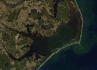
Pamlico Sound is a lagoon in North Carolina which is the largest lagoon along the North American East Coast, extending 80 mi (130 km) long and 15 to 20 miles wide. It is part of a large, interconnected network of lagoon estuaries that includes Albemarle Sound, Currituck Sound, Croatan Sound, Roanoke Sound, Pamlico Sound, Bogue Sound, Back Sound, and Core Sound. Together, these sounds, known as the Albemarle-Pamlico sound system, comprise the second largest estuary in the United States, covering over 3,000 sq. mi. of open water. The Pamlico Sound is separated from the Atlantic Ocean by the Outer Banks, a row of low, sandy barrier islands that include Cape Hatteras National Seashore, Cape Lookout National Seashore, and Pea Island National Wildlife Refuge. The Albemarle-Pamlico Sound is one of nineteen great waters recognized by the America's Great Waters Coalition.

Willie Person Mangum was an American politician and planter who served as U.S. Senator from the state of North Carolina between 1831 and 1836 and between 1840 and 1853. He was one of the founders and leading members of the Whig party, and was a candidate for president in 1836 as part of the unsuccessful Whig strategy to defeat Martin Van Buren by running four candidates with local appeal in different regions of the country.
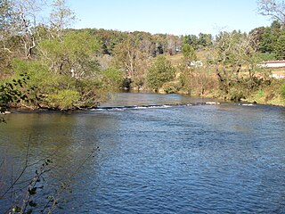
New River State Park is a North Carolina state park in Ashe County, North Carolina in the United States. Located near Jefferson, North Carolina, it covers 3,323 acres (13.45 km2) in the protected New River watershed. The New River is one of the oldest rivers in the United States. It is considered by some geologists to be possibly one of the oldest rivers in the world, between 10 million and 360 million years old. New River State Park is open for year-round recreation, including canoeing, hiking, picnicking, fishing, camping and environmental education. The park is just off U.S. Route 221 in northwestern North Carolina.

Frisco is a small unincorporated community and census-designated place (CDP) on the barrier island of Hatteras Island, between the villages of Buxton and Hatteras. It is located in Dare County, North Carolina, United States, and was previously named "Trent", or "Trent Woods", but received a new name with the coming of the post office in 1898. Most of the land is taken by houses available for rental during the summer months, and as such the community's population varies seasonally. As of the 2010 census, the permanent population of the community was 200. North Carolina Highway 12 serves as the primary road in Frisco and connects the community to others on the island.

The PNC Financial Services Group, Inc. is an American bank holding company and financial services corporation based in Pittsburgh, Pennsylvania. Its banking subsidiary, PNC Bank, operates in 27 states and the District of Columbia, with 2,629 branches and 9,523 ATMs. PNC Bank is on the list of largest banks in the United States by assets and is one of the largest banks by number of branches, deposits, and number of ATMs.

The Sandhills or Carolina Sandhills is a 10-35 mi wide physiographic region within the U.S. Atlantic Coastal Plain province, along the updip (inland) margin of this province in the States of North Carolina, South Carolina, and Georgia. The extent of the Carolina Sandhills is shown in maps of the ecoregions of North Carolina, South Carolina, and Georgia.

Robert Lee "Bob" Doughton, of Alleghany County, North Carolina, sometimes known as "Farmer Bob", was a member of the United States House of Representatives from North Carolina for 42 consecutive years (1911–1953). A Democrat originally from Laurel Springs, North Carolina, he was the Dean of the United States House of Representatives for his last few months in Congress. He is the longest-serving member ever of the United States House of Representatives from the state of North Carolina. In the 1930s Doughton was a key player in the creation of the Blue Ridge Parkway and the passage of the Social Security Act.
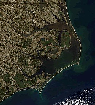
The Outer Banks are a 200 mi (320 km) string of barrier islands and spits off the coast of North Carolina and southeastern Virginia, on the east coast of the United States. They line most of the North Carolina coastline, separating Currituck Sound, Albemarle Sound, and Pamlico Sound from the Atlantic Ocean. A major tourist destination, the Outer Banks are known for their wide expanse of open beachfront and the Cape Hatteras National Seashore. The seashore and surrounding ecosystem are important biodiversity zones, including beach grasses and shrubland that help maintain the form of the land.
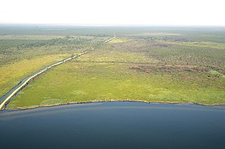
The Alligator River National Wildlife Refuge is a 152,000-acre (620 km2) National Wildlife Refuge located in eastern North Carolina along the Atlantic Coast. It was established on March 14, 1984, to preserve and protect a unique wetland habitat type—the pocosin—and its associated wildlife species.
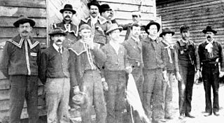
The Red Shirts or Redshirts of the Southern United States were white supremacist paramilitary terrorist groups that were active in the late 19th century in the last years of, and after the end of, the Reconstruction era of the United States. Red Shirt groups originated in Mississippi in 1875, when anti-Reconstruction private terror units adopted red shirts to make themselves more visible and threatening to Southern Republicans, both whites and freedmen. Similar groups in the Carolinas also adopted red shirts.

Jockey's Ridge State Park is a North Carolina state park in Dare County, North Carolina in the United States. Located in Nags Head, North Carolina, it covers a 427-acre (1.73 km2) area, and includes the tallest active sand dune system in the eastern United States. It is the most visited park within the NC park system. The park is a day-use only park and has no campgrounds. Jockey's Ridge contains three unique ecosystems: the Roanoke Sound, the dune system, and the maritime forest. Often when it rains, water collects near the bottom of the dunes creating temporary ponds known as vernal pools. Few fauna can be seen around the dunes, although some types of flora, such as tall grass, may be seen near the bottom of the dunes.

The 1940 United States presidential election in North Carolina took place on November 5, 1940, as part of the 1940 United States presidential election. North Carolina voters chose 13 representatives, or electors, to the Electoral College, who voted for president and vice president.


