Valley Park is a census-designated place and unincorporated community in Issaquena County, Mississippi, United States. Its elevation is 95 feet. Although unincorporated, it has a post office, with the ZIP code of 39177.
Glen Allan is a census-designated place and unincorporated community located in far southern Washington County, Mississippi. It is situated immediately east of Lake Washington's southern shore.

Panther Burn is a census-designated place and unincorporated community located along U.S. Route 61 in northwestern Sharkey County, Mississippi, United States. It has a post office with the ZIP code of 38765.

Dublin, also known as Hopson Bayou, is a census-designated place and unincorporated community located along U.S. Route 49 in southeastern Coahoma County, Mississippi, United States. Dublin is located on the Mississippi Delta Railroad. Dublin has a ZIP code of 38739. A post office first began operation under the name Dublin in 1875.
Ovett is a census-designated place and unincorporated community in southeastern Jones County, Mississippi. Ovett is part of the Laurel Micropolitan Statistical Area.

Moselle is a census-designated place and unincorporated community in southern Jones County, Mississippi. The community is part of the Laurel micropolitan area.

Eastabuchie is a census-designated place and unincorporated community in southwestern Jones County, Mississippi. It is located along U.S. Route 11, just north of the Forrest County line. the community has a post office with the ZIP code 39436. Eastabuchie is part of the Laurel Micropolitan Statistical Area.
Bobo is a census-designated place and unincorporated community in Coahoma County, Mississippi, United States. Bobo is located on U.S. routes 61 and 278, southwest of Clarksdale.
Lamar is a census-designated place and unincorporated community in Benton County, Mississippi, United States. It is located along Mississippi Highway 7 in western Benton County. Lamar has a post office with the ZIP code 38642. The nearly abandoned Mississippi Central Railroad runs through Lamar, and is only used rarely for freight trafficking. Lamar shares its ZIP code with the nearby community of Slayden.
Grace is a census-designated place and unincorporated community in Issaquena County, Mississippi, United States. It is located several miles northeast of Mayersville.
Van Vleet is a census-designated place and unincorporated community in Chickasaw County, Mississippi, United States. Van Vleet is located at the junction of Mississippi Highway 32 and Mississippi Highway 385, 8 miles (13 km) northeast of Houston. Van Vleet has a post office with ZIP code 38877.
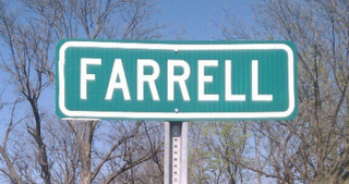
Farrell is an unincorporated community and census-designated place in Coahoma County, Mississippi, United States. Per the 2020 census, the population was 200. Farrell is located approximately 4 miles (6 km) south of Stovall and 4 miles (6 km) north of Sherard on Mississippi Highway 1. It is approximately 9 miles (14 km) northwest of Clarksdale, the county seat.

Dundee is a census-designated place and unincorporated community in Tunica County, Mississippi, United States. Dundee is 12 miles (19 km) south-southwest of Tunica. Dundee has a post office with ZIP code 38626.
Independence is a census-designated place and unincorporated community in Tate County, Mississippi, United States.
New Site is a census-designated place and unincorporated community in Prentiss County, Mississippi, United States. Its population was 851 at the 2010 U.S. Census. Its ZIP code is 38859.
Pattison, also known as Martin, is a census-designated place and unincorporated community in Claiborne County, Mississippi, United States. Its ZIP code is 39144.
Hillsboro is an unincorporated community and census-designated place (CDP) in Scott County, Mississippi, United States. Its population was 1,130 as of the 2010 census. Hillsboro has a post office with ZIP code 39087.
Harperville is a census-designated place and unincorporated community in rural Scott County, Mississippi, United States. Harperville is located on Mississippi Highway 35, 9 miles (14 km) north of Forest. Harperville has a post office with ZIP code 39080. It was first named as a CDP in the 2020 Census which listed a population of 250.
Echo is an unincorporated community and census-designated place (CDP) in Rapides Parish, Louisiana, United States. It was first listed as a CDP in the 2020 census with a population of 352.
Paulina is an unincorporated community and census-designated place in St. James Parish, Louisiana, United States. It was first listed in the 2010 census with a population of 1,178. The community is located on the east bank of the Mississippi River in the eastern part of the parish, west of Lutcher and across the river from Vacherie. Paulina has a post office with ZIP code 70763.