Reynoldsburg, Ohio

Last updated

Reynoldsburg, Ohio
City of Reynoldsburg
Reynoldsburg City Hall 1.jpg
Reynoldsburg City Hall
Flag of Reynoldsburg, Ohio.png
Seal of Reynoldsburg, Ohio.png
Nickname: 
The Birthplace of the Tomato
Motto: 
"The City of Respect"
OHMap-doton-Reynoldsburg.png
Location of Reynoldsburg, Ohio
Fairfield, Franklin, and Licking County, Ohio highlighting Reynoldsburg.svg
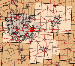
Location in Fairfield, Franklin, and Licking Counties
Coordinates: 39°57′36″N82°47′05″W / 39.96000°N 82.78472°W / 39.96000; -82.78472
Country Flag of the United States.svg United States
State Flag of Ohio.svg  Ohio
Counties Franklin, Licking, Fairfield
Government
  Type Mayor–council government
  MayorJoe Begeny[ citation needed ] (D)
Area
[1]
  Total11.41 sq mi (29.55 km2)
  Land11.33 sq mi (29.34 km2)
  Water0.08 sq mi (0.21 km2)
Elevation
[2]
896 ft (273 m)
Population
 (2020)
  Total41,076
  Estimate 
(2023)
41,220 [3]
  Density3,626.06/sq mi (1,399.98/km2)
Time zone UTC-5 (Eastern (EST))
  Summer (DST) UTC-4 (EDT)
ZIP code
43068, 43069
Area code(s) 614 and 380
FIPS code 39-66390 [4]
GNIS feature ID2396357 [2]
Website https://reynoldsburg.gov/

Reynoldsburg is a city in Fairfield, Franklin, and Licking counties in the U.S. state of Ohio. It is a suburban community in the Columbus, Ohio metropolitan area. The population was 41,076 at the 2020 census.

Contents

History

Reynoldsburg was originally called Frenchtown, and under the latter name was platted in 1831 by John French, and named for him. [5] The present name is for John C. Reynolds, a local merchant. [5] A post office called Reynoldsburgh was established in 1833, and the name was changed to Reynoldsburg in 1893. [6]

Reynoldsburg is known as "The Birthplace of the Tomato", claiming the first commercial variety of tomato was bred there in the 19th century, [7] and the Tomato Festival has been held every year since 1965. Every year there is a Tomato Festival Queen. The Tomato Festival takes place in August. [8]

Geography

According to the United States Census Bureau, the city has a total area of 11.24 square miles (29.11 km2), of which 11.16 square miles (28.90 km2) is land and 0.08 square miles (0.21 km2) is water. [9] Blacklick Creek flows through Reynoldsburg.

Demographics

Historical population
CensusPop.Note
1850 309
1870 457
1880 375−17.9%
1890 3934.8%
1900 339−13.7%
1910 43127.1%
1920 49113.9%
1930 5328.4%
1940 65222.6%
1950 72411.0%
1960 7,793976.4%
1970 13,92178.6%
1980 19,51940.2%
1990 25,74831.9%
2000 32,06924.5%
2010 35,89311.9%
2020 41,07614.4%
2023 (est.)41,2200.4%
Sources: [4] [10] [11] [12] [13] [14] [15] 2020 [16]

2010 census

As of the census [17] of 2010, there were 35,893 people, 14,387 households, and 9,551 families living in the city. The population density was 3,216.2 inhabitants per square mile (1,241.8/km2). There were 15,611 housing units at an average density of 1,398.8 per square mile (540.1/km2). The racial makeup of the city was 69.7% White or European American, 23.3% African American, 0.2% Native American, 1.8% Asian, 0.1% Pacific Islander, 1.3% from other races, and 3.5% from two or more races. Hispanic or Latino of any race were 3.4% of the population.

There were 14,387 households, of which 35.3% had children under the age of 18 living with them, 45.8% were married couples living together, 15.9% had a female householder with no husband present, 4.7% had a male householder with no wife present, and 33.6% were non-families. 28.0% of all households were made up of individuals, and 9.3% had someone living alone who was 65 years of age or older. The average household size was 2.49 and the average family size was 3.06.

The median age in the city was 37.3 years. 26.3% of residents were under the age of 18; 8.1% were between the ages of 18 and 24; 26.8% were from 25 to 44; 27.3% were from 45 to 64; and 11.6% were 65 years of age or older. The gender makeup of the city was 47.4% male and 52.6% female.

2000 census

As of the census [4] of 2000, there were 32,069 people, 12,849 households, and 8,801 families living in the city. The population density was 3,030.0 inhabitants per square mile (1,169.9/km2). There were 13,434 housing units at an average density of 1,269.3 per square mile (490.1/km2). The racial makeup of the city was 85.01% White, 10.44% African American, 1.07% Native American, 1.69% Asian, 0.05% Pacific Islander, 0.74% from other races, and 1.81% from two or more races. Hispanic or Latino of any race were 1.80% of the population.

There were 11,109 households, out of which 34.8% had children under the age of 18 living with them, 52.8% were married couples living together, 12.3% had a female householder with no husband present, and 31.5% were non-families. 25.8% of all households were made up of individuals, and 7.2% had someone living alone who was 65 years of age or older. The average household size was 2.49 and the average family size was 3.01.

In the city, the population was spread out, with 26.6% under the age of 18, 8.0% from 18 to 24, 31.9% from 25 to 44, 23.4% from 45 to 64, and 10.1% who were 65 years of age or older. The median age was 35 years. For every 100 females, there were 91.0 males. For every 100 females age 18 and over, there were 87.0 males.

The median income for a household in the city was $51,108, and the median income for a family was $60,183. Males had a median income of $40,608 versus $30,448 for females. The per capita income for the city was $23,388. About 4.4% of families and 5.5% of the population were below the poverty line, including 7.9% of those under age 18 and 4.4% of those age 65 or over.

Government

Reynoldsburg Police Headquarters Reynoldsburg Police HQ 1.jpg
Reynoldsburg Police Headquarters
Alexander W. Livingston House, now a museum Livingston house 1.jpg
Alexander W. Livingston House, now a museum

The City Parks and Recreation Department is responsible for 275 acres of parkland [18] including nine major parks. [19] Established in 1948 the first Franklin County Metro Park opened in Reynoldsburg, Blacklick Woods and Blacklick Woods Golf Course; a 643-acre park with a golf course, several multi purpose trails, one of the oldest Beech-maple forest in central Ohio, a winter sledding hill, a Nature Center and the Walter A. Tucker State Nature Preserve located inside Blacklick Woods. [20]

The Reynoldsburg Division of Police, with a total of 70 sworn officers, 21 civilians, and 12 reserve police officers, is located next to City Hall. The agency currently has a Motor Unit (with four cycles), a Canine Unit (with two dogs), a Special Investigations Unit, a Criminal Investigations Unit, School Resource Officers (two), Community Resource Officers (two located at sub-stations), bicycle officers, a Dispatch Center, and fields a joint SWAT team with Whitehall Police. RPD has been an innovator in central Ohio. The agency's primary community outreach program is its Illumination Project, borrowed from the City of Charleston Police Department. Each month, the RPD hosts a Q&A sessions with the chief or other officials. RPD was the first agency in central Ohio to begin a security camera registration program, allowing RPD detectives to quickly ascertain potential leads. Other changes implemented in 2019 include a cold case review, body worn cameras, a bias analysis, and a lateral hiring program. [21]

The Ohio Department of Agriculture, the Ohio Fire Academy, and the Office of the Ohio State Fire Marshal are also located in Reynoldsburg.

Parks

Neighborhoods

Schools

The majority of Reynoldsburg is in the Reynoldsburg City School District. [22] [23] [24]

The Reynoldsburg school district currently has seven elementary schools, two junior high schools and one high school with two campuses. [25] The high school and junior high schools' mascot is Rocky Raider (a pirate) and its colors are purple and gold.

Elementary (K-5)

Middle-Junior (6-8)

High School (9-12)

Economy

According to the city's 2021 Independent Audit Report, the top employers in the city are: [26]

Employer# of Employees
Victoria Secret Service Company LLC3,024
Reynoldsburg City Schools 1,111
Kroger 1,110
Walmart 998
State of Ohio 964
Mast Logistics Services Inc.823
Target Corporation 637
Bath & Body Works Brand Mgmt391
Victoria's Secret Stores Brand Management 291
Bath & Body Works LLC 272

Notable people

Related Research Articles

<span class="mw-page-title-main">Putnam County, Ohio</span> County in Ohio, United States

Putnam County is a county located in the northwestern part of the U.S. state of Ohio. As of the 2020 census, the population was 34,451. Its county seat is Ottawa. The county was created in 1820 and later organized in 1834. Its name is in honor of Israel Putnam, a colonial officer in the French and Indian War, who served as a general in the American Revolutionary War. The Blanchard River, which passes through the county, was a key transportation route for early European-American settlers.

<span class="mw-page-title-main">Franklin County, Ohio</span> County in Ohio, United States

Franklin County is a county in the U.S. state of Ohio. As of the 2020 census, the population was 1,323,807, making it the most populous county in Ohio. Most of its land area is taken up by its county seat, Columbus, the state capital and most populous city in Ohio. The county was established on April 30, 1803, less than two months after Ohio became a state, and was named after Benjamin Franklin. Originally, Franklin County extended north to Lake Erie before it was subdivided into smaller counties. Franklin County is the central county of the Columbus, Ohio Metropolitan Statistical Area.

<span class="mw-page-title-main">Fairfield County, Ohio</span> County in Ohio, US

Fairfield County is a county located in the U.S. state of Ohio. As of the 2020 census, the population was 158,921. Its county seat and largest city is Lancaster. Its name is a reference to the Fairfield area of the original Lancaster.

Blacklick Estates is a census-designated place (CDP) in Franklin County, Ohio, United States: partly in Madison Township and partly in Truro Township. As of the 2020 census the population was 8,990.
<span class="mw-page-title-main">New Albany, Ohio</span> City in Ohio, United States

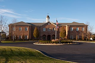
New Albany is a city in the U.S. state of Ohio, located 15 miles (24 km) northeast of the state capital of Columbus. Most of the city is located in Franklin County and a small portion extends into adjacent Licking County. New Albany had a population of 10,825 at the 2020 census. Founded in 1837, it is a growing suburb in the Columbus metropolitan area.

<span class="mw-page-title-main">Deer Park, Ohio</span> City in Ohio, United States

Deer Park is a city in Hamilton County, Ohio, United States. It is a suburb of Cincinnati. The population was 5,432 at the 2020 census.

<span class="mw-page-title-main">Kenton, Ohio</span> City in Ohio, United States

Kenton is a city in and the county seat of Hardin County, Ohio, United States, located in the west-central part of Ohio about 57 mi (92 km) northwest of Columbus and 70 mi (113 km) south of Toledo. Its population was 7,947 at the 2020 census. The city was named for frontiersman Simon Kenton of Kentucky and Ohio.

<span class="mw-page-title-main">Hillsboro, Ohio</span> City in Ohio, United States

Hillsboro is a city in and the county seat of Highland County, Ohio, United States, approximately 35 miles (56 km) west of Chillicothe and 50 miles (80 km) east of Cincinnati. The population was 6,481 at the 2020 census.

<span class="mw-page-title-main">Jackson, Ohio</span> City in Ohio, United States

Jackson is a city in and the county seat of Jackson County, Ohio, United States approximately 27 miles (43 km) southeast of Chillicothe. The population was 6,252 at the 2020 census. It is the principal city of the Jackson, Ohio micropolitan area, which consists of Jackson County.

<span class="mw-page-title-main">Pataskala, Ohio</span> City in Ohio, United States

Pataskala is a city in Licking County, Ohio, United States, approximately 19 miles (31 km) east of Columbus. The population was 17,886 at the 2020 census. Pataskala was a small community until 1996, when what was then the village of Pataskala merged with Lima Township, vastly increasing its population and geographic area.
<span class="mw-page-title-main">Germantown, Ohio</span> City in Ohio, United States

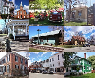
Germantown is a city in Montgomery County, Ohio, United States. The population was 5,796 at the 2020 census. A part of the Dayton metropolitan area, Germantown was founded by German Americans from Pennsylvania and was once home to a cigar industry.

<span class="mw-page-title-main">Riverside, Ohio</span> City in Ohio, United States

Riverside is a city in Montgomery County, Ohio, United States. The population was 24,474 at the 2020 census. A suburb of Dayton, it is part of the Dayton metropolitan area.
<span class="mw-page-title-main">Eaton, Ohio</span> City in Ohio, United States

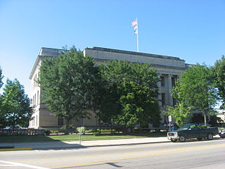
Eaton is a city in, and the county seat of Preble County, Ohio, United States, approximately 24 mi (38 km) west of Dayton. The population was 8,375 at the 2020 census, down 0.4% from the population of 8,407 at the 2010 census.

<span class="mw-page-title-main">Bloomdale, Ohio</span> Village in Ohio, United States

Bloomdale is a village in Wood County, Ohio, United States. The population was 665 at the 2020 census.

<span class="mw-page-title-main">Bowling Green, Ohio</span> City in Wood County, Ohio

Bowling Green is a city in and the county seat of Wood County, Ohio, United States, located 20 miles (32 km) southwest of Toledo. The population was 30,808 at the 2020 census. It is part of the Toledo metropolitan area and a member of the Toledo Metropolitan Area Council of Governments. Bowling Green is the home of Bowling Green State University.

<span class="mw-page-title-main">Rossford, Ohio</span> City in Ohio, United States

Rossford is a city in Wood County, Ohio, United States, located along the Maumee River in the Toledo metropolitan area. The population was 6,299 at the 2020 census. The town includes the intersection of Interstate 75 and the Ohio Turnpike. Rossford Public Library and WPAY serve the community.
<span class="mw-page-title-main">Delphos, Ohio</span> City in Ohio, United States

Delphos is a city in Allen and Van Wert counties in the U.S. state of Ohio approximately 14 mi (23 km) northwest of Lima and 13 mi (21 km) east of Van Wert. The population was 7,117 at the 2020 census.

<span class="mw-page-title-main">Sharonville, Ohio</span> City in Ohio, United States

Sharonville is a city largely in Hamilton County in the U.S. state of Ohio. The population was 14,117 at the 2020 census.

<span class="mw-page-title-main">Columbiana, Ohio</span> City in Ohio, United States

Columbiana is a city in northern Columbiana and southern Mahoning counties in the U.S. state of Ohio. The population was 6,559 at the 2020 census. It is part of the Salem micropolitan area and Youngstown–Warren metropolitan area.

<span class="mw-page-title-main">Pickerington, Ohio</span> City in Ohio, United States

Pickerington is a city in Fairfield and Franklin counties in the central region of the U.S. state of Ohio. It is a suburb of Columbus. The population was 23,094 at the 2020 census. It was founded in 1815 as Jacksonville, named after Andrew Jackson. The name was changed in 1827 in honor of its founder, Abraham Pickering. As land annexation, development, and immigration into the Columbus area continues, the city of Pickerington has generally followed suit. Pickerington is home to the Motorcycle Hall of Fame, located off of Interstate 70.

References

  1. "ArcGIS REST Services Directory". United States Census Bureau. Retrieved September 20, 2022.
  2. 1 2 U.S. Geological Survey Geographic Names Information System: Reynoldsburg, Ohio
  3. "U.S. Census Bureau QuickFacts: Reynoldsburg city, Ohio". www.census.gov. Retrieved May 21, 2024.
  4. 1 2 3 "U.S. Census website". United States Census Bureau . Retrieved January 31, 2008.
  5. 1 2 Overman, William Daniel (1958). Ohio Town Names. Akron, OH: Atlantic Press. p. 117.
  6. "Post offices". Jim Forte Postal History. Retrieved June 19, 2016.
  7. About Reynoldsburg Archived 2011-01-11 at the Wayback Machine , City of Reynoldsburg. Retrieved 2012-04-18.
  8. Lundy, Ronni; Stehling, John (2006). In Praise of Tomatoes: Tasty Recipes, Garden Secrets, Legends & Lore. Sterling Publishing Company, Inc. ISBN   978-1-57990-958-1.
  9. "US Gazetteer files 2010". United States Census Bureau. Archived from the original on January 25, 2012. Retrieved January 6, 2013.
  10. "Population of Civil Divisions Less than Counties" (PDF). Statistics of the Population of the United States at the Ninth Census. U.S. Census Bureau. 1870. Retrieved May 17, 2020.
  11. "Population of Civil Divisions Less than Counties" (PDF). Statistics of the Population of the United States at the Tenth Census. U.S. Census Bureau. 1880. Retrieved November 28, 2013.
  12. "Population: Ohio" (PDF). 1910 U.S. Census. U.S. Census Bureau. Retrieved November 28, 2013.
  13. "Population: Ohio" (PDF). 1930 US Census. U.S. Census Bureau. Retrieved November 28, 2013.
  14. "Number of Inhabitants: Ohio" (PDF). 18th Census of the United States. U.S. Census Bureau. 1960. Retrieved May 17, 2020.
  15. "Ohio: Population and Housing Unit Counts" (PDF). U.S. Census Bureau. Retrieved November 22, 2013.
  16. "Explore Census Data". data.census.gov.
  17. "U.S. Census website". United States Census Bureau . Retrieved January 6, 2013.
  18. "Parks and Recreation | Reynoldsburg Ohio".
  19. "Parks and Facilities | Parks and Recreation | Reynoldsburg Ohio".
  20. "Blacklick Woods".
  21. "Reynoldsburg, OH | Official Website". www.reynoldsburg.gov.
  22. "2020 CENSUS - SCHOOL DISTRICT REFERENCE MAP: Franklin County, OH" (PDF). U.S. Census Bureau. p. 6 (PDF p. 7/10). Retrieved January 20, 2023. - Text list
  23. "2020 CENSUS - SCHOOL DISTRICT REFERENCE MAP: Licking County, OH" (PDF). U.S. Census Bureau . Retrieved January 20, 2023. - Text list
  24. "2020 CENSUS - SCHOOL DISTRICT REFERENCE MAP: Fairfield County, OH" (PDF). U.S. Census Bureau . Retrieved January 20, 2023. - Text list
  25. "Schools". www.reyn.org. Retrieved September 14, 2022.
  26. "2021 Independent Audit Report" . Retrieved September 15, 2022.