
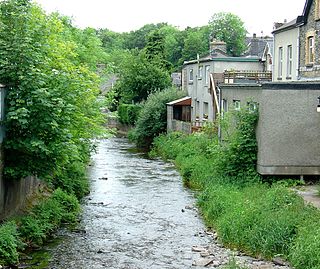
The River Bray is a small river in North Devon, England. It is a tributary of the River Mole, which in turn is a tributary of the River Taw. [1] It rises in Exmoor, near the border with Somerset.
The River Bray is a small river in North Devon, England. It is a tributary of the River Mole, which in turn is a tributary of the River Taw. [1] It rises in Exmoor, near the border with Somerset.
Generally, the river is quite shallow, [2] but it can be prone to flooding. In the Lynmouth Flood, the Bray was affected by the unseasonably high rainfall, and burst its banks, killing a group of schoolboy campers at Filleigh.
The River Bray has given its names to several villages, such as Brayford. [2]

The Snoqualmie River is a 45-mile (72 km) long river in King County and Snohomish County in the U.S. state of Washington. The river's three main tributaries are the North, Middle, and South Forks, which drain the west side of the Cascade Mountains near the town of North Bend and join near the town of Snoqualmie just above the Snoqualmie Falls. After the falls the river flows north through rich farmland and the towns of Fall City, Carnation, and Duvall before meeting the Skykomish River to form the Snohomish River near Monroe. The Snohomish River empties into Puget Sound at Everett. Other tributaries of the Snoqualmie River include the Taylor River and the Pratt River, both of which enter the Middle Fork, the Tolt River, which joins at Carnation, and the Raging River at Fall City.

The Stillwater River is a 69.3-mile-long (111.5 km) tributary of the Great Miami River in western Ohio in the United States. Via the Great Miami and Ohio rivers, it is part of the Mississippi River watershed.

The Pompton River is a tributary of the Passaic River, approximately 8 miles (13 km) long, in Passaic County in northern New Jersey in the United States.

Brayford Pool is a natural pool formed from a widening of the River Witham in the centre of the city of Lincoln in England. It was used as a port by the Romans – who connected it to the River Trent by constructing the Foss Dyke – and has a long industrial heritage.

The River Pool is a tributary of the River Ravensbourne. It is 5.1 km in length, and rises with its tributaries between Shirley and West Wickham in the London Borough of Croydon. It then flows northwards through Beckenham in the London Borough of Bromley, and Sydenham in the London Borough of Lewisham, to join the Ravensbourne in Catford. Two of its tributaries are the River Beck and the Chaffinch Brook.

The River Bandon is a river in County Cork, Ireland.

The Fuji River is a river in Yamanashi and Shizuoka Prefectures of central Japan. It is 128 kilometres (80 mi) long and has a watershed of 3,990 square kilometres (1,540 sq mi). With the Mogami River and the Kuma River, it is regarded as one of the three most rapid flows of Japan.

The Júcar or Xúquer is a river in Spain, on the Iberian Peninsula. The river runs for approximately 509 km from its source at Ojuelos de Valdeminguete, on the eastern flank of the Montes Universales in the Sistema Ibérico. Its most important tributary is the Cabriel.
Bearwallow Creek is a 4.3-mile-long (6.9 km) tributary stream of Tearcoat Creek, itself a tributary of the North River, making it a part of the Potomac River and Chesapeake Bay watersheds. Bearwallow Creek is located in Hampshire County, West Virginia. It rises on Chestnut Oak Ridge, from which it flows southwest along the ridge's eastern flanks and then begins its course southeast along Bear Wallow Hollow Road and U.S. Route 50 until its confluence with Tearcoat Creek at Pleasant Dale.

The River Lemon is a 9.9 miles river in the county of Devon in southwest England. It is a tributary of the River Teign, starting on Dartmoor by Haytor, and ending in Newton Abbot. It rises on the south-east side of Dartmoor near Haytor, joins with the River Sig and the Langworthy Brook at Sigford, then passes the village of Bickington. Lower down, it is joined by the Kestor Brook and it then flows through the woods in Bradley Valley, past the manor house of Bradley, and through the town of Newton Abbot where it flows through a 440-yard-long (400 m) tunnel below the town centre. Just below the town, the river joins the River Teign at 50.517°N 3.607°W, near the head of its estuary.

The River Swincombe is a right-bank tributary of the West Dart River that flows through Dartmoor national park in Devon, south-west England. It rises south-east of Princetown, and flows 2 km south-east to Foxtor Mires, where it turns north-east to meet the West Dart near Hexworthy. The first 2 km are known as the Strane River. Some maps show that the source starts north of Nakers Hill and heads north west to the east of Foxtor Mires where it meets the Strane River which is its own river.
Dry Creek is a stream in Stanislaus County, California, that is a tributary to the Tuolumne River.

The River Tweed is a short tributary of the River Sence. It rises around the west of the village of Barwell, Leicestershire, England and flows westwards, crossing the A447 at Abraham's Bridge.
The River Brenig is a tributary river of the River Teifi and runs through the market town of Tregaron in Ceredigion, Wales.

The River Ottery is a small river in northeast Cornwall, England, United Kingdom. The river is about twenty miles (32 km) long from its source southeast of Otterham to its confluence with the River Tamar at Nether Bridge, two miles (3.2 km) northeast of Launceston.

The River Yeo is a tributary to the River Creedy. It is located in Devon, England, and its headwaters float within two miles of a different River Yeo, which is a tributary to River Taw.

The River Kensey is a river in east Cornwall, England, UK which is a tributary of the River Tamar.
Gun Creek is a major left (north) tributary of the Bridge River in the Interior of British Columbia, Canada. Located at its mouth into today's Carpenter Lake was Minto City, a gold mining town established in the 1930s and destroyed by a flood in the later 1940s. Carpenter Lake is a reservoir of the Bridge River Hydroelectric Project. Gun Lake is part of the creek's basin but is not on the creek itself, but connected to it by a short stream from its northeastern end.

The River Lerryn is a river in east Cornwall, England, UK, a tributary of the River Fowey. The Lerryn is the largest of the tributaries which enter the estuary of the Fowey. The river is tidal up to the village of Lerryn. The landscape of the Lerryn catchment is rural and includes heathland, moorland and rough pasture in the upper reaches and broadleaf, coniferous and mixed plantation woodland in the lower. This catchment includes four SSSIs, including Redlake Meadows & Hoggs Moor. The Lerryn rises at Fairy Cross on the southern slopes of Bodmin Moor and flows south-southwest until it enters the Fowey estuary.

Brays Bayou is a slow-moving river in Harris County, Texas. A major tributary of Buffalo Bayou, the Brays flows for 31 miles (50 km) from the western edge of the county, south of Barker Reservoir along the border with Fort Bend County, east to its convergence with the Buffalo at Harrisburg. Nearly all of the river is located within the city of Houston; it is a defining geographic feature of many neighborhoods and districts, including Meyerland, Braeswood Place, the Texas Medical Center, and Riverside Terrace.
50°59′25″N3°53′19″W / 50.99035°N 3.88850°W
| | This Devon location article is a stub. You can help Wikipedia by expanding it. |