
The River Crane is a river in Dorset, United Kingdom, which flows past Cranborne Manor. [1] [2] Near Verwood it becomes the Moors River.
its name is a shortening of Cranbourne, meaning "a stream frequented by cranes [or herons]". [3]
The River Crane is a river in Dorset, United Kingdom, which flows past Cranborne Manor. [1] [2] Near Verwood it becomes the Moors River.
its name is a shortening of Cranbourne, meaning "a stream frequented by cranes [or herons]". [3]

Shaftesbury is a town and civil parish in Dorset, England. It is on the A30 road, 20 miles west of Salisbury, near the border with Wiltshire. It is the only significant hilltop settlement in Dorset, being built about 215 metres above sea level on a greensand hill on the edge of Cranborne Chase.
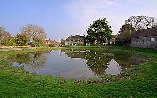
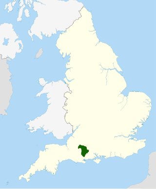
Cranborne is a village in East Dorset, England. At the 2011 census, the parish had a population of 779, remaining unchanged from 2001.

Ashmore is a village and civil parish in the North Dorset district of Dorset, England, 20 miles southwest of Salisbury.

Iwerne Courtney, also known as Shroton, is a village and civil parish in the English county of Dorset. It lies approximately 4 miles north-west of Blandford Forum. It is sited by the small River Iwerne between Hambledon Hill to the south-west and the hills of Cranborne Chase to the east. In 2001 the parish had 187 households and a population of 400. In 2013 the estimated population of the parish was 410.

Iwerne Minster is a village and civil parish in Dorset, England. It lies on the edge of the Blackmore Vale, approximately midway between the towns of Shaftesbury and Blandford Forum. The A350 main road between those towns passes through the edge of the village, just to the west. In the 2011 Census the civil parish had a population of 978.
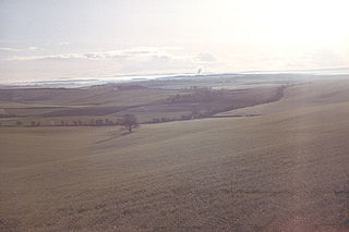
The Dorset Downs are an area of chalk downland in the centre of the county Dorset in south west England. The downs are the most western part of a larger chalk formation which also includes Cranborne Chase, Salisbury Plain, Hampshire Downs, Chiltern Hills, North Downs and South Downs.

Fontmell Magna is a village and civil parish in Dorset, England. It is situated in the Blackmore Vale, close to the chalk hills of Cranborne Chase, on the A350 road five miles south of Shaftesbury and eight miles north of Blandford Forum. In the 2011 census the parish had a population of 734.

Sixpenny Handley or Handley is a village and former civil parish, now in the parish of Sixpenny Handley and Pentridge, in north east Dorset, England, situated on Cranborne Chase ten miles (16 km) north east of Blandford Forum. In the 2011 census the parish had a population of 1,233. The civil parish was abolished on 1 April 2015 and merged with Pentridge to form Sixpenny Handley and Pentridge.

Tarrant Monkton is a village and civil parish in north Dorset, England, situated in the Tarrant Valley about four miles east-northeast of Blandford Forum. Within the parish boundary, 1+1⁄2 miles over hills to the west, lies the major part of Blandford Camp army base. In the 2011 census the parish—including the army base—had a population of 1,986. The village is centred on the All Saints Parish Church, opposite which is the Langton Arms, a public house and restaurant.
Cranborne Chase is an area of central southern England, straddling the counties Dorset, Hampshire and Wiltshire. It is part of the Cranborne Chase and West Wiltshire Downs Area of Outstanding Natural Beauty (AONB).

Hod Hill is a large hill fort in the Blackmore Vale, 3 miles (5 km) north-west of Blandford Forum, Dorset, England. The fort sits on a 143 m (469 ft) chalk hill of the same name that lies between the adjacent Dorset Downs and Cranborne Chase. The hill fort at Hambledon Hill is just to the north. The name probably comes from Old English "hod", meaning a shelter, though "hod" could also mean "hood", referring to the shape of the hill.
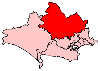
North Dorset is a constituency represented in the House of Commons of the UK Parliament since 2015 by Simon Hoare, a Conservative.
Cranborne Hundred was a hundred in the county of Dorset, England, containing the following parishes:

The Wessex Ridgeway is a long-distance footpath in southwest England. It runs 136 miles (219 km) from Marlborough in Wiltshire to Lyme Regis in Dorset, via the northern edge of Salisbury Plain and across Cranborne Chase AONB. The footpath was opened in 1994.
Cranborne Chase and West Wiltshire Downs is an Area of Outstanding Natural Beauty (AONB) covering 379 square miles (980 km2) of Dorset, Hampshire, Somerset and Wiltshire. It is the sixth largest AONB in England.

Verwood railway station served the town of Verwood, Dorset, and its hinterland, from 1866 to 1964. It was one of many casualties of the mass closure of British railway lines in the 1960s; the last train running on 2 May 1964. The village is now much larger than when the line ran as it is within reasonable travelling distance of the South East Dorset conurbation.

Ackling Dyke is a section of Roman road in England which runs for 22 miles (35 km) southwest from Old Sarum (Sorviodunum) to the hill fort at Badbury Rings (Vindocladia). Part of the road on Oakley Down has been scheduled as an ancient monument.
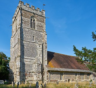
Cranborne Priory is a former priory church in the village of Cranborne, Dorset, England. Founded in 980 as Cranborne Abbey, it became a priory in 1102, remaining that way until it was dissolved in 1540. The tower, nave and aisles from the priory survive to from the Church of St Mary and St Bartholomew, the parish church of Cranborne. The building, which has fragments from the 12th century, is designated a Grade I listed building.

Cranborne Manor is a Grade I listed country house in Cranborne, Dorset, in southern England.

Dorset is a county located in the middle of the south coast of England. It lies between the latitudes 50.512°N and 51.081°N and the longitudes 1.682°W and 2.958°W, and occupies an area of 2,653 km2. It spans 90 kilometres (56 mi) from east to west and 63 kilometres (39 mi) from north to south.
50°51′42″N1°51′14″W / 50.86157°N 1.85399°W