River Piddle

Last updated

River Piddle
River Trent
Riverpiddle1.jpg
The River Piddle at Piddlehinton
Dorset UK relief location map.jpg
Red pog.svg
Location within Dorset
Location
Country England
County Dorset
Towns and villages Wareham, Tolpuddle, Puddletown, Piddletrenthide
Physical characteristics
Source Alton Pancras
  location Dorset
Mouth  
  location
Poole Harbour, Purbeck, Dorset
  coordinates
50°41′39″N2°04′44″W / 50.6941°N 2.0788°W / 50.6941; -2.0788
Discharge 
  location Poole Harbour
Basin features
Tributaries 
  left Bere Stream, Devil's Brook

The River Piddle or Trent or North River is a small rural Dorset river which rises in the Dorset Downs and flows into Poole Harbour near Wareham.

Contents

Etymology

The river's name has Germanic origins and has had various spellings over the years. [1] In AD 966 it was called the 'Pidelen', and on the church tower at Piddletrenthide—the first village to which it gives its name—it is spelled 'Pydel'. [1] Several villages which the river passes through are named after it: as well as Piddletrenthide there are Piddlehinton, Puddletown, Tolpuddle, Affpuddle, Briantspuddle and Turnerspuddle. Local legend tells that the Victorians changed the spelling to 'Puddle', due to 'piddle' being a slang term for 'urine' [1] (although Puddletown was still called Piddletown into the 1950s), but see for instance the John Speed map of the county from 1610 [2] which has the name 'Puddletown'.

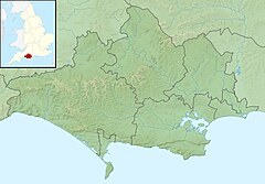
Course and characteristics

In its upper reaches, the Piddle is a chalk stream flowing south through a steep valley cut into the dip slope of the downland, [3] which is dominated by an agricultural landscape of calcareous grassland pasture and arable fields. It rises above the church in Alton Pancras, which was originally named Awultune, a Saxon name meaning the village at the source of a river.

At Puddletown, 6 miles (9.7 km) south of the source, the chalk dips below clay and alluvial sand and gravel geology with a flatter landscape of water-meadows. [3] Here, the Piddle turns to follow an east-south-easterly direction 12 miles (19 km) to Wareham, where it enters Poole Harbour via Wareham Channel. This section of the river runs more or less parallel with its bigger neighbour, the River Frome, together forming a broad, open valley divided by a low ridge of heathland.

Cultural references

Thomas Hardy was born and raised in a cottage at Higher Bockhampton on the ridge between the Piddle and Frome valleys, and the landscape and villages of the valley were inspiration for many of the places in his stories, including Athelhampton House (Athelhall) and Puddletown (Weatherbury).

The Piddle Valley was the subject of Ogden Nash's poem Paradise For Sale, published in the New Yorker in 1959. [4]

See also

Notes

  1. 1 2 3 Roland Gant (1980). Dorset Villages. Robert Hale Ltd. p. 188. ISBN   0-7091-8135-3.
  2. "John Speed's Map of Dorsetshire".
  3. 1 2 https://assets.publishing.service.gov.uk/government/uploads/system/uploads/attachment_data/file/294053/Frome_and_Piddle_Catchment_Flood_Management_Plan.pdf [ bare URL PDF ]
  4. "Paradise for Sale". The New Yorker . 18 July 1959.


Related Research Articles

<span class="mw-page-title-main">River Frome, Dorset</span> River in Dorset, England

The River Frome is a river in Dorset in the south of England. At 30 miles (48 km) long it is the major chalkstream in southwest England. It is navigable upstream from Poole Harbour as far as the town of Wareham.

<span class="mw-page-title-main">Poole Harbour</span> Natural harbour in England

Poole Harbour is a large natural harbour in Dorset, southern England, with the town of Poole on its shores. The harbour is a drowned valley (ria) formed at the end of the last ice age and is the estuary of several rivers, the largest being the Frome. The harbour has a long history of human settlement stretching to pre-Roman times. The harbour is extremely shallow, with one main dredged channel through the harbour, from the mouth to Holes Bay.

<span class="mw-page-title-main">Isle of Purbeck</span> Peninsula in Dorset, England

The Isle of Purbeck is a peninsula in Dorset, England. It is bordered by water on three sides: the English Channel to the south and east, where steep cliffs fall to the sea; and by the marshy lands of the River Frome and Poole Harbour to the north. Its western boundary is less well defined, with some medieval sources placing it at Flower's Barrow above Worbarrow Bay. John Hutchins, author of The History and Antiquities of the County of Dorset, defined Purbeck's western boundary as the Luckford Lake steam, which runs south from the Frome. According to writer and broadcaster Ralph Wightman, Purbeck "is only an island if you accept the barren heaths between Arish Mell and Wareham as cutting off this corner of Dorset as effectively as the sea." The most southerly point is St Alban's Head.

<span class="mw-page-title-main">Wareham, Dorset</span> Human settlement in England

Wareham is a historic market town and, under the name Wareham Town, a civil parish, in the English county of Dorset. The town is situated on the River Frome eight miles (13 km) southwest of Poole.

<span class="mw-page-title-main">Puddletown</span> Human settlement in England

Puddletown is a village and civil parish in Dorset, England. It is situated by the River Piddle, from which it derives its name, about 4.5 miles (7 km) northeast of the county town Dorchester. Its earlier name Piddletown fell out of favour, probably because of connotations of the word "piddle". The name Puddletown was officially sanctioned in the late 1950s. Puddletown's civil parish covers 2,908 hectares and extends to the River Frome to the south. In 2013, the estimated population of the civil parish was 1450.

<span class="mw-page-title-main">Alton Pancras</span> Village in Dorset, England

Alton Pancras is a small village and civil parish in Dorset, England. In the 2011 census the civil parish had a population of 175.

<span class="mw-page-title-main">Bere Regis</span> Human settlement in England

Bere Regis is a village and civil parish in Dorset, England, situated 6 miles (9.7 km) north-west of Wareham. In the 2011 census the civil parish had a population of 1,745.

<span class="mw-page-title-main">River Cerne</span> River in Dorset, England

<span class="mw-page-title-main">Dorset Downs</span>

The Dorset Downs are an area of chalk downland in the centre of the county Dorset in south west England. The downs are the most western part of a larger chalk formation which also includes Cranborne Chase, Salisbury Plain, Hampshire Downs, Chiltern Hills, North Downs and South Downs.

<span class="mw-page-title-main">Piddlehinton</span> Human settlement in England

Piddlehinton is a village and civil parish in west Dorset, England, situated in the Piddle valley 5 miles (8.0 km) north of Dorchester. In the 2011 census the parish had a population of 403. Piddlehinton formerly constituted a liberty containing only the parish itself.

<span class="mw-page-title-main">Piddletrenthide</span> Village in Dorset, England

Piddletrenthide is a village and civil parish in the English county of Dorset. It is sited by the small River Piddle in a valley on the dip slope of the Dorset Downs, 8 miles (13 km) north of Dorchester. In the 2011 census the parish—which includes the small village of Plush to the northeast—had 323 dwellings, 290 households and a population of 647.

<span class="mw-page-title-main">Ridge, Dorset</span> Human settlement in England

Ridge is a village in the English county of Dorset. It is situated on the south bank of the River Frome, about half a mile due south east of the town of Wareham.

<span class="mw-page-title-main">Hampshire Basin</span> Geological basin in England

The Hampshire Basin is a geological basin of Palaeogene age in southern England, underlying parts of Hampshire, the Isle of Wight, Dorset, and Sussex. Like the London Basin to the northeast, it is filled with sands and clays of Paleocene and younger ages and it is surrounded by a broken rim of chalk hills of Cretaceous age.

<span class="mw-page-title-main">Plush, Dorset</span> Village in England

Plush is a small village in the English county of Dorset. It lies within the civil parish of Piddletrenthide in the west of the county, and is approximately 8 miles (13 km) north of the county town Dorchester. It is sited in a small side-valley of the River Piddle at an altitude of 130 metres (430 ft) and is surrounded by chalk hills which rise to 251 metres (823 ft) at Ball Hill, a kilometre to the northeast, and 261 metres (856 ft) at Lyscombe Hill, 2½ kilometres to the east.

<span class="mw-page-title-main">Geography of Dorset</span>

Dorset is a county located in the middle of the south coast of England. It lies between the latitudes 50.512°N and 51.081°N and the longitudes 1.682°W and 2.958°W, and occupies an area of 2,653 km2. It spans 90 kilometres (56 mi) from east to west and 63 kilometres (39 mi) from north to south.

<span class="mw-page-title-main">Dorset Heaths</span>

The Dorset Heaths form an important area of heathland within the Poole Basin in southern England. Much of the area is protected.

The Frome Valley Trail is a long-distance footpath in Dorset, England which follows the River Frome from Evershot to Dorchester and will, when completed, extend to Poole Harbour.