Rockaway Boulevard station

Last updated

 Rockaway Blvd
  NYCS-bull-trans-A-Std.svg
MTA NYC logo.svg New York City Subway station (rapid transit)
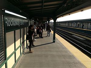
Brooklyn bound platform at Rockaway Blvd.jpg
Brooklyn-bound platform after renovation
Station statistics
AddressRockaway Boulevard & Liberty Avenue
Queens, NY
Borough Queens
Locale Ozone Park
Coordinates 40°40′50″N73°50′37″W / 40.680459°N 73.843703°W / 40.680459; -73.843703
Division B (IND, formerly BMT) [1]
Line IND Fulton Street Line
BMT Fulton Street Line (formerly)
Services    A   NYCS-SSI-alltimes.svg (all times)
TransitAiga bus trans.svg MTA Bus: 20 airtransportation.svg Q7, Q11, Q21, Q41, Q52/Q53 SBS, Q112, BM5, QM15
Structure Elevated
Platforms2 side platforms
Tracks3 (2 in regular service)
Other information
OpenedSeptember 25, 1915;108 years ago (September 25, 1915) [2]
Accessible not ADA-accessible; accessibility planned
AccessibilitySame-platform wheelchair transfer available
Opposite-
direction
transfer
Yes
Former/other namesRockaway Boulevard–96th Street
Traffic
20231,519,523 [3] Increase2.svg 4.1%
Rank213 out of 423 [3]
Services
Preceding station MTA NYC logo.svg New York City Subway Following station
88th Street NYCS-bull-trans-A-Std.svg
Local
104th Street
Aqueduct–North Conduit Avenue
Aqueduct Racetrack
One-way operation
Location
NYCS map blank.svg
Map pointer.svg
USA New York City location map.svg
Map pointer.svg
USA New York location map.svg
Map pointer.svg
Track layout

Contents

BSicon MFADEg.svg
BSicon uv-STR.svg
BSicon MFADEg.svg
BSicon uvSTR.svg
BSicon uv-STRf.svg
BSicon udSTR.svg
BSicon udSTRg.svg
BSicon PLTl.svg
BSicon uvSTR.svg
BSicon udSTR.svg
BSicon dPLTr.svg
BSicon numN090.svg
BSicon PLTl.svg
BSicon uvSTR.svg
BSicon udSTR.svg
BSicon dPLTr.svg
BSicon PLTl.svg
BSicon uvSTR.svg
BSicon udSTR.svg
BSicon dPLTr.svg
BSicon PLTl.svg
BSicon uvSTR.svg
BSicon udSTR.svg
BSicon dPLTr.svg
BSicon uv-SHI2+l.svg
BSicon udSHI2gr+l.svg
BSicon udSHI2gr.svg
BSicon udSTR.svg
BSicon uvSTRfg.svg
BSicon udSTR.svg
BSicon udKRZc2o.svg
BSicon udSTR3.svg
BSicon uvSTR.svg
BSicon dMFADEgq.svg
BSicon udSTRc2.svg
BSicon ud-STR3+1.svg
BSicon ldMKRZc2o.svg
BSicon udKRZ3+1o-.svg
BSicon udSTRc2.svg
BSicon uSTRc4.svg
BSicon uv-STR3.svg
BSicon udSTR.svg
BSicon udSTRc2.svg
BSicon dMFADEgq.svg
BSicon udSTR3+1-.svg
BSicon udSTRc4.svg
BSicon ud-STR3+1.svg
BSicon udKRZ3+1o-.svg
BSicon uSTRc4.svg
BSicon udSTR.svg
BSicon dMFADEgq.svg
BSicon udSTR3+1-.svg
BSicon udSTRc4.svg
BSicon uvSHI2l-.svg
BSicon udENDEa.svg
BSicon udSTR.svg
BSicon uv-SHI2gl.svg
BSicon udSHI2g+lr.svg
BSicon udSHI2gr.svg
BSicon uv-STRf.svg
BSicon udSTR.svg
BSicon udSTRg.svg
BSicon MFADEf.svg
BSicon uv-STR.svg
BSicon udSTR.svg
BSicon dMFADEf.svg
BSicon udSTR.svg
BSicon MFADEf.svg
BSicon uv-STR.svg
Street map

Rockaway Boulevard station

Station service legend
SymbolDescription
NYCS-SSI-alltimes.svg Stops all times

The Rockaway Boulevard station is a station on the IND Fulton Street Line of the New York City Subway. Located at the intersection of Rockaway Boulevard, Woodhaven and Cross Bay Boulevards, and Liberty Avenue in Ozone Park, Queens, it is served by the A train at all times.

History

Rockaway Boulevard was one of the six stations along Liberty Avenue in Queens, from 80th Street through Ozone Park–Lefferts Boulevard, as well as the current three track elevated structure, built for the BMT Fulton Street Line in 1915 as part of BMT's portion of the Dual Contracts. [2] [4]

On April 8, 1928, two eastbound trains crashed in the station, killing one person and injuring 30. [5]

The connection to the BMT was severed on April 26, 1956, and the IND was extended east (railroad south) from Euclid Avenue via a connecting tunnel and new intermediate station at Grant Avenue, with the new service beginning on April 29, 1956. [4] [6] [7] Two months later, a connection to the IND Rockaway Line was provided on June 26, 1956, replacing the Long Island Rail Road's long-troubled Rockaway Beach Branch. [8] [9] [10] [11] [12] [13]

The station was completely renovated in 2015. [14] In 2019, as part of an initiative to increase the accessibility of the New York City Subway system, the MTA announced that it would install elevators at the Rockaway Boulevard station as part of the MTA's 2020–2024 Capital Program. [15] In November 2022, the MTA announced that it would award a $965 million contract for the installation of 21 elevators across eight stations, [16] including Rockaway Bouelvard. [17] [18] :81 A joint venture of ASTM and Halmar International would construct the elevators under a public-private partnership. [17] [18] :80

Station layout

Platform level Side platform
Westbound NYCS-bull-trans-A-Std.svg toward Inwood–207th Street (88th Street)
NYCS-bull-trans-SR-Std-blue.svg late night shuttle toward Euclid Avenue (88th Street)
Peak-direction express No regular service
Eastbound NYCS-bull-trans-A-Std.svg toward Far Rockaway–Mott Avenue or Rockaway Park–Beach 116th Street (Aqueduct–North Conduit Avenue)
NYCS-bull-trans-A-Std.svg ( NYCS-bull-trans-SR-Std-blue.svg late nights) toward Ozone Park–Lefferts Boulevard (104th Street)
(No express service: Ozone Park–Lefferts Boulevard)
Side platform
MezzanineFare control, station agent, Metrocard machines
GroundStreet levelExit/entrance
Station before renovation Rockaway Boulevard IND Fulton Line tracks & platform.jpg
Station before renovation

This station has two side platforms and three tracks. The center track is not used in revenue service. [19] The A train stops here at all times; a shuttle train from Euclid Avenue to Ozone Park–Lefferts Boulevard also serves the station during late nights. [20] The platforms have beige windscreens and green and brown canopies.

This is the outermost station from Manhattan that is shared by all A train branches. Just past the east end of the platforms, the line splits into two routes. Trains heading to Lefferts Boulevard continue east along Liberty Avenue, while those heading to the Rockaways diverge south to bypass Aqueduct Racetrack on an embankment before lowering to run at-grade towards Conduit Avenue, Howard Beach, Jamaica Bay, Broad Channel, and then the Rockaways. [21] The next stop to the east (railroad south) is 104th Street for trains to Lefferts Boulevard and Aqueduct–North Conduit Avenue for trains to the Rockaways; northbound trains departing Aqueduct–North Conduit Avenue first stop at Aqueduct Racetrack before stopping at Rockaway Boulevard. The next stop to the west (railroad north) is 88th Street. [21]

Exits

This station has two station-houses with the full-time one at the west (railroad north) end. Single staircases from each platform go down to the elevated station-house beneath the tracks. Inside are a turnstile bank and token booth. Outside of fare control, two staircases lead to either side of Liberty Avenue at Woodhaven/Cross Bay Boulevard. [22]

The other station-house at the east (railroad south) end is also elevated and beneath the tracks, but unstaffed. It contains two HEET turnstiles, a staircase to each platform, and two staircases to either side of Liberty Avenue at 96th Street. The wooden staircase landings have a high exit-only turnstile to allow passengers to exit the system without having to go through the station. [22]

Related Research Articles

<span class="mw-page-title-main">A (New York City Subway service)</span> New York City Subway service

The A Eighth Avenue Express is a rapid transit service in the B Division of the New York City Subway. Its route emblem, or "bullet", is colored blue since it is a part of the IND Eighth Avenue Line in Manhattan.

<span class="mw-page-title-main">Independent Subway System</span> Defunct subway operator in New York City

The Independent Subway System was a rapid transit rail system in New York City that is now part of the New York City Subway. It was first constructed as the Eighth Avenue Line in Manhattan in 1932. It was originally also known as the Independent City-Owned Subway System (ICOSS) or the Independent City-Owned Rapid Transit Railroad (ICORTR).

<span class="mw-page-title-main">Sutphin Boulevard–Archer Avenue–JFK Airport station</span> New York City Subway station in Queens

The Sutphin Boulevard–Archer Avenue–JFK Airport station is a two-level station on the IND and BMT Archer Avenue Lines of the New York City Subway. It is located at the intersection of Sutphin Boulevard and Archer Avenue in Jamaica, Queens. It is served by the E and J trains at all times, as well as the Z train during rush hours in the peak direction. This station has four tracks and two island platforms, with two platform levels: E trains stop on the upper level while J/Z trains stop on the lower level.

The IND Fulton Street Line is a rapid transit line of the IND Division of the New York City Subway, running from the Cranberry Street Tunnel under the East River through central Brooklyn to a terminus in Ozone Park, Queens. The IND Rockaway Line branches from it just east of Rockaway Boulevard. The A train runs express during daytime hours and local at night on the underground portion of the line; it runs local on the elevated portion of the line at all times. The C train runs local on the underground portion of the line at all times except late nights.

<span class="mw-page-title-main">Aqueduct Racetrack station</span> New York City Subway station in Queens

The Aqueduct Racetrack station is a station on the IND Rockaway Line of the New York City Subway. Located on the west side of Aqueduct Racetrack near Pitkin Avenue in Ozone Park, Queens, it is served by northbound A trains at all times. The station contains four tracks, of which the outer two are in passenger service; the two center express tracks have been disconnected from the line and permanently removed. There is a single side platform next to the northbound local track.
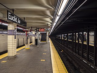
<span class="mw-page-title-main">Euclid Avenue station (IND Fulton Street Line)</span> New York City Subway station in Brooklyn

The Euclid Avenue station is an express station on the IND Fulton Street Line of the New York City Subway, located at the intersection of Euclid and Pitkin Avenues in East New York, Brooklyn. It is served by the A train at all times and is the southern terminal for the C train at all times except nights. During nights, this is the northern terminal for the Lefferts Boulevard shuttle train from Ozone Park, Queens.
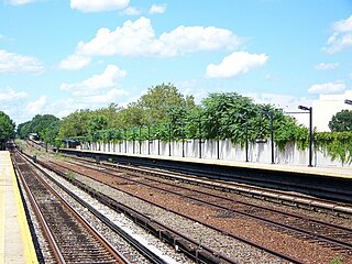
<span class="mw-page-title-main">Aqueduct–North Conduit Avenue station</span> New York City Subway station in Queens

The Aqueduct–North Conduit Avenue station is a station on the IND Rockaway Line of the New York City Subway. Located at North Conduit Avenue near the intersection of Cohancy Street in Ozone Park, Queens, it is served at all times by the A train.

<span class="mw-page-title-main">Utica Avenue station</span> New York City Subway station in Brooklyn

The Utica Avenue station is an express station on the IND Fulton Street Line of the New York City Subway. Located at Utica Avenue and Fulton Street in Bedford–Stuyvesant, Brooklyn, it is served by the A train at all times and the C train at all times except late nights.

<span class="mw-page-title-main">Liberty Avenue station</span> New York City Subway station in Brooklyn

The Liberty Avenue station is a local station on the IND Fulton Street Line of the New York City Subway, located at the intersection of Liberty and Pennsylvania Avenues in East New York, Brooklyn. It is served by the C train at all times except nights, when the A train takes over service.

<span class="mw-page-title-main">80th Street station (IND Fulton Street Line)</span> New York City Subway station in Queens

The 80th Street station is a station on the IND Fulton Street Line of the New York City Subway. Located on Liberty Avenue at 80th Street in Ozone Park, Queens, it is served by the A train at all times.

<span class="mw-page-title-main">Grant Avenue station (IND Fulton Street Line)</span> New York City Subway station in Brooklyn

The Grant Avenue station is a station on the IND Fulton Street Line of the New York City Subway. Located at Grant Avenue just north of Pitkin Avenue in City Line, Brooklyn, near the border between the boroughs of Brooklyn and Queens, it is served by the A train at all times. The station is the line's easternmost stop in Brooklyn; the Fulton Street Line continues east into Queens via the Fulton Street Elevated.

<span class="mw-page-title-main">88th Street station</span> New York City Subway station in Queens

The 88th Street station is a station on the IND Fulton Street Line of the New York City Subway. Located on Liberty Avenue at 88th Street in Ozone Park, Queens, it is served by the A train at all times.

<span class="mw-page-title-main">111th Street station (IND Fulton Street Line)</span> New York City Subway station in Queens

The 111th Street station is a station on the IND Fulton Street Line of the New York City Subway, located on Liberty Avenue at 111th Street in Richmond Hill, Queens. The station is served by the A train at all times.
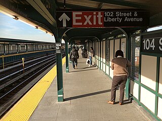
<span class="mw-page-title-main">104th Street station (IND Fulton Street Line)</span> New York City Subway station in Queens

The 104th Street station is a station on the IND Fulton Street Line of the New York City Subway, located on Liberty Avenue at 104th Street in Ozone Park, Queens. The station is served by the Lefferts Boulevard branch of the A train at all times.

<span class="mw-page-title-main">Ozone Park–Lefferts Boulevard station</span> New York City Subway station in Queens

The Ozone Park–Lefferts Boulevard station is an elevated terminal station on the IND Fulton Street Line of the New York City Subway, located at the intersection of Lefferts Boulevard and Liberty Avenue in Queens. It serves as the terminus of the A route's Lefferts Boulevard branch. Despite its name, the station is not actually located in Ozone Park, but rather in the adjacent neighborhood of South Richmond Hill.

<span class="mw-page-title-main">Broadway Junction station</span> New York City Subway station in Brooklyn

The Broadway Junction station is a New York City Subway station complex shared by the elevated BMT Canarsie Line and BMT Jamaica Line, and the underground IND Fulton Street Line. It was also served by trains of the Fulton Street Elevated until that line closed in 1956. It is located roughly at the intersection of Broadway, Fulton Street and Van Sinderen Avenue at the border of Bedford–Stuyvesant and East New York, Brooklyn. The complex is served by the A, J, and L trains at all times; the C train at all times except late nights; and the Z train during rush hours in the peak direction only.

The IND Rockaway Line is a rapid transit line of the IND Division of the New York City Subway, operating in Queens. It branches from the IND Fulton Street Line at Rockaway Boulevard, extending over the Jamaica Bay, into the Rockaways. At its southern end in the Rockaways, the line has two branches: one traveling east to Far Rockaway–Mott Avenue and one traveling west to Rockaway Park–Beach 116th Street. The A train serves the line on the Far Rockaway branch, as well as on the section north of Hammels Wye. The Rockaway Park Shuttle runs between Broad Channel and Rockaway Park. Five rush hour A trains provide service between Rockaway Park and Manhattan in the peak direction.

The Grant Avenue station was a station on the demolished BMT Fulton Street Line in Brooklyn, New York City. It had two tracks and one island platform. The station opened on July 16, 1894 as City Line station, and was the eastern terminal of the line until September 25, 1915, when Hudson Street – 80th Street opened and the line was extended to Lefferts Avenue – 119th Street. The next stop to the west was Crescent Street. It closed on April 26, 1956, and was replaced by the nearby underground Grant Avenue station of the IND Fulton Street Line 1½ blocks south on April 29, 1956. The remainder of the line east to Lefferts Avenue was connected to the Fulton Street subway and continues to operate.
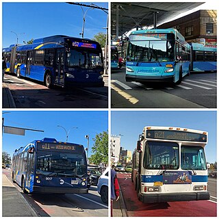
<span class="mw-page-title-main">Woodhaven and Cross Bay Boulevards buses</span> Bus routes in Queens, New York

The Q11, Q21, Q52, and Q53 bus routes constitute a public transit corridor running along Woodhaven and Cross Bay Boulevards in Queens, New York City. The corridor extends primarily along the length of the two boulevards through "mainland" Queens, a distance of 6 miles (9.7 km) between Elmhurst and the Jamaica Bay shore in Howard Beach. The Q52 and Q53 buses, which provide Select Bus Service along the corridor, continue south across Jamaica Bay to the Rockaway peninsula, one of the few public transit options between the peninsula and the rest of the city.
References

  1. "Glossary". Second Avenue Subway Supplemental Draft Environmental Impact Statement (SDEIS) (PDF). Vol. 1. Metropolitan Transportation Authority. March 4, 2003. pp. 1–2. Archived from the original (PDF) on February 26, 2021. Retrieved January 1, 2021.
  2. 1 2 "New Elevated Line Opened for Queens" (PDF). The New York Times. September 26, 1915. Retrieved September 28, 2007.
  3. 1 2 "Annual Subway Ridership (2018–2023)". Metropolitan Transportation Authority. 2023. Retrieved April 20, 2024.
  4. 1 2 Sparberg, Andrew J. (October 1, 2014). From a Nickel to a Token: The Journey from Board of Transportation to MTA. Fordham University Press. ISBN   978-0-8232-6190-1.
  5. "One Killed, 30 Hurt in B.M.T. Collision". The New York Times. April 8, 1928. Retrieved July 16, 2016.
  6. "First Leg of Rockaways Transit Opened at Cost of $10,154,702" (PDF). The New York Times . April 30, 1956. Retrieved June 29, 2015.
  7. Freeman, Ira Henry (June 28, 1956). "Rockaway Trains to Operate Today" (PDF). The New York Times . Retrieved June 29, 2015.
  8. "PRR Chronology, 1956" (PDF). (45.9  KiB), December 2004 Edition
  9. Freeman, Ira Henry (June 28, 1956). "Rockaway Trains to Operate Today" (PDF). The New York Times . Retrieved June 29, 2015.
  10. "First Train On Rockaway Line Runs This Afternoon". Wave of Long Island . Fultonhistory.com. June 28, 1956. p. 1. Retrieved August 16, 2016.
  11. "First Train On Rockaway Line Runs This Afternoon". Wave of Long Island . Fultonhistory.com. June 28, 1956. p. 6. Retrieved August 16, 2016.
  12. "TA's New Line To Rockaways Begins Today: Fifty Piece Band To Play as Special Train Makes First Run". The Leader-Observer. Fultonhistory.com. June 28, 1956. p. 1. Retrieved August 16, 2016.
  13. "To Rockaways: Beach Trains In Operation". Greenpoint Weekly Star. Fultonhistory.com. June 29, 1956. p. 2. Retrieved August 16, 2016.
  14. "Rockaway Boulevard a Train Platform to Close for Summer Construction".
  15. "Press Release - MTA Headquarters - MTA Announces 20 Additional Subway Stations to Receive Accessibility Improvements Under Proposed 2020-2024 Capital Plan". mta.info. Metropolitan Transportation Authority. December 19, 2019. Archived from the original on April 21, 2020. Retrieved December 20, 2019.
  16. Nessen, Stephen (November 28, 2022). "MTA to spend more than $1B on accessibility upgrades". Gothamist. Retrieved December 1, 2022.
  17. 1 2 Brachfeld, Ben (November 29, 2022). "MTA to spend $1 billion on subway, commuter rail accessibility upgrades". amNewYork. Retrieved December 1, 2022.
  18. 1 2 "Capital Program Oversight Committee Meeting November 2022". mta.info. Metropolitan Transportation Authority. November 29, 2022. Retrieved July 14, 2022.
  19. Dougherty, Peter (2020). Tracks of the New York City Subway 2020 (16th ed.). Dougherty. OCLC   1056711733.
  20. "ASubway Timetable, Effective June 26, 2022". Metropolitan Transportation Authority . Retrieved August 26, 2023.
  21. 1 2 "Subway Map" (PDF). Metropolitan Transportation Authority. September 2021. Retrieved September 17, 2021.
  22. 1 2 "MTA Neighborhood Maps: Woodhaven" (PDF). mta.info . Metropolitan Transportation Authority. 2015. Retrieved June 30, 2015.