
Yeppoon is a coastal town and locality in the Shire of Livingstone, Queensland, Australia. Yeppoon is renowned for its beaches, tropical climate, and the islands out on the bay. Twenty-five minutes from the city of Rockhampton, Yeppoon is the principal town on the Capricorn Coast, a string of seaside communities stretching more than 150 kilometres (93 mi) from north to south. The beaches and shallow coves provide a destination both for tourists and retirees settling down in Central Queensland. Offshore, there are 27 islands including Great Keppel Island which is 20 kilometres (12 mi) from Yeppoon.

Yarraman is a rural town and locality in the Toowoomba Region, Queensland, Australia. In the 2016 census, Yarraman had a population of 1,064 people.

The Wellesley Islands is a group of islands off the coast of Far North Queensland, Australia, in the Gulf of Carpentaria. It is a locality within the Shire of Mornington local government area. In the 2016 census, the Wellesley Islands had a population of 1,136 people.

Port Douglas is a coastal town and locality in the Shire of Douglas, Queensland, approximately 60 km north of Cairns. In the 2016 census, Port Douglas had a population of 3,504 people. The town's population can often double, however, with the influx of tourists during the peak tourism season from May to September. The town is named in honour of a former Premier of Queensland, John Douglas. Port Douglas developed quickly based on the mining industry. Other parts of the area were established with timber cutting occurring in the area surrounding the Daintree River and with settlement starting to occur on lots around the Mossman River by 1880.

Lockhart River is a town in the Aboriginal Shire of Lockhart River and a coastal locality split between the Aboriginal Shire of Lockhart River and the Shire of Cook, on the Cape York Peninsula in Queensland, Australia. In the 2016 census, Lockhart River had a population of 724 people.

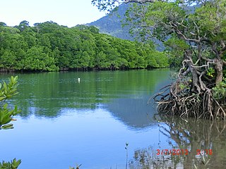
Mossman is a town and a locality in Far North Queensland, Australia, on the Mossman River. It is within the local government area of Shire of Douglas. In the 2016 census, Mossman had a population of 1,937 people.

Yandina Creek is a rural locality in the Sunshine Coast Region, Queensland, Australia. In the 2016 census, Yandina Creek had a population of 760 people.

Keppel Sands is a coastal rural town and locality in the Livingstone Shire, Queensland, Australia. In the 2016 census, Keppel Sands had a population of 360 people.
Wowan is a rural town and locality in the Shire of Banana, Queensland, Australia. The town of Deeford is also within the locality. In the 2016 census, the locality of Wowan had a population of 216 people.

Wonga Beach is a coastal locality in the Shire of Douglas, Queensland, Australia. The town of Wonga is within the locality. In the 2016 census, Wonga Beach had a population of 975 people.

Gunalda is a town in the Gympie Region and a locality split between Gympie Region and Fraser Coast Region in Queensland, Australia. In the 2016 census, the locality had a population of 392 people.

Woolooga is a rural town and locality in the Gympie Region, Queensland, Australia. In the 2016 census the locality of Woolooga had a population of 247 people.

Rosevale is a rural locality in the Scenic Rim Region, Queensland, Australia. In the 2016 census, Rosevale had a population of 208 people.

Bloomfield is a town in the Shire of Cook and a coastal locality which is split between the Shire of Cook and the Shire of Douglas in Queensland, Australia. The neighbourhood of Ayton is within the locality. In the 2016 census, Bloomfield had a population of 204 people.
Lower Wonga is a rural locality in the Gympie Region, Queensland, Australia. In the 2016 census Lower Wonga had a population of 344 people.
Bonnie Doon is a coastal rural locality in the Shire of Douglas, Queensland, Australia. In the 2016 census, Bonnie Doon had a population of 372 people.
Victoria Plantation is a rural locality in the Shire of Hinchinbrook, Queensland, Australia. In the 2016 census Victoria Plantation had a population of 156 people.

Miallo is a locality in the Shire of Douglas, Queensland, Australia. In the 2016 census, Miallo had a population of 376 people.
Lakes Creek is a suburb split between Rockhampton Region and Shire of Livingstone, Queensland, Australia. In the 2016 census Lakes Creek had a population of 552 people.
Diwan is a coastal locality in the Shire of Douglas, Queensland, Australia. In the 2016 census, Diwan had a population of 153 people.
