Whyanbeel

Last updated

Whyanbeel
Queensland
Whyanbeel road.jpg
Whyanbeel Road
Australia Queensland location map.svg
Red pog.svg
Whyanbeel
Coordinates 16°21′00″S145°21′16″E / 16.35°S 145.3544°E / -16.35; 145.3544 (Whyanbeel (centre of locality))
Population172 (SAL 2021) [1]
Postcode(s) 4873
Area55.1 km2 (21.3 sq mi)
Time zone AEST (UTC+10:00)
Location
LGA(s) Shire of Douglas
State electorate(s) Cook
Federal division(s) Leichhardt
Suburbs around Whyanbeel:
Stewart Creek Valley Lower Daintree Wonga Beach
Dedin Whyanbeel Bamboo
Syndicate Miallo Miallo

Whyanbeel is a rural locality in the Shire of Douglas, Queensland, Australia. [2] In the 2021 census, Whyanbeel had a population of 172 people. [3]

Contents

Geography

The terrain varies from 10 to 337 metres (33 to 1,106 ft) above sea level. Most of the locality (particularly in the north) is undeveloped heavily forested mountainous land with elevations of typically 200 metres (660 ft) above sea level with the highest peak, the Pinnacle at 337 metres (1,106 ft) at 16°19′35″S145°21′23″E / 16.3263°S 145.3565°E / -16.3263; 145.3565 (Pinnacle) . [4] [5]

All of the north of the locality and most of the centre is within the Daintree National Park. [6] [7] The remaining land is low-lying at approximately 20 metres (66 ft) and the predominant land use is farming sugarcane and tropical fruit. [7] [8] The southern areas are watered by Whyanbeel Creek and its tributary Chinaman Creek. [9] In the farming land there are cane tramways to transport the harvested sugarcane to the Mossman Sugar Mill. [10]

History

The name Whyanbeel means canoe in an Aboriginal language (possibly Yindinyji) and was recorded on 6 December 1873 by explorer George Elphinstone Dalrymple. [2]

Demographics

In the 2016 census, Whyanbeel had a population of 160 people. [11]

In the 2021 census, Whyanbeel had a population of 172 people. [3]

Education

There are no schools in Whyanbeel. The nearest primary school is Miallo State School in neighbouring Miallo to the south. The nearest secondary school is Mossman State High School in Mossman to the south. [12]

Related Research Articles

<span class="mw-page-title-main">Mossman, Queensland</span> Town in Queensland, Australia

Mossman is a rural town and locality in the Shire of Douglas, Queensland, Australia. It is the administrative centre for the Douglas Shire Council In the 2016 census, the locality of Mossman had a population of 1,937 people.

<span class="mw-page-title-main">Bloomfield, Queensland</span> Suburb of Shire of Cook, Queensland, Australia

Bloomfield is a town in the Shire of Cook and a coastal locality which is split between the Shire of Cook and the Shire of Douglas in Queensland, Australia. The neighbourhood of Ayton is within the locality. In the 2016 census, Bloomfield had a population of 204 people.

<span class="mw-page-title-main">Miallo, Queensland</span> Suburb of Shire of Douglas, Queensland, Australia

Miallo is a rural locality in the Shire of Douglas, Queensland, Australia. In the 2016 census, Miallo had a population of 376 people.

Biboohra is a rural town and locality in the Shire of Mareeba, Queensland, Australia. In the 2021 census, the locality of Biboohra had a population of 561 people.

<span class="mw-page-title-main">Mowbray, Queensland</span> Suburb of Shire of Douglas, Queensland, Australia

Mowbray is a coastal locality in the Shire of Douglas, Queensland, Australia. In the 2021 census, Mowbray had a population of 362 people.

<span class="mw-page-title-main">Cow Bay, Queensland</span> Suburb of Shire of Douglas, Queensland, Australia

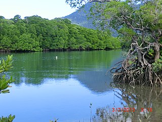
Cow Bay is a coastal locality in the Shire of Douglas, Queensland, Australia. In the 2021 census, Cow Bay had a population of 220 people.

<span class="mw-page-title-main">Rocky Point, Queensland (Douglas Shire)</span> Suburb of Shire of Douglas, Queensland, Australia

Rocky Point is a coastal rural locality in the Shire of Douglas, Queensland, Australia. In the 2016 census, Rocky Point had a population of 129 people.

<span class="mw-page-title-main">Mulgrave, Queensland</span> Suburb of Shire of Burdekin, Queensland, Australia

Mulgrave is a rural locality in the Shire of Burdekin, Queensland, Australia. In the 2021 census, Mulgrave had a population of 19 people.

Kirknie is a rural locality in the Shire of Burdekin, Queensland, Australia. In the 2021 census, Kirknie had a population of 70 people.

<span class="mw-page-title-main">Newell, Queensland</span> Town in Queensland, Australia

Newell is a coastal town and rural locality in the Shire of Douglas, Queensland, Australia. It is a sugarcane growing district.

Cooya Beach is a coastal town and locality in the Shire of Douglas, Queensland, Australia. In the 2016 census, the locality of Cooya Beach had a population of 546 people.

<span class="mw-page-title-main">Oak Beach, Queensland</span> Town in Queensland, Australia

Oak Beach is a coastal town and locality in the Shire of Douglas, Queensland, Australia. In the 2016 census, the locality of Oak Beach had a population of 195 people.

<span class="mw-page-title-main">Diwan, Queensland</span> Suburb of Shire of Douglas, Queensland, Australia

Diwan is a coastal locality in the Shire of Douglas, Queensland, Australia. In the 2021 census, Diwan had a population of 169 people.

Humeburn is a locality in the Shire of Paroo, Queensland, Australia. In the 2021 census, Humeburn had a population of 9 people.

<span class="mw-page-title-main">Lower Daintree, Queensland</span> Suburb of Shire of Douglas, Queensland, Australia

Lower Daintree is a coastal rural locality in the Shire of Douglas, Queensland, Australia. In the 2021 census, Lower Daintree had a population of 83 people.

<span class="mw-page-title-main">Kimberley, Queensland</span> Suburb of Shire of Douglas, Queensland, Australia

Kimberley is a coastal locality in the Shire of Douglas, Queensland, Australia. In the 2021 census, Kimberley had a population of 28 people.

<span class="mw-page-title-main">Forest Creek, Queensland</span> Suburb of Shire of Douglas, Queensland, Australia

Forest Creek is a locality in the Shire of Douglas, Queensland, Australia. In the 2021 census, Forest Creek had a population of 136 people.

Garrawalt is a rural locality in the Shire of Hinchinbrook, Queensland, Australia.

Jaffa is a rural locality in the Cassowary Coast Region, Queensland, Australia. In the 2021 census, Jaffa had a population of 35 people.

Maadi is a rural locality in the Cassowary Coast Region, Queensland, Australia. In the 2021 census, Maadi had a population of 49 people.

References

  1. Australian Bureau of Statistics (28 June 2022). "Whyanbeel (suburb and locality)". Australian Census 2021 QuickStats. Retrieved 28 June 2022.  OOjs UI icon edit-ltr-progressive.svg
  2. 1 2 "Whyanbeel – locality in Shire of Douglas (entry 48934)". Queensland Place Names. Queensland Government . Retrieved 4 November 2019.
  3. 1 2 Australian Bureau of Statistics (28 June 2022). "Whyanbeel (SAL)". 2021 Census QuickStats. Retrieved 28 February 2023. OOjs UI icon edit-ltr-progressive.svg
  4. "Pinnacle – mountain in Douglas Shire (entry 26895)". Queensland Place Names. Queensland Government . Retrieved 25 November 2020.
  5. "Mountain peaks and capes - Queensland". Queensland Open Data. Queensland Government. 12 November 2020. Archived from the original on 25 November 2020. Retrieved 25 November 2020.
  6. "Layers: Locality; Mountains and ranges; Contours; Watercourses". Queensland Globe. Queensland Government . Retrieved 13 March 2024.
  7. 1 2 "Layers: Locality; Protected areas and forests; Land use; Sugarcane areas". Queensland Globe. Queensland Government . Retrieved 13 March 2024.
  8. "Southern Fringes". Destination Daintree. Archived from the original on 5 November 2019. Retrieved 5 November 2019.
  9. "Queensland Globe". State of Queensland . Retrieved 5 November 2019.
  10. "Layers: Locality; Road and rail". Queensland Globe. Queensland Government . Retrieved 13 March 2024.
  11. Australian Bureau of Statistics (27 June 2017). "Whyanbeel (SSC)". 2016 Census QuickStats. Retrieved 20 October 2018. OOjs UI icon edit-ltr-progressive.svg
  12. "Layers: Locality; Schools and school catchments". Queensland Globe. Queensland Government . Retrieved 13 March 2024.