
The River Etherow in northern England is a tributary of the River Goyt. Although now passing through South Yorkshire, Derbyshire and Greater Manchester, it historically formed the ancient county boundary between Cheshire and Derbyshire. The upper valley is known as Longdendale. The river has a watershed of approximately 30 square miles (78 km2), and the area an annual rainfall of 52.5 inches (1,330 mm).
The River Douglas, also known as the River Asland or Astland, flows through parts of Lancashire and Greater Manchester in North West England. It is a tributary of the River Ribble and has several tributaries, the major ones being the River Tawd and the River Yarrow.

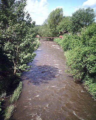
The River Tame flows through Greater Manchester, England. It rises on Denshaw Moor and flows to Stockport where it joins the River Goyt to form the River Mersey.

The River Darwen runs through Darwen and Blackburn in Lancashire, England, eventually joining the River Ribble at Walton le Dale south of Preston on its way to the Ribble Estuary.
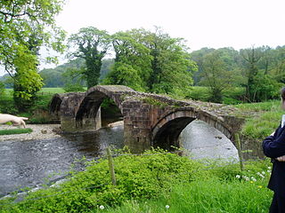
The River Hodder is in Lancashire, England. It is a County Biological Heritage Site.

The West Pennine Moors is an area of the Pennines covering approximately 90 square miles (230 km2) of moorland and reservoirs in Lancashire and Greater Manchester, England. It is a Site of Special Scientific Interest.

Great Hill is a hill in Lancashire, England, on Anglezarke Moor, between the towns of Chorley and Darwen. It is part of the West Pennine Moors and lies approximately 3 miles north of Winter Hill, which is the highest point in the area at 456 m (1,498 ft).

The River Roddlesworth is a river in Lancashire, England, a tributary of the River Darwen.
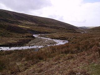
The River Calder is a 13-mile (21 km) long river that is one of the main tributaries of the River Wyre in Lancashire, England. Like the other rivers in England with the name Calder, its name is thought to derive from a mixture of Old Welsh and Old British words meaning "hard and violent water or stream".
Upper Roddlesworth Reservoir is a reservoir on the River Roddlesworth near Abbey Village in Lancashire, England.

Lower Roddlesworth Reservoir is a reservoir on the River Roddlesworth close to Abbey Village in Lancashire, England.

Rake Brook Reservoir is a reservoir fed by two streams, including the eponymous Rake Brook, a tributary of the River Roddlesworth in Lancashire, England.

Eagley Brook is a small river of Lancashire and Greater Manchester in England.

Bradshaw Brook is a river draining parts of Lancashire and Greater Manchester in Northern England.
Longridge Fell is the most southerly fell in England, near the town of Longridge, Lancashire. It lies at the southern end of the Forest of Bowland Area of Outstanding Natural Beauty. As its name suggests, it takes the form of a long ridge which rises in a north-easterly direction from within the town of Longridge to its summit 4.5 miles distant. As the ridge curves towards the east, it comes to a sudden end and drops into the Hodder Valley. The fell is an example of a cuesta; the ridge has a sharp drop or escarpment on its northern side, and a gentler, more varying slope on its southern side. These features make it a popular takeoff for hang-gliders and paragliders on the relatively infrequent occurrences of a northerly wind.

Piethorne Brook is a watercourse in Greater Manchester. It is a tributary of the River Beal.

Hameldon Hill is a Carboniferous sandstone hill with a summit elevation of 409 metres (1,342 ft), situated between the towns of Burnley and Accrington in Lancashire, England. It is listed as a "HuMP" or "Hundred Metre Prominence", its parent being Freeholds Top, a Marilyn near Bacup.
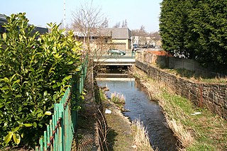
Walverden Water is a minor river in Lancashire, England. It is approximately 2.6 miles (4.2 km) long and has a catchment area of 5.04 square miles (1,304.23 ha).
This page is based on this
Wikipedia article Text is available under the
CC BY-SA 4.0 license; additional terms may apply.
Images, videos and audio are available under their respective licenses.

