Related Research Articles

Cirencester is a market town in Gloucestershire, England, 80 miles (130 km) west of London. Cirencester lies on the River Churn, a tributary of the River Thames, and is the largest town in the Cotswolds. It is the home of the Royal Agricultural University, the oldest agricultural college in the English-speaking world, founded in 1840.

The Riviera Line is the railway between the city of Exeter, towns Dawlish and Teignmouth, and the English Riviera resorts of Torbay in Devon, England. Its tracks are shared with the Exeter to Plymouth Line along the South Devon sea wall. It is part of the Network Rail Route 12.

Kemble is a village in the civil parish of Kemble and Ewen, in the Cotswold district of Gloucestershire, England. Historically part of Wiltshire, it lies 4 miles (6.4 km) from Cirencester and is the settlement closest to Thames Head, the source of the River Thames. In 2020 it had an estimated population of 940. At the 2011 census the parish had a population of 1,036.
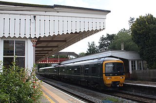
Kemble railway station is a railway station that serves the village of Kemble in Gloucestershire, England. The station is on the Swindon to Gloucester "Golden Valley" line. Despite its rural location, Kemble station has a high number of passengers, due mainly to the proximity of Cirencester.

Newton Abbot railway station serves the town of Newton Abbot in Devon, England. It is 214 miles 5 chains from London, measured from the zero point at London Paddington to the junction for the branch to Paignton. The station today is managed by Great Western Railway, who provide train services along with CrossCountry.
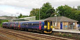
Totnes railway station serves the towns of Totnes and Dartington in Devon, England. It was opened by the South Devon Railway Company in 1847. Situated on the Exeter to Plymouth Line, it is 222 miles 66 chains measured from the zero point at London Paddington via Box.

Dalmally railway station is a railway station serving the village of Dalmally, near Loch Awe in Scotland. This station is on the Oban branch of the West Highland Line, originally part of the Callander and Oban Railway. It is sited 46 miles 76 chains (75.6 km) from Callander via Glen Ogle, between Tyndrum Lower and Loch Awe. ScotRail manage the station and operate all services.
The Cheltenham and Great Western Union Railway was a railway company intended to link Cheltenham, Gloucester and Swindon, in England. It was authorised in 1836 but it found it very hard to raise money for the construction, and it opened only a part of its line, between Swindon and Cirencester, in 1841. It sold its business to the Great Western Railway, which quickly built the line through to Gloucester in 1845 and Cheltenham in 1847; part of that route was shared with other companies.

There are eleven disused railway stations between Exeter St Davids and Plymouth Millbay, Devon, England. At eight of these there are visible remains. Of the eleven stations, South Brent and Plympton are subject of campaigns for reopening while Ivybridge station was replaced by another station on a different site.

Collingbourne railway station served the village of Collingbourne Ducis in Wiltshire, England. It was on the Midland and South Western Junction Railway (M&SWJR) and opened on 1 May 1882 on the southern section of the Swindon, Marlborough and Andover Railway (SM&AR) which at that stage terminated at the-then next station to the north, Grafton and Burbage. In 1883, the SM&AR gained running rights over the Great Western Railway branch from Savernake Low Level to Marlborough and through services started between Swindon Town and Andover Junction railway station, and on down the Sprat and Winkle Line to Southampton. The same year, the Swindon and Cheltenham Extension Railway (S&CER) opened north of Swindon as far as Cirencester and in 1884 the SM&AR and the S&CER merged to form the M&SWJR. The line was completed as a through-route from the Midlands to the south coast by the completion of the northern end of the route between Cirencester and Cheltenham in 1891.

The Chard branch lines were two lines serving the town of Chard in Somerset, England. One was a northward branch, opened in 1863, from the Salisbury to Exeter main line, and the other, opened in 1866, ran south-eastwards from the Bristol – Taunton main line. Each branch had its own Chard passenger station at first, although the two lines connected in Chard.

Trumpers Crossing Halte was a station of scant construction on the Brentford Branch Line of the Great Western Railway, which ran from Southall to Brentford Dock.

The Tetbury branch line was a 7.5-mile (12.1 km) single-track branch railway line that connected Tetbury with the main line at Kemble on the line between Swindon and Gloucester.

The Cirencester branch line was a five-mile-long single-track branch railway line in Gloucestershire, England that connected Cirencester to the main line at Kemble. It was opened by the Cheltenham and Great Western Union Railway in 1841. The main line was extended from Kemble to a junction near Gloucester in 1845, by the GWR which had taken over the C&GWUR. The branch supported a busy passenger and goods business, but these declined in the 1930s, and closure was threatened in the 1950s. To reduce costs and maintain the viability of the line, lightweight four-wheel diesel railbuses were introduced, and they proved popular. Nevertheless, the line's decline was inexorable, passenger service closed in 1964 and the goods service ending the following year.
Tetbury Road railway station was built by the Cheltenham & Great Western Union Railway to serve the Gloucestershire villages of Kemble and Coates, and the town of Tetbury.

Tetbury railway station was the terminus station on the Tetbury branch line, serving the Gloucestershire town of Tetbury.
Ullock railway station was built by the Whitehaven, Cleator and Egremont Railway. It served the village of Ullock, Cumbria, England.
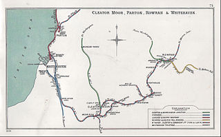
Winder railway station was built by the Whitehaven, Cleator and Egremont Railway. It served the village of Winder, Frizington, Cumbria, England.
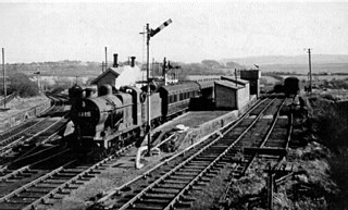
Distington railway station was opened jointly by the Cleator and Workington Junction Railway (C&WJR) and the LNWR and Furness Joint Railway on 1 October 1879. It was situated on the northern edge of the village of Distington, Cumbria, England, where the C&WJR's north–south main line crossed the Joint Line's east–west Gilgarran Branch.
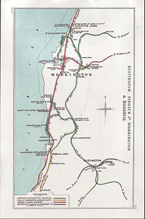
Rosehill railway station was opened by the Cleator and Workington Junction Railway (C&WJR) on the company's Harrington Branch which connected with the Lowca Light Railway (LLR) at Rosehill to provide a through route from Lowca to Workington Central and beyond.
References
- 1 2 3 Herring, Peter (2004). Yesterday's railways (2004 ed.). Newton Abbot: David & Charles. p. 70. ISBN 0715317334.
- ↑ Lloyd, David (1981). "Cirencester and Tetbury Branches". me&im. Archived from the original on 4 June 2011. Retrieved 9 December 2011.
- ↑ Fenton, Mike (March 2019). Blakemore, Michael (ed.). "Kemble Station and its branches, Part 2: The Railbus Years". Back Track. Easingwold: Pendragon Publishing. 33 (3).
- ↑ Atterbury, Paul (2006). Branch line Britain : a nostalgic journey celebrating a golden age. Newton Abbot: David & Charles. p. 128. ISBN 0715324160.