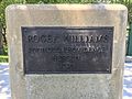
Roger Williams National Memorial | |
 | |
  | |
| Location | Providence, Rhode Island |
|---|---|
| Coordinates | 41°49′49″N71°24′39″W / 41.83038°N 71.41089°W |
| Area | 4.56 acres (1.85 ha) [1] |
| Built | 1636 |
| Architect | Norman Isham |
| Website | Roger Williams National Memorial |
| NRHP reference No. | 66000942 [2] |
| Added to NRHP | October 15, 1966 |
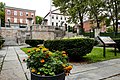
The Roger Williams National Memorial is a landscaped urban park located on a common lot of the original settlement of Providence, Rhode Island, established by minister Roger Williams in 1636. The national memorial commemorates the life of Williams, who co-founded the Colony of Rhode Island and Providence Plantations and championed religious freedom. [3] The park is bounded by North Main, Canal, and Smith Streets, and Park Row.