Related Research Articles

Lower Woods is a 280.1-hectare (692-acre) biological and geological Site of Special Scientific Interest near the village of Wickwar, South Gloucestershire, notified in 1966 and renotified in 1985. The site area has increased at last revision in 1974 to a 284.1-hectare (702-acre) site. The site is a nature reserve managed by the Gloucestershire Wildlife Trust.
Calstone and Cherhill Downs is a 128.6 hectare biological Site of Special Scientific Interest in Wiltshire, notified in 1971, including downland at Calstone Wellington and Cherhill. It provides one of the best examples in Wiltshire of unimproved downland.

Long Knoll is a hill in the west of the English county of Wiltshire. It is a ridge of chalk grassland, some 1.5 kilometres (1 mi) in length, and forms the boundary between the civil parishes of Kilmington to the south and Maiden Bradley to the north. The ridge is 288 metres (945 ft) above sea level at its highest point and it is possible to view King Alfred's Tower, Cranmore Tower, the Black Mountains and Glastonbury Tor on clear days.

Lambert's Castle is an Iron Age hillfort in the county of Dorset in southwest England. Since 1981 it has been designated as a Site of Special Scientific Interest (SSSI) on account of its geology, archaeology and ecology. The hillfort is designated a scheduled monument together with a bowl barrow, the sites of a post-medieval fair and a telegraph station. The site was on the Heritage at Risk Register but was removed in 2022 as a result of the Hillforts and Habitats Project.

Purple moor grass and rush pastures is a type of Biodiversity Action Plan habitat in the UK. It occurs on poorly drained neutral and acidic soils of the lowlands and upland fringe. It is found in the South West of England, especially in Devon.
Winnall Moors is a 64-hectare (160-acre) nature reserve in Winchester in Hampshire. It is managed by the Hampshire and Isle of Wight Wildlife Trust.
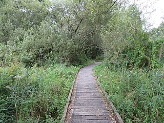
Trodds Copse is a 25.23 hectare biological Site of Special Scientific Interest (SSSI), in central Hampshire, notified in 1989. It comprises ancient semi-natural woodland, unimproved meadows and flushes.

Brassey is a 2.1-hectare (5.2-acre) biological Site of Special Scientific Interest in Gloucestershire, notified in 1954 and renotified in 1983. It is situated on the north side of the Windrush Valley, midway between Naunton and Upper Slaughter. The reserve comprises sloping, unimproved limestone pasture. There is a fast-flowing stream. This site is one of the few freshwater marshes in Gloucestershire. The stream joins the River Windrush.
Chaceley Meadow is a 1.8-hectare (4.4-acre) biological Site of Special Scientific Interest in Gloucestershire, notified in 1954 and renotified in 1993. It lies on the eastern edge of Chaceley village and is about half a mile west of the River Severn.

Clarke's Pool Meadow is a 1.8-hectare (4.4-acre) biological Site of Special Scientific Interest in Gloucestershire, notified in 1997. It lies on the flat top of 'Old Hill' about half a mile south of Blakeney. The site consists of two fields which were purchased by the Gloucestershire Wildlife Trust in 1997. The site was designated an SSSI in the same year and it is one of the finest surviving traditional hay meadows in Gloucestershire.
Cockleford Marsh is a 3.2-hectare (7.9-acre) biological Site of Special Scientific Interest in Gloucestershire, notified in 1991.

Leckhampton Hill and Charlton Kings Common is a 63.8-hectare (158-acre) biological and geological Site of Special Scientific Interest in Gloucestershire, notified in 1954. There are five units of assessment.

Puckham Woods is a 32.38-hectare (80.0-acre) biological Site of Special Scientific Interest in Gloucestershire to the east of Cheltenham near Whittington, notified in 1954. The site is listed in the 'Cotswold District' Local Plan 2001-2011 as a Key Wildlife Site (KWS).
Range Farm Fields is a 12.8-hectare (32-acre) biological Site of Special Scientific Interest in Gloucestershire, near to Gloucester City, notified in 1996.

Neu-Lindsey Nature Reserve is a 0.4-hectare (0.99-acre) nature reserve in Gloucestershire. The site is listed in the ‘Stroud District’ Local Plan, adopted November 2005, Appendix 6 as a Key Wildlife Site (KWS).
Aules Hill Meadows is the name given to a Site of Special Scientific Interest (SSSI) in Northumberland, England. The site, listed since 1992, is a set of four traditionally managed northern hay meadows, now rare in Northumberland.
Barrow Burn Meadows is a Site of Special Scientific Interest (SSSI) in north Northumberland, England. The site is a species-rich hay meadow of a sort now rare in Northumberland.
Ashford Hill is a British national nature reserve next to the village of Ashford Hill in Hampshire. Part of the reserve is a designated a Site of Special Scientific Interest (SSSI). The site is one of Natural Englands nature reserves

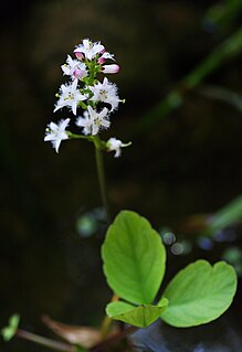
Bishop Monkton Ings is a Site of Special Scientific Interest, or SSSI, situated east of Bishop Monkton village in North Yorkshire, England. It consists mostly of marshy, calcareous grassland, with some broadleaved woodland, and some fen alongside the two watercourses which run through the site. This varied wetland forms a habitat for a variety of plants, including the semi-parasitic marsh lousewort (Pedicularis palustris).
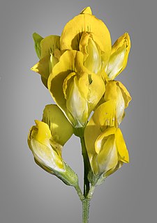
Hatherton Flush is a Site of Special Scientific Interest (SSSI) by the River Weaver in Hatherton, near Wybunbury, Cheshire, England. It is protected for its variety of wetland plants. Species found at the site include the locally rare plants marsh helleborine, marsh lousewort and tubular water dropwort. Hatherton Flush is the largest example of this kind of flush in the county. The site was assessed as being in an "unfavourable"/"recovering" condition in 2008.
References
- 1 2 "Ron Ward's Meadow With Tadley Pastures". Protected Planet.
- ↑ "Visit Ron Ward's meadow". www.vizitit.com.
- 1 2 3 4 5 6 "Site:Ron Ward's Meadow With Tadley Pastures" (PDF). Natural England.
- ↑ "1A: Pamber and Tadley Plantations and Heath" (PDF). Hampshire County Integrated Character Assessment.
- 1 2 "Restricted Access Nature Reserves - Hampshire and Isle of Wight Wildlife Trust". www.hiwwt.org.uk.
- 1 2 "Ron Ward's Meadow, Tadley – 25 May 2014 – Reading & District Natural History Society".
- ↑ "Flora News - Autumn 2009" (PDF). Hampshire and Isle of Wight Wildlife Trust.