Rusadir

Last updated
Rusadir
Plaza de Armas y baluarte de San Pedro, Melilla.jpg
Melilla la Vieja is built over Roman Rusadir
Spain location map with provinces.svg
Archaeological site icon (red).svg
Shown within Spain
Location Spain
Region Melilla
Coordinates 35°17′38″N2°55′59″W / 35.294°N 2.933°W / 35.294; -2.933

Rusadir was an ancient Punic and Roman town at what is now Melilla, Spain, in northwest Africa. Under the Roman Empire, it was a colony in the province of Mauretania Tingitana.

Contents

Name

ršʾdr (Punic : 𐤓‬𐤔𐤀𐤃𐤓‬) [1] was a Punic name meaning "Powerful" [2] or "High Cape", [3] after its nearby headland. [4] It can also be understood as "Cape of the Powerful One", in reference to Baal, Tanit, or some other important Punic god. [5] The format is similar to other Punic names along the North African coast, including Rusguniae , Rusubbicari , Rusuccuru , Rusippisir , Rusigan (Rachgoun), Rusicade , Ruspina , Ruspe , and Rsmlqr. [6] The settlement's name was hellenized as Rhyssádeiron (Greek : Ῥυσσάδειρον). [7] [4] It appears in Latin as Rusadir, [8] Rusicada, [9] and Rusadder. [10] [4] As a Roman colony, it was also known as Flavia.[ citation needed ]

Geography

Like Abyla (present-day Ceuta), Rusadir was located on a small, easily defended peninsula connected to mainland Africa by a narrow isthmus. [11] Its namesake cape is small but includes a large rocky hill, which was fortified. [11] It lies at the northern end of a small bight which formed its harbor, itself part of the eastern shore of a much larger bight that stretches across the southern Mediterranean coast from Cape Three Forks [12] (the classical Metagonites Promontorium) [4] to Cape Figalo west of Oran. [13] Rusadir's own small bight lies beside a kind of natural amphitheater on the eastern slope of a steep rock 500 meters (1,640 ft) high, where modern Melilla has grown up. [3]

History

Punic town

Rusadir was established as a Phoenician colony [3] along the trading route between Phoenicia and the Strait of Gibraltar, itself guarded by the colonies of Tinga (Tangier), Abyla (Ceuta), Kart (San Roque), and Gadir (Cadiz). Like other outposts in the West, Rusadir eventually fell under Carthaginian dominion.

Mauretanian town

After Carthage's defeat in the Punic Wars, Rusadir passed into the control of the Roman client state Mauretania. It minted its own bronze coins, with Punic text and a bearded head (possibly Baal Hammon) obverse and a bee between ears of wheat reverse. [1]

Roman town

Ptolemy's 1st African map, showing Roman Mauretania Tingitana Prima Affrice Tabula.jpg
Ptolemy's 1st African map, showing Roman Mauretania Tingitana

Caligula assassinated the Mauretanian king in AD 40 and proclaimed the annexation of his kingdom. His successor Claudius organized the new territories, placing Rusadir within the province of Mauretania Tingitana. Pliny describes 1st-century Rusadir as a native hillfort (oppidum) and port (portus). [14] [3] It was made a colony in AD 46.

By the 3rd century, Rusadir was fully Christianized and quite prosperous. In the 4th century, Rusadir was the principal port for the Mauro-Roman kingdom.[ citation needed ]

Later history

The Vandal king Gaiseric, probably invited by Count Boniface, crossed from Spain to Tingis (Tangier) in 429. Some of his tens of thousands of followers besieged and conquered Rusadir around 430, while others overran the rest of northwest Africa. Focusing his attention on the Roman province of Africa, Gaiseric allowed Berber rebellions to remove most of his western territories from his control. Rusadir became part of the Berber kingdom of Altava.

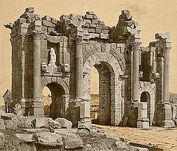
The Byzantine general Belisarius restored Roman control over Northern Africa (including Rusadir) around the year 533, [15] as part of Justinian's Vandalic War. The Exarchate of Africa established by the Byzantines also focused most of its attention on the area of present-day Tunisia and did not expand into the Mauretanian hinterland. Instead, it oversaw its fortified ports from the easily protected stronghold of Septem (Ceuta). Rusadir was conquered by the Visigoth general Suintila (probably on behalf of king Sisebuto) in 614. [16] By the early 7th century a Christian bishop with seat in the city was mentioned in the Thronus Alexandrinus. [15] By 700, Rusadir was conquered by Musa ibn Nusayr on behalf of the Umayyad Caliphate. [17] With an uncertain existence as populated settlement by the mid 9th century, the city was repopulated by Berbers by the late 9th century (c. 890), when it was already known by its new name, [17] Malila/Melilla/Amlil. It was seized by an Andalusian army on behalf of Abd al-Rahman III, emir (soon-to-be Caliph) of Córdoba in 926–927. [18]

It was conquered by the Castilian nobleman Juan Alfonso Pérez de Guzmán in 1497 andunder the name Melilla (q.v.)was formally annexed by Castile in 1506. [3]

Religion

Rusadir remains a titular see of the Roman Catholic Church.[ citation needed ]

See also

Related Research Articles

Abila, also spelled Abyla, may refer to:

<span class="mw-page-title-main">Ceuta</span> Spanish autonomous city in North Africa

Ceuta is an autonomous city of Spain on the North African coast.

<span class="mw-page-title-main">Melilla</span> Autonomous city of Spain on the northwest coast of Africa

Melilla is an autonomous city of Spain in North Africa. It lies on the eastern side of the Cape Three Forks, bordering Morocco and facing the Mediterranean Sea. It has an area of 12.3 km2 (4.7 sq mi). It was part of the Province of Málaga until 14 March 1995, when the Statute of Autonomy of Melilla was passed.

<span class="mw-page-title-main">Mauretania</span> Region in the ancient Maghreb

Mauretania is the Latin name for a region in the ancient Maghreb. It extended from central present-day Algeria to the Atlantic, encompassing northern present-day Morocco, and from the Mediterranean in the north to the Atlas Mountains. Its native inhabitants, of Berber ancestry, were known to the Romans as the Mauri and the Masaesyli.

<span class="mw-page-title-main">Tangier</span> City in and capital of Tanger-Tetouan-Al Hoceima, Morocco

Tangier is a city in northwestern Morocco, on the coasts of the Mediterranean Sea and the Atlantic Ocean. The city is the capital of the Tanger-Tetouan-Al Hoceima region, as well as the Tangier-Assilah Prefecture of Morocco.

<span class="mw-page-title-main">Siga</span> Berber and Roman port near Aïn Témouchent, Algeria

Siga was a Berber and Roman port located near what is now Aïn Témouchent, Algeria. Under the Roman Empire, it was part of western Mauretania Caesariensis, bordering Mauretania Tingitana.

<span class="mw-page-title-main">Rif</span> Geographic and cultural region of Morocco

The Rif or Riff, also called Rif Mountains, is a geographic region in northern Morocco. It is bordered on the north by the Mediterranean Sea and Spain and on the west by the Atlantic Ocean, and is the homeland of the Rifians and the Jebala people. This mountainous and fertile area is bordered by Cape Spartel and Tangier to the west, by Berkane and the Moulouya River to the east, by the Mediterranean to the north, and by the Ouergha River to the south. The Rif mountains are separated into the eastern Rif mountains and western Rif mountains.

<span class="mw-page-title-main">Mauretania Tingitana</span> Roman Province

Mauretania Tingitana was a Roman province, coinciding roughly with the northern part of present-day Morocco. The territory stretched from the northern peninsula opposite Gibraltar, to Sala Colonia and Volubilis to the south, and as far east as the Mulucha river. Its capital city was Tingis, which is the modern Tangier. Other major cities of the province were Iulia Valentia Banasa, Septem, Rusadir, Lixus and Tamuda.

<span class="mw-page-title-main">Cherchell</span> Town in Tipaza, Algeria

Cherchell is a town on Algeria's Mediterranean coast, 89 kilometers (55 mi) west of Algiers. It is the seat of Cherchell District in Tipaza Province. Under the names Iol and Caesarea, it was formerly a Roman colony and the capital of the kingdoms of Numidia and Mauretania.

<span class="mw-page-title-main">Tingi</span>

Tingis or Tingi, the ancient name of Tangier in Morocco, was an important Carthaginian, Moor, and Roman port on the Atlantic Ocean. It was eventually granted the status of a Roman colony and made the capital of the province of Mauretania Tingitana and, after Diocletian's reforms, the diocese of Hispania.

<span class="mw-page-title-main">Tamuda</span> Ancient Berber city and Roman military camp in Morocco

Tamuda was an ancient Berber city and military camp in Mauretania Tingitana. It is located 6 km west of the present-day Tetouan in northern Morocco. Stone ruins from the site are found by the south bank of the Martil Valley. It was considered a city in accordance with the rules of urbanization of the time.

<span class="mw-page-title-main">Abyla</span> Roman colony in northwest Africa

Abyla was the pre-Roman name of Ad Septem Fratres. Ad Septem Fratres, usually shortened to Septem or Septa, was a Roman colony in the province of Mauretania Tingitana and a Byzantine outpost in the exarchate of Africa. Its ruins are located within present-day Ceuta, an autonomous Spanish city in northwest Africa.

Aedemon was a freedman of North African origins from Mauretania who lived in the 1st century AD. Aedemon was a loyal former household slave to the client King Ptolemy of Mauretania, who was the son of King Juba II and the Ptolemaic Princess Cleopatra Selene II.

<span class="mw-page-title-main">Cape Three Forks</span> Cape in northern Morocco

Cape Three Forks, Cape des Trois Fourches, or Cape Tres Forcas is a headland on the Mediterranean coast of northeastern Morocco.

<span class="mw-page-title-main">Tamentfoust</span>

Tamentfoust, the classical Rusguniae and colonial La Pérouse, is a site in the Dar El Beïda District of Algiers in Algeria.

<span class="mw-page-title-main">Iulia Valentia Banasa</span> Ancient Berber-Roman city in Morocco

Iulia Valentia Banasa was a Roman-Berber city in northern Morocco. It was one of the three colonias in Mauretania Tingitana founded by emperor Augustus between 33 and 25 BC for veterans of the battle of Actium, on top of a Mauretanian village. The site was in fact already occupied by the local Amazigh people from the 4th century BC, or perhaps earlier.

<span class="mw-page-title-main">Thamusida</span> Berber, Carthaginian, and Roman river port in Kenitra, Morocco

Thamusida was a Punic river port that was in the present-day towns of Kénitra and Mehdya in Morocco. Under the Roman Empire, it formed a part of the province of Mauretania Tingitana.

<span class="mw-page-title-main">Iulia Campestris Babba</span>

Iulia Campestris Babba is a Mauretanian city created as Roman colony around 30 BC by emperor Augustus. Its actual location is currently unknown, though its existence is confirmed by the literature.

<span class="mw-page-title-main">Rapidum</span>

Rapidum was a Roman settlement and fort located in Mauretania Caesariensis, nearly 100 km south of Icosium (Algiers).

Rusazus was a Phoenician, Carthaginian, and Roman town located near Cape Corbelin, Algeria. Its ruins are near the town of Azeffoun.

References

Citations

  1. 1 2 Head & al. (1911), p. 889.
  2. Mora Serrano (2011), p. 25.
  3. 1 2 3 4 5 Cath. Enc. (1913) , s.v. "Rusaddir".
  4. 1 2 3 4 Dict. Gr. & Rom. Bio. & Myth. (1870) , s.v. "Rusadir".
  5. Juárez, Roberto (3 September 2016), "Significado de Rusaddir", Melilla: Ciudad Desconocida. (in Spanish)
  6. López Pardo (2005), pp. 137–138.
  7. Ptol., Geogr., Bk. IV, Ch. i, §7.
  8. Pliny, Nat. Hist., Bk. I.
  9. Mela, Geogr., Bk. I, §33.
  10. Ant. Itin.
  11. 1 2 Enc. Brit. (1911).
  12. "Melilla", North Africa, P502, NI 30-3, Washington: U.S. Army Map Service, 1953.
  13. "Oran", North Africa, P502, NI 30-4, Washington: U.S. Army Map Service, 1953.
  14. Pliny, Nat. Hist. , Bk. V, Ch. 18.
  15. 1 2 Lara Peinado 1998, p. 24.
  16. Lara Peinado, Fernando (1998). "Melilla: entre Oriente y Occidente" (PDF). Aldaba (30). Melilla: UNED: 24. ISSN   0213-7925.
  17. 1 2 Lara Peinado 1998, p. 25.
  18. Gurriarán Daza, Pedro (2018). "La fortificación de la frontera sur de al-andalus en tiempos del califato de Córdoba" (PDF). Almoraima. Revista de Estudios Campogibraltareños (48). Algeciras: Instituto de Estudios Campogibraltareños: 62.

Bibliography