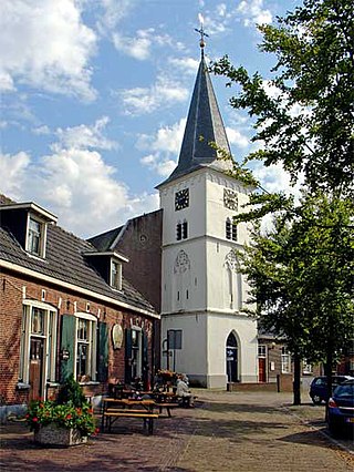
Hellendoorn is a municipality and town in the middle of the Dutch province of Overijssel. As of 2019, the municipality had a population of 35,808.

Ashdown Forest is an ancient area of open heathland occupying the highest sandy ridge-top of the High Weald Area of Outstanding Natural Beauty. It is situated some 30 miles (48 km) south of London in the county of East Sussex, England. Rising to an elevation of 732 feet (223 m) above sea level, its heights provide expansive vistas across the heavily wooded hills of the Weald to the chalk escarpments of the North Downs and South Downs on the horizon.

Lüneburg Heath is a large area of heath, geest, and woodland in the northeastern part of the state of Lower Saxony in northern Germany. It forms part of the hinterland for the cities of Hamburg, Hanover and Bremen and is named after the town of Lüneburg. Most of the area is a nature reserve. Northern Low Saxon is still widely spoken in the region.

Chobham Common is a 655.7-hectare (1,620-acre) biological Site of Special Scientific Interest north of Chobham in Surrey. It is a Nature Conservation Review site, Grade I and a national nature reserve. It is part of the Thames Basin Heaths Special Protection Area and the Thursley, Ash, Pirbright and Chobham Special Area of Conservation. It contains three scheduled monuments. Most of the site is managed by the Surrey Wildlife Trust as the Chobham Common nature reserve, but the SSSI also includes a small private reserve managed by the Trust, Gracious Pond.
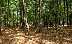
Holten is a village in the municipality of Rijssen-Holten in the Dutch province of Overijssel. Holten is located in a forested area just south of the Holterberg, a 65-metre (210 ft) hill, and is part of the Sallandse Heuvelrug National Park. The National Park is the only area in the Netherlands in which the black grouse can be found. This grouse population is on the brink of extinction, so parts of the National Park are closed to the public during its breeding season.

Hooghalen is a village in the municipality Midden-Drenthe, in the Dutch province Drenthe. In Drenthe it is also called Hoal'n or Hoalen , but then people often mean the entire area, with the neighborhoods Laaghalen, Laaghalerveen and Oosthalen.

Nijverdal is a town of approximately 25,000 inhabitants in the Dutch province of Overijssel. It is the commercial centre of the municipality Hellendoorn.

Mousehold Heath is a freely accessible area of heathland and woodland which lies to the north-east of the medieval city boundary of Norwich, in eastern England.

Faßberg is a municipality in the district of Celle, in Lower Saxony, Germany. It is situated approximately 35 km north of Celle, and 30 km west of Uelzen.
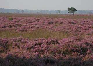
De Zoom–Kalmthoutse Heide Cross-Border Park is a cross-border park on the Belgian–Dutch border. It is a merger of two former parks, the Kalmthoutse Heide(Kalmthout Heath) in Belgium and De Zoom in the Netherlands, together extending over 37.50 square kilometres (14.48 sq mi). A very large part of the park is covered with heath.

Highgate Common is a Staffordshire Wildlife Trust reserve containing a mix of heathland and woodland. It is about 129 hectares or 320 acres in size. The common is a popular leisure destination and a Site of Special Scientific Interest, located in Southern Staffordshire, England.
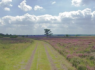
The Strabrechtse Heide is a natural heathland area about 1500 ha in size, located in the municipalities of Heeze-Leende, Someren and Geldrop-Mierlo, in North Brabant, the Netherlands. It is largely under the care of Staatsbosbeheer. In July 2010, around 200 hectares of the area were damaged or destroyed in a wildfire that took over a week to put out.
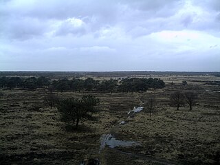
Dwingelderveld National Park is a national park of the Netherlands in the province of Drenthe, founded in 1991. The park covers about 37 km2 (14 sq mi) and is mainly managed by the State Forest Service (Staatsbosbeheer) and the most important Dutch private nature management organisation Natuurmonumenten. It is the largest wet heathland of Western-Europe. Dwingelderveld is also designated as a Natura 2000-area.

The Drents-Friese Wold National Park is a national park in the Dutch provinces of Friesland and Drenthe, covering more than 61 km2 (24 sq mi), founded in 2000. It consists of forests, heath lands and drift-sands.

De Maasduinen National Park(duinen = dunes) is a national park in the Dutch province of Limburg, founded in 1996 and covering approximately 4500 ha. The landscape consists of forests and heathlands on a sandy plateau along the river Meuse close to the German border. The estate 'de Hamert' is the heart of the park. Until 1998 the national park was called 'De Hamert' after this estate. The present name is derived from the parabolic dunes which date from the last glaciation.

Utrechtse Heuvelrug National Park is a national park in the Dutch province of Utrecht. It covers the southern part of the Utrecht Hill Ridge. When it was founded in 2003, the park covered 6,000 ha of heathlands, shifting sands, forests, grass lands and floodplains. In 2013 the park was extended to 10,000 ha, adding the area north of highway A12 when the ecoduct Mollebos was realized. The most striking landscape feature is the glacial ridge after which the park is named.
Cartierheide is a natural landscape area in the south of the Netherlands in province North Brabant located close to the Belgian border in the natural region called The Campine . On the other side of the border is Belgium's first national park, Hoge Kempen.

Suffolk Coast National Nature Reserve is a wildlife reserve on the North Sea coast of the English county of Suffolk. It is located around the village of Walberswick to the south of the town of Southwold. The reserve was designated in 2003, combining the existing Walberswick National Nature Reserve with reserves at Dingle Marshes and Hen Reedbeds to create a 1,340 hectares reserve.

Dartford Heath Common is an area of open heathland situated to the south-west of Dartford, Kent, England, covering around 314 acres (127 ha) of open space. Dartford Heath is classified as lowland heath and is one of only two substantial heathland blocks remaining in Kent. The heath supports a number of rare plants and invertebrates, as well as reptiles, including the common lizard and slow-worm, and rabbits.

The Atlantic mixed forests is a terrestrial ecoregion in western Europe. It extends along the western edge of continental Europe, from southwestern France through northern France, Belgium, the Netherlands, northwestern Germany, and western Denmark. Most of the region's forests and dunes have been converted to fields, pastures, and forest plantations, and its once-extensive wetlands have mostly been drained and filled.