
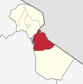
Moshi is a municipality and the capital of Kilimanjaro region in the north eastern Tanzania. As of 2017, the municipality has an estimated population of 201,150 and a population density of 3,409 persons per km2. In the last official census of 2022, the municipality had a population of 221,733. The municipality is situated on the lower slopes of Mount Kilimanjaro, a dormant volcano that is the highest mountain in Africa. The name Moshi has been reported to refer to the smoke that emanates from the nearby mountain. The municipality covers about 59 square kilometres (23 sq mi) and is the smallest municipality in Tanzania by area.

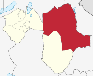
Kilimanjaro Region is one of Tanzania's 31 administrative regions. The regional capital and largest city is the municipality of Moshi. With the 3rd highest HDI of 0.640 in the country, Kilimanjaro is one among the top five most developed regions of Tanzania. According to the 2012 national census, the region had a population of 1,640,087, which was lower than the pre-census projection of 1,702,207. For 2002–2012, the region's 1.8 percent average annual population growth rate was the 24th highest in the country. It was also the eighth most densely populated region with 124 people per square kilometer. The most well-known tribes in the Kilimanjaro region are the chagga, rombos, and pare.

Arusha Region is one of Tanzania's 31 administrative regions and is located in the north of the country. The region's capital and largest city is the city of Arusha. The region is bordered by Kajiado County and Narok County in Kenya to the north, the Kilimanjaro Region to the east, the Manyara and Singida Regions to the south, and the Mara and Simiyu regions to the west. Arusha Region is home to Ngorongoro Conservation Area, a UNESCO World Heritage Site. The region is comparable in size to the combined land and water areas of the state of Maryland in the United States.

Tanga Region is one of Tanzania's 31 administrative regions. The region covers an area of 26,667 km2 (10,296 sq mi). The region is comparable in size to the combined land area of the nation state of Burundi. The regional capital is the municipality of Tanga city. Located in northeast Tanzania, the region is bordered by Kenya and Kilimanjaro Region to the north; Manyara Region to the west; and Morogoro and Pwani Regions to the south. It has a coastline to the east with the Indian Ocean. According to the 2022 national census, the region had a population of 2,615,597.

'Monduli District is one of seven districts of the Arusha Region of Tanzania. It is bordered to the north by Longido District, to the east by Arusha Rural District, to the south by the Manyara Region and to the west by Ngorongoro District and Karatu District. The District covers an area of 6,993 km2 (2,700 sq mi). The town of Monduli is the administrative seat of the district. According to the 2002 Tanzania National Census, the population of the Monduli District was 185,237. By 2012, the population of the district was 158,929. By 2022, the population had grown to 227,585.
Arusha City Council is one of seven administrative districts of Arusha Region in Tanzania. It is surrounded to the south, west and north by Arusha Rural District and to east by Meru District. The district covers an area of 267.0 km2 (103.1 sq mi). The district is comparable in size to the land area of Cayman Islands. The district capital is the city of Arusha. As of 1994, Arusha District was the wealthiest district in Tanzania. According to the 2022 Tanzania National Census, the population of Arusha Urban District was 617,631.
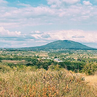
Mwanga is one of the seven districts of the Kilimanjaro Region of Tanzania. The district covers an area of 1,831 km2 (707 sq mi), It is bordered to the northeast by Kenya, to the northwest by the Moshi Rural District, to the southwest by Simanjiro District of Manyara Region, and to the south by the Same District. Its administrative seat is the town of Mwanga. The tallest peak in the district is Kindoroko at 2,100m in the North Pare Mountains that are located entirely within the district. According to the 2022 Tanzania National Census, the population of Mwanga District was 148,763.

Muheza District, officially the, Muheza District Council is one of eleven administrative districts of Tanga Region in Tanzania. The District covers an area of 1,498 km2 (578 sq mi). It is bordered to the north by Mkinga District, to the east by Tanga and the Indian Ocean, to the south by the Pangani District and Handeni District, and to the west by the Korogwe District. The district is comparable in size to the land area of Guadeloupe. The town of Muheza, after which the district is named, serves as its administrative capital. According to the 2012 Tanzania National Census, the population of Muheza District had decreased to 238,260; this is less than ten years before, because Mkinga District was created that same year. The highest point in Muheza District is Kimbo Peak at 1,063m.
Simanjiro District is one of the six districts of the Manyara Region of Tanzania. It is bordered to the north by Arusha Region, to the north east by Kilimanjaro Region, to the south east by Tanga Region, to the south by Kiteto District, to the south west by Dodoma Region and to the west by Babati Rural District. The district headquarters are located in Orkesumet. According to the 2022 Tanzania National Census, the population of Simanjro District was 291,169. Simanjiro District is endowed with gemstones, being the only location on the planet that has tanzanite. Simanjiro was also where the first tsavolite was discovered.
Mkomazi National Park is located in northeastern Tanzania on the Kenyan border, in Same District of Kilimanjaro Region and Lushoto District, with a slither of the park in Mkinga District both of Tanga Region. It was established as a game reserve in 1951 and upgraded to a national park in 2006.

Meru District, officially the Meru District Council is one of seven districts of the Arusha Region of Tanzania.The District is bordered to the north by Longido District, to the east by Siha and Hai Districts of Kilimanjaro Region, to the south by Simanjiro District of Manyara Region, and to the west by Arusha Rural District and Arusha Urban District. It covers an area of 1,266 km2 (489 sq mi). The district is comparable in size to the land area of Faroe Islands. Meru District has an max elevation of 3,800 m (12,500 ft) at Rhino Point on Mount Meru. The administrative capital of the district is Usa River. According to the 2022 Tanzania National Census, the population of Meru District council was 331,603.

Elerai is an administrative ward in Arusha District, Arusha Region of Tanzania. It is one of 19 urban administrative wards in the municipality. The ward is bordered by Olasiti ward to the west, Kiranyi ward to the north, Ngarenaro ward to the east, Sombetini to the south and, a tiny portion of Unga L.T.D ward to the southeast. The ward covers an area of 3.746 km2 and ranks number eleven in the area in Arusha city. The ward is home to the national National College of Tourism, the African Court and Tanzania National Parks Authority (TANAPA)'s national headquarters, also the Arusha Modern school. The school's famous alumna is Tanzanian recording artist, Vanessa Mdee, who received secondary education there. According to the 2012 census, the ward had a total population of 40,749.

Mkinga District, officially the, Mkinga District Council is one of eleven administrative districts of Tanga Region in Tanzania. It was created from Muheza District in 2007. The District covers an area of 2,712 km2 (1,047 sq mi). The district is comparable in size to the land area of Samoa. The administrative capital of the district is Parungu Kasera. The district is bordered by Tanga District to the south east and Muheza District to the south west. On the east the district is bordered by the Indian Ocean. On the west is Korogwe District and Lushoto District. The latter's northern boundary is a slither of Mkomazi National Park. On the north the district borders Kenya. The highest point in the district is Mhinduro Peak at 913m. The district is home to the Umba Game Controlled Area, the Umba Valley; the world's only source of Umba saffires. According to the 2022 Tanzania National Census, the population of Mkinga District was 146,802.
Hai Mjini is an administrative ward in Hai District of Kilimanjaro Region in Tanzania. The ward covers an area of 54 km2 (21 sq mi), and has an average elevation of 1,388 m (4,554 ft). According to the 2012 census, the ward has a total population of 34,098.
Siha is one of the seven administrative districts of Kilimanjaro Region in Tanzania. The district covers approximately 1,217 square kilometres (470 sq mi). It is bordered to the west by Meru District in Arusha Region and to the northeast by Rombo District and the southeast Hai District. The western part of Mount Kilimanjaro is located within the district's boundaries.
Mwanga is a town in northern Tanzania at the foot of the north Pare Mountains. It is the district capital of Mwanga District.

Arusha District or Arusha District Council is one of the seven districts of the Arusha Region of Tanzania. The district is bordered to the north by Longido District, to the east by Meru District, to the south by Kilimanjaro Region, and to the west by Monduli District. the district surrounds Arusha City on all three sides. The district covers an area of 1,547.6 km2 (597.5 sq mi). The district is comparable in size to the land area of Guadeloupe. The district capital is located in Sokon II. According to the 2022 Tanzania National Census, the population of Arusha District was 449,518.
Handeni Town Council also known as Handeni Urban District is one of the 11 districts of the Tanga Region of Tanzania. The district covers an area of 837.4 km2 (323.3 sq mi). The administrative capital of the district is Mdoe. Handeni Town District is bordered to the east by Handeni District and the west by Kilindi District.

Korogwe Urban District is one of the eleven districts of the Tanga Region of Tanzania. The District covers an area of 225.3 km2 (87.0 sq mi). Korogwe Urban District is bordered to the north by Korogwe Rural District and to the south by Handeni Rural District. The administrative capital of the district is Korogwe town. According to the 2012 Tanzania National Census, the population of Korogwe Urban District was 68,308.
The South Pare Mountains is a mountain range located entirely within Same District of Kilimanjaro Region of northern Tanzania, extending from Vumari ward on the border with Mwanga District to Kalemawe ward in on the border with Lushoto District in Tanga Region. The range is part of the Eastern Arc Mountains chain in East Africa. With the North Pare Mountains they make up the Pare Mountains chain. The North and South Pare mountains are named after the original inhabitants of the area, the Pare people. The highest peak in South Pare is Shengena Peak at 2,463m.


