
Washington County is a county in the U.S. state of Wisconsin. As of the 2020 census, the population was 136,761. Its county seat is West Bend. The county was created from Wisconsin Territory in 1836 and organized in 1845. It was named after President George Washington.

Grant County is the most Southwestern county, in the U.S. state of Wisconsin. As of the 2020 census, the population was 51,938. Due to its central location, its county seat is Lancaster. While the largest and only city with more than 10,000 people, is Platteville. The county is named after the Grant River, in turn named after a fur trader who lived in the area when Wisconsin was a territory. Grant County comprises the Platteville, WI Micropolitan Statistical Area. It is in the tri-state area of Illinois, Iowa, and Wisconsin, and is crossed by travelers commuting to Madison from a number of eastern Iowan cities, and by residents of northern Illinois traveling to the Twin Cities or La Crosse, Wisconsin.

Elliott County is a county located in the U.S. state of Kentucky. Its county seat is Sandy Hook. The county was formed in 1869 from parts of Morgan, Lawrence, and Carter counties, and is named for John Lyle Elliott, U.S. Congressman, Confederate Justice of the Kentucky Court of Appeals. In regard to alcohol sales, Elliott County is a dry county, meaning the sale of alcoholic beverages is prohibited everywhere in the county.
Sandy Hook is a home rule-class city beside the Little Sandy River in Elliott County, Kentucky, in the United States. The population was 675 at the 2010 census.

Highlands is a borough in northern Monmouth County, in the U.S. state of New Jersey. An historic waterfront community located on the Raritan Bay within the Raritan Valley region, this scenic borough is a commuter town of New York City in the New York metropolitan area. As of the 2020 United States census, the borough's population was 4,621, a decrease of 384 (−7.7%) from the 2010 census count of 5,005, which in turn reflected a decline of 92 (−1.8%) from the 5,097 counted in the 2000 census. The eastern part of the town is on a high bluff that overlooks Sandy Hook Bay, the entrance to New York Harbor, and the Atlantic Ocean, from which the borough derives its name. Atop this bluff are the Navesink Twin Lights.
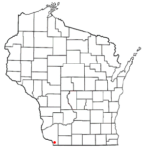
The Town of Jamestown is located in Grant County, Wisconsin, United States. The population was 2,077 at the 2020 census. The census-designated places of Kieler and Sandy Hook and the unincorporated communities of Fair Play, Louisburg, and Rutledge are located within the town; The unincorporated community of Sinsinawa is located partially in the town. The ghost town of Sinnipee was located in the town.
Sandy Hook is a barrier spit along the Atlantic coast of New Jersey.

Sandy Hook is a barrier spit in Middletown Township, Monmouth County, New Jersey, United States. The barrier spit, approximately 6 miles (9.7 km) in length and varying from 0.1 to 1.0 mile wide, is located at the north end of the Jersey Shore. It encloses the southern entrance of Lower New York Bay south of New York City, protecting it from the open waters of the Atlantic Ocean to the east.

Raritan Bay is a bay located at the southern portion of Lower New York Bay between the U.S. states of New York and New Jersey and is part of the New York Bight. The bay is bounded on the northwest by New York's Staten Island, on the west by Perth Amboy, New Jersey, on the south by the Raritan Bayshore communities in the New Jersey counties of Middlesex and Monmouth, and on the east by Sandy Hook Bay. The bay is named after the Raritans, a branch of the Lenape tribe who lived in the vicinity of the bay and its river for thousands of years, prior to the arrival of Dutch and English colonists in the 17th century.

The Sandy Hook Lighthouse, located about one and a half statute miles (2.4 km) inland from the tip of Sandy Hook, New Jersey, is the oldest working lighthouse in the United States. It was designed and built on June 11, 1764 by Isaac Conro. At that time, it stood only 500 feet from the tip of Sandy Hook; however, today, due to growth caused by littoral drift, it is almost one and a half miles (2.4 km) inland from the tip. It was listed as a National Historic Landmark in 1964 and added to the National Register of Historic Places on October 15, 1966, for its significance in commerce and transportation.

Sandy Hook is a village in the town of Newtown, Connecticut. It was founded in 1711. It was listed as a census-designated place prior to the 2020 census.

Shopiere is an unincorporated community and census-designated place in the Town of Turtle, in Rock County, Wisconsin, United States. It was first named a CDP at the 2020 census, which showed a population of 154.

Sandy Hook is an unincorporated community and census-designated place in Washington County, Maryland, United States. Its population was 188 as of the 2010 census. Sandy Hook was briefly important as for a few years it was the end of the line for the Baltimore and Ohio Railroad, then under construction. This period ended with the opening of the B & O Railroad Potomac River Crossing in 1837.

The Sandy Hook Elementary School shooting was a mass shooting that occurred on December 14, 2012, in Newtown, Connecticut, United States, when 20-year-old Adam Lanza shot and killed 26 people. Twenty of the victims were children between six and seven years old, and the other six were adult staff members. Earlier that day, before driving to the school, Lanza fatally shot his mother at their Newtown home. As first responders arrived at the school, Lanza died by suicide, shooting himself in the head.
The Sandy Hook Elementary School shooting occurred on December 14, 2012, in Newtown, Connecticut. The perpetrator, Adam Lanza, fatally shot his mother before murdering 20 students and six staff members at Sandy Hook Elementary School, and later committed suicide. A number of fringe figures have promoted conspiracy theories that doubt or dispute what occurred at Sandy Hook. Various conspiracy theorists have claimed, for example, that the massacre was actually orchestrated by the U.S. government as part of an elaborate plot to promote stricter gun control laws.

Francis Perkins Van Pelt was a 19th-century Sandy Hook Pilot. He is best known for being the President of the New York Sandy Hook Pilots Association and chairman of the executive committee of the New York and New Jersey Pilots' Associations. His father was Augustus Van Pelt a Sandy Hook pilot.
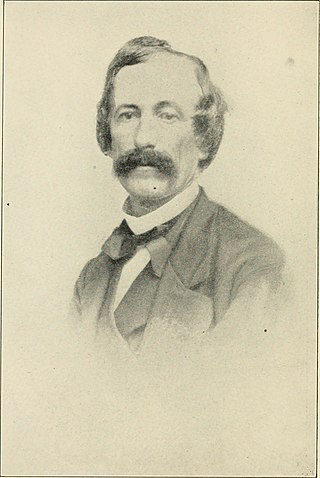
James Howard Van Pelt was a 19th-century New York Sandy Hook Pilot. He is best known for being a Sandy Hook pilot for forty years. He lost his life while boarding a Standard Oil tanker outside Sandy Hook. His father, Howard Van Pelt, was also a Sandy Hook pilot and lost his life in a similar way.
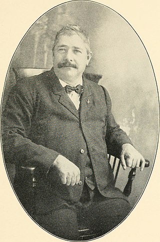
Gideon L. Mapes was a 19th-century New York Sandy Hook Pilot. He was one of the oldest Sandy Hook pilots with his pilots' license dating back to 1852. He lost his life after boarding a White Star Line freight steamship coming into the New York Harbor. He was the pilot and part owner of the pilot boats Eben D. Jordan and Widgeon.
Howard Van Pelt was a 19th-century New York Sandy Hook Pilot. He is best known for being a Sandy Hook pilot that lost his life on duty. He was knocked overboard when the hawser parted struck him in the chest while towing the bark Ukraine. His son, James Howard Van Pelt, was also a Sandy Hook pilot and lost his life when boarding a tank ship in 1915.
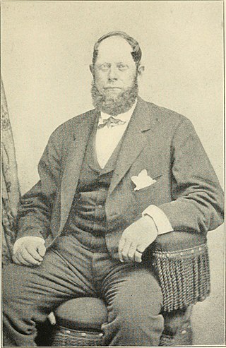
Walter Brewer was a 19th-century American harbor pilot who guided large vessels into and out of New York Harbor as a Sandy Hook pilot. He was part owner of the pilot boats Virginia, William H. Aspinwall and the America, of the New York fleet.


