Blue River, Wisconsin

Last updated

Blue River, Wisconsin
Blue River, Wisconsin 2.jpg
Wis-133 runs through town
Grant County Wisconsin Incorporated and Unincorporated areas Blue River Highlighted.svg
Location of Blue River in Grant County, Wisconsin.
Coordinates: 43°11′13″N90°34′12″W / 43.18694°N 90.57000°W / 43.18694; -90.57000
Country Flag of the United States.svg  United States
State Flag of Wisconsin.svg  Wisconsin
County Grant
Area
[1]
  Total0.91 sq mi (2.36 km2)
  Land0.91 sq mi (2.36 km2)
  Water0.00 sq mi (0.00 km2)
Elevation
[2]
663 ft (202 m)
Population
 (2010) [3]
  Total434
  Estimate 
(2019) [4]
421
  Density462.13/sq mi (178.34/km2)
Time zone UTC-6 (Central (CST))
  Summer (DST) UTC-5 (CDT)
Area code 608
FIPS code 55-08525 [5]
GNIS feature ID1561952 [2]

Blue River is a village in Grant County, Wisconsin, United States. The population was 434 at the 2010 census.

Contents

Places

Eagle Cave is near Blue River.

Geography

Blue River is located at 43°11′13″N90°34′12″W / 43.18694°N 90.57000°W / 43.18694; -90.57000 (43.186952, -90.570131). [6]

According to the United States Census Bureau, the village has a total area of 0.80 square miles (2.07 km2), all of it land. [7]

Demographics

Historical population
CensusPop.Note
1920 396
1930 346−12.6%
1940 38110.1%
1950 42511.5%
1960 356−16.2%
1970 3693.7%
1980 41211.7%
1990 4386.3%
2000 429−2.1%
2010 4341.2%
2019 (est.)421 [4] −3.0%
U.S. Decennial Census [8]

2010 census

As of the census [3] of 2010, there were 434 people, 192 households, and 113 families living in the village. The population density was 542.5 inhabitants per square mile (209.5/km2). There were 217 housing units at an average density of 271.3 per square mile (104.7/km2). The racial makeup of the village was 96.5% White, 0.7% African American, 0.5% Native American, 0.7% Asian, 0.7% from other races, and 0.9% from two or more races. Hispanic or Latino of any race were 1.8% of the population.

There were 192 households, of which 30.7% had children under the age of 18 living with them, 44.3% were married couples living together, 6.8% had a female householder with no husband present, 7.8% had a male householder with no wife present, and 41.1% were non-families. 32.8% of all households were made up of individuals, and 14.6% had someone living alone who was 65 years of age or older. The average household size was 2.26 and the average family size was 2.88.

The median age in the village was 42.1 years. 23.7% of residents were under the age of 18; 6.9% were between the ages of 18 and 24; 23.7% were from 25 to 44; 29.6% were from 45 to 64; and 16.1% were 65 years of age or older. The gender makeup of the village was 51.4% male and 48.6% female.

2000 census

As of the census [5] of 2000, there were 429 people, 183 households, and 116 families living in the village. The population density was 577.8 people per square mile (223.8/km2). There were 205 housing units at an average density of 276.1 per square mile (107.0/km2). The racial makeup of the village was 99.77% White and 0.23% Asian. Hispanic or Latino of any race were 0.23% of the population.

There were 183 households, out of which 30.1% had children under the age of 18 living with them, 49.7% were married couples living together, 9.3% had a female householder with no husband present, and 36.1% were non-families. 33.3% of all households were made up of individuals, and 18.0% had someone living alone who was 65 years of age or older. The average household size was 2.34 and the average family size was 2.97.

In the village, the population was spread out, with 24.9% under the age of 18, 9.6% from 18 to 24, 26.3% from 25 to 44, 23.1% from 45 to 64, and 16.1% who were 65 years of age or older. The median age was 38 years. For every 100 females, there were 107.2 males. For every 100 females age 18 and over, there were 100.0 males.

The median income for a household in the village was $34,250, and the median income for a family was $41,806. Males had a median income of $30,515 versus $20,625 for females. The per capita income for the village was $16,548. About 3.5% of families and 8.6% of the population were below the poverty line, including 7.5% of those under age 18 and 15.1% of those age 65 or over.

Notable people

Related Research Articles

<span class="mw-page-title-main">Fall River, Wisconsin</span> Village in Wisconsin, United States

Fall River is a village in Columbia County, Wisconsin, United States, along the North Fork of the Crawfish River. The population was 1,712 at the 2010 census. It is part of the Madison Metropolitan Statistical Area.

<span class="mw-page-title-main">Ferryville, Wisconsin</span> Village in Wisconsin, United States

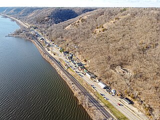
Ferryville is a village in Crawford County, Wisconsin, United States. The population was 176 at the 2010 census. It is located on Wisconsin Highway 35 along the Great River Road.

<span class="mw-page-title-main">Peru, Wisconsin</span> Town in Wisconsin, United States

The Town of Peru is a Town located in Dunn County, Wisconsin, United States. The population was 247 at the 2000 census. The unincorporated communities of Meridean and Red Cedar and the ghost towns of Old Tyrone and Old Meridean are located in the town.

<span class="mw-page-title-main">St. Cloud, Wisconsin</span> Village in Wisconsin, United States

St. Cloud is a village in Fond du Lac County, Wisconsin, United States, along the Sheboygan River. The population was 477 at the 2010 census. St. Cloud is part of The Holyland region in northeastern Fond du Lac County.

<span class="mw-page-title-main">Monticello, Green County, Wisconsin</span> Village in Wisconsin, United States

Monticello is a village in Green County, Wisconsin, United States. The population was 1,217 as of the 2010 census.

<span class="mw-page-title-main">Hollandale, Wisconsin</span> Village in Wisconsin, United States

Hollandale is a village in Iowa County, Wisconsin, United States. The population was 306 at the 2020 census. It is part of the Madison Metropolitan Statistical Area.

<span class="mw-page-title-main">Taylor, Wisconsin</span> Village in Wisconsin, United States

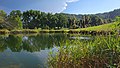
Taylor is a village in Jackson County, Wisconsin, United States, along the Trempealeau River. The population was 484 at the 2020 census.

<span class="mw-page-title-main">Cleveland (village), Wisconsin</span> Village in Wisconsin, United States

Cleveland is a village in Manitowoc County, Wisconsin, United States. The population was 1,579 at the 2020 census.
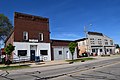
<span class="mw-page-title-main">Pigeon Falls, Wisconsin</span> Village in Wisconsin, United States

Pigeon Falls is a village in Trempealeau County, Wisconsin, United States. The population was 411 at the 2010 census.

<span class="mw-page-title-main">Montfort, Wisconsin</span> Village in Wisconsin, United States

Montfort is a village in Grant and Iowa Counties in the U.S. state of Wisconsin. The population was 718 at the 2010 census. Of this, 622 were in Grant County, and 96 were in Iowa County.

<span class="mw-page-title-main">Newburg, Wisconsin</span> Village in Ozaukee and Washington counties, Wisconsin

Newburg is a village in Ozaukee and Washington counties in the U.S. state of Wisconsin. The population was 1,254 at the 2010 census. Of this, 1,157 were in Washington County, and only 97 were in Ozaukee County.

<span class="mw-page-title-main">Viola, Wisconsin</span> Village in Wisconsin, United States

Viola is a village in Richland (mostly) and Vernon counties in the U.S. state of Wisconsin. The population was 699 at the 2010 census. Of this, 477 were in Richland County, and 222 were in Vernon County.

<span class="mw-page-title-main">Unity, Wisconsin</span> Village in Wisconsin, United States

Unity is a village in Clark and Marathon counties in the U.S. state of Wisconsin. It is part of the Wausau, Wisconsin Metropolitan Statistical Area. The population was 343 at the 2010 census. Of this, 204 were in Marathon County, and 139 were in Clark County. The village is located in northeastern town of Unity in Clark County and northwestern town of Brighton in Marathon County.

<span class="mw-page-title-main">Wauzeka, Wisconsin</span> Village in Wisconsin, United States

Wauzeka is a village in Crawford County, Wisconsin, United States. The population was 628 at the 2020 census. The village is located within the Town of Wauzeka near the confluence of the Kickapoo River and Wisconsin River.

<span class="mw-page-title-main">Lowell, Wisconsin</span> Village in Wisconsin, United States

Lowell is a village in Dodge County, Wisconsin, United States, along the Beaver Dam River. The population was 340 at the 2010 census. The village is located within the Town of Lowell.

<span class="mw-page-title-main">Oakfield, Wisconsin</span> Village in Wisconsin, United States

Oakfield is a village in Fond du Lac County, Wisconsin, United States. The population was 1,052 at the 2020 census. The village is located within the Town of Oakfield.

<span class="mw-page-title-main">Linden, Wisconsin</span> Village in Wisconsin, United States

Linden is a village in Iowa County, Wisconsin, United States. The population was 549 at the 2010 census. The village is located within the Town of Linden.

<span class="mw-page-title-main">Argyle, Wisconsin</span> Village in Wisconsin, United States

Argyle is a village in Lafayette County, Wisconsin, United States. The population was 857 at the 2010 census, up from 823 at the 2000 census. The village is located within the Town of Argyle.

<span class="mw-page-title-main">Pepin, Wisconsin</span> Village in Wisconsin, United States

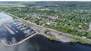
Pepin is a village in Pepin County, Wisconsin, United States. The population was 837 at the 2010 census. The village is located within the Town of Pepin.

<span class="mw-page-title-main">Milltown, Wisconsin</span> Village in Wisconsin, United States

Milltown is a village in Polk County, Wisconsin, United States. The population was 917 at the 2010 census. The village is located within the Town of Milltown.

References

  1. "2019 U.S. Gazetteer Files". United States Census Bureau. Retrieved August 7, 2020.
  2. 1 2 "US Board on Geographic Names". United States Geological Survey. October 25, 2007. Retrieved January 31, 2008.
  3. 1 2 "U.S. Census website". United States Census Bureau . Retrieved November 18, 2012.
  4. 1 2 "Population and Housing Unit Estimates". United States Census Bureau. May 24, 2020. Retrieved May 27, 2020.
  5. 1 2 "U.S. Census website". United States Census Bureau . Retrieved January 31, 2008.
  6. "US Gazetteer files: 2010, 2000, and 1990". United States Census Bureau. February 12, 2011. Retrieved April 23, 2011.
  7. "US Gazetteer files 2010". United States Census Bureau. Archived from the original on January 25, 2012. Retrieved November 18, 2012.
  8. "Census of Population and Housing". Census.gov. Retrieved June 4, 2015.