Dickeyville, Wisconsin

Last updated

Dickeyville, Wisconsin
Watertower in Dickeyville, Wisconsin (2016).jpg
Grant County Wisconsin Incorporated and Unincorporated areas Dickeyville Highlighted.svg
Location of Dickeyville in Grant County, Wisconsin.
Coordinates: 42°37′39″N90°35′34″W / 42.62750°N 90.59278°W / 42.62750; -90.59278
Country Flag of the United States.svg  United States
State Flag of Wisconsin.svg  Wisconsin
County Grant
Area
[1]
  Total1.01 sq mi (2.62 km2)
  Land1.01 sq mi (2.62 km2)
  Water0.00 sq mi (0.00 km2)
Elevation
[2]
958 ft (292 m)
Population
 (2010) [3]
  Total1,061
  Estimate 
(2019) [4]
1,024
  Density1,013.86/sq mi (391.27/km2)
Time zone UTC-6 (Central (CST))
  Summer (DST) UTC-5 (CDT)
Area code 608
FIPS code 55-20175 [5]
GNIS feature ID1563972 [6]
Website www.dickeyville.com

Dickeyville is a village in Grant County, Wisconsin, United States. The population was 1,061 at the 2010 census.

Contents

The Dickeyville Grotto is located in the heart of the village. [7]

History

Dickeyville was not formally platted. [8] The village was named for Charles Dickey, who opened a general store in the early 1840s. [9] He was also the first postmaster when the post office was established (as Dickeysville) in 1849. [10]

Geography

According to the United States Census Bureau, the village has a total area of 0.88 square miles (2.28 km2), all of it land. [11]

Demographics

Historical population
CensusPop.Note
1950 269
1960 671149.4%
1970 1,05757.5%
1980 1,1569.4%
1990 862−25.4%
2000 1,04321.0%
2010 1,0611.7%
2019 (est.)1,024 [4] −3.5%
U.S. Decennial Census [12]

2010 census

As of the census [3] of 2010, there were 1,061 people, 459 households, and 289 families living in the village. The population density was 1,205.7 inhabitants per square mile (465.5/km2). There were 471 housing units at an average density of 535.2 per square mile (206.6/km2). The racial makeup of the village was 99.1% White, 0.2% African American, 0.4% from other races, and 0.4% from two or more races. Hispanic or Latino of any race were 1.1% of the population.

There were 459 households, of which 28.5% had children under the age of 18 living with them, 54.5% were married couples living together, 6.5% had a female householder with no husband present, 2.0% had a male householder with no wife present, and 37.0% were non-families. 31.8% of all households were made up of individuals, and 12.9% had someone living alone who was 65 years of age or older. The average household size was 2.31 and the average family size was 2.93.

The median age in the village was 40.7 years. 24% of residents were under the age of 18; 5.5% were between the ages of 18 and 24; 25.6% were from 25 to 44; 24.8% were from 45 to 64; and 20.1% were 65 years of age or older. The gender makeup of the village was 49.6% male and 50.4% female.

2000 census

As of the census [5] of 2000, there were 1,043 people, 420 households, and 299 families living in the village. The population density was 1,197.3 people per square mile (462.9/km2). There were 431 housing units at an average density of 494.8 per square mile (191.3/km2). The racial makeup of the village was 99.52% White, 0.29% Asian, and 0.19% from two or more races. Hispanic or Latino of any race were 0.29% of the population.

There were 420 households, out of which 28.1% had children under the age of 18 living with them, 62.9% were married couples living together, 6.9% had a female householder with no husband present, and 28.8% were non-families. 25.5% of all households were made up of individuals, and 10.7% had someone living alone who was 65 years of age or older. The average household size was 2.48 and the average family size was 2.96.

In the village, the population was spread out, with 24.6% under the age of 18, 8.1% from 18 to 24, 26.8% from 25 to 44, 24.8% from 45 to 64, and 15.5% who were 65 years of age or older. The median age was 38 years. For every 100 females, there were 97.2 males. For every 100 females age 18 and over, there were 96.0 males.

The median income for a household in the village was $47,353, and the median income for a family was $56,875. Males had a median income of $32,625 versus $26,944 for females. The per capita income for the village was $23,147. About 6.9% of families and 11.7% of the population were below the poverty line, including 20.4% of those under age 18 and 3.8% of those age 65 or over.

Notable person

Related Research Articles

<span class="mw-page-title-main">Stockholm, Wisconsin</span> Village in Wisconsin, United States

Stockholm is a village in Pepin County, Wisconsin, United States, founded in 1854 by immigrants from Karlskoga, Sweden, who named it after their country's capital. The population was 78 at the 2020 census. The village is located within the Town of Stockholm.

<span class="mw-page-title-main">Eagle, Michigan</span> Village in Michigan, United States

Eagle is a village in southwest Clinton County in the U.S. state of Michigan. The population was 122 at the 2020 census. The village is within Eagle Township in the southwest corner of the county. It is near Interstate 96 about 15 miles (24 km) northwest of Lansing.

<span class="mw-page-title-main">Cedar Rapids, Nebraska</span> Village in Nebraska, United States

Cedar Rapids is a village in Boone County, Nebraska, United States. The population was 382 at the 2010 census.

<span class="mw-page-title-main">Doylestown, Wisconsin</span> Village in Wisconsin, United States

Doylestown is a village in Columbia County, Wisconsin, United States. The population was 297 at the 2010 census. It is part of the Madison Metropolitan Statistical Area.

<span class="mw-page-title-main">Poynette, Wisconsin</span> Village in Wisconsin, United States

Poynette is a village in Columbia County, Wisconsin, United States. The population was 2,575 at the 2022 United States census. It is part of the Madison Metropolitan Statistical Area.

<span class="mw-page-title-main">Bell Center, Wisconsin</span> Village in Wisconsin, United States

Bell Center is a village in Crawford County, Wisconsin, United States. The population was 117 at the 2010 census.

<span class="mw-page-title-main">Brokaw, Wisconsin</span> Village in Wisconsin, United States

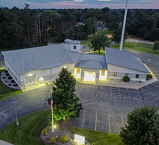
Brokaw is a former village in Marathon County, Wisconsin, United States. It is part of the Wausau, Wisconsin Metropolitan Statistical Area. The population was 251 at the 2010 census. Brokaw merged with the village of Maine, Wisconsin on October 1, 2018.

<span class="mw-page-title-main">Boaz, Wisconsin</span> Village in Wisconsin, United States

Boaz is a village in Richland County, Wisconsin, United States. According to the 2010 census, the population of the village was 156.

<span class="mw-page-title-main">Weyerhaeuser, Wisconsin</span> Village in Wisconsin, United States

Weyerhaeuser is a village in Rusk County, Wisconsin, United States. The population was 238 at the 2010 census.

<span class="mw-page-title-main">Woodville, Wisconsin</span> Village in Wisconsin, United States

Woodville is a village in St. Croix County, Wisconsin, United States. The population was 1,344 at the 2010 census.

<span class="mw-page-title-main">Ontario, Wisconsin</span> Village in Wisconsin, United States

Ontario is a village in Vernon County, Wisconsin, United States. The population was 554 at the 2010 census.

<span class="mw-page-title-main">Ogdensburg, Wisconsin</span> Village in Wisconsin, United States

Ogdensburg is a village in Waupaca County, Wisconsin, United States. The population was 185 at the 2010 census.

<span class="mw-page-title-main">Wild Rose, Wisconsin</span> Village in Wisconsin, United States

Wild Rose is a village in Waushara County, Wisconsin, United States. The population was 725 at the 2010 census.

<span class="mw-page-title-main">Randolph, Wisconsin</span> Village in Wisconsin, United States

Randolph is a village in Columbia and Dodge Counties in the U.S. state of Wisconsin. The population was 1,811 at the 2010 census. Of this, 1,339 were in Dodge County, and 472 were in Columbia County. The village is located at the southeast corner of the Town of Randolph in Columbia County, although only a tiny portion of the village lies within the town. Most of the village lies within the Town of Westford in Dodge County. Small portions also lie within the Town of Fox Lake to the north and the Town of Courtland in Columbia County.

<span class="mw-page-title-main">Black Earth, Wisconsin</span> Village in Wisconsin, United States

Black Earth is a village in Dane County, Wisconsin, United States. The population was 1,338 at the 2010 census. The village is located within the Town of Black Earth. It is part of the Madison Metropolitan Statistical Area.

<span class="mw-page-title-main">Dane, Wisconsin</span> Village in Wisconsin, United States

Dane is a village in Dane County, Wisconsin, United States. The population was 1,117 at the 2020 census. Located in the Town of Dane, the village is part of the Madison Metropolitan Statistical Area.

<span class="mw-page-title-main">Mount Hope, Wisconsin</span> Village in Wisconsin, United States

Mount Hope is a village in Grant County, Wisconsin, United States. The population was 225 at the 2010 census. The village is located within the Town of Mount Hope.

<span class="mw-page-title-main">Pepin, Wisconsin</span> Village in Wisconsin, United States

Pepin is a village in Pepin County, Wisconsin, United States. The population was 837 at the 2010 census. The village is located within the Town of Pepin.

<span class="mw-page-title-main">Milltown, Wisconsin</span> Village in Wisconsin, United States

Milltown is a village in Polk County, Wisconsin, United States. The population was 917 at the 2010 census. The village is located within the Town of Milltown.

<span class="mw-page-title-main">Radisson, Wisconsin</span> Village in Wisconsin, United States

Radisson is a village in Sawyer County, Wisconsin, United States, along the Couderay River. The population was 241 at the 2010 census. The village is located within the Town of Radisson and was named in honor of the early French explorer, Pierre-Esprit Radisson (c.1636–1710).

References

  1. "2019 U.S. Gazetteer Files". United States Census Bureau. Retrieved August 7, 2020.
  2. "US Board on Geographic Names". United States Geological Survey. October 25, 2007. Retrieved January 31, 2008.
  3. 1 2 "U.S. Census website". United States Census Bureau . Retrieved November 18, 2012.
  4. 1 2 "Population and Housing Unit Estimates". United States Census Bureau. May 24, 2020. Retrieved May 27, 2020.
  5. 1 2 "U.S. Census website". United States Census Bureau . Retrieved January 31, 2008.
  6. "Dickeyville". Geographic Names Information System . United States Geological Survey, United States Department of the Interior.
  7. Hintz, Martin (June 19, 2012). Wisconsin Off the Beaten Path: A Guide to Unique Places. Rowman & Littlefield. p. 18. ISBN   978-0-7627-8619-0.
  8. Holford, Castello N (1900). History of Grant County, Wisconsin: Including Its Civil, Political, Geological, Mineralogical, Archaeological and Military History, and a History of the Several Towns. Walsworth Publishing Company. p. 766.
  9. Callary, Edward (2016). Place Names of Wisconsin. Madison, WI: University of Wisconsin Press. p. 76. ISBN   978-0-299-30964-0.
  10. "Grant County". Jim Forte Postal History. Archived from the original on October 6, 2014. Retrieved October 2, 2014.
  11. "US Gazetteer files 2010". United States Census Bureau. Archived from the original on July 2, 2012. Retrieved November 18, 2012.
  12. "Census of Population and Housing". Census.gov. Retrieved June 4, 2015.