Grant County, Wisconsin

Last updated

Grant County
Grant County, Wisconsin Courthouse.jpg
Map of Wisconsin highlighting Grant County.svg
Location within the U.S. state of Wisconsin
Wisconsin in United States.svg
Wisconsin's location within the U.S.
Coordinates: 42°52′N90°43′W / 42.86°N 90.71°W / 42.86; -90.71
CountryFlag of the United States.svg United States
StateFlag of Wisconsin.svg  Wisconsin
Founded1837
Seat Lancaster
Largest city Platteville
Area
  Total1,183 sq mi (3,060 km2)
  Land1,147 sq mi (2,970 km2)
  Water36 sq mi (90 km2)  3.1%
Population
 (2020) [1]
  Total51,938
  Density45.3/sq mi (17.5/km2)
Time zone UTC−6 (Central)
  Summer (DST) UTC−5 (CDT)
Congressional district 3rd
Website www.co.grant.wi.gov

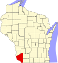
Grant County is the most southwestern county in the U.S. state of Wisconsin. As of the 2020 census, the population was 51,938. [2] Its county seat is Lancaster and its largest city is Platteville. [3] The county is named after the Grant River, in turn named after a fur trader who lived in the area when Wisconsin was a territory. [4] Grant County comprises the Platteville Micropolitan Statistical Area. It is in the tri-state area of Wisconsin, Illinois, and Iowa, and is crossed by travelers commuting to Madison, Wisconsin, from a number of eastern Iowan cities, and by residents of northern Illinois traveling to the Twin Cities or La Crosse, Wisconsin.

Contents

History

Indian presence

What is now Grant County was largely uninhabited prior to contact with Europeans, as it was a border region between the territories of the Kickapoo, Menominee, and Illinois tribes. The only Native Americans to have a permanent settlement in the area were the Fox tribe, who had a temporary village in what is now the extreme northeast of the county during the mid-1700s.

Colonial period

Between 1520 and 1620 this area was nominally ruled by Spain, although the lack of explorers left the region completely untouched by Spanish authority. The first Frenchmen to reach what is now Grant County were Jacques Marquette and Louis Joliet, who explored the region in the spring of 1673, after setting out from what would later become Green Bay. No permanent settlement was made. In 1680 Louis Hennepin also passed through the region that would later become Grant County, also making no permanent settlement. In 1689 Nicholas Perrot passed through the territory and claimed it for the King of France. The first settlement was a temporary trading post that Pierre Marin founded in 1725.

The British technically ruled the region during the period between the French and Indian War and the American Revolution, though no effort was made to settle or administer the region. After the abandonment of Marin's trading post, the region went unvisited until the expedition of Jonathan Carver, a New England Yankee who passed through what is now Grant County in 1766 during an attempt to discover the Pacific Ocean.

American period

In 1783, the British government acknowledged the jurisdiction of the United States over the land east of the Mississippi River, including what is now Grant County. American and European traders visiting the region over the next decades were yet as nomadic as the Indians, and no records survive. Grant County was created as part of Wisconsin Territory in 1837. [5] It was named after an Indian trader; his first name, origins, and eventual fate are all unknown. [6]

Geography

According to the U.S. Census Bureau, the county has a total area of 1,183 square miles (3,060 km2), of which 1,147 square miles (2,970 km2) is land and 36 square miles (93 km2) (3.1%) is water. [7]

Major highways

Railroads

Buses

Airports

Adjacent counties

Demographics

Historical population
CensusPop.Note
1840 3,926
1850 16,169311.8%
1860 31,18992.9%
1870 37,97921.8%
1880 37,852−0.3%
1890 36,651−3.2%
1900 38,8816.1%
1910 39,0070.3%
1920 39,0440.1%
1930 38,469−1.5%
1940 40,6395.6%
1950 41,4602.0%
1960 44,4197.1%
1970 48,3989.0%
1980 51,7366.9%
1990 49,264−4.8%
2000 49,5970.7%
2010 51,2083.2%
2020 51,9381.4%
U.S. Decennial Census [8]
1790–1960 [9] 1900–1990 [10]
1990–2000 [11] 2010–2020 [2]

2020 census

As of the census of 2020, [1] the population was 51,938. The population density was 45.3 people per square mile (17.5 people/km2). There were 22,110 housing units at an average density of 19.3 units per square mile (7.5 units/km2). The racial makeup of the county was 93.8% White, 1.3% Black or African American, 0.8% Asian, 0.2% Native American, 1.0% from other races, and 2.8% from two or more races. Ethnically, the population was 2.4% Hispanic or Latino of any race.

2000 Census Age Pyramid for Grant County. USA Grant County, Wisconsin age pyramid.svg
2000 Census Age Pyramid for Grant County.

2000 census

As of the census of 2000, [12] there were 49,597 people, 18,465 households, and 12,390 families residing in the county. The population density was 43 people per square mile (17 people/km2). There were 19,940 housing units at an average density of 17 units per square mile (6.6 units/km2). The racial makeup of the county was 98.23% White, 0.52% Black or African American, 0.13% Native American, 0.46% Asian, 0.01% Pacific Islander, 0.14% from other races, and 0.50% from two or more races. 0.56% of the population were Hispanic or Latino of any race. 52.0% were of German, 9.2% English, 8.8% Irish, 6.6% American and 6.4% Norwegian ancestry.

There were 18,465 households, out of which 30.50% had children under the age of 18 living with them, 56.10% were married couples living together, 7.50% had a female householder with no husband present, and 32.90% were non-families. 26.00% of all households were made up of individuals, and 12.10% had someone living alone who was 65 years of age or older. The average household size was 2.51 and the average family size was 3.03.

In the county, the population was spread out, with 23.70% under the age of 18, 14.60% from 18 to 24, 24.80% from 25 to 44, 21.60% from 45 to 64, and 15.30% who were 65 years of age or older. The median age was 36 years. For every 100 females there were 103.00 males. For every 100 females age 18 and over, there were 102.00 males.

Government and infrastructure

The Wisconsin Secure Program Facility (WSPF), a Wisconsin Department of Corrections prison for men, is located in Boscobel in Grant County. [13] [14]

Politics

Grant County has been a reliably Republican county at the federal level for most of its existence. Starting in 1992 however, it voted for the Democratic candidate for president six elections in a row before shifting back to the GOP in 2016.

United States presidential election results for Grant County, Wisconsin [15]
Year Republican Democratic Third party
No.%No.%No.%
2020 14,14255.22%10,99842.95%4681.83%
2016 12,35050.68%10,05141.25%1,9678.07%
2012 10,25542.29%13,59456.06%3991.65%
2008 9,06837.29%14,87561.16%3771.55%
2004 12,20848.32%12,86450.92%1920.76%
2000 10,24046.64%10,69148.69%1,0254.67%
1996 7,02136.54%9,20347.89%2,99115.57%
1992 7,67833.16%8,91438.49%6,56528.35%
1988 10,04951.32%9,42148.12%1100.56%
1984 13,43062.58%7,89236.78%1380.64%
1980 13,29855.82%8,40635.28%2,1208.90%
1976 12,01654.11%9,63943.41%5522.49%
1972 11,87362.29%6,91536.28%2731.43%
1968 10,78962.49%5,41431.36%1,0616.15%
1964 7,87245.74%9,30954.09%300.17%
1960 11,56460.05%7,67839.87%160.08%
1956 11,64868.69%5,20830.71%1020.60%
1952 14,32777.21%4,19722.62%320.17%
1948 8,29955.00%6,57543.57%2151.42%
1944 10,22662.56%6,09137.27%280.17%
1940 11,14359.40%7,45839.76%1580.84%
1936 7,19641.11%9,17052.39%1,1376.50%
1932 5,98637.60%9,70160.94%2321.46%
1928 10,05259.85%6,63039.48%1120.67%
1924 5,71440.33%1,51810.71%6,93748.96%
1920 9,63880.92%1,97116.55%3022.54%
1916 4,71856.29%3,45941.27%2052.45%
1912 3,28341.63%3,61545.84%98812.53%
1908 4,98955.09%3,69640.81%3714.10%
1904 5,80464.52%2,88632.08%3053.39%
1900 5,60961.15%3,25435.48%3093.37%
1896 5,31557.40%3,68339.77%2622.83%
1892 4,21750.23%3,68543.89%4945.88%

Communities

Cities

Downtown at night in Platteville Downtown at night Platteville.jpg
Downtown at night in Platteville

Villages

Towns

Census-designated places

Unincorporated communities

Ghost towns/neighborhoods

Fair play was founded by a prospector, rather than a farmer or logger, and within two years the prospector found ore, the settlement was built on the corner of Hwy 11 and Sandy Hook Road, the place was rather rowdy and fights based in greed was not uncommon, the place got it's moniker when a violent fight broke out and one contender did not carry weapon, but the other man did, and thus the crowd started chanting 'Fair Play! Fair Play! Fair Play!' until the fight ended, and thus the village formerly known as 'Hard Town' was redubbed as 'Fair Play', in 1846, the last threatened duel took place and afterwards the settlement was abandoned.

[16]

Paris was a settlement 1/8th of a mile South of 'Dickeyville' near Hwy 151/61 between 1838 and 1843, a small settlement built on the Platte River, the founder had malaria and he named the place after his homelands capitol, Paris, (France), he built a bridge across the river that proved the counties first one made, the founder, Detantabaritz, had started experiencing financial issues, and he ended up facing a creditor, choosing swords as dueling weapons as he was himself a Dragoon, the creditor backed down, and later the founder took his own life due to debt anxieties, and now only a tavern remains, selling ribs.

[17]

Notable people

See also

Footnotes

  1. 1 2 "2020 Decennial Census: Grant County, Wisconsin". data.census.gov. U.S. Census Bureau. Retrieved July 5, 2022.
  2. 1 2 "State & County QuickFacts". United States Census Bureau. Archived from the original on June 6, 2011. Retrieved January 18, 2014.
  3. "Find a County". National Association of Counties. Archived from the original on May 31, 2011. Retrieved June 7, 2011.
  4. "Grant County Place Names". Grant County Historical Society. Retrieved June 3, 2022.
  5. "Wisconsin: Individual County Chronologies". Wisconsin Atlas of Historical County Boundaries. The Newberry Library. 2007. Archived from the original on April 14, 2017. Retrieved August 13, 2015.
  6. Castello N. Holford History of Grant County, Wisconsin . Chicago: Western Historical Company, 1881, pp. 7-9.
  7. "2010 Census Gazetteer Files". United States Census Bureau. August 22, 2012. Retrieved August 4, 2015.
  8. "U.S. Decennial Census". United States Census Bureau. Retrieved August 4, 2015.
  9. "Historical Census Browser". University of Virginia Library. Retrieved August 4, 2015.
  10. Forstall, Richard L., ed. (March 27, 1995). "Population of Counties by Decennial Census: 1900 to 1990". United States Census Bureau. Retrieved August 4, 2015.
  11. "Census 2000 PHC-T-4. Ranking Tables for Counties: 1990 and 2000" (PDF). United States Census Bureau. April 2, 2001. Archived (PDF) from the original on October 9, 2022. Retrieved August 4, 2015.
  12. "U.S. Census website". United States Census Bureau . Retrieved May 14, 2011.
  13. "Boscobel city, Wisconsin [ permanent dead link ]." U.S. Census Bureau. Retrieved on October 10, 2010.
  14. "Wisconsin Secure Program Facility Archived September 14, 2010, at the Wayback Machine ." Wisconsin Department of Corrections. Retrieved on October 10, 2010.
  15. Leip, David. "Dave Leip's Atlas of U.S. Presidential Elections". uselectionatlas.org. Retrieved November 11, 2020.
  16. "Lost Towns of Wisconsin" (author unknown)
  17. "Lost Towns of Wisconsin" (author unknown)
  18. "Willard H. Burney (1857-1943)". The Political Graveyard. Retrieved October 6, 2012.
  19. "B. W. Countryman (b. 1867)". Political Graveyard. Retrieved October 10, 2013.
  20. "Jim Fagan, Snowshoes, Saloons, and Salvation: The Life And Times Of a 19th Century Colorado Pioneer Preacher, December 20, 2004". snowshoemag.com. Retrieved January 18, 2014.
  21. "William Garner Waddel". Political Graveyard. Retrieved November 23, 2013.

Further reading

42°52′N90°43′W / 42.86°N 90.71°W / 42.86; -90.71

Related Research Articles

<span class="mw-page-title-main">Rock County, Wisconsin</span> County in Wisconsin, United States

Rock County is a county in the U.S. state of Wisconsin. As of the 2020 census, the population was 163,687. Its county seat is Janesville. Rock County comprises the Janesville-Beloit, WI Metropolitan Statistical Area and is included in the Madison-Janesville-Beloit, WI Combined Statistical Area.

<span class="mw-page-title-main">Richland County, Wisconsin</span> County in Wisconsin, United States

Richland County is a county in the U.S. state of Wisconsin. As of the 2020 census, the population was 17,304. Its county seat is Richland Center. The county was created from the Wisconsin Territory in 1842 and organized in 1850. It is named for the high quality of its soil.

<span class="mw-page-title-main">Lafayette County, Wisconsin</span> County in Wisconsin, United States

Lafayette County, sometimes spelled La Fayette County, is a county located in the U.S. state of Wisconsin. It was part of the Wisconsin Territory at the time of its founding. As of the 2020 census, the population was 16,611. Its county seat is Darlington. The county was named in honor of the Marquis de Lafayette, the French general who rendered assistance to the Continental Army in the American Revolutionary War. The courthouse scenes from the 2009 film Public Enemies were filmed at the Lafayette County Courthouse in Darlington.

<span class="mw-page-title-main">Iowa County, Wisconsin</span> County in Wisconsin, United States

Iowa County is a county in the U.S. state of Wisconsin. As of the 2020 census, the population was 23,709. Its county seat and largest city is Dodgeville. When created, it was part of the Michigan Territory. Iowa County is part of the Madison, Wisconsin, Metropolitan Statistical Area.

<span class="mw-page-title-main">Green County, Wisconsin</span> County in Wisconsin, United States

Green County is a county located in the U.S. state of Wisconsin. As of the 2020 census, the population was 37,093. Its county seat is Monroe. Green County is included in the Madison, WI Metropolitan Statistical Area.

<span class="mw-page-title-main">Wright County, Iowa</span> County in Iowa, United States

Wright County is a county in the U.S. state of Iowa. As of the 2020 census, the population was 12,943. The county seat is Clarion. The county organization became effective in January 1851, and is believed to be named either after Silas Wright, a governor of New York, or Joseph Albert Wright, a governor of Indiana.

<span class="mw-page-title-main">Linn County, Iowa</span> County in Iowa, United States

Linn County is a county located in the U.S. state of Iowa. As of the 2020 census, the population was 230,299, making it the second-most populous county in Iowa. The county seat is Cedar Rapids. Linn County is named in honor of Senator Lewis F. Linn of Missouri. Linn County is included in the Cedar Rapids, IA Metropolitan Statistical Area.

<span class="mw-page-title-main">Keokuk County, Iowa</span> County in Iowa, United States

Keokuk County is a county located in the U.S. state of Iowa. As of the 2020 United States Census, the population was 10,033. The county seat is Sigourney.

<span class="mw-page-title-main">Stephenson County, Illinois</span> County in Illinois, United States

Stephenson County is a county located in the U.S. state of Illinois. According to the 2020 United States Census, it had a population of 44,630. Its county seat is Freeport.

<span class="mw-page-title-main">Jo Daviess County, Illinois</span> County in Illinois, United States

Jo Daviess County is the northwesternmost county in the U.S. state of Illinois. According to the 2020 census, it had a population of 22,035. Its county seat is Galena.

<span class="mw-page-title-main">Ellenboro, Wisconsin</span> Town in Wisconsin, United States

The Town of Ellenboro is a town located in Grant County, Wisconsin, United States. The population was 608 at the 2000 census.

<span class="mw-page-title-main">Lancaster, Wisconsin</span> City in Wisconsin, United States

Lancaster is a city in and the county seat of Grant County, Wisconsin, United States. The population was 3,907 at the 2020 census.

<span class="mw-page-title-main">Wiota, Wisconsin</span> Town in Wisconsin, United States

Wiota is a town in Lafayette County, Wisconsin, United States. The population was 856 at the 2010 census. The unincorporated communities of Wiota, Woodford and Five Corners are located in the town.

<span class="mw-page-title-main">Montfort, Wisconsin</span> Village in Wisconsin, United States

Montfort is a village in Grant and Iowa Counties in the U.S. state of Wisconsin. The population was 718 at the 2010 census. Of this, 622 were in Grant County, and 96 were in Iowa County.

<span class="mw-page-title-main">Boscobel, Wisconsin</span> City in Wisconsin, United States

Boscobel is a city in Grant County, Wisconsin, United States. The population was 3,286 at the 2020 census. Approximately 0.6 mi. (1 km) to the north of the city, across a riparian swamp, is the Wisconsin River. U.S. Route 61 crosses the Wisconsin River at Boscobel. To the south, the city is bordered by the Town of Boscobel.

<span class="mw-page-title-main">Cassville, Wisconsin</span> Village in Wisconsin, United States

Cassville is a village in Grant County, Wisconsin, United States. The population was 777 at the 2020 census. The village is located along the Mississippi River, opposite from the mouth of the Turkey River. It is surrounded by the Town of Cassville.

<span class="mw-page-title-main">Platteville, Wisconsin</span> City in Wisconsin, United States

Platteville is the largest city in Grant County, Wisconsin. The population was 11,836 at the 2020 census, up from 11,224 at the 2010 census. Much of this growth is likely due to the enrollment increase of the University of Wisconsin–Platteville. It is the principal city of the Platteville Micropolitan Statistical area, which has an estimated population of 51,938. Platteville is located atop the greater Platte River valley in the southern Driftless Region of Wisconsin, an area known for its karst topography and rolling hills.

<span class="mw-page-title-main">Wisconsin Highway 81</span> Highway in Wisconsin

State Trunk Highway 81 is a state highway in the U.S. state of Wisconsin. It runs east–west in southwest and south central Wisconsin from Cassville to Beloit. Between Brodhead and Monroe it run concurrently with WIS 11 for 13 miles (21 km). The route was originally designated as a state highway in the early 1920s, but there were three different designations along the route. It was not signed as WIS 81 along the entire route until 1934.

The Dubuque area is the general area encompassing Dubuque, Iowa. The official population of the Dubuque metro was 92,384 as of the 2005 population estimates. Although, if the unofficial counties are included, the area's population is near 190,000.

<span class="mw-page-title-main">Wisconsin's 49th Assembly district</span> American legislative district in southwest Wisconsin

Wisconsin's 49th Assembly district is one of 99 districts in the Wisconsin State Assembly. Located in southwest Wisconsin, the district comprises all of Crawford County and most of Grant County. It includes the cities of Boscobel, Fennimore, Lancaster, Platteville, and Prairie du Chien, and the villages of Bagley, Bell Center, Bloomington, Cassville, De Soto, Dickeyville, Eastman, Ferryville, Gays Mills, Lynxville, Mount Hope, Mount Sterling, Patch Grove, Potosi, Soldiers Grove, Steuben, Tennyson, Wauzeka, and Woodman. The district also contains the University of Wisconsin–Platteville campus, Wyalusing State Park, and Nelson Dewey Memorial State Park, and historic landmarks such as the Potosi Brewery and the Grant County Courthouse. The district has been represented by Travis Tranel, a Republican, since January 2011.