Rock County, Wisconsin

Last updated

Rock County
Rock County Courthouse, Wisconsin.JPG
Rock County Courthouse
Rock County wi seal.jpg
Map of Wisconsin highlighting Rock County.svg
Location within the U.S. state of Wisconsin
Wisconsin in United States.svg
Wisconsin's location within the U.S.
Coordinates: 42°40′N89°04′W / 42.67°N 89.07°W / 42.67; -89.07
CountryFlag of the United States.svg United States
StateFlag of Wisconsin.svg  Wisconsin
Founded1839
Named for Rock River
Seat Janesville
Largest cityJanesville
Area
  Total726 sq mi (1,880 km2)
  Land718 sq mi (1,860 km2)
  Water8.0 sq mi (21 km2)  1.1%
Population
 (2020) [1]
  Total163,687
  Density230/sq mi (87/km2)
Time zone UTC−6 (Central)
  Summer (DST) UTC−5 (CDT)
Congressional districts 1st, 2nd
Website www.co.rock.wi.us

Rock County is a county in the U.S. state of Wisconsin. As of the 2020 census, the population was 163,687. [1] Its county seat is Janesville. [2] Rock County comprises the Janesville-Beloit, WI Metropolitan Statistical Area and is included in the Madison-Janesville-Beloit, WI Combined Statistical Area.

Contents

History

Rock County was created as a territorial county on December 7, 1836, from Milwaukee County and fully organized February 19, 1839. [3] The county is named for the Rock River, which bisects the county from north to south. [4]

Geography

According to the U.S. Census Bureau, the county has a total area of 726 square miles (1,880 km2), of which 718 square miles (1,860 km2) is land and 8.0 square miles (21 km2) (1.1%) is water. [5]

Cook Memorial Arboretum, a natural area with birding and nature trails, is located northwest of Janesville. It is owned by the Janesville School District. [6]

Transportation

Major highways

Railroads

Buses

Airport

Southern Wisconsin Regional Airport (KJVL) serves Rock County and the surrounding communities.

Adjacent counties

Demographics

Historical population
CensusPop.Note
1840 1,701
1850 20,7501,119.9%
1860 36,69076.8%
1870 39,0306.4%
1880 38,823−0.5%
1890 43,22011.3%
1900 51,20318.5%
1910 55,5388.5%
1920 66,15019.1%
1930 74,20612.2%
1940 80,1738.0%
1950 92,77815.7%
1960 113,91322.8%
1970 131,97015.9%
1980 139,4205.6%
1990 139,5100.1%
2000 152,3079.2%
2010 160,3315.3%
2020 163,6872.1%
U.S. Decennial Census [7]
1790–1960 [8] 1900–1990 [9]
1990–2000 [10] 2010 [11] 2020 [1]

As of the census of 2020, [1] the population was 163,687. The population density was 227.9 people per square mile (88.0 people/km2). There were 70,068 housing units at an average density of 97.6 units per square mile (37.7 units/km2). The racial makeup of the county was 81.3% White, 5.1% Black or African American, 1.3% Asian, 0.5% Native American, 4.6% from other races, and 7.2% from two or more races. Ethnically, the population was 9.7% Hispanic or Latino of any race.

2000 Census Age Pyramid for Rock County USA Rock County, Wisconsin age pyramid.svg
2000 Census Age Pyramid for Rock County

As of the census [12] of 2010, there were 160,331 people residing in the county.

As of the census [12] of 2000, were 152,307 people, 58,617 households, and 40,387 families residing in the county. The population density was 211 people per square mile (81 people/km2). there were 62,187 housing units at an average density of 86 units per square mile (33 units/km2). The racial makeup of the county was 91.01% white, 4.63% black or African American, 0.28% Native American, 0.78% Asian, 0.04% Pacific Islander, 1.77% from other races, and 1.50% from two or more races. 3.91% of the population were Hispanic or Latino of any race. 32.8% were of German, 13.0% Norwegian, 10.1% Irish, 7.5% English and 5.5% American ancestry.

There were 58,617 households, out of which 33.60% had children under the age of 18 living with them, 53.50% were married couples living together, 10.90% had a female householder with no husband present, and 31.10% were non-families. 25.10% of all households were made up of individuals, and 9.70% had someone living alone who was 65 years of age or older. The average household size was 2.54 and the average family size was 3.03.

In the county, the population was spread out, with 26.50% under the age of 18, 8.60% from 18 to 24, 29.80% from 25 to 44, 22.30% from 45 to 64, and 12.70% who were 65 years of age or older. The median age was 36 years. For every 100 females there were 97.00 males. For every 100 females age 18 and over, there were 94.10 males.

Communities

Cities

Villages

Towns

Census-designated places

Unincorporated communities

Ghost towns/neighborhoods

Politics

Since 1988, Rock County has consistently voted for the Democratic candidate in every Presidential election. In 2016, Hillary Clinton carried the county by the smallest margin of victory since Michael Dukakis in 1988.

United States presidential election results for Rock County, Wisconsin [13]
Year Republican Democratic Third party
No.%No.%No.%
2020 37,13843.51%46,65854.66%1,5641.83%
2016 31,49341.40%39,33951.71%5,2426.89%
2012 30,51737.82%49,21961.00%9541.18%
2008 27,36434.56%50,52963.82%1,2761.61%
2004 33,15141.19%46,59857.90%7300.91%
2000 27,46739.01%40,47257.49%2,4653.50%
1996 20,09633.32%32,45053.80%7,77412.89%
1992 21,94231.79%31,15445.13%15,92923.08%
1988 28,17848.43%29,57650.83%4340.75%
1984 32,49154.76%26,43344.55%4100.69%
1980 30,96050.60%24,74040.44%5,4828.96%
1976 28,32549.04%28,04848.56%1,3892.40%
1972 30,36158.03%21,03340.20%9251.77%
1968 25,22950.97%20,56741.56%3,6977.47%
1964 20,37241.85%28,25758.04%550.11%
1960 29,67560.63%19,19439.22%760.16%
1956 28,98067.42%13,83432.18%1730.40%
1952 27,83764.64%15,18335.26%450.10%
1948 17,06850.66%16,15047.93%4741.41%
1944 18,47752.23%16,76647.39%1330.38%
1940 20,14153.15%17,54346.29%2140.56%
1936 14,69343.56%17,99153.34%1,0453.10%
1932 16,82556.07%12,61242.03%5711.90%
1928 21,49770.75%8,72628.72%1610.53%
1924 14,81560.92%1,4535.97%8,05233.11%
1920 16,15283.53%2,44712.65%7383.82%
1916 7,01161.09%4,01534.98%4513.93%
1912 4,27643.21%3,03230.64%2,58726.14%
1908 7,83966.81%3,22727.50%6685.69%
1904 7,97271.65%2,34821.10%8077.25%
1900 8,24969.97%3,09426.24%4473.79%
1896 8,28267.46%3,65529.77%3402.77%
1892 6,05255.24%4,23138.62%6736.14%

Education

School districts include: [14]

There is a state-operated school, Wisconsin School for the Blind and Visually Impaired.

Tree cities

See also

Related Research Articles

<span class="mw-page-title-main">Natrona County, Wyoming</span> County in Wyoming, United States

Natrona County is a county in the U.S. state of Wyoming. As of the 2020 United States Census, the population was 79,955, making it the second-most populous county in Wyoming. Its county seat is Casper.

<span class="mw-page-title-main">Washburn County, Wisconsin</span> County in Wisconsin, United States

Washburn County is a county in the U.S. state of Wisconsin. It is named after Governor Cadwallader C. Washburn. As of the 2020 census, the population was 16,623. Its county seat is Shell Lake. The county was created in 1883.

<span class="mw-page-title-main">Walworth County, Wisconsin</span> County in Wisconsin, United States

Walworth County is a county located in the U.S. state of Wisconsin. As of the 2020 census, the population was 106,478. Its county seat is Elkhorn. The county was created in 1836 from Wisconsin Territory and organized in 1839. It is named for Reuben H. Walworth. Walworth County comprises the Whitewater-Elkhorn, WI Micropolitan Statistical Area and is included in the Milwaukee-Racine-Waukesha, WI Combined Statistical Area. Lake Geneva, the University of Wisconsin-Whitewater, and Alpine Valley Resort, and Music Theatre are located in Walworth County.

<span class="mw-page-title-main">Richland County, Wisconsin</span> County in Wisconsin, United States

Richland County is a county in the U.S. state of Wisconsin. As of the 2020 census, the population was 17,304. Its county seat is Richland Center. The county was created from the Wisconsin Territory in 1842 and organized in 1850. It is named for the high quality of its soil.

<span class="mw-page-title-main">Dane County, Wisconsin</span> County in Wisconsin, United States

Dane County is a county in the U.S. state of Wisconsin. As of the 2020 census, the population was 561,504, making it the second-most populous county in Wisconsin after Milwaukee County. The county seat is Madison, which is also the state capital.

<span class="mw-page-title-main">Columbia County, Wisconsin</span> County in Wisconsin, United States

Columbia County is a county located in the U.S. state of Wisconsin. As of the 2020 census, the population was 58,490. Its county seat and largest city is Portage. The county was created in 1846 as part of Wisconsin Territory.

<span class="mw-page-title-main">Beloit, Wisconsin</span> City in Wisconsin, United States

Beloit is a city in Rock County, Wisconsin, United States. As of the 2020 census, the city had a population of 36,657 people. Beloit is a principal city of the Janesville-Beloit Metropolitan Statistical Area and is included in the Madison Combined Statistical Area.

<span class="mw-page-title-main">Scott County, Iowa</span> County in Iowa, United States

Scott County is a county located in the U.S. state of Iowa. As of the 2020 census, the population was 174,669, making it the third-most populous county in Iowa. The county seat is Davenport.

<span class="mw-page-title-main">Bremer County, Iowa</span> County in Iowa, United States

Bremer County is a county in the northeastern part of the U.S. state of Iowa. As of the 2020 Census, the population was 24,988. Its county seat is Waverly. The county was named for Fredrika Bremer, a Swedish feminist writer.

<span class="mw-page-title-main">Winnebago County, Illinois</span> County in Illinois, United States

Winnebago County is a county located in the U.S. state of Illinois. According to the 2020 census, it had a population of 285,350 making it the seventh most populous county in Illinois behind Cook County and its five surrounding collar counties. Its county seat is Rockford. Winnebago County is the central county of the Rockford metropolitan area.

<span class="mw-page-title-main">Evansville, Wisconsin</span> City in Wisconsin, United States

Evansville is a city in Rock County, Wisconsin, United States. The population was 5,703 at the 2020 census. Evansville is a part of the Janesville-Beloit Metropolitan Statistical Area and the Madison-Janesville-Beloit CSA.

<span class="mw-page-title-main">Rock, Rock County, Wisconsin</span> Town in Wisconsin, United States

The Town of Rock is a located in Rock County, Wisconsin, United States. The population was 2,981 at the 2020 census. The unincorporated community of Afton is in the town.

<span class="mw-page-title-main">Edgerton, Wisconsin</span> City in Wisconsin, United States

Edgerton is a city in Rock County and partly in Dane County in the U.S. state of Wisconsin. The population was 5,945 at the 2020 census. Of this, 5,799 were in Rock County, and 146 were in Dane County. Known locally as "Tobacco City U.S.A.," because of the importance of tobacco growing in the region, Edgerton continues to be a center for the declining tobacco industry in the area.

<span class="mw-page-title-main">Oregon, Wisconsin</span> Village in Wisconsin, United States

Oregon is a village in Dane County, Wisconsin. As of the census of 2020, the population was 11,179. Oregon is part of the Madison Metropolitan Statistical Area. The village is located mostly within the Town of Oregon.

<span class="mw-page-title-main">Clinton (village), Rock County, Wisconsin</span> Village in Wisconsin, United States

Clinton is a village in Rock County, Wisconsin, United States. The population was 2,221 in the 2020 census. The village is located within the town of Clinton. The Norwegian-American Jefferson Prairie Settlement was located near the village.

<span class="mw-page-title-main">Janesville, Wisconsin</span> City in Wisconsin, United States

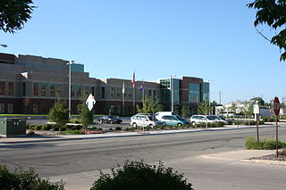
Janesville is the most populous city and the county seat of Rock County, Wisconsin, United States. It is a principal municipality of the Janesville, Wisconsin, Metropolitan Statistical Area and is included in the Madison–Janesville–Beloit, WI Combined Statistical Area. As of the 2020 census, the city had a population of 65,615, making it the tenth-most populous city in Wisconsin.

<span class="mw-page-title-main">Milton, Wisconsin</span> City in Wisconsin, United States

Milton is a city in Rock County, Wisconsin, United States. The population was 5,716 at the 2020 census.

<span class="mw-page-title-main">Madison metropolitan area, Wisconsin</span> Combined Statistical Area in Wisconsin, United States

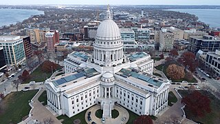
The Madison, Wisconsin, metropolitan area, also known as Greater Madison, is the metropolitan area surrounding the city of Madison, Wisconsin. Madison is the state capital of Wisconsin and is Wisconsin's second largest city, and the metropolitan area is also the state's second largest which the Madison MSA borders to its east.

<span class="mw-page-title-main">Brooklyn (village), Wisconsin</span> Place in Wisconsin, United States

Brooklyn is a village in Dane and Green counties in Wisconsin, United States. The population was 1,524 at the 2020 census, with 1,026 residents in Dane County and 498 in Green County.

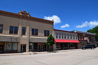
The 15th Senate District of Wisconsin is one of 33 districts in the Wisconsin Senate. Located in southern Wisconsin, the district comprises most of Rock County and parts of northwest Walworth County and southern Jefferson County. It includes the cities of Janesville, Beloit, Edgerton, Evansville, Milton, and Whitewater.

References

  1. 1 2 3 4 "2020 Decennial Census: Rock County, Wisconsin". data.census.gov. U.S. Census Bureau. Retrieved July 3, 2022.
  2. "Find a County". National Association of Counties. Retrieved June 7, 2011.
  3. "Wisconsin: Individual County Chronologies". Wisconsin Atlas of Historical County Boundaries. The Newberry Library. 2007. Archived from the original on April 14, 2017. Retrieved August 15, 2015.
  4. "Rock County, origin of place name" Dictionary of Wisconsin History.
  5. "2010 Census Gazetteer Files". United States Census Bureau. August 22, 2012. Retrieved August 8, 2015.
  6. Great Wisconsin Birding & Nature Trail. Cook Memorial Arboretum.
  7. "U.S. Decennial Census". United States Census Bureau. Retrieved August 8, 2015.
  8. "Historical Census Browser". University of Virginia Library. Retrieved August 8, 2015.
  9. Forstall, Richard L., ed. (March 27, 1995). "Population of Counties by Decennial Census: 1900 to 1990". United States Census Bureau. Retrieved August 8, 2015.
  10. "Census 2000 PHC-T-4. Ranking Tables for Counties: 1990 and 2000" (PDF). United States Census Bureau. April 2, 2001. Archived (PDF) from the original on October 9, 2022. Retrieved August 8, 2015.
  11. "State & County QuickFacts". United States Census Bureau. Archived from the original on February 27, 2016. Retrieved January 23, 2014.
  12. 1 2 "U.S. Census website". United States Census Bureau . Retrieved May 14, 2011.
  13. Leip, David. "Dave Leip's Atlas of U.S. Presidential Elections". uselectionatlas.org. Retrieved November 11, 2020.
  14. "2020 census - school district reference map: Rock County, WI" (PDF). U.S. Census Bureau. Archived (PDF) from the original on October 9, 2022. Retrieved July 23, 2022. - Text list

Further reading

42°40′N89°04′W / 42.67°N 89.07°W / 42.67; -89.07