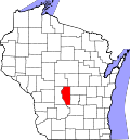
Adams County, Wisconsin

Last updated

Adams County
Adams County Wisconsin Courthouse.jpg
Map of Wisconsin highlighting Adams County.svg
Location within the U.S. state of Wisconsin
Wisconsin in United States.svg
Wisconsin's location within the U.S.
Coordinates: 43°58′N89°46′W / 43.97°N 89.77°W / 43.97; -89.77
CountryFlag of the United States.svg United States
StateFlag of Wisconsin.svg  Wisconsin
Founded1853
Named for John Quincy Adams
Seat Friendship (village)
Largest city Adams
Area
  Total689 sq mi (1,780 km2)
  Land646 sq mi (1,670 km2)
  Water43 sq mi (110 km2)  6.2%
Population
 (2020) [1]
  Total20,654
  Density32.0/sq mi (12.4/km2)
Time zone UTC−6 (Central)
  Summer (DST) UTC−5 (CDT)
Congressional district 3rd
Website www.co.adams.wi.us

Adams County is a county in the U.S. state of Wisconsin. As of the 2020 census, the population was 20,654. [2] Its county seat is Friendship. [3] The county was created in 1848 and organized in 1853. [4] Sources differ as to whether its name is in honor of the second President of the United States, John Adams, or his son, the sixth President, John Quincy Adams.

Contents

History

The founders of Adams County were from upstate New York. These people were "Yankee" settlers, that is to say they were descended from the English Separatists who settled New England in the 1600s. They were part of a wave of New England farmers who headed west into what was then the wilds of the Northwest Territory during the early 1800s. Most of them arrived as a result of the completion of the Erie Canal and the end of the Black Hawk War. They got to what is now Adams County by sailing up the Wisconsin River from the Mississippi River on small barges which they constructed themselves out of materials obtained from the surrounding woodlands. When they arrived in what is now Adams County there was nothing but dense virgin forest, the "Yankee" New Englanders laid out farms, constructed roads, erected government buildings and established post routes. They brought with them many of their Yankee New England values, such as a passion for education, establishing many schools as well as staunch support for abolitionism. They were mostly members of the Congregationalist Church though some were Episcopalian. Due to the second Great Awakening some of them had converted to Methodism and some became Baptist before moving to what is now Adams County. Adams County, like much of Wisconsin, would be culturally very continuous with early New England culture for most of its early history. [5] [6]

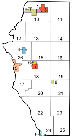
In the late 1880s, German immigrants began to settle in Adams County, making up less than one out of thirty settlers in the county before this date. Generally there was little conflict between them and the "Yankee" settlers, however when conflict did arise it focused around the issue of prohibition of alcohol. On this issue the Yankees were divided and the Germans almost unanimously were opposed to it, tipping the balance in favor of opposition to prohibition. [7] Later the two communities would be divided on the issue of World War I in which, once again, the Yankee community would be divided and the Germans were unanimously opposed to American entry into the war. The Yankee community was generally pro-British, however many of the Yankees also did not want America to enter the war themselves. The Germans were sympathetic to Germany and did not want the United States to enter into a war against Germany, but the Germans were not anti-British. Prior to World War I, many German community leaders in Wisconsin spoke openly and enthusiastically about how much better America was than Germany, due primarily (in their eyes) to the presence of English law and the English political culture the Americans had inherited from the colonial era, which they contrasted with the turmoil and oppression in Germany which they had so recently fled. [8] The area covered by present-day Adams County was historically part of several other counties. In 1840, when Wisconsin was still a territory, Adams County was the southwestern section of Brown County. In 1836, Portage County was created and included most of present-day Columbia County, including the city of Portage, Wisconsin. In 1846, Portage County was renamed Columbia County. The area from the northern boundary of Columbia County to Lake Superior was removed from Brown County and was then called Portage County. In 1848, the southern part of Portage County was renamed Adams County and included all of current-day Adams County and the northern section of Juneau County. Adams County was organized in April 1853. [4] In 1858, The northwestern part of Adams County was joined with the northern part of Sauk County to form present-day Juneau County. At this time, Adams County took its current shape.

Friendship was founded by settlers coming from Friendship, New York. Today, Adams is the largest community in Adams County, but this was not always so. In the 1880s, there were plans for a railroad that connected Chicago and St. Paul to pass through Friendship. Once this was decided, local landowners increased their demands. Instead of paying more for the land in Friendship, the railroad placed the tracks two miles (3.2 km) south of Friendship. It was recorded that Emma Barnes, wife of "Appletree" Barnes, Friendship postmaster in the 1920s, wrote in 1957, "I believe that the people of Friendship should express their appreciation of two of the early citizens... J. B. Hill and J. W. Purves... for holding the price of their land so high that the great C&NW R.R. Co. would not purchase a right of way... for who would enjoy the smoke and the noise of a train running through this beautiful village?"

To house workers, boxcars were stacked to form housing, and the town of Adams was created. What is now the city of Adams the railroad originally called Friendship, but because there were two rail depot stops named "Friendship" on the rail-line, passengers were often confused and bought the wrong tickets, so it was suggested that the name be changed. The new name was determined by the citizens who chose between Adams, for President John Adams, and Nottingham. This stretch of track became the famous "400" route. Today the population of Adams is about three times that of Friendship, WI.

Geography

According to the U.S. Census Bureau, the county has a total area of 689 square miles (1,780 km2), of which 646 square miles (1,670 km2) is land and 43 square miles (110 km2) (6.2%) is water. [9]

Major highways

Railroads

Buses

Airport

Adjacent counties

Demographics

Historical population
CensusPop.Note
1850 187
1860 6,4923,371.7%
1870 6,6011.7%
1880 6,7412.1%
1890 6,8892.2%
1900 9,14132.7%
1910 8,604−5.9%
1920 9,2877.9%
1930 8,003−13.8%
1940 8,4495.6%
1950 7,906−6.4%
1960 7,566−4.3%
1970 9,23422.0%
1980 13,45745.7%
1990 15,68216.5%
2000 18,64318.9%
2010 20,87512.0%
2020 20,654−1.1%
U.S. Decennial Census [10]
1790–1960 [11] 1900–1990 [12]
1990–2000 [13] 2010–2020 [14]

2020 census

As of the census of 2020, [1] the population was 20,654. The population density was 32.0 inhabitants per square mile (12.4/km2). There were 16,692 housing units at an average density of 25.9 per square mile (10.0/km2). The racial makeup of the county was 90.7% White, 2.9% Black or African American, 1.0% Native American, 0.4% Asian, 1.1% from other races, and 3.9% from two or more races. Ethnically, the population was 3.9% Hispanic or Latino of any race.

2000 Census Age Pyramid for Adams County USA Adams County, Wisconsin age pyramid.svg
2000 Census Age Pyramid for Adams County

2000 census

As of the census [15] of 2000, there were 18,643 people, 7,900 households, and 5,466 families residing in the county. The population density was 29 people per square mile (11 people/km2). There were 14,123 housing units at an average density of 22 per square mile (8.5/km2). The racial makeup of the county was 97.63% White, 0.27% Black or African American, 0.59% Native American, 0.33% Asian, 0.02% Pacific Islander, 0.33% from other races, and 0.83% from two or more races. 1.44% of the population were Hispanic or Latino of any race. 39.3% were of German, 14.8% American, 9.2% Polish, 8.3% Norwegian, 8.0% Irish and 6.0% English ancestry. 96.1% spoke English, 1.8% Spanish and 1.1% German as their first language.

There were 7,900 households, out of which 23.60% had children under the age of 18 living with them, 58.50% were married couples living together, 6.70% had a female householder with no husband present, and 30.80% were non-families. 25.50% of all households were made up of individuals, and 11.50% had someone living alone who was 65 years of age or older. The average household size was 2.33 and the average family size was 2.76.

In the county, the population was spread out, with 20.80% under the age of 18, 5.60% from 18 to 24, 24.30% from 25 to 44, 28.40% from 45 to 64, and 20.90% who were 65 years of age or older. The median age was 44 years. For every 100 females there were 102.90 males. For every 100 females age 18 and over, there were 101.30 males.

In 2017, there were 131 births, giving a general fertility rate of 57.1 births per 1000 women aged 15–44, the 17th lowest rate out of all 72 Wisconsin counties. 51 of the births were to unmarried mothers, 80 were to married mothers. In 2017, 12.2% of the babies had a low birthweight, up from 7.8% in 2016 and the highest by percent in the state for 2017. In 71.0% of cases, prenatal care was deemed to be adequate, the 13th lowest in the state. [16] Additionally, there were 10 induced abortions performed on women of Adams County residence in 2017. [17]

Communities

Map of Adams County Wisconsin.svg

Bracketed number refers to location on map, right

Cities

Village

Towns

County boundary marker along the Wisconsin River. AdamsCountyWisconsinWisconsinRiver.jpg
County boundary marker along the Wisconsin River.

Census-designated places

Unincorporated communities

Ghost towns/neighborhoods

Politics

United States presidential election results for Adams County, Wisconsin [18]
Year Republican Democratic Third party
No.%No.%No.%
2020 7,36262.29%4,32936.63%1271.07%
2016 5,96658.89%3,74536.97%4194.14%
2012 4,64445.14%5,54253.87%1010.98%
2008 3,97439.80%5,80658.14%2062.06%
2004 4,89046.77%5,44752.09%1191.14%
2000 3,92043.00%4,82652.94%3704.06%
1996 2,45031.31%4,11952.65%1,25516.04%
1992 2,46530.63%3,53943.97%2,04425.40%
1988 3,25847.33%3,59852.27%270.39%
1984 3,64556.86%2,71442.33%520.81%
1980 3,30450.69%2,77342.54%4416.77%
1976 2,37742.54%3,08955.28%1222.18%
1972 2,20053.18%1,83344.31%1042.51%
1968 1,69144.81%1,61442.77%46912.43%
1964 1,21934.94%2,26264.83%80.23%
1960 2,10957.40%1,55142.22%140.38%
1956 1,85459.48%1,24439.91%190.61%
1952 2,25965.35%1,18034.13%180.52%
1948 1,25945.60%1,41951.39%833.01%
1944 1,57951.40%1,47848.11%150.49%
1940 1,81848.74%1,88350.48%290.78%
1936 1,19133.28%2,28963.96%992.77%
1932 77726.35%2,12071.89%521.76%
1928 1,62462.95%91435.43%421.63%
1924 77928.99%1736.44%1,73564.57%
1920 1,52876.13%39219.53%874.33%
1916 95751.15%82444.04%904.81%
1912 68946.09%46230.90%34423.01%
1908 1,16768.97%43625.77%895.26%
1904 1,39979.90%27315.59%794.51%
1900 1,51377.47%40920.94%311.59%
1896 1,43276.74%39120.95%432.30%
1892 97268.89%40228.49%372.62%

See also

Related Research Articles

<span class="mw-page-title-main">Wood County, Wisconsin</span> County in Wisconsin, United States

Wood County is a county located in the U.S. state of Wisconsin. As of the 2020 census, the population was 74,207. Its county seat is Wisconsin Rapids. The county is named after Joseph Wood, a member of the Wisconsin State Assembly. Wood County comprises the Wisconsin Rapids-Marshfield, WI Micropolitan Statistical Area and is included in the Wausau-Stevens Point-Wisconsin Rapids, WI Combined Statistical Area.

<span class="mw-page-title-main">Walworth County, Wisconsin</span> County in Wisconsin, United States

Walworth County is a county located in the U.S. state of Wisconsin. As of the 2020 census, the population was 106,478. Its county seat is Elkhorn. The county was created in 1836 from Wisconsin Territory and organized in 1839. It is named for Reuben H. Walworth. Walworth County comprises the Whitewater-Elkhorn, WI Micropolitan Statistical Area and is included in the Milwaukee-Racine-Waukesha, WI Combined Statistical Area. Lake Geneva, the University of Wisconsin-Whitewater, and Alpine Valley Resort, and Music Theatre are located in Walworth County.

<span class="mw-page-title-main">Vernon County, Wisconsin</span> County in Wisconsin, United States

Vernon County is a county in the U.S. state of Wisconsin. As of the 2020 census, the population was 30,714. Its county seat is Viroqua.

<span class="mw-page-title-main">Shawano County, Wisconsin</span> County in Wisconsin, United States

Shawano County is a county located in the U.S. state of Wisconsin. As of the 2020 census, the population was 40,881. Its county seat is Shawano.

<span class="mw-page-title-main">Sauk County, Wisconsin</span> County in Wisconsin, United States

Sauk County is a county in Wisconsin. It is named after a large village of the Sauk people. As of the 2020 census, the population was 65,763. Its county seat and largest city is Baraboo. The county was created in 1840 from Wisconsin Territory and organized in 1844. Sauk County comprises the Baraboo, WI Micropolitan Statistical Area and is included in the Madison metropolitan area.

<span class="mw-page-title-main">Richland County, Wisconsin</span> County in Wisconsin, United States

Richland County is a county in the U.S. state of Wisconsin. As of the 2020 census, the population was 17,304. Its county seat is Richland Center. The county was created from the Wisconsin Territory in 1842 and organized in 1850. It is named for the high quality of its soil.

<span class="mw-page-title-main">Marathon County, Wisconsin</span> County in Wisconsin, United States

Marathon County is a county located in the U.S. state of Wisconsin. As of the 2020 census, the population was 138,013. Marathon County's seat is Wausau. It was founded in 1850, created from a portion of Portage County. At that time the county stretched to the northern border with the upper Michigan peninsula. It is named after the battlefield at Marathon, Greece.

<span class="mw-page-title-main">Juneau County, Wisconsin</span> County in Wisconsin, United States

Juneau County is a county located in the U.S. state of Wisconsin. As of the 2020 census, the population was 26,718. Its county seat is Mauston.

<span class="mw-page-title-main">Jackson County, Wisconsin</span> County in Wisconsin, United States

Jackson County is a county located in the U.S. state of Wisconsin. As of the 2020 census, the population was 21,145. Its county seat is Black River Falls. Jackson County was formed from Crawford County in 1853. It was named for President Andrew Jackson.

<span class="mw-page-title-main">Green County, Wisconsin</span> County in Wisconsin, United States

Green County is a county located in the U.S. state of Wisconsin. As of the 2020 census, the population was 37,093. Its county seat is Monroe. Green County is included in the Madison, WI Metropolitan Statistical Area.

<span class="mw-page-title-main">Dodge County, Wisconsin</span> County in Wisconsin, United States

Dodge County is a county located in the U.S. state of Wisconsin. As of the 2020 census, the population was 89,396. Its county seat is Juneau. The county was created from the Wisconsin Territory in 1836 and organized in 1844.

<span class="mw-page-title-main">Dane County, Wisconsin</span> County in Wisconsin, United States

Dane County is a county in the U.S. state of Wisconsin. As of the 2020 census, the population was 561,504, making it the second-most populous county in Wisconsin after Milwaukee County. The county seat is Madison, which is also the state capital.

<span class="mw-page-title-main">Columbia County, Wisconsin</span> County in Wisconsin, United States

Columbia County is a county located in the U.S. state of Wisconsin. As of the 2020 census, the population was 58,490. Its county seat and largest city is Portage. The county was created in 1846 as part of Wisconsin Territory.

<span class="mw-page-title-main">Wisconsin Dells, Wisconsin</span> City in Wisconsin, United States

Wisconsin Dells is a city in Wisconsin, straddling four counties: Adams, Columbia, Juneau, and Sauk. A popular Midwestern tourist destination, the city forms an area known as "The Dells" with the nearby village of Lake Delton. The Dells is home to several water parks and tourist attractions. It is about 42 miles (68 km) northwest of Madison, Wisconsin, the state's capital city. Wisconsin Dells has a population of 2,942 people as of the 2020 census.

<span class="mw-page-title-main">Portage, Wisconsin</span> City in Wisconsin, United States

Portage is a city in and the county seat of Columbia County, Wisconsin, United States. The population was 10,581 at the 2020 census, making it the largest city in Columbia County. The city is part of the Madison Metropolitan Statistical Area.

<span class="mw-page-title-main">Juneau, Wisconsin</span> City in Wisconsin, United States

Juneau is a city in Dodge County, Wisconsin, United States. The population was 2,658 at the 2020 census. It is the county seat of Dodge County.

<span class="mw-page-title-main">Sauk City, Wisconsin</span> Village in Wisconsin, United States

Sauk City is a village in Sauk County, Wisconsin, United States. The population was 3,518 as of the 2020 census. The first incorporated village in the state, the community was founded by Agoston Haraszthy and his business partner, Robert Bryant.

<span class="mw-page-title-main">Lodi, Wisconsin</span> City in Wisconsin, United States

Lodi is a city in Columbia County, Wisconsin, United States. The population was 3,209 at the 2022 United States census. Lodi is part of the Madison Metropolitan Statistical Area.

<span class="mw-page-title-main">Baraboo, Wisconsin</span> City in Wisconsin, United States

Baraboo is the largest city in and the county seat of Sauk County, Wisconsin, United States. The largest city in the county, Baraboo is the principal city of the Baraboo Micropolitan Statistical Area which comprises a portion of the Madison Combined Statistical area. Its 2020 population was 12,556. It is situated on the Baraboo River.

<span class="mw-page-title-main">Prairie du Sac, Wisconsin</span> Village in Wisconsin, United States

Prairie du Sac is a village in Sauk County, Wisconsin, United States. The population was 4,420 at the 2020 census. The village is surrounded by the Town of Prairie du Sac, the Wisconsin River, and the village of Sauk City; together, Prairie du Sac and Sauk City are referred to as Sauk Prairie.

References

  1. 1 2 "2020 Decennial Census: Adams County, Wisconsin". data.census.gov. U.S. Census Bureau. Retrieved July 2, 2022.
  2. "QuickFacts: Adams County, Wisconsin". U.S. Census Bureau .
  3. "Find a County". National Association of Counties. Archived from the original on May 31, 2011. Retrieved June 7, 2011.
  4. 1 2 "Wisconsin: Individual County Chronologies". Wisconsin Atlas of Historical County Boundaries. The Newberry Library. 2007. Archived from the original on April 14, 2017. Retrieved August 12, 2015.
  5. The Yankee Exodus: An Account of Migration from New England by Stewart Hall Holbrook University of Washington Press, 1968
  6. American Zion: The Old Testament as a Political Text from the Revolution to ... By Eran Shalev, Yale University Press, March 26, 2013 ISBN   9780300186925 page 70-71
  7. Wisconsin Then and Now, Volumes 21-24 State Historical Society of Wisconsin, 1974 pages 102-103, page 138
  8. The German Historians and England: A Study in Nineteenth-century Views By Charles E. McClelland pages 19, 136, 138. 176, 196
  9. "2010 Census Gazetteer Files". United States Census Bureau. August 22, 2012. Retrieved August 2, 2015.
  10. "U.S. Decennial Census". United States Census Bureau. Retrieved August 2, 2015.
  11. "Historical Census Browser". University of Virginia Library. Retrieved August 2, 2015.
  12. Forstall, Richard L., ed. (March 27, 1995). "Population of Counties by Decennial Census: 1900 to 1990". United States Census Bureau. Retrieved August 2, 2015.
  13. "Census 2000 PHC-T-4. Ranking Tables for Counties: 1990 and 2000" (PDF). United States Census Bureau. April 2, 2001. Retrieved August 2, 2015.
  14. "State & County QuickFacts". United States Census Bureau. Archived from the original on June 6, 2011. Retrieved January 17, 2014.
  15. "U.S. Census website". United States Census Bureau . Retrieved May 14, 2011.
  16. "Annual Wisconsin Birth and Infant Mortality Report, 2017 P-01161-19 (June 2019): Detailed Tables". Archived from the original on June 19, 2019. Retrieved June 20, 2019.
  17. Reported Induced Abortions in Wisconsin, Office of Health Informatics, Division of Public Health, Wisconsin Department of Health Services. Section: Trend Information, 2013-2017, Table 18, pages 17-18
  18. Leip, David. "Dave Leip's Atlas of U.S. Presidential Elections". uselectionatlas.org. Retrieved November 10, 2020.

Further reading

43°58′N89°46′W / 43.97°N 89.77°W / 43.97; -89.77