Schoppernau

Last updated

Schoppernau
Uentschenspitze Halde1.JPG
Wappen at schoppernau.png
Coat of arms
Schoppernau im Bezirk B.png
Location in the district
Austria adm location map.svg
Red pog.svg
Schoppernau
Location within Austria
Coordinates: 47°18′48″N10°01′03″E / 47.31333°N 10.01750°E / 47.31333; 10.01750 Coordinates: 47°18′48″N10°01′03″E / 47.31333°N 10.01750°E / 47.31333; 10.01750
Country Austria
State Vorarlberg
District Bregenz
Government
   Mayor Walter Beer
Area
[1]
  Total47.64 km2 (18.39 sq mi)
Elevation
852 m (2,795 ft)
Population
 (2018-01-01) [2]
  Total950
  Density20/km2 (52/sq mi)
Time zone UTC+1 (CET)
  Summer (DST) UTC+2 (CEST)
Postal code
6886
Area code 05515
Vehicle registration B
Website www.au-schoppernau.at

Schoppernau is a town in the Bregenzerwald Region (Bregenz district) of the Austrian state of Vorarlberg. Schoppernau has an area of 47.64 km2.

Contents

Population

Historical population
YearPop.±%
1869486    
1880456−6.2%
1890445−2.4%
1900504+13.3%
1910601+19.2%
1923541−10.0%
1934535−1.1%
1939531−0.7%
1951712+34.1%
1961662−7.0%
1971785+18.6%
1981885+12.7%
1991897+1.4%
2001905+0.9%
2011923+2.0%

History

Until the 10th century, Schoppernau seems to have been pristine forest. Schoppernau and Au were the last villages to be settled in the Bregenzerwald. Early on, the land in and around Schoppernau was probably used primarily as pastureland for sheep. The surrounding terrain was probably used as pastureland for sheep, as the name ("Schappernouw" = Schafau = sheep meadow or mead) indicates. The neighboring village of Au showed similar developments.

Coat of arms

The Schoppernau coat of arms has been in use since 12 March 1930. It is red with a bronze frame, showing a silver mountain summit in the background. In the middle there is a green uprooted spruce, with two silver cow bells to the left and right.

Culture

Schoppernau is part of the Bregenzerwald Umgang (literally "Bregenzerwald Walking Tour"). This walking tour offers insights into the architecture and community planning of 12 traditional villages in the Bregenzerwald. While walking over various landscapes, visiting public buildings, homes and everyday objects, walkers gain a comprehensive overview of typical Bregenzerwald architectural styles as they developed throughout the ages. The nine buildings chosen for the walking tour in Schoppernau include the Alpine Cheese Dairy (Bergkäserei), several farmhouses, an old sawmill, the fire department, and the primary school.

The 19th century half-timbered farmhouses in Schoppernau present many typical features of the unique Bregenzerwald farm architecture, particularly their joined timber beams sealed with moss.

Exhibits in the Franz Michael Felder Museum present the life, times and work of Franz Michael Felder, author, farmer and social reformer, one of the most prominent historical personalities of the Bregenzerwald.

The parish church Schoppernau was built in 1710 by the architect Johann Brenner von Gräsalp (1664-1749). In 1838, an organ was installed. In 1917, all four church bells were taken down and their metal was used in the war effort World War I.

Panoramic view of Schoppernau Schoppernau Panorama.jpg
Panoramic view of Schoppernau

Climate

Climate data for Schoppernau (1981–2010)
MonthJanFebMarAprMayJunJulAugSepOctNovDecYear
Record high °C (°F)16.0
(60.8)
17.5
(63.5)
21.7
(71.1)
24.5
(76.1)
29.9
(85.8)
32.6
(90.7)
34.0
(93.2)
33.4
(92.1)
29.3
(84.7)
25.3
(77.5)
23.1
(73.6)
19.2
(66.6)
34.0
(93.2)
Average high °C (°F)0.5
(32.9)
3.1
(37.6)
7.6
(45.7)
12.0
(53.6)
17.4
(63.3)
20.0
(68.0)
22.3
(72.1)
21.6
(70.9)
17.8
(64.0)
13.5
(56.3)
5.8
(42.4)
1.2
(34.2)
11.9
(53.4)
Daily mean °C (°F)−4.1
(24.6)
−2.9
(26.8)
1.0
(33.8)
5.1
(41.2)
10.6
(51.1)
13.8
(56.8)
15.8
(60.4)
14.9
(58.8)
11.2
(52.2)
7.1
(44.8)
0.9
(33.6)
−2.8
(27.0)
5.9
(42.6)
Average low °C (°F)−7.7
(18.1)
−7.0
(19.4)
−3.2
(26.2)
0.5
(32.9)
4.9
(40.8)
8.2
(46.8)
10.3
(50.5)
10.0
(50.0)
7.0
(44.6)
3.2
(37.8)
−2.4
(27.7)
−6.0
(21.2)
1.5
(34.7)
Record low °C (°F)−28.0
(−18.4)
−23.8
(−10.8)
−23.3
(−9.9)
−10.6
(12.9)
−4.9
(23.2)
−1.0
(30.2)
1.5
(34.7)
1.6
(34.9)
−2.2
(28.0)
−11.5
(11.3)
−19.8
(−3.6)
−21.0
(−5.8)
−28.0
(−18.4)
Average precipitation mm (inches)135
(5.3)
126
(5.0)
161
(6.3)
134
(5.3)
172
(6.8)
225
(8.9)
265
(10.4)
251
(9.9)
175
(6.9)
126
(5.0)
149
(5.9)
153
(6.0)
2,073
(81.6)
Average snowfall cm (inches)93
(37)
88
(35)
84
(33)
39
(15)
5
(2.0)
1
(0.4)
0
(0)
0
(0)
0
(0)
6
(2.4)
54
(21)
90
(35)
459
(181)
Average relative humidity (%) (at 14:00)82.369.358.952.153.756.657.959.160.664.079.485.665.0
Source: Central Institute for Meteorology and Geodynamics [3] [4] [5] [6] [7]

Trivia

In Vorarlberg, Austria, Schoppernau is known for the song "Vo Mello bis ge Schoppornou" (Alemannic: From Mellau to Schoppernau), by the Bregenzerwälder band Holstuonarmusigbigbandclub.

Personalities

See also

Related Research Articles

Bregenz Place in Vorarlberg, Austria

Bregenz (German pronunciation: [ˈbʁeːgɛnt͡s], is the capital of Vorarlberg, the westernmost state of Austria. The city lies on the eastern shores of Lake Constance, the third-largest freshwater lake in Central Europe, between Switzerland in the west and Germany in the northwest.

Sankt Pölten Place in Lower Austria, Austria

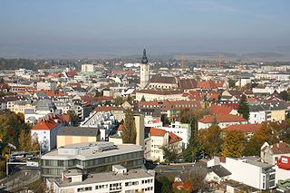
Sankt Pölten, mostly abbreviated to the official name St. Pölten, is the capital and largest city of the State of Lower Austria in northeast Austria, with 55,538 inhabitants as of 1 January 2020. St. Pölten is a city with its own statute and therefore it is both a municipality and a district in the Mostviertel.

Eisenstadt Place in Burgenland, Austria

Eisenstadt is a city in Austria, the state capital of Burgenland. It had a recorded population on 1 January 2020 of 14,815.

Neusiedl am See Place in Burgenland, Austria

Neusiedl am See is a town in Burgenland, Austria, and administrative center of the district of Neusiedl am See.

Reuthe Place in Vorarlberg, Austria

Reuthe is a municipality of the Bregenzerwald,in the westernmost Austrian state of Vorarlberg. It is located in the district of Bregenz. Its main industry is tourism.

Au, Vorarlberg Place in Vorarlberg, Austria

Au is a town in the Bregenz Forest in the westernmost Austrian state of Vorarlberg.

Mellau Place in Vorarlberg, Austria

Mellau is a town in the Bregenz Forest in the westernmost Austrian state of Vorarlberg, part of the district of Bregenz.

Schwarzenberg, Austria Place in Vorarlberg, Austria

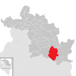
Schwarzenberg is a municipality in the Bregenz Forest in the western Austrian state of Vorarlberg, part of the district of Bregenz. Schwarzenberg has an area of 25.76 km². It lies south of Lake Constance. The village center is heritage-protected for its traditional rustic wooden houses.

Bad Gastein Place in Salzburg, Austria

Bad Gastein is a spa town in the district of St. Johann im Pongau, in the Austrian state of Salzburg. Picturesquely situated in a high valley of the Hohe Tauern mountain range, it is known for the Gastein Waterfall and a variety of Belle Époque hotel buildings.

Bernstein im Burgenland Place in Burgenland, Austria

Bernstein is a municipality in Burgenland in the district Oberwart in Austria.

Feldkirch, Vorarlberg Place in Vorarlberg, Austria

Feldkirch is a medieval town in the western Austrian state of Vorarlberg, bordering on Switzerland and Liechtenstein. It is the administrative centre of the Feldkirch district. After Dornbirn, it is the second most populous town in Vorarlberg. The westernmost point in Austria lies in Feldkirch on the river Rhine, at the tripoint between Austria, Switzerland, and Liechtenstein.

Krumbach, Vorarlberg Place in Vorarlberg, Austria

Krumbach is a village in the westernmost Austrian state of Vorarlberg, in the Bregenz district. The municipality has about 1,000 inhabitants.

Bruckneudorf Place in Burgenland, Austria

Bruckneudorf is a small town in the district of Neusiedl am See in the federal state of Burgenland in Austria, neighbouring Bruck an der Leitha. Its name means bridge new village, whereas the Hungarian version means royal bridge, and the royal refers to King Francis I. Historically and geographically, Bruckneudorf represents the extension of the Austrian town of Bruck an der Leitha over the Austrian border into Hungary. This border, symbolised by the river Leitha, separated the Austrian Empire from the Kingdom of Hungary. Its main current national significance derives from the Bruckneudorf military exercise ground of the Austrian federal army. Currently it is also the site of Bruck an der Leitha railway station, an important railway station near the borders with Hungary and Slovakia, a stop for nearly all the international trains that pass through it.

Hohenau an der March Place in Lower Austria, Austria

Hohenau an der March is a town in the district of Gänserndorf in the Austrian state of Lower Austria, close to Vienna and the borders with the Czech Republic and Slovakia.

Poysdorf Place in Lower Austria, Austria

Poysdorf is a town in the district of Mistelbach in the Austrian state of Lower Austria.

Vandans Place in Vorarlberg, Austria

Vandans is a town located in the Bludenz district in the Austrian state of Vorarlberg. Located 650 m (2133 ft) above sea level, it is known for its skiing and hiking activities.

Bürs Place in Vorarlberg, Austria

Bürs is a municipality in the district of Bludenz in the Austrian state of Vorarlberg.

Klösterle, Austria Place in Vorarlberg, Austria

Klösterle is a municipality in the district of Bludenz in the Austrian state of Vorarlberg.

Lingenau Place in Vorarlberg, Austria

Lingenau is a municipality in the district of Bregenz, in the westernmost Austrian state of Vorarlberg.

Schröcken Place in Vorarlberg, Austria

Schröcken is a municipality in the district of Bregenz, in the westernmost Austrian state of Vorarlberg.

References

  1. "Dauersiedlungsraum der Gemeinden Politischen Bezirke und Bundesländer - Gebietsstand 1.1.2018". Statistics Austria. Retrieved 10 March 2019.
  2. "Einwohnerzahl 1.1.2018 nach Gemeinden mit Status, Gebietsstand 1.1.2018". Statistics Austria. Retrieved 9 March 2019.
  3. "Klimamittel 1981–2010: Lufttemperatur" (in German). Central Institute for Meteorology and Geodynamics. Archived from the original on 21 October 2019. Retrieved 19 November 2019.
  4. "Klimamittel 1981–2010: Niederschlag" (in German). Central Institute for Meteorology and Geodynamics. Archived from the original on 29 December 2014. Retrieved 19 November 2019.
  5. "Klimamittel 1981–2010: Schnee" (in German). Central Institute for Meteorology and Geodynamics. Archived from the original on 29 December 2014. Retrieved 19 November 2019.
  6. "Klimamittel 1981–2010: Luftfeuchtigkeit" (in German). Central Institute for Meteorology and Geodynamics. Archived from the original on 21 October 2019. Retrieved 19 November 2019.
  7. "Klimamittel 1981–2010: Strahlung" (in German). Central Institute for Meteorology and Geodynamics. Archived from the original on 29 December 2014. Retrieved 19 November 2019.
  8. "Klimadaten von Österreich 1971–2000 – Vorarlberg-Schoppernau" (in German). Central Institute for Meteorology and Geodynamics. Archived from the original on 12 October 2019. Retrieved 7 November 2019.