Seymour, Eau Claire County, Wisconsin

Last updated

Seymour, Wisconsin
WIMap-doton-Seymour.png
Location of Seymour in Wisconsin
Seymour, Eau Claire County, Wisconsin map.png
Location of Seymour in Eau Claire County
Coordinates: 44°50′2″N91°22′28″W / 44.83389°N 91.37444°W / 44.83389; -91.37444
Country Flag of the United States.svg  United States
State Flag of Wisconsin.svg  Wisconsin
County Eau Claire
Area
  Total32.2 sq mi (83.5 km2)
  Land31.2 sq mi (80.7 km2)
  Water1.1 sq mi (2.8 km2)
Elevation
[1]
912 ft (278 m)
Population
 (2000)
  Total2,978
  Density95.6/sq mi (36.9/km2)
Time zone UTC-6 (Central (CST))
  Summer (DST) UTC-5 (CDT)
Area code(s) 715 & 534
FIPS code 55-72675 [2]
GNIS feature ID1584127 [1]

Seymour is a town in Eau Claire County, Wisconsin, United States. The population was 2,978 at the 2000 census. The unincorporated community of Seymour is located in the southwestern portion of the town.

Contents

Geography

According to the United States Census Bureau, the town has a total area of 32.2 square miles (83.5 km2), of which, 31.2 square miles (80.7 km2) of it is land and 1.1 square miles (2.8 km2) of it (3.32%) is water.

Demographics

Historical population
CensusPop.Note
1930 570
1940 1,283125.1%
1950 1,248−2.7%
1960 1,87950.6%
1970 2,21718.0%
1980 2,59917.2%
1990 2,7576.1%
2000 2,9788.0%
2010 3,2097.8%
2020 (est.)3,352 [3] 4.5%

As of the census [2] of 2000, there were 2,978 people, 1,108 households, and 863 families residing in the town. The population density was 95.6 people per square mile (36.9/km2). There were 1,151 housing units at an average density of 36.9 per square mile (14.3/km2). The racial makeup of the town was 97.85% White, 0.10% Black or African American, 0.54% Native American, 0.84% Asian, 0.03% Pacific Islander, 0.10% from other races, and 0.54% from two or more races. 0.84% of the population were Hispanic or Latino of any race.

There were 1,108 households, out of which 35.2% had children under the age of 18 living with them, 69.0% were married couples living together, 5.0% had a female householder with no husband present, and 22.1% were non-families. 16.1% of all households were made up of individuals, and 5.7% had someone living alone who was 65 years of age or older. The average household size was 2.69 and the average family size was 3.02.

The population was 26.1% under the age of 18, 5.6% from 18 to 24, 29.9% from 25 to 44, 28.0% from 45 to 64, and 10.5% who were 65 years of age or older. The median age was 39 years. For every 100 females, there were 109.1 males. For every 100 females age 18 and over, there were 105.5 males.

The median income for a household in the town was $48,365, and the median income for a family was $50,969. Males had a median income of $37,963 versus $27,958 for females. The per capita income for the town was $20,263. About 1.6% of families and 3.7% of the population were below the poverty line, including 4.3% of those under age 18 and 4.0% of those age 65 or over.

Related Research Articles

<span class="mw-page-title-main">Lipscomb, Alabama</span> City in Alabama, United States

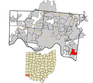
Lipscomb is a city in western Jefferson County, Alabama. It is part of the Birmingham, Alabama, metropolitan area. At the 2020 census, the population was 2,086.

<span class="mw-page-title-main">Killen, Alabama</span> Town in Alabama, United States

Killen is a town in Lauderdale County, Alabama, United States. It is part of the Florence - Muscle Shoals Metropolitan Statistical Area known as "The Shoals". It was incorporated in 1957. As of the 2020 census, the population of the town is 1,034, down from its record high of 1,119 in 2000.

<span class="mw-page-title-main">Middleton, Idaho</span> City in Idaho, United States

Middleton is a city in Canyon County, Idaho, United States. The population amounted to 9,091 at the 2021 census estimate, up from 5,524 at the 2010 census and 2,978 in 2000. It is part of the Boise City–Nampa, Idaho Metropolitan Statistical Area.

<span class="mw-page-title-main">Belgrade, Maine</span> Town in the state of Maine, United States

Belgrade is a town in Kennebec County, Maine, United States. Its population was 3,250 at the 2020 census. However, its population approximately doubles during the summer months as part-year residents return to seasonal camps on the shores of Great Pond, Long Pond and Messalonskee Lake. Belgrade includes the villages of North Belgrade, Belgrade Depot and Belgrade Lakes. It is included in the Augusta, Maine micropolitan New England City and Town Area.

Forester Township is a civil township of Sanilac County in the U.S. state of Michigan. The population was 883 at the 2020 census.

<span class="mw-page-title-main">Arnold, Minnesota</span> Census-designated place in Minnesota, US

Arnold is a former census-designated place (CDP), which was located in Rice Lake, Saint Louis County, Minnesota, United States. The population was 2,960 at the 2010 census. The census-designated place of Arnold was located entirely within the former Rice Lake Township, adjacent to the north side of the city of Duluth. Rice Lake Township was incorporated as the city of Rice Lake on October 22, 2015, thus rendering the census-designated place of Arnold to no longer exist.

<span class="mw-page-title-main">Kearney, Missouri</span> City in Missouri, United States

Kearney is a city in Clay County, Missouri, United States. The population per the 2020 U.S. Census was 10,404. The city was the birthplace of Jesse James, and there is an annual festival in the third weekend of September to recognize the outlaw. It is part of the Kansas City metropolitan area.

<span class="mw-page-title-main">Fort Calhoun, Nebraska</span> City in Washington County, Nebraska, United States

Fort Calhoun is a city in Washington County, Nebraska, United States. The population was 1,108 at the 2020 census. The city includes Fort Atkinson, the first fort built west of the Missouri River.

<span class="mw-page-title-main">Lucama, North Carolina</span> Town in North Carolina, United States

Lucama is a town in Wilson County, North Carolina, United States. The population was 1,108 at the 2010 census.

<span class="mw-page-title-main">Forestville, Ohio</span> Census-designated place in Ohio, United States

Forestville is a census-designated place (CDP) in Hamilton County, Ohio, United States. The population was 10,615 at the 2020 census.

Middletown is a census-designated place (CDP) in Bethlehem Township in Northampton County, Pennsylvania, United States. The population of Middletown was 7,441 at the 2010 census. Middletown is part of the Lehigh Valley, which had a population of 861,899 and was the 68th-most populous metropolitan area in the U.S. as of the 2020 census.

<span class="mw-page-title-main">Donaldson, Pennsylvania</span> CDP in Pennsylvania, United States

Donaldson is a census-designated place (CDP) in Frailey Township, Schuylkill County, Pennsylvania, United States. The population was 325 at the 2000 census.

<span class="mw-page-title-main">Highland, Washington</span> Unincorporated community in Washington, United States

Highland was a former unincorporated community and former census-designated place (CDP) in Benton County, Washington, United States. The population was 3,388 at the 2000 census. The area was not listed as a CDP for the 2010 census and the inhabited north end from S Olympia Street to Elliot Lake have since been added to Kennewick.

<span class="mw-page-title-main">Bellevue, Wisconsin</span> Village in Wisconsin, United States

Bellevue is a village in Brown County, Wisconsin. It was a town until incorporating as a village on February 14, 2003. The population was 15,935 at the time of the 2020 census. Bellevue is part of the Green Bay metropolitan area. Bellevue sits around 4.34 miles (6.99 km) east from central Green Bay.

<span class="mw-page-title-main">Pacific, Wisconsin</span> Town in Wisconsin, United States

Pacific is a town in Columbia County, Wisconsin, United States. The population was 2,518 at the 2000 census.

<span class="mw-page-title-main">Forest, Fond du Lac County, Wisconsin</span> Town in Wisconsin, United States

Forest is a town in Fond du Lac County, Wisconsin, United States. The population was 1,108 at the 2000 census. The unincorporated communities of Banner, Dotyville, and Graham Corners are located in the town.

<span class="mw-page-title-main">Brooklyn, Green County, Wisconsin</span> Town in Wisconsin, United States

Brooklyn is a town in Green County, Wisconsin, United States. The population was 1,108 at the 2020 census. The unincorporated community of Attica is located in the town. Section one of the Town of Brooklyn contains the portion of the village of Brooklyn that lies in Green County.

<span class="mw-page-title-main">Seymour, Lafayette County, Wisconsin</span> Town in Wisconsin, United States

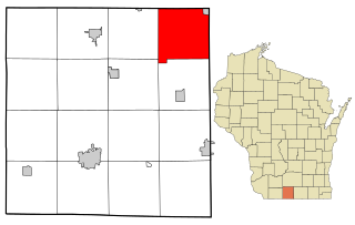
Seymour is a town in Lafayette County, Wisconsin, United States. The population was 446 at the 2010 census, up from 363 at the 2000 census. The unincorporated community of Seymour Corners is located in the town.

<span class="mw-page-title-main">Hermon, New York</span> Town in New York, United States

Hermon is a town in St. Lawrence County, New York, United States. The population was 1,108 at the 2010 census. Hermon is named after Mount Hermon in Israel, which is the name corresponding to Mount Jabal al-Sheikh in Syria. The town contains a hamlet also called Hermon, and is in the south-central part of the county, southwest of Canton.

<span class="mw-page-title-main">Seymour, Outagamie County, Wisconsin</span> Town in Wisconsin, United States

Seymour is a town in Outagamie County, Wisconsin, United States. The population was 1,216 at the 2000 census. The City of Seymour is located within the town. The unincorporated community of Isaar, Wisconsin is also located in the town. The ghost town of Lime Rock was also located partially in the town.

References

  1. 1 2 "US Board on Geographic Names". United States Geological Survey. October 25, 2007. Retrieved January 31, 2008.
  2. 1 2 "U.S. Census website". United States Census Bureau . Retrieved January 31, 2008.
  3. "County Population Totals: 2010-2020" . Retrieved June 22, 2021.