The Cornwall Wildlife Trust is a charitable organisation founded in 1962 that is concerned solely with Cornwall, England, United Kingdom.

St Erth is a civil parish and village in Cornwall, England, United Kingdom.
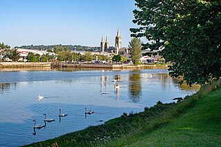
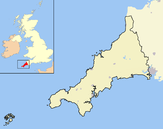
The Truro River is a river in the city of Truro in Cornwall, England, UK. It is the product of the convergence of the two rivers named Kenwyn and Allen which run under the city: the Truro River flows into the River Fal, estuarial waters where wildlife is abundant, and then out into the Carrick Roads. The river is navigable up to Truro.

Mount Hawke is a village in Cornwall, United Kingdom. It is situated approximately eight miles (13 km) west-northwest of Truro, five miles (8.0 km) north-northeast of Redruth, and two and a half miles (4.0 km) south of St Agnes.

Grampound is a village and former civil parish, now in the parish of Grampound with Creed, in the Cornwall district, in the ceremonial county of Cornwall, England. It is at an ancient crossing point of the River Fal and today is on the A390 road six miles (10 km) west of St Austell and eight miles (13 km) east of Truro. In 1961 the parish had a population of 412.

Gunwalloe is a coastal civil parish in Cornwall, England, United Kingdom. It is situated on the Lizard Peninsula three miles (4.8 km) south of Helston and partly contains The Loe, the largest natural freshwater lake in Cornwall. The parish population including Berepper at the 2011 census was 219. The hamlets in the parish are Chyanvounder, Berepper and Chyvarloe. To the east are the Halzephron cliffs and further east the parish church.

Morwenstow is a civil parish in north Cornwall, England, United Kingdom. The parish abuts the west coast, about six miles (10 km) north of Bude and within the Cornwall Area of Outstanding Natural Beauty (AONB).

Lanlivery is a village and civil parish in Cornwall, England, United Kingdom. The village is about 1+1⁄2 miles (2.4 km) west of Lostwithiel and five miles (8 km) south of Bodmin. The Saints' Way runs past Lanlivery. Helman Tor, Red Moor and Breney Common nature reserves lie within the parish.

St Goran is a coastal civil parish in Cornwall, England, UK, six miles (10 km) south-southwest of St Austell. The largest settlement in the parish is the coastal village of Gorran Haven, a mile to the east with a further cluster of homes at Trevarrick. The population at the 2011 census was 1,411.

St Michael Caerhays is a civil parish and village in Cornwall, England, United Kingdom. The village is about seven miles (11 km) south-southwest of St Austell. The population as of the 2011 census was 96

Roche is a civil parish and village in mid-Cornwall, England, United Kingdom. The village gets its name from the 20-metre (66-foot) high Roche Rock, a quartz-schorl outcrop east of the village. Roche is the Norman-French word for Rock. The parish population at the 2011 census including Belowda, Bilberry, Carbis, Coldvreath and Criggan is 3,381, and the ward population at the same census was 3,867.

Perranarworthal is a civil parish and village in Cornwall, England, United Kingdom. The village is about four miles (6.5 km) northwest of Falmouth and five miles (8 km) southwest of Truro. The parish population at the 2011 census was 1,496.

Kenwyn is a settlement and civil parish in Cornwall, England, United Kingdom. The settlement is a suburb of the city of Truro and lies 0.5 mi (1 km) north of the city centre, within Truro parish, whereas Kenwyn parish covers an area west and north-west of the city. Kenwyn gives its name to one of three rivers that flow through the city.

Ruan Lanihorne is a civil parish and village in south Cornwall, England, United Kingdom. The village is situated approximately four miles (6.5 km) east-southeast of Truro between the River Fal and its tributary the Ruan River.

St Anthony-in-Meneage is a coastal civil parish and village in Cornwall, England, United Kingdom. The parish is in the Meneage district of the Lizard peninsula. In the 2001 census the parish had a population of 171, decreasing to 168 at the 2011 census.

Threemilestone is a small village in the civil parish of Kenwyn, located precisely three miles west of Truro, the only city in Cornwall, England, United Kingdom. Threemilestone has grown in recent years, as housing estates to the west have been developed. Between Truro and Threemilestone there is a continuous line of schools, colleges and industrial estates, including Truro College and Richard Lander School. Furthermore the village also houses a primary school.
There are seventeen disused railway stations on the Cornish Main Line between Plymouth in Devon and Penzance in Cornwall, England. The remains of nine of these can be seen from passing trains. While a number of these were closed following the so-called "Beeching Axe" in the 1960s, many of them had been closed much earlier, the traffic for which they had been built failing to materialise.

St Breward is a civil parish and village in Cornwall, England, United Kingdom. It is on the western side of Bodmin Moor, about 6 miles (10 km) north of Bodmin. At the 2011 census the parish population including Cooksland and Fentonadle was 919.

Week St Mary is a village and civil parish in northeast Cornwall, England, United Kingdom. It is situated south of Bude close to the River Tamar and the border between Cornwall and Devon in the Hundred of Stratton. The parish population at the 2011 census is 657.

St Gennys is a coastal civil parish and small settlement in north Cornwall, England, United Kingdom.
