Sleddale

Last updated

Sleddale
Sleddale (7319).jpg
Sleddale looking northwards
Length3 miles (4.8 km)
South west–north east [1]
Geology
TypeGlacial
Geography
CountryEngland
Coordinates 54°16′N2°13′W / 54.27°N 2.21°W / 54.27; -2.21 [2]
RiverDuerley Beck (Gayle Beck)

Sleddale is a short, narrow valley to the south of Wensleydale in North Yorkshire, England. The waters draining down the valley feed into the River Ure and form part of the Humber Catchment. The valley has only one settlement, Gayle, although Hawes lies at the mouth of the beck where it runs into the River Ure. The dale is characterised by upland farming and historical mine workings, and is between the slopes of Dodd Fell to the west, and Wether Fell to the east.

Contents

History

The name Sleddale first appears in documents in 1280 as Seldalegile. The name is a combination of the Old English words of slæd and dæl, meaning slow-dale. [3] The name of the beck which flows down the valley (Duerley Beck), has not influenced the name of the dale (or vice versa), which does occur in the Yorkshire Dales, but is uncommon. [4] [5] Occasionally, the name for the water down the valley was referred to as Sleddale Beck. [6] According to the Yorkshire Dales National Park Authority, the dale extends from Tongue Wood in the south, to just above (south of) the hamlet of Gayle, and is a classic U-shaped glacial valley, that feeds into Mid-Wensleydale. [7]

Historically, the dale was in the Ancient Parish of Askrigg, but is now part of the civil parish of Hawes. [8] The dale was traditionally a farming valley with a history of hay-making, and circular buildings set aside for silage evident in the dale. [9] However, even this was not easy as the land is not as cultivable as nearby pastures, and as such, the dale is largely undeveloped. [10] Besides upland farming, one of the old industries in the valley was the picking of cloudberries. They grew with such abundance on the upper slopes of the valley that the berries were regularly sold at markets in Hawes and Settle. [11] The dale was enclosed in 1816, along with most other areas around Hawes and Bainbridge. [12] [13]

The road through Sleddale from Gayle, goes up over the moors past Fleet Moss and into Langstrothdale. [14] Between Gayle and Fleet Moss, the road is known as Beggarman's Road, and follows the contours of the eastern side of the valley. [15] [16] [17] The road is Yorkshire's highest road capable of accepting normal motorised vehicular traffic, and the climb from Gayle is 1,000 feet (300 m) in only 3 miles (4.8 km). [18] It is also noted as being a tough bicycle ride for cyclists going up the valley. [19] [20]

The Pennine Way skirts to the west of the summit of Dodd Fell and traverses the high ground separating Widdale from Sleddale. The walk then enters Sleddale in its lower reaches, going through Gayle and then Hawes. [21] [22] Sleddale is "hemmed in by the lofty hills of Dodd Fell, and Drumaldrace (Wether Fell)." [23]

Geology

The underlying rock in the valley is from the Yoredale Series and mainly consists of limestone, shale and sandstone. [24] Just below the Middle Limestone formation lies a narrow coal seam which was exploited in Sleddale (and nearby Cotterdale too). [25] The thin layer of coal is attributed to small swamps which developed here rather than the extensive bogs that led to deeper and better coalfields elsewhere in Yorkshire and the North of England. [26] Four mines are known to have existed in the upper dale; West Duerley, Storth, Scar Head and Bank Gill Colliery. [27] The collieries in the dale worked a very poor seam of coal, but in the absence of good transportation, they survived largely until the Wensleydale Railway was opened, and better quality coal could be railed into Wensleydale. [28] The spoil heaps from these workings, which consist largely of shale and iron nodules, still scar the upper valley landscape. [15] [29]

The dale was also used to produce peat for people in Appersett, Gayle, Hawes and Snaizeholme, who held turbary rights at Ten End peat ground ( SD844868 ). [30] Along with the adjacent south to north valleys of Mid-Wensleydale (Snaizeholme, Widdale and Raydale), Sleddale lacks the mineral deposits on the northern side of the main valley (lead, barytes etc). [31]

Duerley Beck cuts through the dale, and enters the River Ure just past the town of Gayle at the bottom of the valley, though Hawes is where the beck enter the Ure. [32] The beck runs for 5.23 miles (8.42 km) and drains an rea of 5.66 square miles (14.65 km2). [33] The beck drains the land between Dodd Fell in the west, and Wether Fell in the east. [34] At the lower end of the valley, the beck is shown on OS Mapping as Gayle Beck, and before it reaches the hamlet of Gayle at the southern end of the valley, it drops 40 feet (12 m) over Aysgill Force. [35] [36] [37] White-clawed crayfish (austropotamobius pallipes) have been observed in Duerley beck in the 1980s and 1990s. [38]

The beck is hard to see in the landscape at the northern end as it is low on the valley floor, and fringed with trees. [1] The cascade of water through the rocks at Gayle is partially artificial; the rock within the beck was cut out during road-building efforts in the 18th century. [39]

Rainfall in Sleddale 1961 – 1975
YearRainfallLocationGridrefAltitudeNotesRef
19611,326 millimetres (52.22 in)Hawes SD874502 230 metres (750 ft) [40]
19681,847 millimetres (72.7 in)Top Duerley SD860846 578 metres (1,896 ft)Location is on the high ground between Dodd Fell and Wether Fell [41]
19691,858 millimetres (73.1 in)Top Duerley SD860846 578 metres (1,896 ft) [42]
19701,854 millimetres (73.0 in)Top Duerley SD860846 578 metres (1,896 ft) [43]
19751,059 millimetres (41.7 in)Hawes sewage works SD874502 230 metres (750 ft)Location is at the very end of the dale, where Gayle Beck meets the River Ure [44]

Related Research Articles

<span class="mw-page-title-main">Yorkshire Dales</span> Upland area of the Pennines in Northern England

The Yorkshire Dales are a series of valleys, or dales, in the Pennines, a range of hills in England. They are mostly located in the ceremonial county of North Yorkshire, but extend into Cumbria and Lancashire; they were historically entirely within Yorkshire. The majority of the dales are within the Yorkshire Dales National Park, created in 1954. The exception is the area around Nidderdale, which forms the separate Nidderdale Area of Outstanding Natural Beauty.

<span class="mw-page-title-main">Wensleydale</span> Upper valley of the River Ure in North Yorkshire, England

Wensleydale is a valley in North Yorkshire, England. It is one of the Yorkshire Dales, which are part of the Pennines. The dale is named after the village of Wensley, formerly the valley's market town. The principal river of the valley is the Ure, which is the source of the alternative name Yoredale. The majority of the dale is within the Yorkshire Dales National Park; the part below East Witton is within the national landscape of Nidderdale.

<span class="mw-page-title-main">Swaledale</span> Valley in North Yorkshire, England

Swaledale is a valley in North Yorkshire, England. It is one of the Yorkshire Dales, which are part of the Pennines, and within the Yorkshire Dales National Park. It is named after the River Swale, which runs through it. Swaledale is the most northerly of the major dales.

<span class="mw-page-title-main">Great Shunner Fell</span> Mountain in Cumbria, England

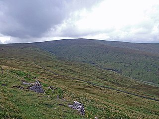
Great Shunner Fell is the third-highest mountain in the Yorkshire Dales, North Yorkshire, England, and the highest point in Wensleydale; at 716 metres above sea level. In clear weather the summit affords views of Wensleydale to the south, Ribblesdale to the southwest and Swaledale to the north, as well as views into Cumbria and County Durham beyond the A66.

<span class="mw-page-title-main">Hawes</span> Market town and civil parish in North Yorkshire, England

Hawes is a market town and civil parish in North Yorkshire, England, at the head of Wensleydale in the Yorkshire Dales, and historically in the North Riding of Yorkshire. The River Ure north of the town is a tourist attraction in the Yorkshire Dales National Park.

<span class="mw-page-title-main">Gayle, North Yorkshire</span> Hamlet in North Yorkshire, England

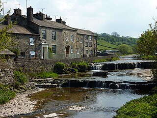
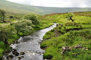
Gayle is a hamlet 0.4-mile (0.64 km) south of Hawes in Wensleydale, North Yorkshire, England. It is noted for the beck that flows through it and the old mill, which featured on the BBC TV programme Restoration.

<span class="mw-page-title-main">Appersett</span> Hamlet in Wensleydale, North Yorkshire, England

Appersett is a hamlet in the Yorkshire Dales in the Richmondshire district of North Yorkshire, England one mile (1.6 km) west of Hawes. It lies on the A684 road and an unclassified road runs alongside Widdale Beck to connect with the B6255 road between Hawes and Ingleton.

<span class="mw-page-title-main">Sedbusk</span> Hamlet in North Yorkshire, England

Sedbusk is a hamlet near Hawes and Hardraw Force within the Yorkshire Dales in North Yorkshire, England. The hamlet is 1 mile (1.5 km) north of the town of Hawes across the River Ure. Sedbusk is in the civil parish of High Abbotside along with Hardraw and Simonstone. The name of the hamlet derives from the Old Norse Saetr buskr, which means 'the bush by the shieling'. In 1280, it was recorded as setebuskste.

<span class="mw-page-title-main">Burtersett</span> Village in North Yorkshire, England

Burtersett is a small village in the Yorkshire Dales, North Yorkshire, England. It lies approximately 1 mile (1.6 km) east from Hawes and Gayle. The village is known for its former quarrying industry and being the seat of the Hillary family, with one strand of the family emigrating to New Zealand and raising Sir Edmund Hillary, the famous mountaineer.

<span class="mw-page-title-main">Coverdale, North Yorkshire</span> Valley of the Yorkshire Dales, England

Coverdale is a dale in the far east of the Yorkshire Dales, North Yorkshire, England. It takes its name from the River Cover, a tributary of the River Ure. The dale runs south-west from the eastern end of Wensleydale to the dale head at a pass, known as Park Rash Pass, between Great Whernside to the south and Buckden Pike to the north. It is accessible by a single track road, which runs the length of the dale and over the pass to Kettlewell in Wharfedale. The name is taken from that of the River Cover, which is of Brittonic origin. Ekwall suggested that it might mean "hollow stream", but more recently Andrew Breeze has argued that it is cognate with Welsh gofer "streamlet".

<span class="mw-page-title-main">Dentdale</span> Valley in Cumbria, England

Dentdale is a dale or valley in the north-west of the Yorkshire Dales National Park in Cumbria, England. It is the valley of the River Dee, but takes its name from the village of Dent. The dale runs east to west, starting at Dent Head, which is the location of a railway viaduct on the Settle-Carlisle Line.

<span class="mw-page-title-main">Cotter Force</span> Waterfall in North Yorkshire, England

Cotter Force is a small waterfall on Cotterdale Beck, a minor tributary of the River Ure, near the mouth of Cotterdale, a side dale in Wensleydale, North Yorkshire, England.
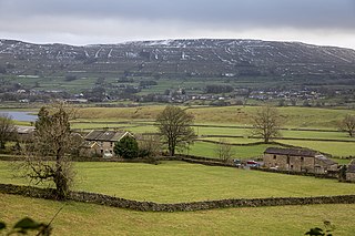
<span class="mw-page-title-main">Bishopdale Beck</span> Stream in North Yorkshire, England

Bishopdale Beck is a major tributary of the River Ure in North Yorkshire, England. The beck flows down Bishopdale, a side valley of Wensleydale in the Yorkshire Dales.

<span class="mw-page-title-main">Widdale</span> Small valley in the Yorkshire Dales, England

Widdale is a small side dale on the south side of Wensleydale in North Yorkshire, England. The dale lies to the east of Great Knoutberry Hill and is bounded on the west by Dentdale, south by Sleddale and north by Mossdale. It is drained by Widdale and Snaizeholme Becks which feed the waters north into the River Ure at Appersett. The name Widdale means 'The Wooded Valley' in Old Norse.

<span class="mw-page-title-main">Richmond to Lancaster Turnpike</span> Former road in Northern England

The Richmond to Lancaster Turnpike, was a road that was opened in the second half of the 18th century between Richmond, in the North Riding of Yorkshire and Lancaster in Lancashire, Northern England. The turnpike was built to allow goods to be taken from Yorkshire to the port of Lancaster. It was approved in 1751, but was not wholly completed until 1774.

<span class="mw-page-title-main">Wether Fell</span> Peak in the Yorkshire Dales, England

Wether Fell, also known as Drumaldrace, is a mountain in the Yorkshire Dales National Park, in North Yorkshire, England. Wether Fell is mountain that divides Wensleydale in the north and Upper Wharfedale in the south. Its summit is 614 metres (2,014 ft). A Roman Road, the Cam High Road, passes along the southern edge of the summit reaching 1,900 feet (580 m).

<span class="mw-page-title-main">Cauldron Falls (North Yorkshire)</span> Waterfall in North Yorkshire, England

Cauldron Falls, is a series of waterfalls on Walden Beck in the village of West Burton, North Yorkshire, England. It is known as Cauldron Falls due to the swirls in the plunge pools beneath the cascades of the waterfall. The beck continues on underneath a packhorse bridge where there is another cascade.

<span class="mw-page-title-main">Moorcock Inn</span> Pub in the Yorkshire Dales, England

The Moorcock Inn is a public house near the watershed between the rivers Clough and Ure, in Upper Wensleydale, North Yorkshire, England. It is adjacent to the junction of the A684 road and the B6259 road and near Garsdale railway station on the Settle–Carlisle line. The history of the inn can be traced back to the 1740s but it has been called The Moorcock only since 1840. The pub is near some long-distance paths and is popular with walkers.

<span class="mw-page-title-main">Snaizeholme</span> Valley in the Yorkshire Dales, England

Snaizeholme is a small side valley of Wensleydale in the Yorkshire Dales National Park (YDNP), North Yorkshire, England. The valley is noted for its red squirrel reserve, the only place within the North Yorkshire part of the Yorkshire Dales National Park where red squirrels are known to live, and a tree re-wilding project.

<span class="mw-page-title-main">Chapel-le-Dale (valley)</span> Valley in the Yorkshire Dales, England

Chapel-le-Dale is west-facing valley in the Yorkshire Dales, England. The U-shaped valley of Chapel-le-Dale is one of the few which drain westwards towards the Irish Sea, however, the river that flows through the valley has several names with the Environment Agency and the Ordnance Survey listing it as the River Doe. However, some older texts insist the name of the watercourse through the dale is the River Greta, which runs from a point below the hamlet of Chapel-le-Dale, and onwards past Ingleton. The dale is sparsely populated with only one settlement, the hamlet of Chapel-le-Dale, which has a small chapel.

References

  1. 1 2 Warren 2001, p. 67.
  2. "Sleddale, Richmondshire - area information, map, walks and more". getoutside.ordnancesurvey.co.uk. Retrieved 24 February 2024.
  3. Smith, A. H. (1979) [1928]. The Place Names of the North Riding of Yorkshire. English Place Name Society. p. 267. OCLC   19714705.
  4. Pontefract, Ella; Hartley, Marie (1988) [1936]. Wensleydale. Otley: Smith Settle. p. 71. ISBN   1-870071-20-4.
  5. "River Ure: Yorkshire Dales National Park". yorkshiredales.org.uk. Retrieved 2 March 2024.
  6. Alderson 1980, p. 7.
  7. Warren 2001, pp. 56, 67.
  8. "Election Maps". ordnancesurvey.co.uk. Retrieved 26 February 2024. On the left of the screen is the "Boundary" tab; click this and activate either civil parishes or Westminster Constituencies (or both), however, only two functions can be active at any one time.
  9. Richardson, Shaun; Dennison, Ed (2015). "Circular silage silo, West Shaw Farm, Sleddale, near Hawes, North Yorkshire". Ed Dennison Archaeological Services Ltd Unpublished Report Series. Beverley: Ed Dennison Archaeological Services: 6. doi:10.5284/1040415.
  10. "Upper Wensleydale – Out of Oblivion". outofoblivion.org.uk. Retrieved 26 February 2024.
  11. Speight, Harry (1897). Romantic Richmondshire : Being a complete account of the history, antiquities and scenery of the picturesque valleys of the Swale and Yore. London: Elliot Stock. p. 483. OCLC   7241488.
  12. "Bainbridge enclosure records 1816". discovery.nationalarchives.gov.uk. Retrieved 2 March 2024.
  13. North Yorkshire County Record Office Publications No. 41 North Riding and North Yorkshire Enclosure Awards. Northallerton: North Yorkshire County Council. 2020 [1987]. p. 17. ISBN   978-0-906035-30-6.
  14. Lennie 2005, p. 17.
  15. 1 2 Warren 2001, p. 68.
  16. "LCA 18 Wensleydale" (PDF). yorkshiredales.org.uk. p. 7. Retrieved 25 February 2024.
  17. Lennie 2005, p. 20.
  18. Lennie 2005, p. 41.
  19. Warren, Simon (20 July 2012). "Britain's top 10 toughest cycle climbs". The Guardian. Retrieved 2 March 2024.
  20. Allen, James (2014). 50 classic cycle climbs. Yorkshire & Peak District. Ramsbury: Crowood. p. 78. ISBN   9781847977632.
  21. Warren 2001, p. 60.
  22. Lennie 2005, p. 45.
  23. "Aysgill Force". The Northern Echo. 7 January 2010. Retrieved 26 February 2024.
  24. Dakyns, J. R., ed. (1890). The geology of the country around Ingleborough, with parts of Wensleydale and Wharfedale. London: HMSO. p. 68. OCLC   5289721.
  25. Waltham 2007, p. 49.
  26. Gill, M. C. (2008). "The Great Dales Coalfield, Eastern Areas". Memoirs (86). Keighley: Northern Mine Research Society: 69. ISSN   0308-2199.
  27. "Storth and Bank Gill Collieries". nmrs.org.uk. Retrieved 26 February 2024.
  28. "Storth colliery – Out of Oblivion". outofoblivion.org.uk. Retrieved 26 February 2024.
  29. Alderson 1980, p. 53.
  30. "Ten End Peat Ground – Out of Oblivion". outofoblivion.org.uk. Retrieved 26 February 2024.
  31. "Northern Pennine Orefield Volume II—Stainmore to Craven". webapps.bgs.ac.uk. Chapter 11 Mineral deposits Details, Area 13 South Swaledale and Wensleydale. Retrieved 2 March 2024.
  32. Pontefract, Ella; Hartley, Marie (1988) [1936]. Wensleydale. Otley: Smith Settle. pp. 63, 72. ISBN   1-870071-20-4.
  33. "Duerley Beck from Source to River Ure | Catchment Data Explorer | Catchment Data Explorer". environment.data.gov.uk. Retrieved 24 February 2024.
  34. "OL30" (Map). Yorkshire Dales - Northern & Central Area. 1:25,000. Explorer. Ordnance Survey. 2016. ISBN   978-0-319-26335-8.
  35. Lennie 2005, p. 21.
  36. Appleton, Mike (2023). A–Zof the Yorkshire Dales. Stroud: Amberley Publishing. p. 9. ISBN   978-1-3981-1263-6.
  37. "Conservation Area Appraisals in the Yorkshire Dales National Park Gayle 2011 Draft Update" (PDF). yorkshiredales.org.uk. 2011. p. 13. Retrieved 24 February 2024.
  38. Howes, C. A. "A Historical Gazetteer of the White-clawed crayfish in Watsonian Yorkshire" (Word doc). ynu.org.uk. pp. 6, 8. Retrieved 26 February 2024.
  39. Alderson 1980, p. 56.
  40. Rainfall 1961. Bracknell: Meteorological Office. 1967. p. 13.
  41. Rainfall 1968. Bracknell: Meteorological Office. 1974. p. 10. ISBN   0-11-400279-7.
  42. Rainfall 1969. Bracknell: Meteorological Office. 1979. p. 4. ISBN   0-86-180-021-4.
  43. Rainfall 1970. Bracknell: Meteorological Office. 1979. p. 4. ISBN   0-86-180-022-2.
  44. Rainfall 1975. Bracknell: Meteorological Office. 1981. p. 5. ISBN   0-86180-067-2.

Sources