Smith Village, Oklahoma

Last updated

Smith Village, Oklahoma
Oklahoma County Oklahoma Incorporated and Unincorporated areas Smith Village highlighted.svg
Location in Oklahoma County and the state of Oklahoma.
Coordinates: 35°27′03″N97°27′25″W / 35.45083°N 97.45694°W / 35.45083; -97.45694
Country United States
State Oklahoma
County Oklahoma
Founded byRose Smith
Named for Rose Smith
Area
[1]
  Total0.03 sq mi (0.07 km2)
  Land0.03 sq mi (0.07 km2)
  Water0.00 sq mi (0.00 km2)
Elevation
[2]
1,214 ft (370 m)
Population
 (2020)
  Total49
  Density1,750.00/sq mi (671.32/km2)
Time zone UTC-6 (Central (CST))
  Summer (DST) UTC-5 (CDT)
FIPS code 40-68200 [3]
GNIS feature ID2413298 [2]

Smith Village is a town in Oklahoma County, Oklahoma, United States, and a part of the Oklahoma City Metropolitan Area. The population was 66 at the 2010 census.

Contents

History

Rose Henrietta Smith inherited a twenty-acre farm which she subdivided into lots and created the Rose Smith Addition housing development. The town encompasses three-tenths of a square mile and is bounded by Oklahoma City on the west side and by Del City on the North, East and South. [4] In 1952 when Del City attempted to annex the addition, its residents decided to incorporate which was done by a vote in November 1952. [4] Since 1952 a town government has been elected on an irregular basis. Water and sewer services are provided by Sooner Utilities. [4]

Geography

According to the United States Census Bureau, the town has a total area of 0.0 mi2 (0.1 km2), all land.

Demographics

Historical population
CensusPop.Note
1960 93
1970 930.0%
1980 60−35.5%
1990 34−43.3%
2000 4017.6%
2010 6665.0%
2020 49−25.8%
U.S. Decennial Census [5]

As of the census [3] of 2010, there were 66 people, 26 households, and 20 families residing in the town. The population density was 1,390.5 inhabitants per square mile (536.9/km2). There were 20 housing units at an average density of 695.3 per square mile (268.5/km2). The racial makeup of the town was 85.00% White, 5.00% Native American, 5.00% from other races, and 5.00% from two or more races. Hispanic or Latino of any race were 7.50% of the population.

There were 26 households, out of which 23.1% had children under the age of 18 living with them, 50.0% were married couples living together, and 23.1% were non-families. 31.6% of all households were made up of individuals, and none had someone living alone who was 65 years of age or older. The average household size was 2.11 and the average family size was 2.64.

In the town, the population was spread out, with 17.5% under the age of 18, 7.5% from 18 to 24, 35.0% from 25 to 44, and 40.0% from 45 to 64. The median age was 42 years. For every 100 females, there were 110.5 males. For every 100 females age 18 and over, there were 135.7 males.

The median income for a household in the town was $40,000, and the median income for a family was $50,625. Males had a median income of $16,250 versus $30,833 for females. The per capita income for the town was $12,926. About 22.2% of families and 33.3% of the population were below the poverty line, including no under eighteens and 100.0% of those over 64.

Education

It is in the Mid-Del School District. [6]

The zoned schools are Epperly Heights Elementary School, Del Crest Junior High School, and Del City High School. [7]

See also

Related Research Articles

<span class="mw-page-title-main">Circle, Alaska</span> CDP in Alaska, United States

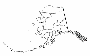
Circle is a census-designated place (CDP) in Yukon-Koyukuk Census Area, Alaska, United States. At the 2010 census the population was 104, up from 100 in 2000.

<span class="mw-page-title-main">Muscotah, Kansas</span> City in Kansas, United States

Muscotah is a city in Atchison County, Kansas, United States. As of the 2020 census, the population of the city was 155. Muscotah was named after the Kickapoo Native American word for "prairie".

<span class="mw-page-title-main">Funkley, Minnesota</span> City in Minnesota, United States

Funkley is a city in Beltrami County, Minnesota, United States. The population was 18 at the 2020 census, making the city the second-least populous incorporated place in Minnesota. It shared that distinction with Tenney until the latter dissolved in 2011.

<span class="mw-page-title-main">Cave, Missouri</span> City in Missouri, United States

Cave is a City in Lincoln County, Missouri, United States. The population was 5 at the 2010 census. However, As of the 2020 census, the population is 0, making it the smallest incorporated community in the U.S state of Missouri. It is the 939th largest city in Missouri and the 19481st largest city in the United States. Cave is currently declining at a rate of 0.00% annually and its population has decreased by 0.00% since the most recent census, which recorded a population of 5 in 2010.

<span class="mw-page-title-main">Stotesbury, Missouri</span> Village in Missouri, United States

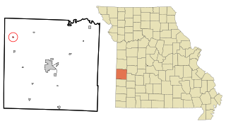
Stotesbury is a village in northwest Vernon County, Missouri, United States. The population was 18 at the 2010 census.

<span class="mw-page-title-main">Boys Town, Nebraska</span> Village in Douglas County, Nebraska, United States

Boys Town is a village in Douglas County, Nebraska, United States. The population was 410 at the 2020 census. Boys Town is an enclave and a suburb of Omaha.

<span class="mw-page-title-main">Douglas, Oklahoma</span> Town in Oklahoma, United States

Douglas is a town in Garfield County, Oklahoma, United States. The population was 32 at the 2010 census.

<span class="mw-page-title-main">Renfrow, Oklahoma</span> Town in Oklahoma, United States

Renfrow is a town in Grant County, Oklahoma, United States. The population was 12 at the 2010 census, a decline of 33.3 percent from the figure of 16 at the 2000 census.

<span class="mw-page-title-main">Arkoma, Oklahoma</span> Town in Oklahoma, United States

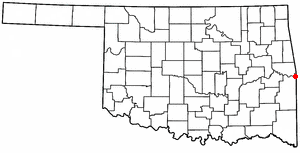
Arkoma is a town in LeFlore County, Oklahoma, United States. It is part of the Fort Smith, Arkansas-Oklahoma Metropolitan Statistical Area. The population was 1,989 at the 2010 census, a decline from 2,180 in 2000. The name of the town is a portmanteau of Arkansas and Oklahoma. Throughout its history, Arkoma has served as a "bedroom community" because many residents commuted to work in Fort Smith.

<span class="mw-page-title-main">Dibble, Oklahoma</span> Town in Oklahoma, United States

Dibble is a town in McClain County, Oklahoma, United States. The population within city limits was 867 at the 2020 census, down from 878 at the 2010 census. The community has 8,868 residents in its 73031 zipcode, according to Sperling's Best Places. Dibble is in the outer suburban area west of Purcell and southwest of Norman, in the Oklahoma City Metropolitan Area, according to the U.S. Census.

<span class="mw-page-title-main">Forest Park, Oklahoma</span> Town in Oklahoma, United States

Forest Park is a town in Oklahoma County, Oklahoma, United States, and a part of the Oklahoma City metropolitan area. The population was 998 at the 2010 census.

<span class="mw-page-title-main">Lake Aluma, Oklahoma</span> Town in Oklahoma, United States

Lake Aluma is a town in Oklahoma County, Oklahoma, United States, and a part of the Oklahoma City Metropolitan Area. The population was 88 at the 2010 census.

<span class="mw-page-title-main">Woodlawn Park, Oklahoma</span> Town in Oklahoma, United States

Woodlawn Park is a town in Oklahoma County, Oklahoma, United States, and a part of the Oklahoma City Metropolitan Area. The population was 161 at the 2000 census.

<span class="mw-page-title-main">North Miami, Oklahoma</span> Town in Oklahoma, United States

North Miami is a town in Ottawa County, Oklahoma, United States. The population was 290 at the 2020 census. The town is primarily a bedroom community for several larger towns in the county.

<span class="mw-page-title-main">Cleveland, Oklahoma</span> City in Oklahoma, United States

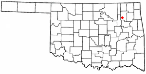
Cleveland is a city in Pawnee County, Oklahoma, United States. The 2010 census population was 3,251, a decrease of 0.9 percent from the figure of 3,282 recorded in 2000.

<span class="mw-page-title-main">Valley Park, Oklahoma</span> Town in Oklahoma, United States

Valley Park is a town in Rogers County, Oklahoma, United States. The population was 77 at the 2010 census, up 221 percent from the figure of 24 recorded in 2000.

<span class="mw-page-title-main">Muldrow, Oklahoma</span> Town in Oklahoma, United States

Muldrow, officially the Town of Muldrow, is a town in Sequoyah County, Oklahoma, United States. It is part of the Fort Smith, Arkansas–Oklahoma Metropolitan Statistical Area. The population was 3,466 at the 2010 census, an increase of 11.7 percent over the figure of 3,104 recorded in 2000.

<span class="mw-page-title-main">Paradise Hill, Oklahoma</span> Town in Oklahoma, United States

Paradise Hill is a town in the northwest corner of Sequoyah County, Oklahoma, United States. It is part of the Fort Smith, Arkansas-Oklahoma Metropolitan Statistical Area. The population was 85 at the 2010 census, a decline from the figure of 100 recorded in 2000.

<span class="mw-page-title-main">Hollister, Oklahoma</span> Town in Oklahoma, United States

Hollister is a town in Tillman County, Oklahoma, United States. The population was 35 as of the 2020 United States census. The town is located about 12 driving miles east-southeast of the county seat of Frederick, and is located along Oklahoma State Highway 54.

<span class="mw-page-title-main">Hammon, Oklahoma</span> Town in Oklahoma, United States

Hammon is a town in the U.S. state of Oklahoma, the majority of which is in Roger Mills County, but some of which extends into Custer County. It is located at the junction of Oklahoma State Highways 33 and 34.

References

  1. "ArcGIS REST Services Directory". United States Census Bureau. Retrieved September 20, 2022.
  2. 1 2 U.S. Geological Survey Geographic Names Information System: Smith Village, Oklahoma
  3. 1 2 "U.S. Census website". United States Census Bureau . Retrieved October 31, 2008.
  4. 1 2 3 Everett, Dianna. "History of Smith Village". Okhistory.org. Retrieved February 26, 2015.
  5. "Census of Population and Housing". Census.gov. Retrieved June 4, 2015.
  6. "2020 CENSUS - SCHOOL DISTRICT REFERENCE MAP: Oklahoma County, OK" (PDF). U.S. Census Bureau . Retrieved January 28, 2024.
  7. "Mid-Del Map" (PDF). Mid-Del School District . Retrieved January 28, 2024. - Location of Smith Village indicated. - See also Census Map 2020 of Smith Village