Snow Mountain (Oxford County, Maine)

Last updated
Snow Mountain
USA Maine location map.svg
Red triangle with thick white border.svg
Snow Mountain
Highest point
Elevation 3,783 ft (1,153 m)
Prominence 1,280 ft (390 m) [1]
Listing New England 100 Highest #94
Coordinates 45°10′09″N70°49′36″W / 45.169167°N 70.826667°W / 45.169167; -70.826667 Coordinates: 45°10′09″N70°49′36″W / 45.169167°N 70.826667°W / 45.169167; -70.826667
Geography
Location Oxford County, Maine, U.S.
Topo map USGS Little Kennebago Lake
Climbing
Easiest route trailless bushwack

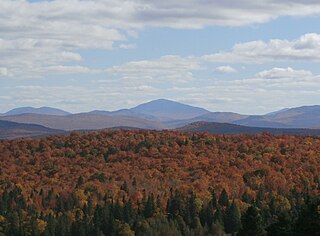
Snow Mountain is a mountain located in Oxford County, Maine, about 4 mi (6.4 km) south of the Canada–United States border with Québec. [2] The mountain is sometimes called "Cupsuptic Snow", to distinguish it from another "Snow Mountain" about 10 mi (16 km) to the northeast. [3] Snow Mountain is flanked to the north by Kennebago Divide Mountain, and to the south by Twin Mountains and West Kennebago Mountain.

Mountain A large landform that rises fairly steeply above the surrounding land over a limited area

A mountain is a large landform that rises above the surrounding land in a limited area, usually in the form of a peak. A mountain is generally steeper than a hill. Mountains are formed through tectonic forces or volcanism. These forces can locally raise the surface of the earth. Mountains erode slowly through the action of rivers, weather conditions, and glaciers. A few mountains are isolated summits, but most occur in huge mountain ranges.

Oxford County, Maine county in Maine, US

Oxford County is a county in the state of Maine, United States. As of the 2010 Census, the county had a population of 57,833. Its county seat is the town of Paris. The county was formed on March 4, 1805 from northerly portions of York and Cumberland counties. It borders the Canadian province of Quebec.

Maine State of the United States of America

Maine is a state in the New England region of the northeastern United States. Maine is the 12th smallest by area, the 9th least populous, and the 38th most densely populated of the 50 U.S. states. It is bordered by New Hampshire to the west, the Atlantic Ocean to the southeast, and the Canadian provinces of New Brunswick and Quebec to the northeast and northwest respectively. Maine is the easternmost state in the contiguous United States, and the northernmost state east of the Great Lakes. It is known for its jagged, rocky coastline; low, rolling mountains; heavily forested interior; and picturesque waterways, as well as its seafood cuisine, especially lobster and clams. There is a humid continental climate throughout most of the state, including in coastal areas such as its most populous city of Portland. The capital is Augusta.

Snow Mountain stands within the watershed of the upper Androscoggin River, which drains into Merrymeeting Bay, the estuary of the Kennebec River, and then into the Gulf of Maine. The west end of Snow Mtn. drains into Snow Mountain Brook, then into the Cupsuptic River, Cupsuptic Lake, through a series of lakes into the Rapid River and Umbagog Lake, the source of the Androscoggin River. The south side of Snow Mtn. drains into the East Branch of the Cupsuptic River. The northeast and northwest sides of Snow Mtn. drain into Wiggle Brook, then into the Kennebago River and Cupsuptic Lake.

Drainage basin Area of land where precipitation collects and drains off into a common outlet

A drainage basin is any area of land where precipitation collects and drains off into a common outlet, such as into a river, bay, or other body of water. The drainage basin includes all the surface water from rain runoff, snowmelt, and nearby streams that run downslope towards the shared outlet, as well as the groundwater underneath the earth's surface. Drainage basins connect into other drainage basins at lower elevations in a hierarchical pattern, with smaller sub-drainage basins, which in turn drain into another common outlet.

Androscoggin River river in New Hampshire and Maine, United States

The Androscoggin River is a river in the U.S. states of Maine and New Hampshire, in northern New England. It is 178 miles (286 km) long and joins the Kennebec River at Merrymeeting Bay in Maine before its water empties into the Gulf of Maine on the Atlantic Ocean. Its drainage basin is 3,530 square miles (9,100 km2) in area. The name "Androscoggin" comes from the Eastern Abenaki term /aləssíkɑntəkw/ or /alsíkɑntəkw/, meaning "river of cliff rock shelters" ; or perhaps from Penobscot /aləsstkɑtəkʷ/, meaning "river of rock shelters". The Anglicization of the Abenaki term is likely an analogical contamination with the colonial governor Edmund Andros.

Merrymeeting Bay is a large freshwater tidal bay in Sagadahoc, Lincoln, and Cumberland counties, in the U.S. state of Maine. Merrymeeting Bay's unusual geography defies common landform terms. It is not what is usually meant by the word bay. It is somewhat like an estuary except for being fresh water with very little salt. Geologically it is described as an "inland delta" and biologically as "tidal riverine."

Related Research Articles

Mooselookmeguntic Lake lake of the United States of America

Mooselookmeguntic Lake is located in Franklin County and Oxford County, Maine, in the United States. It is part of the Androscoggin River watershed. It is located in the western part of Maine, near the border with the state of New Hampshire and the Canadian province of Quebec. The lake is just a few miles from the Appalachian Trail.

Rapid River is a 6.0-mile-long (9.7 km) river in the northwestern portion of the US state of Maine flowing from Lower Richardson Lake to Umbagog Lake. Despite its short length, it forms the end of a major portion of the Umbagog Lake and Androscoggin River watersheds. Much of this watershed is covered by Lower and Upper Richardson Lakes, Mooselookmeguntic Lake, Cupsuptic Lake and Rangeley Lake. The major tributaries of this system are the Cupsuptic, Kennebago and Rangeley rivers, all of which flow into Cupsuptic Lake.

Old Speck Mountain mountain in United States of America

Old Speck Mountain, also known as Old Speckle Mountain, is a mountain located in Oxford County, Maine, United States. The mountain, the fourth-highest in the state, is the northeasternmost and highest of the Mahoosuc Range, the northeasternmost part of the White Mountains. Old Speck is flanked to the southwest by Mahoosuc Arm, and faces Baldpate Mountain to the northeast across Grafton Notch.

Sandwich Mountain mountain in United States of America

Sandwich Mountain is a mountain located on the border between Carroll and Grafton counties, New Hampshire. The mountain is part of the Sandwich Range of the White Mountains. Sandwich Mountain is flanked to the northeast by Mount Tripyramid, and to the southwest by Mount Weetamoo across Sandwich Notch. Several maintained hiking trails pass over the summit.

Snow Mountain (Franklin County, Maine)

Snow Mountain is a mountain located in Franklin County, Maine, about 5 mi (8 km) from the Canada–United States border. Snow Mtn. is flanked to the northeast by Bag Pond Mountain, and to the southeast by Round Mountain.

Baldpate Mountain (Maine)

Baldpate Mountain is a mountain located in Oxford County, Maine. Baldpate has two prominent peaks; West Peak has 3,662 feet (1,116 m) of elevation, and stands 222 feet (68 m) above the col between them.

Elephant Mountain (Oxford County, Maine)

Elephant Mountain is a mountain located in Township C, Oxford County, Maine. Its northeastern end is in Township D, Franklin County. Elephant Mountain is flanked to the northeast by Bemis Mountain, and to the southeast by Old Blue Mountain.

Big Moose Mountain mountain in United States of America

Big Moose Mountain, previously named Big Squaw Mountain, is a mountain located in Piscataquis County, Maine. Big Moose Mountain is flanked to the southeast by Little Moose Mountain.

Goose Eye Mountain mountain in United States of America

Goose Eye Mountain, also known as Mt. Goose High, is a mountain located in Oxford County, Maine, about 1 mi (1.6 km). (2 km) east of the New Hampshire-Maine border. The mountain is the second-highest peak of the Mahoosuc Range of the White Mountains.

White Cap Mountain (Franklin County, Maine) mountain in United States of America

White Cap Mountain is a mountain located in Franklin County, Maine, about 1 mi (1.6 km) east of the Canada–US border with Québec. White Cap Mountain is flanked to the south by Kennebago Divide Mountain.

Boundary Peak (Maine/Quebec)

This mountain, which has no formal name, is located on the Canada–US border between boundary markers 445 and 446. It is the highest point on the border east of the Rocky Mountains. Specifically it is the highest point for 3190 miles of border from the Passamquoddy Bay up to 111 degrees west in Liberty County, Montana at border monument 360 (miles) from the Pacific. The southeast half is in Oxford County, Maine; the northwest half is in Le Granit Regional County Municipality, Quebec, Canada.

East Kennebago Mountain mountain in United States of America

East Kennebago Mountain is a trailless mountain located in Franklin County, Maine. East Kennebago Mtn. is a monadnock, flanked by its spurs: Tim Mountain to the north, Black Spur to the west, and Blackcat Mountain to the southwest.

Kennebago Divide mountain in United States of America

Kennebago Divide is a mountain located in Maine's Franklin and Oxford counties. It is also known as North Peak of Kennebago Divide. Its highest peak is in Franklin County, about 1.5 miles (2.4 km) southeast of the Canada–United States border with Québec. Kennebago Divide is flanked to the northeast by White Cap Mountain, and to the south by Snow Mountain.

West Kennebago Mountain mountain in United States of America

West Kennebago Mountain is a mountain located in Oxford County, Maine. West Kennebago is flanked to the north by Twin Mountains, and to the southwest by Burnt Mountain.

Saddleback Mountain (Keene, New York)

Saddleback Mountain is a mountain located in Essex County, New York. The mountain is part of the Great Range of the Adirondack Mountains. The 0.2 mi (0.32 km) long summit ridge has peaks at each end with a pronounced dip between, giving it the profile of a saddle. Saddleback Mtn. is flanked to the southwest by Basin Mountain, and to the east by Gothics.

Noyes Mountain (Maine) mountain in United States of America

Noyes Mountain is a mountain located in Maine near the town of South Paris. It is named after George Lorenzo Noyes, who built and operated Harvard Quarry located nearby.

The Cupsuptic River is a 23.7-mile-long (38.1 km) river in Maine. It flows from its source near the Canada–United States border to Cupsuptic Lake, the northern arm of Mooselookmeguntic Lake, which drains via other lakes into the Androscoggin River. Although short, the Cupsuptic River includes three of the highest mountains of New England — Kennebago Divide, Snow Mountain, and White Cap Mountain — within its watershed. The name "Cupsuptic" derives from the Abenaki language, meaning "a closed-up stream."

The Kennebago River is a 30-mile-long (48 km) river in northwestern part of the U.S. state of Maine. It is a tributary of Cupsuptic Lake, an arm of Mooselookmeguntic Lake. Via a chain of lakes and the Rapid River, it is part of the Androscoggin River watershed.

The Little East Branch Cupsuptic River is a short tributary of the Cupsuptic River in Maine. It flows 2.6 miles (4.2 km) from its source, on the slope of West Kennebago Mountain, to its mouth on the Cupsuptic.

Elephant Mountain (Piscataquis County, Maine)

Elephant Mountain is a mountain located in Bowdoin College Grant West Piscataquis County, Maine. It is about 5 miles (8 km) southeast of Moosehead Lake, 2 miles southwest of Baker Mountain, and 5 miles west of White Cap Mountain.

References

See also

There are various mountains called Snow Mountain in the United States: