Mount Blue (Maine)

Last updated
Mount Blue
Mount Blue Maine.jpg
Mt. Blue, seen from the north side of Webb Lake
Highest point
Elevation 3202  NAVD 88 [1]
Prominence 1,840 ft (560 m) [2]
Listing 49 New England Fifty Finest
Coordinates 44°43′41″N70°20′31″W / 44.728064169°N 70.341991756°W / 44.728064169; -70.341991756 [1]
Geography
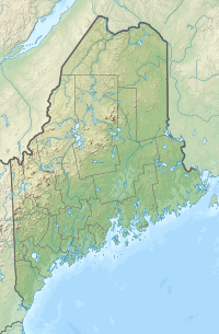
USA Maine relief location map.svg
Red triangle with thick white border.svg
Mount Blue
Topo map USGS Mount Blue
Climbing
Easiest route Hiking, class 1

Mount Blue is a mountain in Maine, USA. It is a hiking destination with outstanding views from the observation deck of a tower at the summit. Its name is shared with Mount Blue State Park in Weld and Mount Blue High School in Farmington.

Contents

Access to summit, and reflections

Mount Blue is a mountain 3,187 ft (971.4 m), in Franklin County, western Maine. To the south and west it drains into the Androscoggin River Valley, while the north and east slopes drain toward the Sandy River in the Kennebec River Valley. The summit and much of the trail are in the town of Avon, while the lower part of the trail is in Weld. [3] The trail and summit are part of Mount Blue State Park, see map, history and further information. [4] Access to the trailhead is through a chain-gated entrance road, Mt. Blue Road, which is located along Center Hill Road. Mt Blue Road is about 2.5 mi (4.02 km) long and is a dead end with the parking lot and trailhead at the end. Hours are 9 am til sunset, with no camping except groups in the Adirondack shelter at the end of the road, with reservations made in advance. [5] However, camping is available at Mount Blue State Park's excellent campground on the southwest shore of Webb Lake. [6] Camping reservations are recommended and can be made online starting in February each year.

On the drive along Mt. Blue Road, the forest protected in this state park is beautiful but, as with Maine forests in most places, it lacks larger sized trees and fallen logs that were here in the 1600s. The Wabanaki people were the first owners of these forests, summits and waters, and they continue to be present in Maine with us today. Visitors may notice occasional stone walls in the woods especially on the east side of the road. These were built by Anglo-European settlers as early as the late 1700s, some of whom had migrated from Massachusetts. They created open fields here, but the forest has long since reclaimed hard-won farm openings in this area. Some of the early settlers may be among those buried at Center Hill Cemetery (1809), on Center Hill Road in North Weld on the way from/to Route 142. Some of their descendants might still live in the area.

The trailhead has parking for about fifteen vehicles. An outhouse is available to the east of the parking lot near the Adirondack shelter. The hiking distance from trailhead to summit is 1.6 mi (2.58 km) (incorrectly indicated as 1.2 mi on at least one map), with an approximate 1600 ft (488 m) elevation gain. This is a steep, rocky, strenuous trail with only a few short level areas, but no iron rings or much bouldering. While the trail is well marked at the trailhead there are few other markings. Just a few obvious side trails are apparent over the length of the trail, and it seems that most hikers are unlikely to lose their way; just stay with the well-worn path. Over the years some sections have been improved by Maine Conservation Corps volunteers with water bars and stone steps. Less than halfway up, below a stream crossing, are the remnants of an old cabin that was used by people working in the former fire lookout tower at the summit. Its associated outhouse (a two-holer) is across the trail. Both are now in disrepair. As the trail ascends, some mature yellow birch trees are dominant in the canopy, but then higher up, the spruce-fir slope forest is prominent on bouldery steep ground. Mountain paper birch, red spruce, black spruce, and balsam fir are the principal tree species in the upper slopes.

The trail increases in steepness as one approaches the summit, ascending a cone-like upper part of the mountain. At the summit there is a large, elaborate galvanized steel tower that appears from a distance to be a fire tower, but it is a communications tower, part of a vital emergency network. [7] There is also a utility building with warning signs and absolutely no access. The public can climb steel steps to the second level of the tower to enjoy 360 degree views from what is referred to as the observation deck. In clear weather, Mount Washington in the Presidential Range, Hew Hampshire, can be seen about 54.2 mi (87.23 km) to the southwest. Sugarloaf Mountain in Carrabasset Valley, Maine can be seen 20.6 mi (33.15 km) to the North. The route back to the trailhead and parking lot are the same as the trail up. Estimated hiking times to the summit seem to have been offered by hardy, fast-paced hikers. Slower hikers should start early, and allow all day long. It is suggested to bring two bottles of water per person, extra food, and rain gear. Cell coverage can be had at the summit but is otherwise unreliable at the State Park and should probably not be considered an emergency backup.

In the 1940s there was a proposal for a ski hill on Mount Blue and a winter recreation complex nearby; these were illustrated in an engaging flier [8] but apparently developments did not take place.

Nearby lakes

West of Mount Blue is Webb Lake, a very shallow 2,124-acre (8.60 km2) lake. Webb Lake is publicly accessible and has several fish species, including brook trout. [9] About 3 miles (4.8 km) north of Mount Blue is Mount Blue Pond, a 134-acre (0.54 km2) lake that is accessible by the public and is reported to have good fishing. [10]

Related Research Articles

<span class="mw-page-title-main">Mount Monadnock</span> Mountain in New Hampshire, USA

Mount Monadnock, or Grand Monadnock, is a mountain in the towns of Jaffrey and Dublin, New Hampshire. It is the most prominent mountain peak in southern New Hampshire and is the highest point in Cheshire County. It lies 38 miles (61 km) southwest of Concord and 62 miles (100 km) northwest of Boston. At 3,165 feet (965 m), Mount Monadnock is nearly 1,000 feet (305 m) higher than any other mountain peak within 30 miles (48 km) and rises 2,000 feet (610 m) above the surrounding landscape. Monadnock's bare, isolated, and rocky summit provides expansive views. It is known for being featured in the writings of Ralph Waldo Emerson and Henry David Thoreau.

<span class="mw-page-title-main">Mount Katahdin</span> Highest mountain in Maine, US

Mount Katahdin is the highest mountain in the U.S. state of Maine at 5,269 feet (1,606 m). Named Katahdin, which means "Great Mountain", by the Penobscot Native Americans, it is within Northeast Piscataquis, Piscataquis County, and is the centerpiece of Baxter State Park. It is a steep, tall massif formed from a granite intrusion weathered to the surface. The flora and fauna on the mountain are typical of those found in northern New England.

<span class="mw-page-title-main">Mount Marcy</span> Mountain in New York State

Mount Marcy is the highest point in New York, with an elevation of 5,343.1 feet (1,628.6 m). It is located in the Town of Keene in Essex County. The mountain is in the heart of the Adirondack High Peaks region of the High Peaks Wilderness Area. Its stature and expansive views make it a popular destination for hikers, who crowd its summit in the summer months.

<span class="mw-page-title-main">Mount Mitchell State Park</span>

Mount Mitchell State Park is a 4,789-acre (1,938 ha) North Carolina state park in Yancey County, North Carolina in the United States. Established in 1915 by the state legislature, it became the first state park of North Carolina. By doing so, it also established the North Carolina State Parks System within the same bill.

<span class="mw-page-title-main">Mount Tamalpais</span> Mountain in California, United States

Mount Tamalpais, known locally as Mount Tam, is a peak in Marin County, California, United States, often considered symbolic of Marin County. Much of Mount Tamalpais is protected within public lands such as Mount Tamalpais State Park, the Marin Municipal Water District watershed, and National Park Service land, such as Muir Woods.

<span class="mw-page-title-main">Hunter Mountain (New York)</span> Highest mountain in Greene County, New York, and second highest in the Catskills

Hunter Mountain is in the towns of Hunter and Lexington, just south of the village of Hunter, in Greene County, New York, United States. At approximately 4,040 feet (1,231 m) in elevation, it is the highest peak in the county and the second-highest peak in the Catskill Mountains.

<span class="mw-page-title-main">Camel's Hump</span> Mountain in Vermont, US

Camel's Hump is a mountain in the Green Mountains in the U.S. state of Vermont. The north slope of the mountain borders the Winooski River, which has carved through the Green Mountains over eons. At 4,083 ft (1,244 m), it is tied with Mount Ellen for the third-highest mountain in Vermont. Surmounted by 10 acres (4 ha) of alpine tundra, the mountain is the most significant feature in Camel's Hump State Park. Because of its distinctive profile, it is perhaps the state's most recognized mountain, featured on the state quarter.

<span class="mw-page-title-main">Slide Mountain (Ulster County, New York)</span> Highest peak of New Yorks Catskill Mountains

Slide Mountain is the highest peak in the Catskill Mountains of the U.S. state of New York. It is located in the town of Shandaken in Ulster County. While the 4,180-foot (1,270 m) contour line on topographic maps is generally accepted as its height, the exact elevation of the summit has never been officially determined by the U.S. Coast and Geodetic Survey, and many informal surveys suggest the mountain may actually top 4,200 feet (1,300 m) above sea level.

The Forney Ridge Trail is an American hiking trail, in the Great Smoky Mountains National Park of Swain County, North Carolina. The trail descends from just beneath the highest summit in the national park, Clingmans Dome, along Forney Ridge and passes through Andrews Bald before terminating at a junction with the Springhouse Branch Trail.

<span class="mw-page-title-main">Kaaterskill High Peak</span> Mountain in United States of America

Kaaterskill High Peak is one of the Catskill Mountains, located in the Town of Hunter in Greene County, New York, United States. It was once believed to be the highest peak in the entire range, but its summit, at 3,655 feet (1,114 m) in elevation, places it only 23rd among the Catskill High Peaks. It is, however, the fourth most prominent peak in the range. Due to its situation as the easternmost High Peak, its summit is just outside the watersheds of New York City's reservoirs in the region.

<span class="mw-page-title-main">Devil's Path (hiking trail)</span> Mountainous hiking trail in New York States Catskill region

The Devil's Path is a hiking trail in the Greene County section of the Catskill Mountains of New York, sometimes described as one of the more challenging trails in the New York Tri-state area. It goes across the eponymous mountain range and then three other peaks to the west, offering hikers and peakbaggers a chance to reach the summits of five of the 35 Catskill High Peaks. It draws hikers from not just the region but far outside, due to the challenging climbs straight up and down the steep gaps between the four peaks of the range, which often require hikers to use hands as well as feet to pull themselves almost straight up cliffs and through rocky chutes. These climbs, however, lead to views across the Catskill range.

<span class="mw-page-title-main">Tumbledown Mountain</span> Mountain in the state of Maine

Tumbledown Mountain is a mountain in Franklin County, Maine. The mountain is a popular hiking spot in western Maine, with trailheads located on Byron Road in unincorporated Township 6, north of Weld. It is distinguished by an alpine pond just below the summit. Tumbledown Mountain is also located near Coos Canyon, a mountain stream. Tumbledown offers trails of varying difficulty for different hikers.

<span class="mw-page-title-main">Hadley Mountain</span> Mountain in New York, United States

Hadley Mountain is a mountain located in the southern Adirondacks in the U.S. state of New York and is the second-highest peak in Saratoga County after neighboring Tenant Mountain. The Hadley Mountain Fire Observation Station was listed on the National Register of Historic Places on September 23, 2001 for its role as a Fire lookout tower with the New York State Forest Preserve. Hadley Mountain is the highest of the three peaks that form the West Mountain ridge.

<span class="mw-page-title-main">Tully Mountain</span> Mountain in Massachusetts

Tully Mountain, 1,163 ft (354 m), is a prominent, steep-sided monadnock located in north central Massachusetts in the town of Orange. It is part of the Tully Mountain Wilderness Management Area. An exposed east facing ledge on the summit provides views of the Millers River valley, Mount Monadnock, Mount Wachusett, and the Wapack Range. The 22-mile (35 km) Tully Trail traverses the mountain.

<span class="mw-page-title-main">Halcott Mountain</span> Mountain in the Catskill range in U.S. state of New York

Halcott Mountain is one of the Catskill Mountains of the U.S. state of New York. It is mostly located in Greene County, with some of its lower slopes in Delaware and Ulster counties. Its exact summit elevation has not been officially determined, but the highest contour line on the mountain is 3,520 feet (1,070 m). It is one of the peaks on the divide between the Delaware and Hudson watersheds.

<span class="mw-page-title-main">Balsam Mountain (Ulster County, New York)</span> 28th highest peak of Catskill Mountains

Balsam Mountain is one of the High Peaks of the Catskill Mountains in the U.S. state of New York. Its exact height has not been determined, so the highest contour line, 3,600 feet (1,100 m), is usually given as its elevation. It is located in western Ulster County, on the divide between the Hudson and Delaware watersheds. The summit and western slopes of the peak are within the Town of Hardenburgh and its eastern slopes are in Shandaken. The small community of Oliverea is near its base on that side. Most of the mountain is publicly owned, managed by the New York State Department of Environmental Conservation as part of the state Forest Preserve, part of the Big Indian-Beaverkill Range Wilderness Area in the Catskill Park. The summit is on a small corner of private land.

<span class="mw-page-title-main">Balsam Lake Mountain</span> Westernmost of the Catskill High Peaks in U.S. state of New York

Balsam Lake Mountain is one of the Catskill Mountains, located in the Town of Hardenburgh, New York, United States. It is the westernmost of the range's 35 High Peaks. Its exact height has not been determined, but the highest contour line on topographic maps, 3,720 feet (1,130 m), is usually given as its elevation.

<span class="mw-page-title-main">Brace Mountain</span> Mountain in New York, United States

Brace Mountain is the peak of a ridge in the southern Taconic Mountains, near the tripoint of the U.S. states of New York, Connecticut and Massachusetts. Its 2,311-foot (704 m) main summit is located in New York; it is the highest point in that state's Dutchess County.

<span class="mw-page-title-main">Musick Guard Station</span> United States historic place

The Musick Guard Station is a rustic cabin located in the Umpqua National Forest in western Oregon, United States. It was originally built to house fire crews assigned to patrol the surrounding National Forest. In the 1990s, the United States Forest Service began renting Musick Guard Station to recreational visitors. The Musick Guard Station is listed on the National Register of Historic Places.

<span class="mw-page-title-main">Mount Tremper</span> Mountain in U.S. state of New York

Mount Tremper, officially known as Tremper Mountain and originally called Timothyberg, is one of the Catskill Mountains in the U.S. state of New York. It is located near the hamlet of Phoenicia, in the valley of Esopus Creek.

References

  1. 1 2 "Mt Blue". NGS Data Sheet. National Geodetic Survey, National Oceanic and Atmospheric Administration, United States Department of Commerce . Retrieved 2013-01-17.
  2. "Mount Blue, Maine". Peakbagger.com. Retrieved 2012-05-06.
  3. "Mount Blue, Franklin County, Maine". MaineAdventure.net. Retrieved 2013-01-16.
  4. "Mount Blue State Park" (PDF). www.maine.gov. Retrieved 2022-09-14.
  5. "Maine Department of Agriculture, Conservation and Forestry". www.maine.gov/dacf/parks. Retrieved 2022-09-14.
  6. "Maine Department of Agriculture, Conservation and Forestry". www.maine.gov/dacf/parks. Retrieved 2022-09-13.
  7. "Daily Bull Dog". dailybulldog.com. Retrieved 2022-09-13.
  8. "New England Ski History". newenglandskihistory.com. Retrieved 2022-09-14.
  9. "Webb Lake". ME Fish Finder. Retrieved 2012-05-06.
  10. "Mount Blue Pond" (PDF). Maine Inland Fisheries and Wildlife. Retrieved 2012-05-06.