South Vinemont, Alabama

Last updated

South Vinemont, Alabama
Cullman County Alabama Incorporated and Unincorporated areas South Vinemont Highlighted 0171900.svg
Location of South Vinemont in Cullman County, Alabama.
Coordinates: 34°14′1″N86°51′46″W / 34.23361°N 86.86278°W / 34.23361; -86.86278
Country United States
State Alabama
County Cullman
Area
[1]
  Total0.91 sq mi (2.35 km2)
  Land0.90 sq mi (2.33 km2)
  Water0.01 sq mi (0.02 km2)
Elevation
1,017 ft (310 m)
Population
 (2020)
  Total558
  Density620.69/sq mi (239.56/km2)
Time zone UTC-6 (Central (CST))
  Summer (DST) UTC-5 (CDT)
FIPS code 01-71900
GNIS feature ID0134967

South Vinemont is a town in Cullman County, Alabama, United States. At the 2010 census the population was 749, [2] up from 425 in 2000.

Contents

Initially incorporated as the town of Vinemont in 1961, state officials informed them the name was already taken and so was later changed to South Vinemont. [3] However, the U.S. Census still referred to the town as Vinemont in 1970 and was not acknowledged as South Vinemont until 1980. [4]

Geography

South Vinemont is located in northern Cullman County at 34°14′1″N86°51′46″W / 34.23361°N 86.86278°W / 34.23361; -86.86278 (34.233641, -86.862916). [5] It is 4 miles (6 km) north of Cullman, the county seat.

According to the U.S. Census Bureau, South Vinemont has a total area of 0.89 square miles (2.3 km2), of which 0.0077 square miles (0.02 km2), or 1.05%, is water. [2]

Demographics

Historical population
CensusPop.Note
1970 480
1980 61528.1%
1990 543−11.7%
2000 425−21.7%
2010 74976.2%
2020 558−25.5%
U.S. Decennial Census [6]
2013 Estimate [7]

2020 census

South Vinemont racial composition [8]
RaceNum.Perc.
White (non-Hispanic)42175.45%
Black or African American (non-Hispanic)10.18%
Native American 10.18%
Asian 40.72%
Other/Mixed 305.38%
Hispanic or Latino 10118.1%

As of the 2020 United States census, there were 558 people, 264 households, and 141 families residing in the town.

2000 census

As of the census [9] of 2000, there were 425 people, 180 households, and 115 families residing in the town. The population density was 651.6 inhabitants per square mile (251.6/km2). There were 203 housing units at an average density of 311.2 per square mile (120.2/km2). The racial makeup of the town was 94.59% White, 0.47% Black or African American, 1.41% Native American, 0.24% from other races, and 3.29% from two or more races. 4.00% of the population were Hispanic or Latino of any race.

There were 180 households, out of which 25.6% had children under the age of 18 living with them, 52.2% were married couples living together, 6.7% had a female householder with no husband present, and 36.1% were non-families. 31.7% of all households were made up of individuals, and 12.2% had someone living alone who was 65 years of age or older. The average household size was 2.36 and the average family size was 2.93.

In the town, the population was spread out, with 22.1% under the age of 18, 10.4% from 18 to 24, 27.5% from 25 to 44, 25.9% from 45 to 64, and 14.1% who were 65 years of age or older. The median age was 37 years. For every 100 females, there were 90.6 males. For every 100 females age 18 and over, there were 94.7 males.

The median income for a household in the town was $26,806, and the median income for a family was $35,000. Males had a median income of $30,250 versus $16,250 for females. The per capita income for the town was $16,141. About 11.1% of families and 16.5% of the population were below the poverty line, including 10.1% of those under age 18 and 18.2% of those age 65 or over.

Education

Vinemont High School serves 323 students in grades 9-12. Its mascot is an eagle, and the school colors are red, white and blue. Its athletics compete in the State 3A division. It is a part of the Cullman County Board of Education. [10]

Notable person

Related Research Articles

<span class="mw-page-title-main">Cullman County, Alabama</span> County in Alabama, United States

Cullman County is a county located in the north central portion of the U.S. state of Alabama. As of the 2020 census, the population was 87,866. Its county seat and largest city is Cullman. Its name is in honor of Colonel John G. Cullmann.

<span class="mw-page-title-main">Marshall County, Alabama</span> County in Alabama, United States

Marshall County is a county of the state of Alabama, United States. As of the 2020 census the population was 97,612. Its county seat is Guntersville. A second courthouse is in Albertville. Its name is in honor of John Marshall, famous Chief Justice of the United States. Marshall County is a dry county, with the exception of the five cities of Albertville, Arab, Grant, Guntersville, and Boaz. Marshall County comprises the Albertville, AL Micropolitan Statistical Area, which is also included in the Huntsville-Decatur-Albertville, AL Combined Statistical Area.

<span class="mw-page-title-main">Garden City, Alabama</span> Town in Alabama, United States

Garden City is a town in Cullman and Blount counties in the U.S. state of Alabama. At the 2020 census, the population was 528. Garden City was founded by Johann Cullmann, namesake of Cullman County in 1873 after founding Cullman, Alabama. It was located in Blount County and was incorporated in 1878. Cullman County was created in 1877. Garden City was annexed by Cullman County with a shift in county borders until 1901. After a lapse in its incorporation, it was re-incorporated in 1950.

<span class="mw-page-title-main">Snead, Alabama</span> Town in Alabama, United States

Snead is a town in Blount County, Alabama, United States. At the 2020 census, the population was 1,032.

<span class="mw-page-title-main">Arab, Alabama</span> City in Alabama, United States

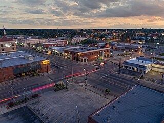
Arab is a city in Marshall County in the northern part of the U.S. state of Alabama, located 10 miles (16 km) from Guntersville Lake and Guntersville Dam, and is included in the Huntsville-Decatur Combined Statistical Area. The population was 8,461 at the 2020 census.

<span class="mw-page-title-main">Baileyton, Alabama</span> Town in Alabama, United States

Baileyton is a town in Cullman County, Alabama, United States. At the 2020 census, the population was 649.

<span class="mw-page-title-main">Colony, Alabama</span> Town in Alabama, United States

Colony is a town in Cullman County, Alabama, United States. At the 2010 census the population was 268, down from 385 in 2000. Colony is a historically African-American town. In its early days it was a haven for African Americans in the Deep South. It incorporated in 1981.

<span class="mw-page-title-main">Cullman, Alabama</span> City in and county seat of Cullman County, Alabama

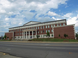
Cullman is the largest city and county seat of Cullman County, Alabama, United States. It is located along Interstate 65, about 50 miles (80 km) north of Birmingham and about 55 miles (89 km) south of Huntsville. As of the 2020 census it had a population of 18,213, with an estimated population of 19,251 in 2022.

<span class="mw-page-title-main">Dodge City, Alabama</span> Town in Alabama, United States

Dodge City is a town in Cullman County, Alabama, United States. At the 2020 census, the population was 548. It was incorporated in 1993.

<span class="mw-page-title-main">Fairview, Alabama</span> Town in Alabama, United States

Fairview is a town in Cullman County, Alabama, United States. At the 2010 census the population was 446, down from 522 in 2000. It incorporated in 1968.

<span class="mw-page-title-main">Good Hope, Alabama</span> City in Alabama, United States

Good Hope is a city in Cullman County, Alabama, United States. As of the 2010 census, the population of the city was 2,264. It incorporated in April 1962.

<span class="mw-page-title-main">Hanceville, Alabama</span> City in Alabama, United States

Hanceville is a city in Cullman County, Alabama, United States. At the 2020 census, the population was 3,217.

<span class="mw-page-title-main">West Point, Alabama</span> Town in Alabama, United States

West Point is a town in Cullman County, Alabama, United States. The population was 584 at the 2020 census. West Point was incorporated on October 15, 1977.

<span class="mw-page-title-main">Falkville, Alabama</span> Town in Alabama, United States

Falkville is a town in Morgan County, Alabama, United States, and is included in the Decatur Metropolitan Area and Huntsville-Decatur Combined Statistical Area. As of the 2020 census, the population of the town was 1,197.

<span class="mw-page-title-main">Hartselle, Alabama</span> City in Alabama, United States

Hartselle is the second largest city in Morgan County, Alabama, United States, 13 miles (21 km) south of Decatur. It is part of the Decatur Metropolitan Area and the Huntsville-Decatur Combined Statistical Area.

<span class="mw-page-title-main">Priceville, Alabama</span> City in Alabama, United States

Priceville is the third largest municipality in Morgan County, Alabama, United States and is included in the Decatur Metropolitan Area, as well as the Huntsville-Decatur Combined Statistical Area. The 2020 census counted a population of 3,513, up from 2,658 in 2010.

<span class="mw-page-title-main">Urania, Louisiana</span> Town in Louisiana, United States

Urania is a town in La Salle Parish, Louisiana United States. The population was 1,313 at the 2010 census.

<span class="mw-page-title-main">Lakeside, San Patricio County, Texas</span> Town in Texas, United States

Lakeside is a town in San Patricio County, Texas, United States. As of the 2010 census, the town population was 312.

<span class="mw-page-title-main">Rhine, Wisconsin</span> Town in Wisconsin, United States

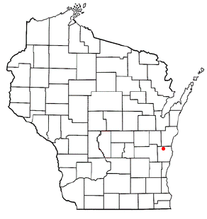
Rhine is a town in Sheboygan County, Wisconsin, United States. The population was 2,244 at the 2000 census. The village of Elkhart Lake is located within the town. The unincorporated community of Rhine Center is also located in the town. The town is included in the Sheboygan, Wisconsin Metropolitan Statistical Area.

<span class="mw-page-title-main">Brookhurst, Wyoming</span> CDP in Wyoming, United States

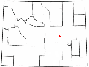
Brookhurst is a census-designated place (CDP) in Natrona County, Wyoming, United States. It is part of the Casper, Wyoming Metropolitan Statistical Area. The population was 185 at the 2010 census.

References

  1. "2020 U.S. Gazetteer Files". United States Census Bureau. Retrieved October 29, 2021.
  2. 1 2 "Geographic Identifiers: 2010 Demographic Profile Data (G001): South Vinemont town, Alabama". U.S. Census Bureau, American Factfinder. Archived from the original on February 12, 2020. Retrieved June 11, 2014.
  3. "South Vinemont".
  4. Bureau of the Census (February 1973). "1970 Census of Population - Characteristics of the Population - Alabama" (PDF).
  5. "US Gazetteer files: 2010, 2000, and 1990". United States Census Bureau. February 12, 2011. Retrieved April 23, 2011.
  6. "U.S. Decennial Census". Census.gov. Retrieved June 6, 2013.
  7. "Annual Estimates of the Resident Population: April 1, 2010 to July 1, 2013" . Retrieved June 3, 2014.
  8. "Explore Census Data". data.census.gov. Retrieved December 18, 2021.
  9. "U.S. Census website". United States Census Bureau . Retrieved January 31, 2008.
  10. "School List". Cullman County Board of Education. Retrieved November 4, 2010.

34°14′01″N86°51′46″W / 34.233641°N 86.862916°W / 34.233641; -86.862916