Speedway, Indiana

Last updated

Speedway, Indiana
Indianapolis-motor-speedway.jpg
Indianapolis Motor Speedway and the town of Speedway in 2005
Speedway seal.png
Nicknames: 
"Home of the 500"; "Racing Capital of the World"
Marion County Indiana Incorporated and Unincorporated areas Speedway Highlighted 1871828.svg
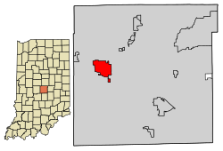
Location in Marion County, Indiana
Coordinates: 39°47′43″N86°15′18″W / 39.79528°N 86.25500°W / 39.79528; -86.25500
Country United States
State Indiana
County Marion
Township Wayne
IncorporatedJuly 14, 1926
Government
  Town ManagerGrant Kleinhenz
Area
[1]
  Total4.79 sq mi (12.40 km2)
  Land4.79 sq mi (12.40 km2)
  Water0.00 sq mi (0.01 km2)
Elevation
[2]
728 ft (222 m)
Population
 (2020) [3]
  Total13,952
  Density2,915.17/sq mi (1,125.55/km2)
Time zone UTC-5 (EST)
  Summer (DST) UTC-4 (EDT)
ZIP code
46224
Area code 317
FIPS code 18-71828 [4]
GNIS feature ID2397670 [2]
Website www.speedwayin.gov

Speedway is a town in Wayne Township, Marion County, Indiana, United States. The population was 13,952 at the 2020 census, [3] up from 11,812 in 2010. [5] Speedway, which is an enclave of Indianapolis, is the home of the Indianapolis Motor Speedway.

Contents

History

Speedway was laid out in 1912 as a residential suburb. [6] It took its name from the Indianapolis Motor Speedway, constructed three years earlier. [7] It is an early example of a residential community planned for the industrial plants located nearby. [8] Carl G. Fisher, James A. Allison, Frank Wheeler, and Arthur Newby, founders of the Indianapolis Motor Speedway, planned the suburb of Speedway west of the track. [9] Fisher and Allison owned plants that needed workers, the Prest-O-Lite factory and Allison Engine Company. The investors' goal was to create a city without horses, where residents would drive automobiles, as well as participate in creating mechanical parts for new modes of transportation. [8]

Speedway was incorporated as a town in July 1926. [10] The Speedway Historic District was listed on the National Register of Historic Places in 2005. [11]

Geography

Speedway is located in western Marion County. It is 5 miles (8 km) west-northwest of downtown Indianapolis.

According to the U.S. Census Bureau, Speedway has a total area of 4.79 square miles (12.41 km2), of which 0.004 square miles (0.01 km2), or 0.08%, are water. [1] The town is drained by Eagle Creek, which runs along the southwest edge of town, and its tributaries Dry Run and Little Eagle Creek, which flow past or around the speedway. Eagle Creek continues east to join the White River in southwest Marion County.

Climate

The climate in this area is characterized by hot, humid summers and generally mild to cool winters. According to the Köppen Climate Classification system, Speedway has a humid subtropical climate, Cfa on climate maps. [12] With a January daily mean of −2 °C (28 °F) however, Speedway is very close to the humid continental type.

Climate data for Speedway
MonthJanFebMarAprMayJunJulAugSepOctNovDecYear
Mean daily maximum °F (°C)34
(1)
39
(4)
48
(9)
63
(17)
72
(22)
81
(27)
84
(29)
82
(28)
77
(25)
64
(18)
50
(10)
39
(4)
61
(16)
Daily mean °F (°C)28
(−2)
32
(0)
39
(4)
52
(11)
63
(17)
72
(22)
75
(24)
73
(23)
66
(19)
55
(13)
41
(5)
32
(0)
52
(11)
Mean daily minimum °F (°C)19
(−7)
23
(−5)
32
(0)
41
(5)
50
(10)
61
(16)
64
(18)
63
(17)
54
(12)
43
(6)
32
(0)
25
(−4)
41
(5)
Average precipitation inches (mm)2.8
(72)
2.5
(63)
3.8
(96)
3.7
(94)
4.1
(103)
4.0
(102)
4.0
(102)
3.3
(84)
3.1
(78)
2.7
(68)
3.2
(82)
2.9
(73)
40.0
(1,017)
Source: [13]

Demographics

Historical population
CensusPop.Note
1930 1,420
1940 2,32563.7%
1950 5,498136.5%
1960 9,62475.0%
1970 14,52350.9%
1980 12,641−13.0%
1990 13,0923.6%
2000 12,881−1.6%
2010 11,812−8.3%
2020 13,95218.1%
U.S. Decennial Census [14]

2010 census

As of the census [15] of 2010, 11,812 people, 5,550 households, and 2,931 families resided in the town. The population density was 2,481.5 inhabitants per square mile (958.1/km2). The 6,709 housing units averaged 1,409.5 per square mile (544.2/km2). The racial makeup of the town was 74.2% White, 16.7% African American, 0.3% Native American, 2.0% Asian, 4.4% from other races, and 2.3% from two or more races. Hispanics or Latinos of any race were 7.6% of the population.

Of the 5,550 households, 26.9% had children under the age of 18 living with them, 32.4% were married couples living together, 15.3% had a female householder with no husband present, 5.2% had a male householder with no wife present, and 47.2% were not families. About 39.9% of all households were made up of individuals, and 12.9% had someone living alone who was 65 years of age or older. The average household size was 2.13 and the average family size was 2.84.

The median age in the town was 37.8 years. About 21.7% of residents were under the age of 18; 10.8% were between the ages of 18 and 24; 26.7% were from 25 to 44; 25.8% were from 45 to 64; and 14.8% were 65 years of age or older. The gender makeup of the town was 48.3% male and 51.7% female.

2000 census

As of the census [4] of 2000, 12,882 people, 6,151 households, and 3,278 families resided in the town. The 6,151 households had 24.5% with children under the age of 18 living with them, 36.6% married couples living together, 12.5% female householders with no husband present, and 46.7% not families. In the town, the population was spread out, with 20.9% under the age of 18, 10.1% from 18 to 24, 31.5% from 25 to 44, 20.2% from 45 to 64, and 17.2% who were 65 years of age or older. The median age was 37 years. For every 100 females, there were 89.2 males. For every 100 females age 18 and over, there were 84.9 males.

The median income for a household in the town was $37,713, and for a family was $49,005. Males had a median income of $36,756 versus $26,954 for females. The per capita income for the town was $21,468. About 5.6% of families and 8.8% of the population were below the poverty line, including 7.7% of those under age 18 and 9.5% of those age 65 or over.

Education

The town has a lending library, the Speedway Public Library. [16]

Economy

Dallara IndyCar Factory Dallara IndyCar Factory in 2017.jpg
Dallara IndyCar Factory

In addition to the Indianapolis Motor Speedway itself, several related companies are located south of the racetrack, including the United States Auto Club headquarters, the Dallara racecar factory, racing teams A. J. Foyt Racing, and Harding Racing, and the Speedway Indoor karting racetrack. Also, Allison Transmission has a factory nearby.[ citation needed ]

Notable people

Sister cities

See also

Related Research Articles

<span class="mw-page-title-main">Brookwood, Alabama</span> City in Alabama, United States

Brookwood is a city in Tuscaloosa County, Alabama, United States. It incorporated in September 1977. As of the 2020 census, the population of the town is 2,504.

<span class="mw-page-title-main">Chatom, Alabama</span> City in and county seat of Washington County, Alabama

Chatom is a town in Washington County, Alabama, United States. It incorporated in 1949. Chatom is the county seat of Washington County, holding the distinction since 1907. The town's population was 1,288 At the 2010 census, up from 1,193 in 2000.

<span class="mw-page-title-main">Zionsville, Indiana</span> Town in Indiana, United States

Zionsville is a suburban town located in the extreme southeast area of Boone County, Indiana, United States, northwest of Indianapolis. The population was 14,160 at the 2010 census, 30,693 at the 2020 census.

<span class="mw-page-title-main">Moores Hill, Indiana</span> Town in Indiana, United States

Moores Hill is a town in Sparta Township, Dearborn County, Indiana, United States. The population was 597 at the 2010 census.

<span class="mw-page-title-main">Owensville, Indiana</span> Town in Indiana, United States

Owensville is the third largest town and the smallest of the five larger communities in Gibson County, Indiana, United States. The population was 1,338 in 2020.

<span class="mw-page-title-main">Elizabeth, Indiana</span> Town in Indiana, United States

Elizabeth is a town in Posey Township, Harrison County, Indiana, United States. The population was 162 at the 2010 census.

<span class="mw-page-title-main">New Castle, Indiana</span> City in Indiana, United States

New Castle is a city in Henry County, Indiana, 44 miles (71 km) east-northeast of Indianapolis, on the Big Blue River. The city is the county seat of Henry County. New Castle is home to New Castle Fieldhouse, the largest high school gymnasium in the world. The city is surrounded by agricultural land. In the past, it was a manufacturing center for the production of sheet iron and steel, automobiles, caskets, clothing, scales, bridges, pianos, furniture, handles, shovels, lathes, bricks, and flour. Starting in the early 20th century, it was known as the Rose City, at one point having 100 florists and numerous growers.

<span class="mw-page-title-main">Whiteland, Indiana</span> Town in Indiana, United States

Whiteland is a town in Pleasant, Franklin and Clark townships, Johnson County, Indiana, United States. The population was 4,599 at the 2020 census.

<span class="mw-page-title-main">Lawrence, Indiana</span> City in Indiana, United States

Lawrence is a city in Marion County, Indiana, United States. It is one of four "excluded cities" in Marion County. The city is home to Fort Benjamin Harrison within Fort Harrison State Park. The population was 49,370 at the 2020 census. The city is on the northeast side of Indianapolis.

<span class="mw-page-title-main">New Market, Indiana</span> Town in Indiana, United States

New Market is a town in Montgomery County, Indiana, in the United States. The population was 559 at the 2020 census, down from 636 in 2010.

<span class="mw-page-title-main">Petersburg, Indiana</span> City in Indiana, United States

Petersburg is a city within Washington Township and the county seat of Pike County, in the U.S. state of Indiana. The population was 2,383 at the 2010 census.

<span class="mw-page-title-main">Milton, Kentucky</span> City in Kentucky, United States

Milton is a home rule-class city along the south bank of the Ohio River in Trimble County, Kentucky, United States. The population was 597 at the time of the 2020 census, making it the largest city in Trimble County. The Milton-Madison Bridge connects it to Madison, Indiana, and is the only road link between the two states for 40 miles (64 km) in either direction.

<span class="mw-page-title-main">Fife Lake, Michigan</span> Village in Michigan, United States

Fife Lake is a village in southeastern Grand Traverse County in the U.S. state of Michigan. Its population was 456 at the 2020 census, up from 443 at the 2010 census. The village is part of the Traverse City metropolitan area, and lies upon the shore of the lake of the same name.

<span class="mw-page-title-main">Mayville, Michigan</span> Village in Michigan, United States

Mayville is a village in Tuscola County, in the U.S. state of Michigan. The population was 948 at the 2010 census. The village is within Fremont Township along the boundary with Dayton Township.

<span class="mw-page-title-main">Pukwana, South Dakota</span> Town in South Dakota, United States

Pukwana is a town in Brule County, South Dakota, United States. The population was 233 at the 2020 census.

<span class="mw-page-title-main">Wagner, South Dakota</span> City in South Dakota, United States

Wagner is a city in Charles Mix County, South Dakota, United States. The population was 1,490 at the 2020 census. The city is served by Wagner Municipal Airport as well as YST Transit buses.

<span class="mw-page-title-main">Loudon, Tennessee</span> City in Tennessee, United States

Loudon is a city in and the county seat of Loudon County, Tennessee, United States. Its population was 6,001 at the 2020 census. It is included in the Knoxville, Tennessee Metropolitan Statistical Area. The city is located in East Tennessee, southwest of Knoxville, on the Tennessee River. Fort Loudoun, the colonial era fort for which the city was named, is located several miles to the south in Monroe County.

<span class="mw-page-title-main">Powell, Texas</span> Town in Texas, United States

Powell is a town in Navarro County, Texas, United States. The population was 136 at the 2010 census.

<span class="mw-page-title-main">Emory, Texas</span> City in Texas, United States

Emory is a city in Rains County, Texas, United States. The population was 1,239 at the 2010 census. It is the county seat of Rains County. Previously known as Springville, the city and county are named after Emory Rains, who was a legislator from the area. Rains was the author of the Homestead Law of Texas, which was later used as a model for the protection of homesteads throughout the United States. Special legislation passed to create Rains County called for the citizens to vote on the location of the county seat and for that selected town to be named Emory.

<span class="mw-page-title-main">Hamlin, West Virginia</span> Town in West Virginia, United States

Hamlin is a town in and the county seat of Lincoln County, West Virginia, United States, along the Mud River. The population was recorded as 1,040 at the 2020 census. It is part of the Huntington–Ashland metropolitan area.

References

  1. 1 2 "2022 U.S. Gazetteer Files: Indiana". United States Census Bureau. Retrieved April 13, 2023.
  2. 1 2 U.S. Geological Survey Geographic Names Information System: Speedway, Indiana
  3. 1 2 "P1. Race – Speedway town, Indiana: 2020 DEC Redistricting Data (PL 94-171)". U.S. Census Bureau. Retrieved April 13, 2023.
  4. 1 2 "U.S. Census website". United States Census Bureau . Retrieved January 31, 2008.
  5. "P1. Race – Speedway town, Indiana: 2010 DEC Redistricting Data (PL 94-171)". U.S. Census Bureau. Retrieved April 13, 2023.
  6. Bodenhamer, David J.; Barrows, Robert G. (November 22, 1994). The Encyclopedia of Indianapolis. Indiana University Press. p. 1284. ISBN   0-253-11249-4.
  7. Baker, Ronald L. (October 1995). From Needmore to Prosperity: Hoosier Place Names in Folklore and History . Indiana University Press. p.  308. ISBN   978-0-253-32866-3. ...named the city for "Speedway Course"...
  8. 1 2 "Speedway Historic District". nps.gov. Retrieved February 4, 2015.
  9. "Feel the Need for Speed in Indy". nps.gov. Retrieved February 4, 2015.
  10. "1926: IMS pagoda on fire, rookie wins the 500". WRTV Indianapolis. March 3, 2016. Retrieved October 22, 2023.
  11. "National Register Information System". National Register of Historic Places . National Park Service. July 9, 2010.
  12. "Speedway, Indiana Köppen Climate Classification (Weatherbase)". Weatherbase.
  13. "Speedway, Indiana Temperature Averages". Weatherbase. Retrieved April 28, 2015.
  14. "Census of Population and Housing". Census.gov. Retrieved June 4, 2015.
  15. "U.S. Census website". United States Census Bureau . Retrieved December 11, 2012.
  16. "Indiana public library directory" (PDF). Indiana State Library. Archived from the original (PDF) on February 18, 2017. Retrieved March 10, 2018.
  17. Washington Post, November 23, 1990
  18. "Former Attorney General Stricken Fatally in Cab". Jeffersonville Evening News. August 6, 1954.