St. James City, Florida

Last updated

St. James City, Florida
Lee County Florida Incorporated and Unincorporated areas St. James City Highlighted.svg
Location in Lee County and the state of Florida
Coordinates: 26°32′11″N82°5′29″W / 26.53639°N 82.09139°W / 26.53639; -82.09139
CountryUnited States
State Flag of Florida.svg  Florida
County   Lee
Area
[1]
  Total16.68 sq mi (43.21 km2)
  Land14.61 sq mi (37.83 km2)
  Water2.08 sq mi (5.38 km2)
Elevation
7 ft (2 m)
Population
 (2020)
  Total3,876
  Density265.35/sq mi (102.45/km2)
Time zone UTC-5 (Eastern (EST))
  Summer (DST) UTC-4 (EDT)
FIPS code 12-62675 [2]
GNIS feature ID0290196 [3]

St. James City is an unincorporated community and census-designated place (CDP) on Pine Island in Lee County, Florida, United States. The population was 3,876 at the 2020 census, [4] up from 3,784 at the 2010 census. It is part of the Cape Coral-Fort Myers, Florida Metropolitan Statistical Area.

Contents

Geography

The St. James City CDP occupies the southern half of Pine Island, with the town center situated at the southern end of the island. The community is bordered by San Carlos Bay to the south, by Pine Island Sound to the west, by San Carlos Bay, Matlacha Pass, and Pine Island Creek to the east, and by the community of Pine Island Center to the north. Stringfellow Road (County Road 767) is the main road in the community, running north–south along the center of the island. By road it is 17 miles (27 km) to the middle of Cape Coral and 26 miles (42 km) to downtown Fort Myers, the Lee county seat.

According to the United States Census Bureau, the St. James City CDP has a total area of 16.7 square miles (43.2 km2), of which 14.6 square miles (37.8 km2) are land and 2.1 square miles (5.4 km2), or 12.45%, are water. [5]

Demographics

Historical population
CensusPop.Note
2000 4,105
2010 3,784−7.8%
2020 3,8762.4%
U.S. Decennial Census [6]

As of the census [2] of 2000, there were 4,105 people, 2,138 households, and 1,417 families residing in the CDP. The population density was 281.1 inhabitants per square mile (108.5/km2). There were 2,921 housing units at an average density of 200.0 per square mile (77.2/km2). The racial makeup of the CDP was 98.95% White, 0.10% African American, 0.15% Native American, 0.27% Asian, 0.15% from other races, and 0.39% from two or more races. Hispanic or Latino of any race were 0.76% of the population.

There were 2,138 households, out of which 7.0% had children under the age of 18 living with them, 62.4% were married couples living together, 2.5% had a female householder with no husband present, and 33.7% were non-families. 28.1% of all households were made up of individuals, and 18.2% had someone living alone who was 65 years of age or older. The average household size was 1.92 and the average family size was 2.28.

In the CDP, the population was spread out, with 7.1% under the age of 18, 1.7% from 18 to 24, 10.8% from 25 to 44, 35.4% from 45 to 64, and 45.0% who were 65 years of age or older. The median age was 63 years. For every 100 females, there were 98.5 males. For every 100 females age 18 and over, there were 97.8 males.

The median income for a household in the CDP was $35,746, and the median income for a family was $42,176. Males had a median income of $34,120 versus $22,179 for females. The per capita income for the CDP was $26,520. About 1.5% of families and 4.3% of the population were below the poverty line, including 6.0% of those under age 18 and 3.8% of those age 65 or over.

Related Research Articles

<span class="mw-page-title-main">Pine Island Ridge, Florida</span> Neighborhood in Broward, Florida, United States

Pine Island Ridge was a census-designated place (CDP) in Broward County, Florida, United States. The population was 5,199 at the 2000 census. Formerly a part of unincorporated Broward County, Pine Island Ridge was annexed into the town of Davie, Florida on 15 September 2006, and is now a neighborhood of that town.

<span class="mw-page-title-main">Black Diamond, Florida</span> Census-designated place in Florida, US

Black Diamond is a census-designated place (CDP) in Citrus County, Florida, United States. The population was 1,101 at the 2010 census, up from 694 in 2000.

<span class="mw-page-title-main">Pelican Bay, Florida</span> Census-designated place in Florida

Pelican Bay is a census-designated place (CDP) in Collier County, Florida, United States. The population was 6,346 at the 2010 census. It is part of the Naples–Marco Island Metropolitan Statistical Area.

<span class="mw-page-title-main">Pine Ridge, Collier County, Florida</span> Census-designated place in Florida

Pine Ridge is a census-designated place (CDP) in Collier County, Florida, United States. The population was 1,918 at the 2010 census. It is part of the Naples–Marco Island Metropolitan Statistical Area.

<span class="mw-page-title-main">Pine Island, Hernando County, Florida</span> Census-designated place in Florida, United States

Pine Island is an unincorporated community and census-designated place (CDP) in Hernando County, Florida, United States. The population was 64 at the 2010 census, unchanged from the 2000 census.

<span class="mw-page-title-main">University, Hillsborough County, Florida</span> Census-designated place in Florida, United States

University is an unincorporated census-designated place in Hillsborough County, Florida, United States. The population was 41,163 at the 2010 census, up from 30,736 at the 2000 census. The University of South Florida is located just southeast of the community, within the Tampa city limits. The community is also known as "University West", mainly due to its location in relation to the university. The community is often notoriously referred to by locals as "Suitcase City" due to the high rate of transients.

<span class="mw-page-title-main">Pine Lakes, Florida</span> Census-designated place in Florida

Pine Lakes is an unincorporated community and census-designated place (CDP) in Lake County, Florida, United States. The population was 862 at the 2010 census, up from 755 at the 2000 census. It is part of the Orlando–Kissimmee Metropolitan Statistical Area.

<span class="mw-page-title-main">Bokeelia, Florida</span> Census-designated place in Florida, United States

Bokeelia is an unincorporated community and census-designated place (CDP) located on Pine Island in Lee County, Florida, United States. As of the 2020 census, the CDP had a population of 1,855, up from 1,780 at the 2010 census. It is part of the Cape Coral-Fort Myers, Florida Metropolitan Statistical Area. Bokeelia is still home to one of Lee County's first pioneer families, the Padillas, who came by way of Cayo Costa.

<span class="mw-page-title-main">Harlem Heights, Florida</span> Census-designated place in Florida, United States

Harlem Heights is an unincorporated community and census-designated place (CDP) in Lee County, Florida, United States. The population was 1,930 at the 2020 census, down from 1,975 at the 2010 census. It is part of the Cape Coral-Fort Myers, Florida Metropolitan Statistical Area.

<span class="mw-page-title-main">Iona, Florida</span> Census-designated place in Florida, United States

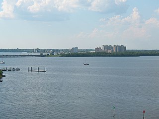
Iona is an unincorporated community and census-designated place (CDP) in Lee County, Florida, United States. The population was 16,908 at the 2020 census, up from 15,404 at the 2010 census. It is part of the Cape Coral-Fort Myers, Florida Metropolitan Statistical Area.

<span class="mw-page-title-main">Matlacha, Florida</span> Census-designated place in Florida, United States

Matlacha is a census-designated place (CDP) in Lee County, Florida, United States. As of the 2020 census, the CDP had a population of 598. It is part of the Cape Coral-Fort Myers, Florida Metropolitan Statistical Area.

<span class="mw-page-title-main">Matlacha Isles-Matlacha Shores, Florida</span> Census-designated place in Florida, United States

Matlacha Isles-Matlacha Shores is an unincorporated community and census-designated place (CDP) in Lee County, Florida, United States. The population was 227 at the 2020 census, down from 229 at the 2010 census. It is part of the Cape Coral-Fort Myers, Florida Metropolitan Statistical Area.

<span class="mw-page-title-main">North Fort Myers, Florida</span> Census-designated place in Florida, United States

North Fort Myers is an unincorporated area and census-designated place (CDP) in Lee County, Florida, United States. It is part of the Cape Coral-Fort Myers, Florida Metropolitan Statistical Area. The population was 42,719 at the 2020 census.

<span class="mw-page-title-main">Palmona Park, Florida</span> Census-designated place in Florida, United States

Palmona Park is a census-designated place (CDP) in Lee County, Florida, United States. The population was 1,240 at the 2020 census, down from 1,146 at the 2010 census. It is part of the Cape Coral-Fort Myers, Florida Metropolitan Statistical Area.

<span class="mw-page-title-main">Pine Island Center, Florida</span> Census-designated place in Florida, United States

Pine Island Center is an unincorporated community and census-designated place (CDP) located on Pine Island in Lee County, Florida, United States. The population was 1,942 at the 2020 census. It is part of the Cape Coral-Fort Myers, Florida Metropolitan Statistical Area.

<span class="mw-page-title-main">Pineland, Florida</span> Census-designated place in Florida, United States

Pineland is an unincorporated community and census-designated place (CDP) on Pine Island in Lee County, Florida, United States. The population was 466 at the 2020 census. It is part of the Cape Coral-Fort Myers, Florida Metropolitan Statistical Area.

<span class="mw-page-title-main">Villas, Florida</span> Census-designated place in Florida, United States

Villas, Florida is an unincorporated community and census-designated place (CDP) in Lee County, Florida, United States. It is part of the Cape Coral-Fort Myers, Florida Metropolitan Statistical Area.

<span class="mw-page-title-main">Big Pine Key, Florida</span> Census-designated place in Florida, United States

Big Pine Key is a census-designated place and unincorporated community in Monroe County, Florida, United States, on an island of the same name in the Florida Keys. As of the 2020 census, the town had a total population of 4,521.

<span class="mw-page-title-main">Orlo Vista, Florida</span> Census-designated place & Unincorporated community in Florida, United States

Orlo Vista is an unincorporated community and census-designated place in Orange County, Florida, United States. While the spelling "Orlo Vista" is used by the U.S. Postal Service, the community is shown as Orlovista on federal maps. The population of the Orlovista census-designated place was 6,123 at the 2010 census. It is part of the Orlando–Kissimmee Metropolitan Statistical Area. The boundaries of the Orlovista CDP are West Colonial Drive on the north, Pine Hills Road on the east, Old Winter Garden Road and Carter Street at the Orlando city limits on the south, and Hiawassee Road on the west.

<span class="mw-page-title-main">Hutchinson Island South, Florida</span> CDP in Florida, United States

Hutchinson Island South is a census-designated place (CDP) on the barrier island of Hutchinson Island in St. Lucie County, Florida, United States. The South in its name refers to its location in the southern part of St. Lucie County, as it is actually in the central part of the island as a whole. The population was 4,846 at the 2000 census. It is part of the Port St. Lucie Metropolitan Statistical Area. Its mail is delivered from Jensen Beach 34957 in nearby Martin County. The Jensen Beach post office has a postal contract substation known as Hutchinson Beach located at 11007 South Ocean Drive, but it offers only post office boxes and counter services.

References

  1. "2020 U.S. Gazetteer Files". United States Census Bureau. Retrieved December 2, 2021.
  2. 1 2 "U.S. Census website". United States Census Bureau. Retrieved January 31, 2008.
  3. "US Board on Geographic Names". United States Geological Survey. October 25, 2007. Retrieved January 31, 2008.
  4. "Explore Census Data". data.census.gov. Retrieved September 30, 2022.
  5. "U.S. Gazetteer Files: 2019: Places: Florida". U.S. Census Bureau Geography Division. Retrieved December 4, 2019.
  6. "Census of Population and Housing". Census.gov. Retrieved June 4, 2016.