Fort Myers Beach, Florida

Last updated

Fort Myers Beach, Florida
City of Fort Myers Beach
FortMyersFLfish.jpg
Fishermen wading in Fort Myers Beach
Lee County Florida Incorporated and Unincorporated areas Fort Myers Beach Highlighted.svg
Location in Lee County and the state of Florida
Coordinates: 26°26′19″N81°55′32″W / 26.43861°N 81.92556°W / 26.43861; -81.92556
Country United States of America
State Florida
County Lee
Incorporated December 31, 1995
Government
  Type Council-Manager
   Mayor Dan Allers
   Vice Mayor Jim Atterholt
   Council Members John R. King,
Karen Woodson,
and Bill Veach
   Town Manager Andy Hyatt
   Town Clerk Amy Baker
Area
[1]
  Total6.17 sq mi (15.98 km2)
  Land2.78 sq mi (7.20 km2)
  Water3.39 sq mi (8.78 km2)
Elevation
3 ft (1 m)
Population
 (2020)
  Total5,582
  Density2,006.47/sq mi (774.84/km2)
Time zone UTC-5 (Eastern (EST))
  Summer (DST) UTC-4 (EDT)
ZIP codes
33931-33932
Area code 239
FIPS code 12-24150 [2]
GNIS feature ID0282701 [3]
Website www.fortmyersbeachfl.gov

Fort Myers Beach is a town located on the North end of Estero Island in Lee County, Florida, United States. The town is on the Gulf of Mexico and is accessed from the mainland by a bridge over Estero Bay. It is part of the Cape Coral-Fort Myers, Florida Metropolitan Statistical Area. It was officially incorporated on December 31, 1995. The population was 5,582 at the 2020 census, down from 6,277 at the 2010 census.

Contents

Geography

Fort Myers Beach is located at 26°26′19″N81°55′32″W / 26.43861°N 81.92556°W / 26.43861; -81.92556 (26.438676, –81.925620). [4]

The town is situated on the North end of Estero Island, one of the barrier islands in the Gulf of Mexico off the coast of Fort Myers, Florida.

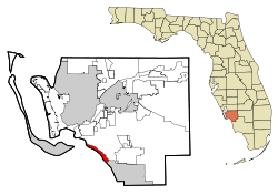
According to the United States Census Bureau, the town has a total area of 6.2 square miles (16 km2), of which 2.9 square miles (7.5 km2) is land and 3.3 square miles (8.5 km2) (53.41%) is water.

Climate

Fort Myers Pier Fmpier.jpg
Fort Myers Pier

Fort Myers Beach has a tropical climate and has the following statistics on average. It receives 56 inches of rain and 0 inches of snow per year. The number of days with any measurable precipitation is 76. There are 265 sunny days per year. The July high is around 89 degrees and the low is 75 degrees. The January high is 75 and the low is 55. [5] [6]

History

Early history

The Calusa Indians first inhabited Estero Island, the island that Fort Myers Beach occupies, 2,000 years ago. The Calusa Indians resisted Spanish colonization attempts successfully including those by Ponce de León in 1513 and 1521. The Calusa met their demise 150 years later due to disease, hostilities, and political and economic upheaval. In the mid to late 1700s, Cuban fishermen then began to settle a small fishing village known as a Ranchero. This effectively displaced the remaining Calusa. In 1845, Florida became the 27th state. [7]

American settlement

The Homestead Act of 1862 initiated American settlements on Estero Island. In 1862, Robert Gilbert received a homestead grant at the end of Connecticut Street, the highest point on Fort Myers Beach. In 1911, William Case developed the first subdivision and cottage rental industry. By 1914, all the property on the island was homesteaded with little industry beyond a hotel, fishing, gardening, and a sawmill operated by the Koreshan Unity (a communal society based on mainland Estero). At this point, Estero Island was named Crescent Beach. [7]

Development on Crescent Beach was slow until the 1920s when Florida gained national attention as a vacation destination. In 1921, a toll bridge was opened connecting the beach to the mainland, followed closely by the construction of two casinos, hotels, a pier and the island's first canal. The land boom ended with the hurricanes of 1921 and 1926 that challenged the paradise appeal of southwest Florida. Despite entering a depression, Crescent Beach continued to gain small businesses, restaurants, subdivisions, and a school. In the 1950s, Crescent Beach continued to modernize. Many hotels were built including the Rancho del Mar, which boasted the first swimming pool. Additionally, the swing bridge was electrified to facilitate traffic. During this time, "pink gold" or pink shrimp were discovered igniting the shrimping industry and ancillary businesses to support it as the population increased by 50 percent. During this second land boom, numerous civic organizations, churches, local newspapers, weather and US Coast Guard stations, and the Beach Library were added to the island. [7] The library became the first free public library in Lee County and opened in 1955 in a one-room cottage with a single librarian. [8]

Incorporation

Fort Myers Beach has continued to develop to the present day. The island has a mix of year-round and seasonal residents, as well as a vibrant tourism industry. On December 31, 1995, legislation was passed to incorporate the town of Fort Myers Beach. [7]

Hurricane Ian

On September 28, 2022, Hurricane Ian made landfall just north of the town as a high-end Category 4 hurricane, causing catastrophic damage and substantial loss of life in the city from high winds and destructive storm surge, which damaged the majority of homes and businesses along the coastline, including the popular Times Square. [9]

Demographics

Historical population
CensusPop.Note
1960 2,463
1970 4,30574.8%
1980 5,75333.6%
1990 9,28461.4%
2000 6,561−29.3%
2010 6,277−4.3%
2020 5,582−11.1%
source: [10] [11]
Fort Myers Beach racial composition
(Hispanics excluded from racial categories)
(NH = Non-Hispanic)
RacePop 2010 [12] Pop 2020 [13] % 2010% 2020
White (NH)5,9995,27295.57%94.45%
Black or African American (NH)16130.25%0.23%
Native American or Alaska Native (NH)10100.16%0.18%
Asian (NH)34120.54%0.21%
Pacific Islander or Native Hawaiian (NH)100.02%0.00%
Some other race (NH)6140.10%0.25%
Two or more races/Multiracial (NH)361010.57%1.81%
Hispanic or Latino (any race)1751602.79%2.87%
Total6,2775,582100.00%100.00%

As of the 2020 United States census, there were 5,582 people, 3,497 households, and 2,198 families residing in the town. [14]

As of the 2010 United States census, there were 6,277 people, 3,596 households, and 2,025 families residing in the town. [15]

The population density in 2010 was 2,262.8 inhabitants per square mile (873.7/km2). There were 9,402 housing units at an average density of 3,248.3 per square mile (1,254.2/km2).

In 2010, there were 3,444 households, out of which 7.9% had children under the age of 18 living with them, 50.4% were married couples living together, 4.0% had a female householder with no husband present, and 43.4% were non-families. 35.6% of all households were made up of individuals, and 17.7% had someone living alone who was 65 years of age or older. The average household size was 1.81 and the average family size was 2.23.

In 2010, in the town, the population was spread out, with 5.4% under the age of 18, 3.2% from 18 to 24, 11.6% from 25 to 44, 34.9% from 45 to 64, and 45.4% who were 65 years of age or older. The median age was 63.2 years. For every 100 females, there were 97.9 males. For every 100 females age 18 and over, there were 96.9 males.

In 2010, the median income for a household in the town was $55,213, and the median income for a family was $79,292. Males had a median income of $41,761 versus $39,961 for females. The per capita income for the town was $57,902.

Government

Fort Myers Beach is governed by a five-member town council. The current town council consists of Mayor Dan Allers, Vice Mayor Jim Atterholt, Council Member John R. King, Council Member Bill Veach, and Council Member Karen Woodson. The town attorney, John Herin, works with the Town Council to implement plans.

The Town of Fort Myers Beach also operates Mound House Cultural and Environmental Learning Center located at 451 Connecticut Street, Newton Beach Park located at 4650 Estero Boulevard, Bay Oaks Recreational Campus (BORC) located at 2731 Oak Street, and Bayside Park located at San Carlos Boulevard and First Street. A few features of BORC include four full-size outdoor tennis courts, an 18-hole disc golf course, two full-size indoor basketball courts, weight room and a public pool that offers a children's pool along with a large slide. The pool is also available for lap swimmers.

Times Square is the retail, restaurant, and entertainment center of the Town of Fort Myers Beach, which also has public beach access.

Education

Primary schools

Secondary schools

There are no secondary schools on Fort Myers Beach. See Lee County School District for other public schools in Lee County that school-age children on Fort Myers can attend.

Churches

The Chapel by the Sea was the first church on the island. A congregation of the Presbyterian Church (USA), Chapel by the Sea was started in 1932 as a mission of the Presbyterians. It was officially founded one year later. The first building was constructed in 1937 with a seating capacity of 47. Today's Sanctuary holds 700. Although it is Presbyterian, the Chapel is known on the island as the community church. The church hosts "God's Table" feeding the poor and needy of the beach every day, Monday through Friday.

Saint Raphael's Episcopal Church was the second church built on the island. It was founded on March 5, 1951, and the church was built in 1953. They are known for hosting the island's annual Blessing of the Shrimp Fleet, a tradition started in 1952 to bless all the boats and their crews. [16]

Other churches on the island are the Roman Catholic Church of the Ascension, the Beach United Methodist Church, St. Peter's Lutheran Church, and the Beach Baptist Church.

Public transportation

Fort Myers Beach is served by LeeTran buses operated by the county. [17]

Community events

Fort Myers Beach Lions Club Shrimp Festival

The Fort Myers Beach Lions Club Shrimp Festival takes place in March. The Shrimp Festival celebrates the shrimping industry on Fort Myers Beach. It consists of a shrimp eating competition, a 5k run, a parade, a pageant, and a food and crafts exposition. [18] [19]

Taste of the Beach

Taste of the Beach takes place in May. Taste of the Beach is an event where local restaurants offer samples of their signature dishes for purchase and compete for top Taste of the Beach Award in categories such as Best Appetizer, Best Beef Dish, Best Seafood Dish, Best Chicken Dish, Best Dessert, Best Decorated Booth, and People's choice award. Live music is performed throughout the event. [18] [19]

Fort Myers Beach Pirate Festival

The Fort Myers Beach Pirate Festival takes place the second weekend in October. The Fort Myers Beach Pirate Festival was named the #2 Pirate Festival in the Country by USA. This family-friendly event attracts thousands of people that come to enjoy the pirate bazaar, themed live music and performances, live ship battles, children's activities and the jolly pub quest (21+ event). [18] [19]

American Sand Sculpting Championship

The American Sand Sculpting Championship takes place in November. This is the largest sand sculpting event in the United States. Nearly 47,000 attendees visit and 2000 tons of sand are sculpted. [18] [19]

Fort Myers Beach Christmas Boat Parade

The Fort Myers Beach Christmas Boat Parade takes place in December. The event features 30 to 50 illuminated boats decorated with an array of animated Christmas scenes and filling the air with Christmas carols. The parade travels through the Back Bay and passes by some restaurants. [18] [19]

Fort Myers Beach sunset 1.JPG
Fort Myers Beach skyline at sunset

Related Research Articles

<span class="mw-page-title-main">Collier County, Florida</span> County in Florida, United States

Collier County is a county in the U.S. state of Florida. As of the 2020 census, its population was 375,752; an increase of 16.9% since the 2010 United States Census. Its county seat is East Naples, where the county offices were moved from Everglades City in 1962.

<span class="mw-page-title-main">DeSoto County, Florida</span> County in Florida, United States

DeSoto County is a county located in the Florida Heartland region of the U.S. state of Florida. As of the 2020 census, the population was 33,976. Its county seat is Arcadia.

<span class="mw-page-title-main">Hendry County, Florida</span> County in Florida, United States

Hendry County is a county in the Florida Heartland region of the U.S. state of Florida. As of the 2020 census, the population was 39,619, down from 42,022 at the 2010 census. Its county seat is LaBelle.

<span class="mw-page-title-main">Lee County, Florida</span> County in Florida, United States

Lee County is located in southwestern Florida, United States, on the Gulf Coast. As of the 2020 census, its population was 760,822. In 2022, the population was 822,453, making it the eighth-most populous county in the state. The county seat is Fort Myers, with a population of 86,395 as of the 2020 census, and the largest city is Cape Coral, with an estimated 2020 population of 194,016.

<span class="mw-page-title-main">Dauphin Island, Alabama</span> Town in Alabama, United States

Dauphin Island is an island town in Mobile County, Alabama, United States, on a barrier island of the same name, in the Gulf of Mexico. It incorporated in 1988. The population was 1,778 at the 2020 census, up from 1,238 at the 2010 census. The town is part of the Mobile metropolitan area. The island was renamed for Louis XIV of France's great-grandson and heir, the dauphin, the future Louis XV of France. The name of the island is often mistaken as Dolphin Island; the word dauphin is French for dolphin, but historically, the term was used as the title of the heir apparent to the French monarch.

<span class="mw-page-title-main">Lauderdale-by-the-Sea, Florida</span> Town in Florida, United States

Lauderdale-by-the-Sea is a town in Broward County, Florida, United States, situated 33 miles north of Miami. The town is part of the South Florida metropolitan area. As of the 2020 census, the population was 6,198.

<span class="mw-page-title-main">Marco Island, Florida</span> City in Florida, United States

Marco Island is a city and barrier island in Collier County, Florida, 20 miles (32 km) south of Naples on the Gulf Coast of the United States. It is the largest barrier island in Southwest Florida's Ten Thousand Islands area, which extends southerly to Cape Sable. Marco Island is home to an affluent beach community with resort amenities.

<span class="mw-page-title-main">Bonita Springs, Florida</span> City in Florida, United States

Bonita Springs is a city in Lee County, Florida, United States. The population was 53,644 at the 2020 census, up from 43,914 at the 2010 census. It is part of the Cape Coral-Fort Myers, Florida Metropolitan Statistical Area, on the state's southwest coast.

<span class="mw-page-title-main">Cape Coral, Florida</span> City in Florida, United States

Cape Coral is a city located in Lee County, Florida, United States, on the Gulf of Mexico. Founded in 1957 and developed as a planned community, the city's population had grown to 194,016 as of the 2020 Census, a 26% increase from 154,309 at the 2010 Census, making it the 130th most populous city in the United States. With an area of 120 square miles (310 km2), Cape Coral is the largest city between Tampa and Miami in both population and area. It is the largest and principal city in the Cape Coral-Fort Myers, Florida Metropolitan Statistical Area. The city has over 400 mi (640 km) of navigable waterways, more than any other city on earth.

<span class="mw-page-title-main">Captiva, Florida</span> Census-designated place in Florida, United States

Captiva is an unincorporated community and census-designated place (CDP) in Lee County, Florida, United States. It is located on Captiva Island. As of the 2020 census, the population was 318, down from 583 at the 2010 census. It is part of the Cape Coral-Fort Myers, Florida Metropolitan Statistical Area.

<span class="mw-page-title-main">Estero, Florida</span> Village in Florida, United States

Estero is an incorporated village in Lee County, Florida, United States, located directly beside the first aquatic nature preserve established in Florida: The Estero Bay Aquatic Preserve, otherwise referred to as Estero Bay Preserve State Park which is within Estero Bay, Florida. At the time of the 2010 census, Estero was an unincorporated community and census-designated place, but incorporated as a village on the last calendar date of 2014. It is part of the Cape Coral-Fort Myers, Florida Metropolitan Statistical Area. As of the 2020 census, the population was 36,939.

<span class="mw-page-title-main">Matlacha, Florida</span> Census-designated place in Florida, United States

Matlacha is a census-designated place (CDP) in Lee County, Florida, United States. The CDP had a population of 598 at the 2020 census, down from 677 at the 2010 census. It is part of the Cape Coral-Fort Myers, Florida Metropolitan Statistical Area.

<span class="mw-page-title-main">North Fort Myers, Florida</span> Census-designated place in Florida, United States

North Fort Myers is an unincorporated area and census-designated place (CDP) in Lee County, Florida, United States. The population was 42,719 at the 2020 census, up from 39,407 at the 2010 census. It is part of the Cape Coral-Fort Myers, Florida Metropolitan Statistical Area.

<span class="mw-page-title-main">Pineland, Florida</span> Census-designated place in Florida, United States

Pineland is an unincorporated community and census-designated place (CDP) on Pine Island in Lee County, Florida, United States. The population was 466 at the 2020 census, up from 407 at the 2010 census. It is part of the Cape Coral-Fort Myers, Florida Metropolitan Statistical Area.

<span class="mw-page-title-main">Punta Rassa, Florida</span> Census-designated place in Florida, United States

Punta Rassa is an unincorporated community and census-designated place (CDP) in Lee County, Florida, United States. The population was 1,620 at the 2020 census, down from 1,750 at the 2010 census. It is part of the Cape Coral-Fort Myers, Florida Metropolitan Statistical Area.

<span class="mw-page-title-main">San Carlos Park, Florida</span> Census-designated place in Florida, United States

San Carlos Park is a census-designated place (CDP) in Lee County, Florida, United States. The population was 18,563 at the 2020 census, up from 16,824 at the 2010 census. It is part of the Cape Coral-Fort Myers, Florida Metropolitan Statistical Area.

<span class="mw-page-title-main">Sanibel, Florida</span> City in Florida, United States of America

Sanibel is an island and city in Lee County, Florida, United States. The population was 6,382 at the 2020 census, down from 6,469 at the 2010 census. It is part of the Cape Coral-Fort Myers, Florida Metropolitan Statistical Area. The island, also known as Sanibel Island, constitutes the entire city. It is a barrier island—a collection of sand on the leeward side of the more solid coral-rock of Pine Island.

<span class="mw-page-title-main">Villas, Florida</span> Census-designated place in Florida, United States

Villas, Florida is an unincorporated community and census-designated place (CDP) in Lee County, Florida, United States. The population was 12,687 at the 2020 census, up from 11,569 at the 2010 census. It is part of the Cape Coral-Fort Myers, Florida Metropolitan Statistical Area.

<span class="mw-page-title-main">Fernandina Beach, Florida</span> City in Florida, United States

Fernandina Beach is a city in northeastern Florida and the county seat of Nassau County, Florida, United States. It is the northernmost city on Florida's Atlantic coast, situated on Amelia Island, and is one of the principal municipalities comprising Greater Jacksonville. The area was first inhabited by the Timucuan Indian people. Known as the "Isle of 8 Flags", Amelia Island has had the flags of the following nations flown over it: France, Spain, Great Britain, Spain (again), the Republic of East Florida (1812), the Republic of the Floridas (1817), Mexico, the Confederate States of America, and the United States.

<span class="mw-page-title-main">Carolina Beach, North Carolina</span> Town in North Carolina, United States

Carolina Beach is a beach town in New Hanover County, North Carolina, United States, situated about 12 miles (19 km) south of Wilmington International Airport in southeastern coastal North Carolina. As of the 2020 census, the city population was 6,564. It is part of the Wilmington metropolitan area. The community of Wilmington Beach was annexed by the town in 2000.

References

  1. "2020 U.S. Gazetteer Files". United States Census Bureau. Retrieved October 31, 2021.
  2. "U.S. Census website". United States Census Bureau. Retrieved January 31, 2008.
  3. "US Board on Geographic Names". United States Geological Survey. October 25, 2007. Retrieved January 31, 2008.
  4. "US Gazetteer files: 2010, 2000, and 1990". United States Census Bureau. February 12, 2011. Retrieved April 23, 2011.
  5. Data, US Climate. "Climate Fort Myers - Florida and Weather averages Fort Myers". www.usclimatedata.com. Retrieved April 15, 2017.
  6. "Fort Myers Beach, Florida Climate". www.bestplaces.net. Retrieved April 15, 2017.
  7. 1 2 3 4 "Island History | Town of Fort Myers Beach, FL - Official Website". www.fortmyersbeachfl.gov. Retrieved April 15, 2017.
  8. "Island History | Town of Fort Myers Beach, FL - Official Website". www.fortmyersbeachfl.gov. Retrieved April 15, 2017.
  9. Deliso, Meredith; Kekatos, Mary. "More than 100 deaths reported after Hurricane Ian slams into Florida, North Carolina". ABC News. Retrieved October 4, 2022.
  10. "CENSUS OF POPULATION AND HOUSING (1790-2010)". U.S. Census Bureau. Retrieved August 15, 2013.
  11. Census figures from 1960 to 1990 were enumerated prior to incorporation as Fort Myers Beach CDP.
  12. "P2 HISPANIC OR LATINO, AND NOT HISPANIC OR LATINO BY RACE - 2010: DEC Redistricting Data (PL 94-171) - Fort Myers Beach town, Florida". United States Census Bureau .
  13. "P2 HISPANIC OR LATINO, AND NOT HISPANIC OR LATINO BY RACE - 2020: DEC Redistricting Data (PL 94-171) - Fort Myers Beach town, Florida". United States Census Bureau .
  14. "S1101 HOUSEHOLDS AND FAMILIES - 2020: Fort Myers Beach town, Florida". United States Census Bureau .
  15. "S1101 HOUSEHOLDS AND FAMILIES - 2010: Fort Myers Beach town, Florida". United States Census Bureau .
  16. "Saint Raphaels Episcopal Church, Saint Raphael's Episcopal Church About Us". Archived from the original on July 27, 2011. Retrieved November 24, 2010.
  17. "LeeTran". Lee County Southwest Florida.
  18. 1 2 3 4 5 "List of Major Events - The Catch". The Catch. Retrieved April 15, 2017.
  19. 1 2 3 4 5 "The Ultimate Discovery Guide". Fort Myers Beach. Retrieved April 15, 2017.