St. Marys, Ontario

Last updated

St. Marys
Town of St. Marys
St Marys Ontario Queen St E 1.jpg
Nickname: 
The StoneTown
Motto: 
The Town Worth Living In
Perth locator map 2021.svg
Red pog.svg
St. Marys
Canada Southern Ontario location map 2.png
Red pog.svg
St. Marys
Coordinates: 43°15.5′N81°08′W / 43.2583°N 81.133°W / 43.2583; -81.133
CountryCanada
Province Ontario
County Perth
Established1844
Incorporated1864
Government
[1]
  MayorAl Strathdee
Area
  Land12.45 km2 (4.81 sq mi)
Population
 (2016) [2]
  Total7,265
  Density583.5/km2 (1,511/sq mi)
Time zone UTC-5 (EST)
  Summer (DST) UTC-4 (EDT)
Forward sortation area
N4X
Area code(s) 519 and 226
Website townofstmarys.com

St. Marys is a town in southwestern Ontario, Canada. It is located at the confluence of the north branch of the Thames River and Trout Creek southwest of Stratford, and is surrounded by the Township of Perth South in Perth County, Ontario. St. Marys operates under its own municipal government that is independent from the county's government. Nonetheless, the three entities "enjoy a large degree of collaboration and work together to grow the region as a leading location for industry and people". Census data published for Perth County by Statistics Canada includes St. Marys and most Perth County publications also do, at least in some sections of the document. [3]

Contents

The town is also known by its nickname, "The Stone Town", due to the abundance of limestone in the surrounding area, giving rise to numerous limestone buildings and homes throughout the town. St. Marys Cement, a large cement producer founded in the town, capitalized on this close feed stock, and grew to be a major producer of cement in the province of Ontario.

St. Marys is home to the Canadian Baseball Hall of Fame. It is the burial place of Arthur Meighen, Canada's ninth prime minister. Timothy Eaton, who went on to become one of Canada's most famous retailers, opened his first businesses in Canada in nearby Kirkton, Ontario, and later St. Marys.

History

The "Mill Race," a 19th-century limestone canal to divert water from the Thames River to the mills Mill Race.jpg
The "Mill Race," a 19th-century limestone canal to divert water from the Thames River to the mills

In 1839, the Canada Company sent a surveyor to Blanshard Township in the Huron Tract to choose a site for a town on the Thames River which would later be named St. Marys.

The first settlers arrived at the junction of the Thames River and Trout Creek, southwest of Stratford in the early 1840s, attracted by the area's natural resources. At the new town site, the Thames River cascaded over a series of limestone ledges, providing the power to run the first pioneer mills and giving the community an early nickname: Little Falls.

The Smith's Canadian Gazetteer of 1846 describes the settlement as follows:

It was laid out in 1844, and contains about 120 inhabitants. There is an excellent limestone quarry close to the village. Professions and Trades.—One grist mill, one saw mill, one physician and surgeon, two asheries, three stores, one tavern, one shoemaker, one tailor, one cooper, one blacksmith. [4]

The arrival of the Grand Trunk Railway in the late 1850s increased the growth; the community became a centre for milling, grain-trading and the manufacture of agriculture-related products. In 1854 the community was incorporated as a village and in 1863 as a town. However, it did not incorporate itself into Perth County.

In the riverbed and along the banks, limestone was close to the surface and could be quarried for building materials. Many 19th century limestone structures survive: churches, commercial blocks, and private homes. They have given St. Marys its current nickname: Stonetown. [5]

A plaque erected by the Government of Ontario provides additional details about the early days:

When opening Blanshard Township for settlement in 1839, the Canada Company made an arrangement with Thomas Ingersoll, a brother of Laura Secord, to build mills at "the Little Falls" of the Thames. In 1841-43 he erected a sawmill and a grist-mill and in return obtained 337 acres of land in this vicinity. The mills formed the nucleus of a settlement named St. Marys. The building of railways, 1857–60, stimulated development and in 1864, when St. Marys became a town, it was already the centre of lumber and limestone quarry industries and the adjacent prosperous agricultural region. [6]

The first library was opened in 1857; it belonged to the local Mechanics Institute but had no permanent home and had to rent space where it could. In 1904, the Andrew Carnegie Foundation provided $10,000 for the construction of a library building. It was built and opened on August 17, 1905. By 1913 the shelves contained 4000 books. Major renovations were completed in 1988 including the addition of a new wing. [7]

In 1908, a handle and hockey stick company was founded by Solen Doolittle in the town of St. Marys called the St. Marys Wood Specialty Company. Located on James Street in St. Marys from the early 1900s, it moved to Hespeler, Ontario in 1933. During their time in St. Marys the company made many such items as hammer handles, hockey sticks and baseball bats. After many ownership changes over the years, by 1988 the now-Cooper bat had risen to #2 in the National Baseball League after Louisville Slugger. This success subsequently inspired the town to bid for the Canadian Baseball Hall of Fame.

On January 1, 1998, Perth County was restructured by reducing fourteen municipalities to four. However, the City of Stratford and the Town of St. Marys were unaffected, remaining independent entities.

Municipal government

Fully independent of the County of Perth, the Town of St. Marys has its own Mayor and six councillors including the Deputy Mayor. They meet at Town Hall on a regular basis. [1] The Mayor for the 2018–2022 term is Al Strathdee. [1]

Demographics

Historical populations
YearPop.±%
19915,496    
1996 5,952+8.3%
2001 6,293+5.7%
2006 6,617+5.1%
2011 6,655+0.6%
2016 7,265+9.2%
[8]

In the 2021 Census of Population conducted by Statistics Canada, St. Marys had a population of 7,386 living in 3,128 of its 3,216 total private dwellings, a change of

Attractions

St. Marys contains many 19th century buildings built with locally quarried limestone. Notable buildings include the Opera House built in 1880, the spired municipal Town Hall built in 1891, and the Public Library built in 1904. The Museum and Archives contains a great deal of historical information, with photographs. The Town Hall theatre offers theatrical productions and events. [10] The Municipal Heritage Committee helps in preserving the historic stone buildings and publishes a useful brochure online, with interesting facts about those in the downtown area. [11]

The Grand Trunk Trail is a walkway transformed from a two kilometre section of the former Grand Trunk Railway line. The trail features a walk over the restored Sarnia bridge, providing panoramic views over the town.

In 2012, the Re-Purposing of the Sarnia Bridge to part of the Grand Trunk Trail was inducted to the North America Railway Hall of Fame. [12] The bridge was inducted in the “Community, Business, Government or Organization" class in the "National" category.

The Canadian Baseball Hall of Fame moved to St. Marys from Toronto in 1994 and opened in 1998. It is dedicated to preserving Canada's baseball heritage. Since opening, 75 members (46 players, 23 builders, 2 honorary, 4 honorary teams) have been inducted. It includes professional ballplayers, amateurs, builders, and honorary members who have helped popularize the sport in Canada. The facility also includes a baseball field designed by landscape architect Art Lierman of London, Ontario. There are thousands of artifacts on display in the museum "including Fergie Jenkins and Larry Walker memorabilia, artifacts from Canada's two major league franchises, the Toronto Blue Jays and the Montreal Expos, a Babe Ruth collection, a large display on all the current MLB Canadians and a tribute to the Canadian women who played in the All-American Girls Professional Baseball League." [13]

Also on site, there are four ballfields, including the St. Marys Cement Company Field, Rotary Field, King Field and 3rd Field. All these fields were constructed between 1998 and 2014. Over 900 events are held on site each year, including Major League Baseball tryout camps and World Junior Championship exhibition games.

The Wildwood Dam is a dam located on Trout Creek, upstream of the Town of St. Marys.

The Quarries consist of two former limestone quarries located in southern St. Marys, one of which has been rehabilitated as an outdoor swimming pool. The area became a popular swimming spot with locals after filling with water between 1930 and 1935. In 1945 the town bought the quarries along with 50 acres (200,000 m2) of surrounding land, and now manages it as a public recreational facility. The quarry is Canada's largest outdoor swimming pool.[ citation needed ]

Transportation

St. Marys is located along Highway 7. [14] The town is serviced by Via Rail at St. Marys railway station connecting it to a rail line between Toronto and Sarnia, as well as a GO Transit pilot project from Toronto to London. [14]

Sports

The St. Marys Lincolns are a member of the OHA Junior "B" Hockey Association and play in the Western Junior "B" Hockey League (now Greater Ontario Junior Hockey League). They play their home games at the Pyramid Recreation Centre. Prior Lincoln team members who played in the NHL include Terry Crisp, Don Luce, Lonnie Loach, Mark Bell, Steve Shields, J. P. Parisé and Bob Boughner.

Media

Notable people

See also

Related Research Articles

<span class="mw-page-title-main">Perth, Ontario</span> Town in Ontario, Canada

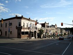
Perth is a town in Eastern Ontario, Canada. It is located on the Tay River, 83 kilometres (52 mi) southwest of Ottawa, and is the seat of Lanark County.

<span class="mw-page-title-main">Woodstock, Ontario</span> City in Ontario, Canada

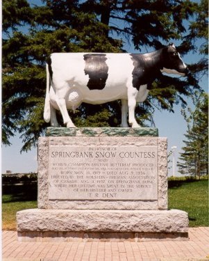
Woodstock is a city in Southwestern Ontario, Canada. The city has a population of 46,705 according to the 2016 Canadian census. Woodstock is the seat of Oxford County, at the head of the Thames River, approximately 128 km from Toronto, and 43 km from London, Ontario. The city is known as the Dairy Capital of Canada and promotes itself as "The Friendly City".

<span class="mw-page-title-main">Stratford, Ontario</span> City in Ontario, Canada

Stratford is a city on the Avon River within Perth County in southwestern Ontario, Canada, with a 2021 population of 33,232 in a land area of 30.02 square kilometres (11.59 sq mi). Stratford is the seat of Perth County, which was settled by English, Irish, Scottish and German immigrants, in almost equal numbers, starting in the 1820s but primarily in the 1830s and 1840s. Most became farmers; even today, the area around Stratford is known for mixed farming, dairying and hog production.

<span class="mw-page-title-main">Smiths Falls</span> Town in Ontario, Canada

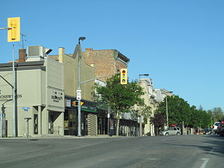
Smiths Falls is a town in Eastern Ontario, Canada, 72 kilometres (45 mi) southwest of Ottawa. As of the 2021 census it has a population of 9,254. It is in the Census division for Lanark County, but is separated from the county. The Rideau Canal waterway passes through the town, with four separate locks in three locations and a combined lift of over 15 metres (49.2 ft).

<span class="mw-page-title-main">Milton, Ontario</span> Town in Ontario, Canada

Milton is a town in Southern Ontario, Canada, and part of the Halton Region in the Greater Toronto Area. Between 2001 and 2011, Milton was the fastest growing municipality in Canada, with a 71.4% increase in population from 2001 to 2006 and another 56.5% increase from 2006 to 2011. In 2016, Milton's census population was 110,128 with an estimated growth to 228,000 by 2031. It remained the fastest growing community in Ontario but was deemed to be the sixth fastest growing in Canada at that time.

<span class="mw-page-title-main">Ingersoll, Ontario</span> Town in Ontario, Canada

Ingersoll is a town in Oxford County on the Thames River in southwestern Ontario, Canada. The nearest cities are Woodstock to the east and London to the west.

<span class="mw-page-title-main">Georgetown, Ontario</span> Community in Ontario, Canada

Georgetown is a large unincorporated community in the town of Halton Hills, Ontario, Canada, in the Regional Municipality of Halton. The town includes several small villages or settlements such as Norval, Limehouse, Stewarttown and Glen Williams near Georgetown and another large population centre, Acton. In 2016, the population of Georgetown was 42,123. It sits on the banks of the Credit River, approximately 40 km west of Toronto, and is part of the Greater Toronto Area. Georgetown was named after entrepreneur George Kennedy who settled in the area in 1821 and built several mills and other businesses.

<span class="mw-page-title-main">Caledonia, Ontario</span> Unincorporated community in Ontario, Canada

Caledonia is a community located on the Grand River in Haldimand County, Ontario, Canada. It had a population of 12,179 as of the 2021 Canadian Census. Caledonia is within Ward 3 of Haldimand County. The Councillor elected for Ward 3 is Dan Lawrence. As of 2021, there were 4,310 private dwellings in Caledonia.

<span class="mw-page-title-main">Elora, Ontario</span> Unincorporated community in Ontario, Canada

Elora is a community in the township of Centre Wellington, Wellington County, Ontario, Canada. It is well known for its 19th-century limestone architecture and the geographically significant Elora Gorge.

<span class="mw-page-title-main">Oxford County, Ontario</span> Regional municipality in Ontario, Canada

Oxford County is a regional municipality in the Canadian province of Ontario. Highway 401 runs east–west through the centre of the county, creating an urban industrial corridor with more than half the county's population, spanning 25 km between the Toyota auto assembly plant in Woodstock and the CAMI General Motors auto assembly plant in Ingersoll. The local economy is otherwise dominated by agriculture, especially the dairy industry.

<span class="mw-page-title-main">Perth County, Ontario</span> County in Ontario, Canada

Perth County is a county in the Canadian province of Ontario in Southwestern Ontario, 100 kilometres (62 mi) west of Toronto. Its population centres are Listowel, Mitchell and Milverton. The City of Stratford and the Town of St. Marys are within the Perth census division, but are separate from Perth County. The 2016 population of Perth County was 38,066.

<span class="mw-page-title-main">Middlesex Centre</span> Municipality in Ontario, Canada

Middlesex Centre is a township in Middlesex County, in southwestern Ontario, Canada, north and west of London. The Corporation of the Township of Middlesex Centre formed on January 1, 1998, with the amalgamation of the former Townships of Delaware, Lobo, and London. It is part of the London census metropolitan area.

<span class="mw-page-title-main">Strathroy-Caradoc</span> Municipality in Ontario, Canada

Strathroy-Caradoc is a municipality located in Southwestern Ontario, Canada. It is 35 kilometres (22 mi) west of London.

<span class="mw-page-title-main">Guelph/Eramosa</span> Township in Ontario, Canada

Guelph/Eramosa is a township located in Wellington County, in midwestern Ontario, Canada. It partly encircles the city of Guelph, surrounding it in a continuous arc from approximately northeast to south-southwest of the city. It is part of the Guelph census metropolitan area.

<span class="mw-page-title-main">East Zorra-Tavistock</span> Township in Ontario, Canada

East Zorra-Tavistock is a township in southwestern Ontario, Canada, formed on 1 January 1975 through the amalgamation of the Township of East Zorra and the Village of Tavistock. It is part of Oxford County. The township had a population of 7,129 in the Canada 2016 Census.

<span class="mw-page-title-main">Listowel, Ontario</span> Unincorporated community in Ontario, Canada

Listowel is an unincorporated community in Ontario, Canada, located in the Municipality of North Perth. Incorporated as the Town of Listowel in 1875, it was dissolved in 1998 following amalgamation with several other communities in the northern section of Perth County. Its population was 9,539 at the Canada 2021 Census in a land area of 6.73 square kilometres; at the time there were 3,910 occupied dwellings.

<span class="mw-page-title-main">Mitchell, Ontario</span>

<span class="mw-page-title-main">North Middlesex, Ontario</span> Municipality in Middlesex County, Ontario, Canada

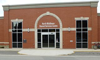
North Middlesex is a municipality in Middlesex County, Ontario, Canada.

<span class="mw-page-title-main">South-West Oxford</span> Township in Ontario, Canada

South-West Oxford is a township in the Canadian province of Ontario, located within Oxford County. The township had a population of 7,664 in the 2016 Canadian census. A predominantly rural municipality, South-West Oxford was formed in 1975 through the amalgamation of Dereham and West Oxford townships and the village of Beachville.

<span class="mw-page-title-main">St. Marys station (Ontario)</span> Railway station in St. Marys, Canada

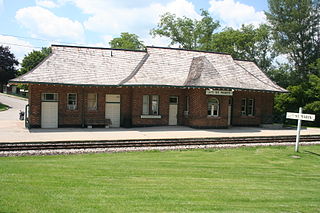
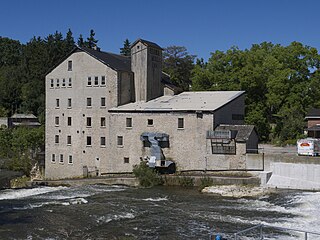
St. Marys station in St. Marys, Ontario, Canada is a staffed railway station used by Via Rail's Corridor intercity train service and GO Transit's Kitchener line regional train service. The station is served by two daily trains in each direction between Toronto and London, one of which continues beyond London to Sarnia.

References

  1. 1 2 3 "Mayor and Council". Town of St. Marys. 2019. Retrieved 7 March 2017.
  2. "Census Profile, 2016 Census: St. Marys, Town". Statistics Canada. Retrieved June 28, 2019.
  3. "Cultivating Opportunity - Community Profile 2014" (PDF). County of Perth. The Corporation of the County of Perth. 2014. Archived from the original (PDF) on 8 March 2017. Retrieved 7 March 2017.
  4. Smith, Wm. H. Smith (1846). Smith's Canadian Gazetteer - Statistical and General Information Respecting all parts of The Upper Province, or Canada West. Toronto: H. & W. Rowsell. p.  183.
  5. "About St. Marys". Town of St. Marys. 2015. Retrieved 7 March 2017.
  6. "Founding of St. Marys". OntarioPlaques.com. Alan L. Brown. Retrieved June 28, 2019.
  7. "History". Town of St. Marys. 2015. Retrieved 7 March 2017.
  8. Statistics Canada: 1996, 2001, 2006, 2011 census
  9. "Population and dwelling counts: Canada, provinces and territories, census divisions and census subdivisions (municipalities), Ontario". Statistics Canada. February 9, 2022. Retrieved March 30, 2022.
  10. "Arts, Culture and Heritage". Town of St. Marys. 2015. Retrieved 7 March 2017.
  11. "Heritage and Historic Landmarks". Town of St. Marys. 2015. Retrieved 7 March 2017.
  12. "Canadian Baseball Hall of Fame and Museum". Town of St. Marys. 2015. Retrieved 7 March 2017.
  13. 1 2 "Transportation" (PDF). www.townofstmarys.com. Town of St. Marys. Archived from the original (PDF) on 4 March 2014. Retrieved 27 February 2014.
  14. "Postmedia-Torstar deal ends Journal-Argus' 164-year run – St. Marys Indy". stmarysindy.com. Retrieved 2018-02-26.