Prescott is a town on the north shore of the Saint Lawrence River in province of Ontario, Canada. The town is a part of the United Counties of Leeds and Grenville. In 2021, it had a population of 4,078. The Ogdensburg–Prescott International Bridge, 5 kilometres (3.1 mi) east of Prescott at Johnstown, crosses the Canada–United States border and connects the town with the city of Ogdensburg, New York.

Athens is a township in the United Counties of Leeds and Grenville in Eastern Ontario, Canada. It is located approximately 25 kilometres (16 mi) north of the St. Lawrence River, near Brockville, west of Addison, and about 90 kilometres (56 mi) south west of Ottawa. Formerly, it was a part of Yonge township before becoming Rear of Yonge and Escott with Athens as its own census division and finally, Athens township. The township consists of the town of Athens and a few other small communities.
Elizabethtown-Kitley is a township in eastern Ontario, Canada, in the United Counties of Leeds and Grenville. Its southern border lies along the St. Lawrence River and it extends north into many rural hamlets and villages. The township was created on January 1, 2001 by the amalgamation of the former Township of Elizabethtown and Township of Kitley.

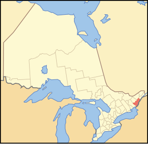
Grenville County is a former county in the Canadian province of Ontario. It fronted on the north shore of the Saint Lawrence River, between the towns of Kingston and Cornwall. The county was created in 1792, and named in honour of William Grenville, 1st Baron Grenville, who was the British Secretary of State responsible for the colonies in 1790. It consisted of five townships, which were settled primarily by United Empire Loyalists in the late 1700s after the Revolutionary War. Prior to being settled by Europeans, the area was home to many generations of native cultures. Grenville County merged with Leeds County in 1850 to create Leeds and Grenville County. The county covered an area of 272,261 acres (110,180 ha).
Leeds County is a historic county in the Canadian province of Ontario. The county was first surveyed in 1792 as one of the nineteen counties created by Sir John Graves Simcoe in preparation for the United Empire Loyalists to settle here. The county took its name from Francis Osborne, 5th Duke of Leeds; the "Leeds" of the Dukedom referred to Leeds in West Yorkshire, England and not for Leeds, Kent, England. In 1850, Leeds County merged with Grenville County to create the United Counties of Leeds and Grenville. This county was home to several townships as well as the city of Brockville.

Leeds—Grenville—Thousand Islands and Rideau Lakes is a federal electoral district in Ontario, Canada, that has been represented in the House of Commons since 1979. Prior to the 2015 election, the riding was known as Leeds—Grenville.
Brockville was a federal electoral district in Ontario, Canada, that was represented in the House of Commons of Canada from 1867 to 1917. It was created by the British North America Act of 1867.
Leeds was a federal electoral district represented in the House of Commons of Canada from 1904 to 1979. It was located in the province of Ontario. This riding was first created in 1903 from parts of Leeds North and Grenville North and Leeds South ridings.
Basil Rorison Church was a physician and political figure in Canada West.
Rideau Lakes is a township located within Leeds and Grenville United Counties in Eastern Ontario, Canada. The township was incorporated on 1 January 1998 by amalgamating the former townships of North Crosby, South Crosby, Bastard, South Burgess and South Elmsley with the village of Newboro.

Kemptville Creek is a stream in the municipalities of North Grenville and Augusta, in the United Counties of Leeds and Grenville, in Eastern Ontario, Canada. It is in the Ottawa River drainage basin, is a right tributary of the Rideau River, and is under the auspices of the Rideau Valley Conservation Authority.

Front of Yonge is a township found in the United Counties of Leeds and Grenville in Ontario, Canada. It is the location of the Thousand Islands National Park and Brown's Bay Provincial Park, as well as a number of private campgrounds, the Jones Creek walking trail system, and the 1000 Islands Waterfront Trail’s walking/bike path which runs from just beyond the township’s eastern boundary to neighbouring towns. The predominance of the Canadian Shield produces scenic and diverse landscapes which include exposed rock formations and heavy tree cover, as well as wide fields and beaches.

Merrickville–Wolford is a village-status municipality in Eastern Ontario, Canada, located in the United Counties of Leeds and Grenville. It spans both shores of the Rideau River.

Leeds and the Thousand Islands is a township in the Canadian province of Ontario, located within the United Counties of Leeds and Grenville. The township is located along the Saint Lawrence River, and extends north into rural hamlets and villages. Formerly, this township was divided into three separate townships: Leeds, Lansdowne, and Escott townships; these townships amalgamated to form the current township of Leeds and the Thousand Islands.
King's Highway 29, commonly referred to as Highway 29, was a provincially maintained highway in the Canadian province of Ontario. The 52.29-kilometre (32.49 mi) route connected Highway 2 in downtown Brockville with Highway 15 south of Smiths Falls. Between those larger settlements, it provided access to the communities of Forthton, Addison, Frankville, Toledo and Newbliss.
Elections were held in Leeds and Grenville United Counties, Ontario on October 27, 2014 in conjunction with municipal elections across the province.
Elections were held in Leeds and Grenville United Counties, Ontario on October 22, 2018 in conjunction with municipal elections across the province.
Leeds was an electoral district of the Legislative Assembly of the Parliament of the Province of Canada, in the eastern area of Canada West. Leeds was created in 1841, upon the establishment of the Province of Canada by the union of Upper Canada and Lower Canada. It was based on Leeds County, located on the north shore of the Saint Lawrence River.
A by-election was held in the federal riding of Leeds—Grenville—Thousand Islands and Rideau Lakes in Ontario on December 3, 2018, following the sudden death of incumbent Conservative MP Gord Brown on May 2, 2018.
Elections were held in Leeds and Grenville United Counties, Ontario on October 24, 2022, in conjunction with municipal elections across the province.